|
November 7, 2005: Hawaii Trip Day 3 |
 |
November 5, 2005: Hawaii Trip Day 1 |
 |
Return to Main Index for Hawaii Pictures |
November 6, 2005
Hawaii Trip Day 2
Diamond Head Lighthouse
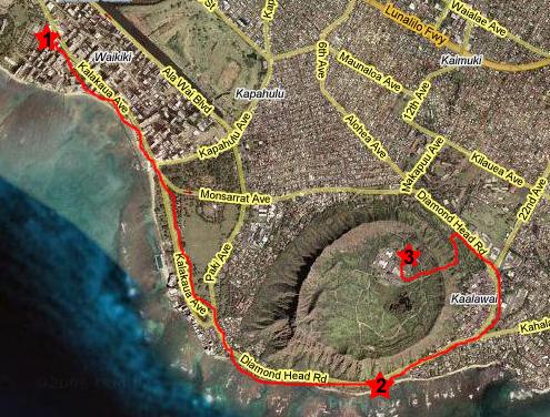
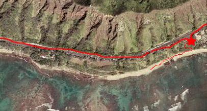
Today, we planned to do some driving around the island of Oahu. Since no one but me has been here before, I think that it's a good idea to see a variety of things, and certainly the south and east sides of Oahu have plenty to look at. We'll also be able to drive to the North Shore (pretty famous in TV and surfer movies) and then return to the city through the middle of the island, again getting different views. In the first section of our trip, which we began after getting just a bit of breakfast at the hotel (#1), we plan to drive along Waikiki on Kalakaua Avenue and then follow that same road around the south tip of the island, between the ocean and Diamond Head. There, there is a park (#2) and lighthouse that is worth the short walk.
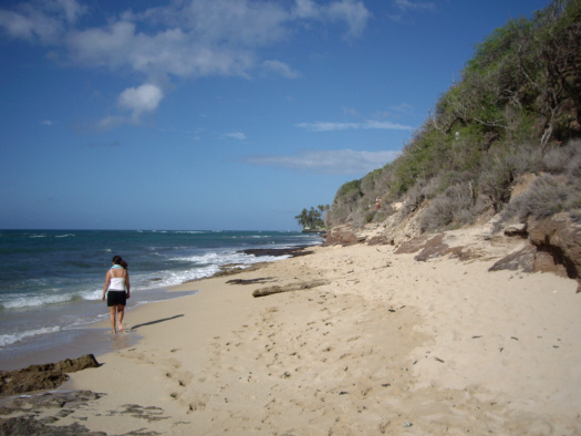
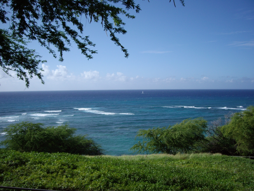
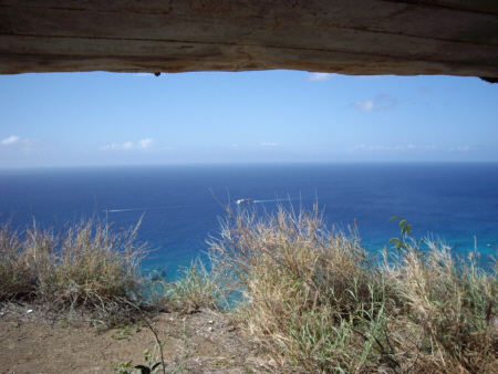
We arrived at the parking area for Diamond Head Beach Park after just a few minutes, and the first thing that we saw when we got out was a
beautiful ocean vista.
The ocean view looks almost directly southwest, and it is not hard to imagine that Tahiti is somewhere way off in that direction. Tahiti, of course, is where the first Hawaiians originated- at least according to the best knowledge we have. We headed off towards the paved path down to the shore. On the way down the path, we could begin to see the
surfers out in the ocean
trying to catch the early morning waves. Also on the way down the path, Fred got the first view of
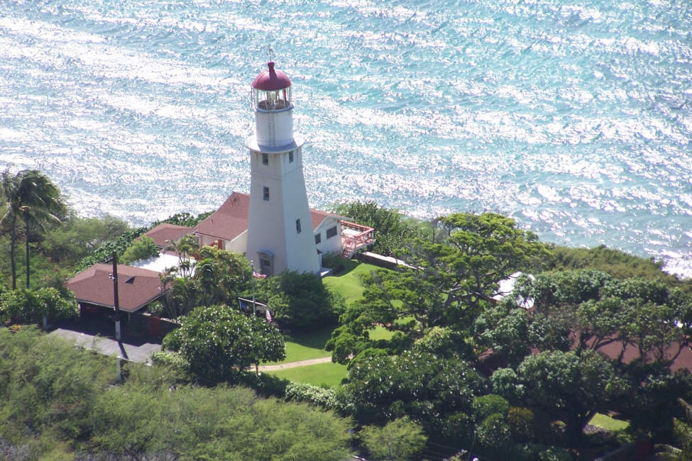
Diamond Head Lighthouse,
seen here through the trees.
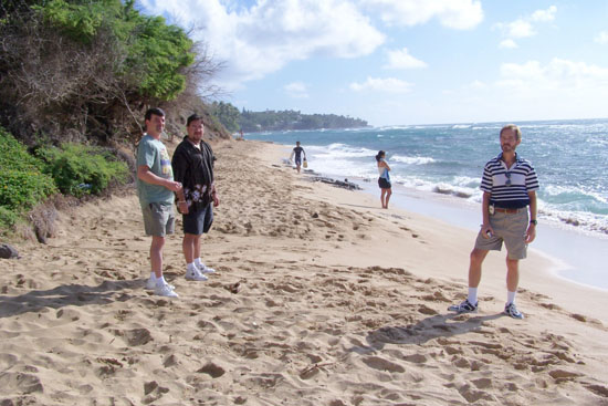
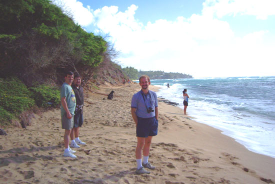
When we got down to the shore, we walked along towards the west and the lighthouse. On the way, both Fred and I snapped pictures of the rest of the group (looking back towards the east along the shore):
We walked a bit further west along the beach, and Fred got a picture of
us with the top of Diamond Head Lighthouse
in the background. And then it was just a bit further along the beach to a spot where we could stand on an
ancient lava flow
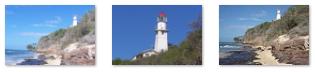
where we could get some views of the Diamond Head Lighthouse. To see any of these views, just click on its thumbnail below:
|
(Click on Thumbnails to View) |
To try to give you a better idea of what the area was like, I also took a movie of the lighthouse, the beach and the rest of the guys, and you can view that movie using the player at left.
We headed back along the beach to the
walkway up to the parking area.
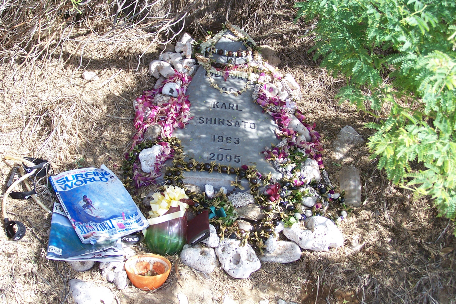
A Surfer Memorial
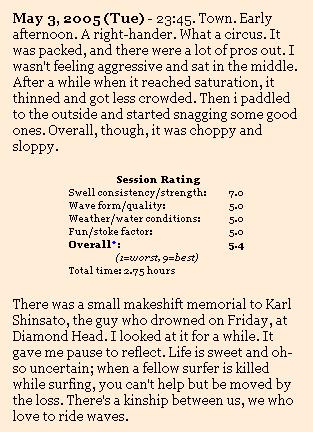
Back at the top of the path, Fred discovered something we'd missed on our way down- a memorial to someone, presumably a surfer, who had died here this same year. It could not have been too long ago, since the magazines were still readable and some of the flowers still colorful. I was able later to find out some particulars, and I will include them here, along with a picture of the memorial (please click on it to see a full-size view; it will be much more interesting) and the view from the exact spot (you may also click on its thumbnail for a full-size view).
Once back in the car, we headed off a short distance along the beach highway, and then followed the residential streets around the east side of Diamond Head Crater until we came to the entrance for the crater itself. We paid a small fee and went in to park (#3).
Diamondhead Crater
We parked the car, and just before we set off on the trail to the observation post, I recorded our visit here to Diamond Head. Then we were off.
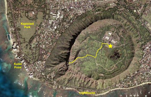
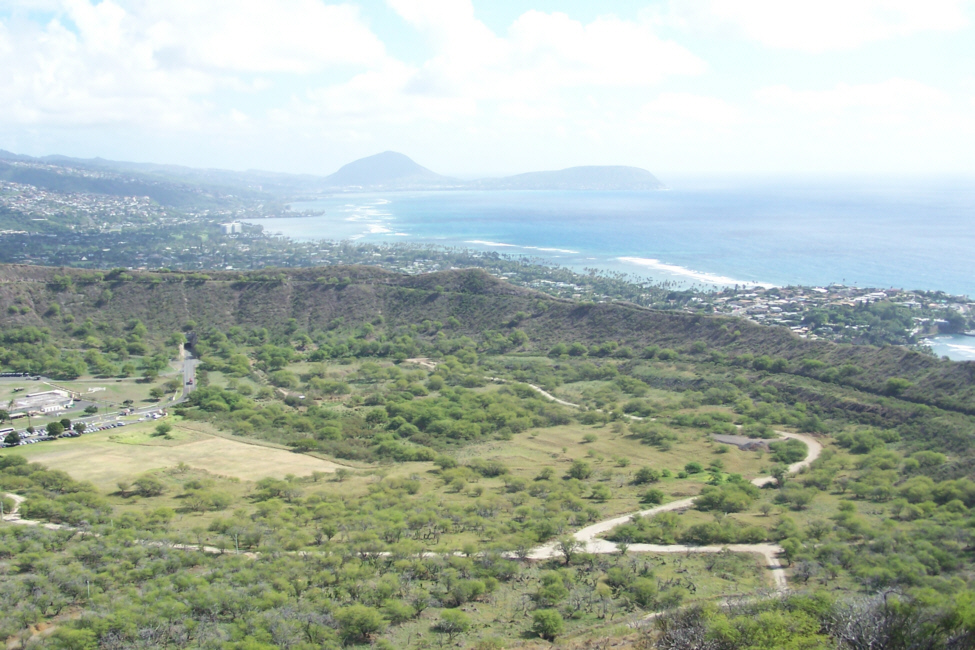
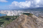
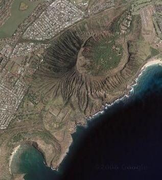
On the aerial view of Diamond Head Crater at the right, I've marked the parking area with the yellow star, and we followed the marked trail towards the rim. I have sketched the trail that we followed with the yellow line, which ends at the rim observation point. But getting there was not just a simple hike. The trail took a lot of interesting turns and there was lots to see. About halfway up, we came on an
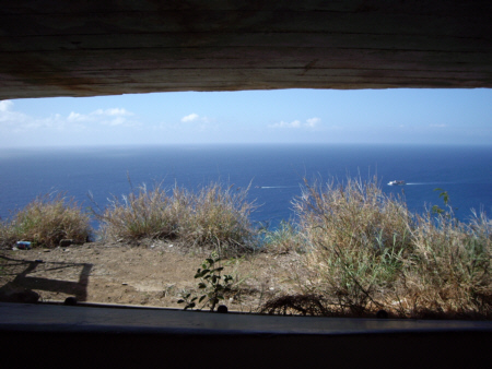
old observation platform
that must have served a purpose during wartime but which wasn't used for anything now. Actually, you had to get a short distance off the main trail to get to it.
Once we got near the crater wall, the trail got very steep, and a
stone pathway with railings
and from this point on for quite a ways the trail was a series of
switchbacks
like this one. The last of the switchbacks turned us around into
a long, steep stairway,
shown here which, as you can see, enters a
tunnel!
Just before entering the tunnel, I took a picture of the
Diamond Head Crater
looking north along the shoreline of Oahu.
This trail had just about everything. It was quite crowded, and the going was sometimes slow on the narrow stairs and in the tunnel. But there was one last surprise. Once in the tunnel, you don't come out into the open air again until you are on the observation platform. The tunnel takes you inside the crater wall and then, when you are under the observation platform, this set of
metal spiral stairs
takes you the rest of the way to the observation platform.
 |
 |
I think it's important to remember that the observation platforms here at Diamond Head were not built for the tourist trade. They were built and manned as wartime observation posts, from which it was thought that soldiers could see ships and planes far off at sea, and sound an alarm. Whether by luck or calculation, the attack on December 7, 1941, came from a different direction- across the middle of the island from behind where a person with this view would be looking. And unless the soldier were out in the open, or leaned way out the "window," he wouldn't even see most of the attack. Not from this post, anyway.
Now, of course, tourists can get up on top of the observation rooms (whether this part of the platform was here during the war or not I am not sure) to a platform (actually three of them) that allow unobstructed views in all directions. Let's begin with a set of two movies that will show you the entire 360-degree panorama. The first movie goes counterclockwise from Waikiki to Kailua, and you can watch it with the left-hand player, below. The second continues from Kailua, past the mountains and back to Waikiki. You can watch that one with the right-hand player, below:
Now let me show you the many individual pictures that Fred and I took from atop the crater. They will be in approximately the same order as you might have seen in the movies. To see the full-size image, just click on the thumbnail:
|
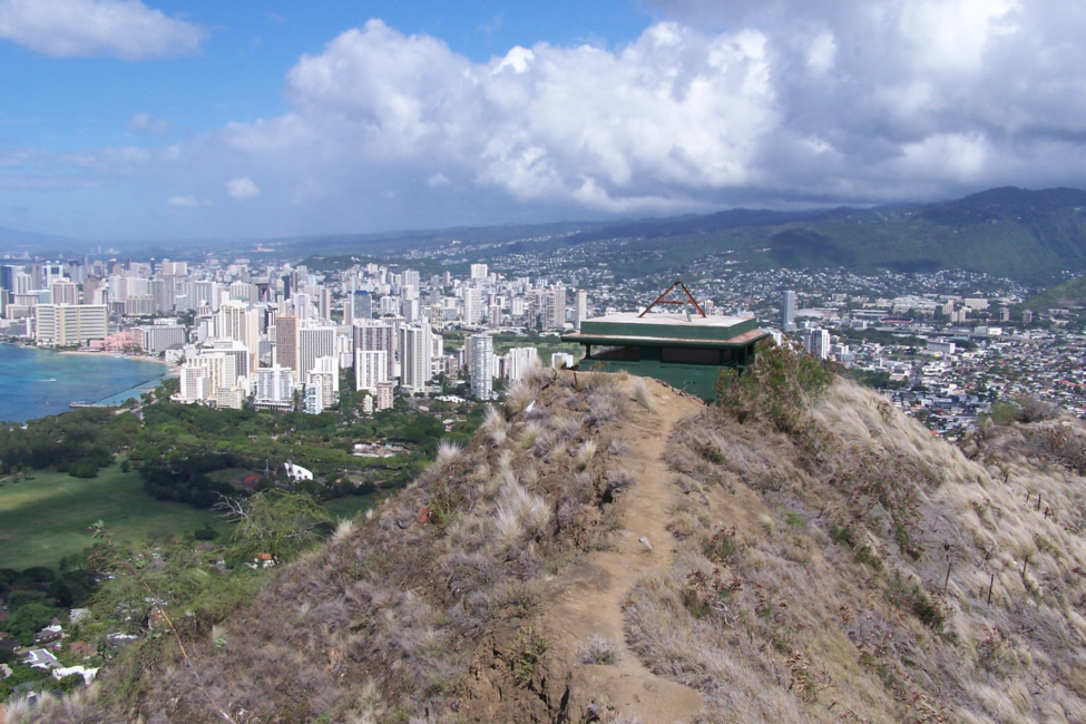
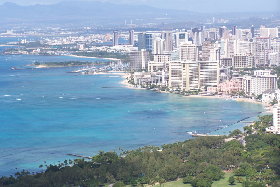
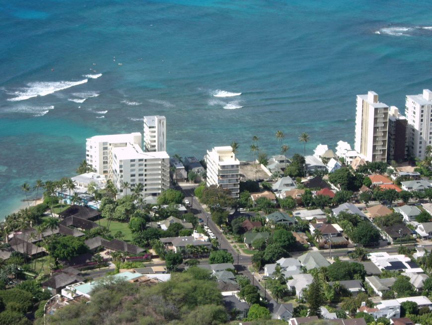
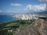
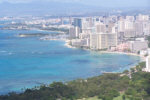
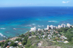
A view looking northwest that features, in the nearground, another observation platform about a hundred and fifty feet away, the University of Hawaii beyond it to the right, Waikiki and, beyond Waikiki, the Punchbowl (the feature that looks like another crater. Inside the crater, incidentally, you can see the memorial buildings- the bright white spots. On the beach at the extreme left are the pink Royal Hawaiian Hotel (one of the oldest hotels on the beah, and, just beyond it, the distinctive Sheraton Waikiki. In the foreground to the left is Kapiolani Park. You can see the pier that we visited last night, jutting a short ways out into the ocean.
|
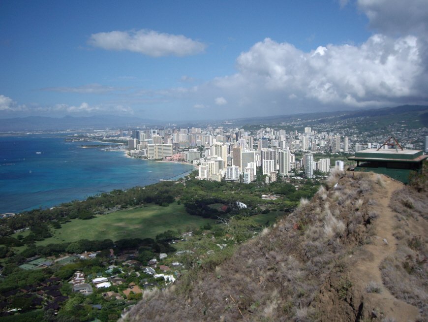
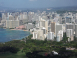
This view, taken without any magnification, is an excellent view taking in the broad sweep of Honolulu. You have the nearby observation platform here on the Diamond Head crater rim, Kapiolani Park, Waikiki and Honolulu proper. You can see the airport and Pearl Harbor in the distance to the left, and the interior of Oahu in the distance to the right. My army friend from Korea, Pete Cannon, grew up in one of the houses you can see in the cluster just below us, between Diamond Head and the park. Pete's father was President of the Bank of Hawaii which was, oddly enough, one of the purchasors of EEO-Reporter, the software package that Greg and I developed for Cullinane Corporation in 1976-1977. I stayed with the Cannons on my way back from Korea, although Pete was not in Honolulu at that time. And I also talked with Mr. and Mrs. Cannon when Tony Hirsch and I came back in 1978 to do the installation of EEO-Reporter at the Bank.
|
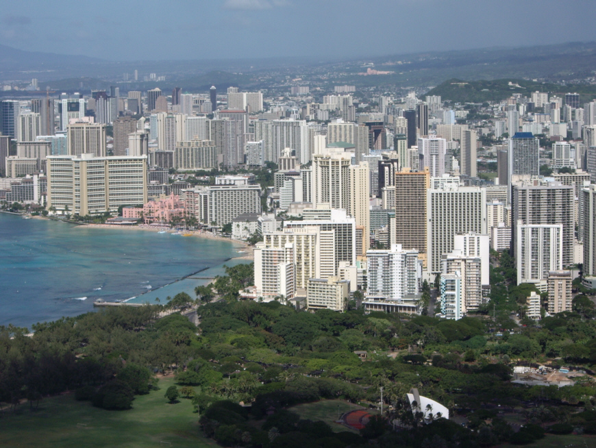
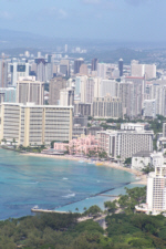
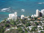
Here is my own closeup view of Waikiki and Honolulu. Again, you can pick out the two signature hotels on Waikiki- the Royal Hawaiian (where Don Ho performed for many years) and the Sheraton Waikiki. When Tony and I visited here to work, we always stayed at the Sheraton; when Grant and I visited here, we stayed in a small hotel next to it.
|
A zoom view looking northwest that gives you an even better view of the Royal Hawaiian Hotel and the Sheraton Waikiki. Our hotel is the taller of the two buildings just to the right of the Sheraton Waikiki. The tall hotel just to the right of the yacht harbor is the Outrigger, and it, too, has been here for a long time. That is the Honolulu Yacht Club, the same one I visited with Grant twenty years ago. The green area beyond is Ala Moana park and the Ala Moana Shopping Center. Then there is part of the port of Honolulu and, in the distance, Honolulu International Airport. The actual business district of Honolulu encompasses the area beyond Waikiki- where most of the darker-colored skyscrapers are. The State Capitol is in there somewhere, too.
|
When people talk about Waikiki Beach, THIS is the beach they are talking about. The Waikiki hotels are beachside and for a couple of blocks back from the beach, then there is the Ali Wah area, which is centered around a canal and is partly hotel and partly condo, a whole group of highrise condominiums and apartments and then the city of Honolulu.
|
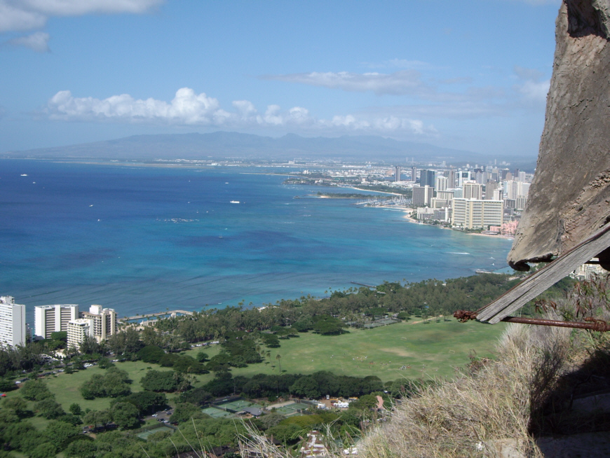
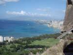
Moving a bit counterclockwise, this view takes in part of the wartime observation structure itself, and then looks past Waikiki and downtown to focus on the International Airport and Pearl Harbor in the distance. The other shore of the island is down the other side of that farthest ridge of mountains that you can see here. In the nearground is Kapiolani Park and the beginning of Kuilei Point.
|
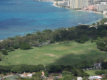
Kapiolani Park, the largest park in the city. It is just one wide, open space, lined with trees and jogging trails all the way around. In the many times I came to Hawaii, my habit was to do my evening jogging from the Sheraton, down the broad sidewalks of Kalakaua Avenue to the corner of the park, and then entirely around the park on the jogging trail and then back to the hotel. There is a good deal more of the park out of the picture to the right, and the entire jog was about five miles.

|
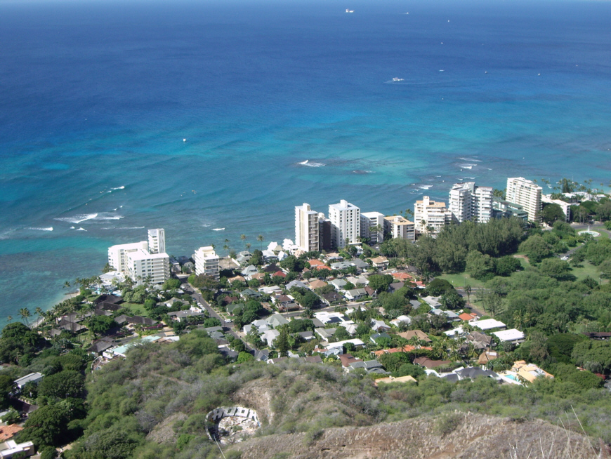
This is Kuilei Point, an area of small, luxury condos and boutique hotels. You are looking at some of Honolulu's most expensive housing, right below Diamond Head.
|
A closeup of Kuilei Point, just below Diamond Head. Some of the oceanside buildings are condominiums, but there are also a number of boutique hotels, I am told. This exclusive area, right at the end of Kapiolani Park, is one of the most exclusive in the city.
|
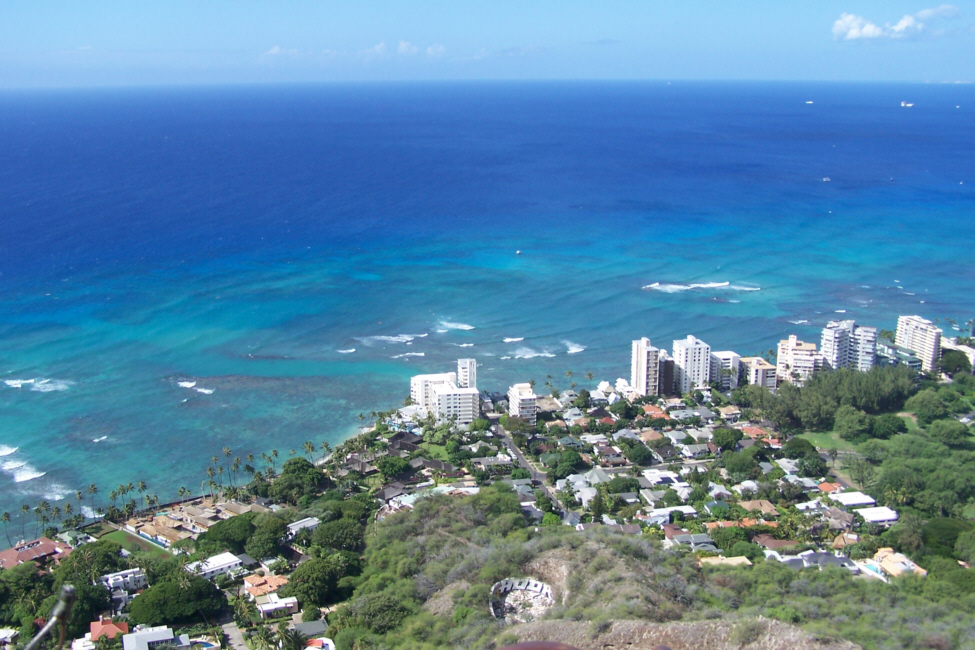
Here is my own closeup view of some of the houses and condos at Kuilei Point. On our way here from the hotel this morning, we drove straight across that nearby street from right to left.

|
A closeup of the Diamond Head Lighthouse, the same lighthouse that we saw when we were walking on the beach a bit earlier. Lots of lighthouses I've visited are in cold, out of the way places, but it looks as if duty in this one would be a pleasure.
|
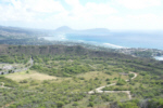
A view looking pretty much east-northeast across the Diamond Head caldera and to Kailua and beyond.
|
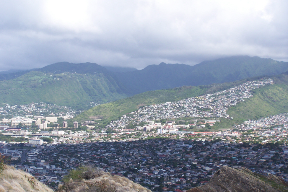
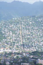
This zoom view looks north from Diamond Head and shows some of the typical hillside housing that has crept a good way up the hillsides all around the city. One of the reasons that homes in Hawaii, and especially on Oahu, are so expensive is that there is so little land available for development. Many of the homes you see here obviously have wonderful views.

|
This zoom view also looks north from Diamond Head and shows more of the hillside housing here in Honolulu. This time, you can see that housing surrounds Diamond Head completely. Again you can see the University of Hawaii at the left, but now you can see one of Hawaii's three Interstate Highways- HI-3- which begins in Kailua and goes all the way past Pearl Harbor almost to the other side of the island.
Most of the pictures that we took from the top of Diamond Head were vistas, but we did get some people shots as well. Fred took this one of
me with Honolulu in the background.
I took this one of
Jay and Ron,
as well as this one of the
tourists on the observation platform.
As I mentioned, the observation platform was actually a couple of levels. The spiral staircase brings you up into the observation shelter, and then you have to kind of duck through a smallish opening to get up on top of the shelter. Here is a picture of
Jay on the walkway outside the shelter.
Some of the tourists are going in and out of the opening, and the pictures above that illustrate the view that the occupants must have had when on duty was taken from inside the opening that you can see here. The platform from which most of our pictures were taken is up some stairs behind Jay.
We were able to get one of the Japanese tourists to take a picture of
the four of us,
and it turned out to be an excellent picture.
We spent more than an hour at the top just taking in all the views, but we had other places to see so we headed back down. I mentioned on the way up that the switchback trail ends in a long, narrow staircase that finally enters the tunnel into the crater itself. Going down, you come out of the tunnel onto this
narrow stairway
that eventually opens up and becomes the yellow outside stairs.
As you are going down the stairway that you saw in an earlier picture, Fred found that he could get an excellent closeup view of the
trail switchbacks
that we described earlier, and that he could also pan back to
put them in perspective.
Our last trail picture was taken quite a ways further down, while we were descending the switchbacks. Our backs had been to this view on the way up, so we missed it. Here is an excellent view of the
trail and the summit observation structures
that gives you a good idea of how all the trail elements tie together.
Lunch at Hawaii Kai
Diamond Head was really an interesting place, and this was the first time I had ever visited it, in all my times in Hawaii. We left the crater and returned to the highway heading east. As you could see from the crater pictures, Diamond Head is surrounded by houses, and so we were going through residential neighborhoods all the way through Kahala. Then we were in and out of housing until we reached the suburb of Hawaii Kai.
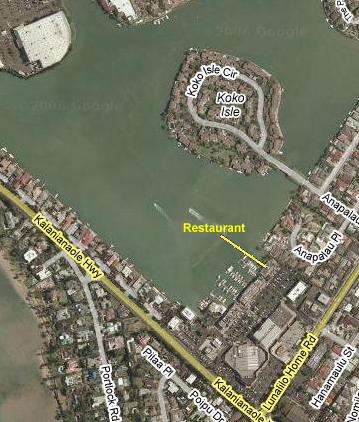
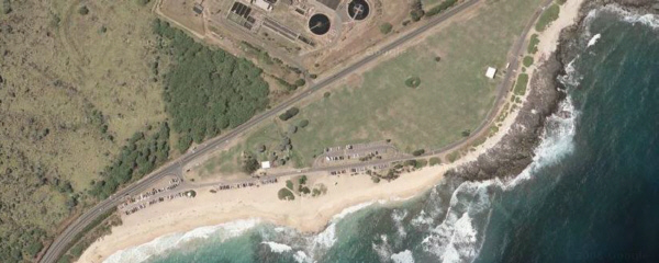
Hawaii Kai is a near-eastern suburb of Honolulu, just east of Diamond Head. Everyone was hungry, so we stopped for lunch here. I've noted on the aerial view just where we had lunch so that you have some context for the photos that I've included here. Just before we left Diamond Head, you could see
all the way to Hawaii Kai-
the area we were going to drive through.
We drove into Hawaii Kai and found a shopping center with lots of restaurants right by the main highway, so we turned off there. The restaurant we chose was one of those local places with a long, broad menu, so everyone found something they liked. After lunch, we walked around the area for just a bit. The restaurant was on the shore of an artificial bay, which was also called Hawaii Kai; it seemed that while there might have been a natural inlet here before, when the area was developed the inlet was modified so that houses could be built along it. In the middle of the bay is
Koko Island
(named, of course, for the crater just east of here), an artificial island with more houses on it. Fred got a good picture of
us at Hawaii Kai
just before we got back in the car and headed off east.
Just east of Hawaii Kai, as we climbed a bit along the coast road, we found a turnoff where we could
take some pictures
of the area where we'd just been, such as this picture of
Hawaii Kai and Koko Island
(looking back towards Diamond Head which is out of the picture to the left) and this view of
the mountains between here and Honolulu.
We headed east again to our next stop- Koko Head.
Koko Head
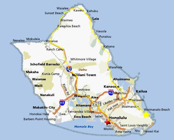
Driving around Oahu can be confusing; I know that I've gotten turned around more than once. The problem is that those of us who live on the mainland are used to beaches that run north to south. We know instinctively that if we are in California, and we are looking out to sea, we are looking west. Similarly, if we're in Fort Lauderdale, we are looking east out to sea. Waikiki is the only famous beach in the United States that runs east to west; it runs along the southern border of an island that is basically a lopsided square. So, standing on Waikiki and looking out to sea, we are looking south, not west. Those of us who spend most of our time on East Coast beaches instinctively think we are looking east, so, if we turn our heads to the left towards Diamond Head, we think we are looking north. But we aren't. We are looking east- almost directly east as the map above shows.
The other odd thing is that, from Waikiki, Diamond Head looks like the point where the coast turns 90 degrees and (now that we understand our directions) heads north. But it isn't. Sure, it is a point of land (a "head," as they are called), but all it does is jut out from the southern coast of Oahu- the coastline continues almost due eastward until you pass Koko Head, which, as you will see later, IS the point where the coastline makes a major turn to the north.
 |
Koko Head is about ten miles east of Diamond Head, and about two miles east of Hawaii Kai where we had lunch. As you can see from this closer aerial view, Koko Head (Hawaiians tend to refer both to the crater and the promontory of land with the same name- Diamond Head or Koko Head- and I'll do the same here) is also a major caldera crater, although just a bit smaller than Diamond Head. Development is encroaching here, too. There are some hikes within the crater itself, but no major tourist destination like the observation post at Diamond Head.
Hawaii is a relatively young chain of islands, with Hawaii itself ("The Big Island") being the youngest (if you don't count a small, new island that is growing up out of the Pacific southeast of The Big Island). There are islands to the northwest of Oahu, where we are now, and they are the oldest. Oahu is middle-aged for the chain. Even so, the island is young enough that not all of the lava flows have been worn into sandy beaches, and the stretch here alongside Koko Head is a good example. In fact, almost all of the coastline of Oahu IS sandy beaches EXCEPT for the area from Diamond Head eastward, around Koko Head and up to Kailua. Why is the southeastern corner of the island different? It has to do, partially, with ocean currents, which rarely move directly towards the shore in this area. But an even more important factor is the way the Hawaiian Islands are being formed. As I'll describe when we tour Volcanoes National Park on The Big Island this coming Wednesday, this corner of Oahu is very much the youngest part of this island, and has had much less time than the rest of the island to be worn down.
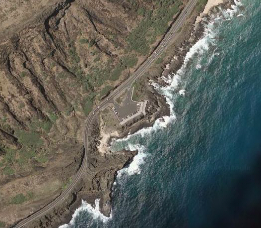
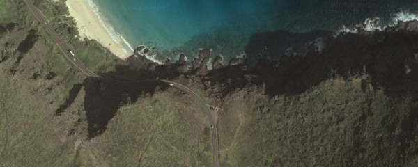
So, we have driven a few miles eastward from Hawaii Kai on the Kalanianaole Highway, climbed over a ridge and dropped down to one of the most rugged but beautiful shorelines in the entire Hawaiian Island chain.
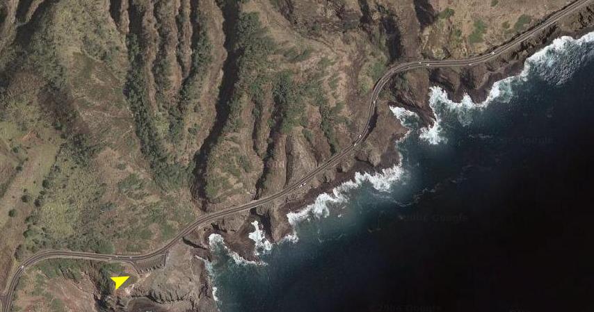
As soon as we came over the ridge, a
beautiful shoreline vista
lay spread out before us. We stopped at the overlook that you can see in the aerial view at left and all four of us just stood at the stone wall for a time taking in the rugged beauty of the cliffs and the shore. Fred walked over to the side of the parking area and used his zoom to take a picture of
the road ahead.
He was standing approximately where the yellow arrowhead is, and looking in the direction that the arrow is pointing. Perhaps you can pick out the elements of his picture- the bridge, the roadside turnout up ahead- in the aerial view (although I am sure the parked cars are different). It's also interesting that there is an outcropping of rock right where the road turns up ahead (you can see the shadow it casts) that is high enough to block the view of the next stretch of road.
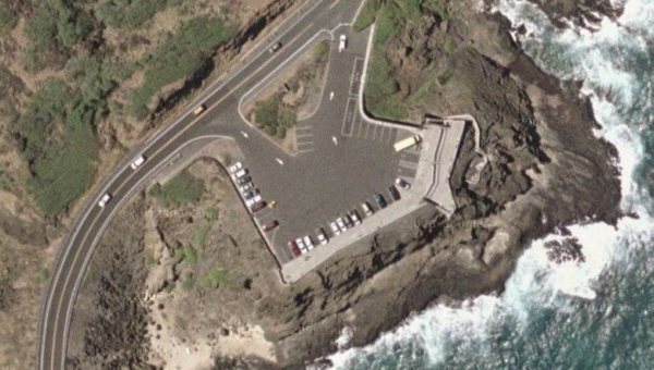
We would have done some walking around on the shore here, but as you can see in this closeup view of the overlook from the air, there is not much rock space in front of the parking area before it drops off quite a bit. I remembered from my previous drives along this side of the island that there was a better viewpoint and spot to climb around on the rocks up ahead, so after spending a few minutes here, we headed off a bit further east.
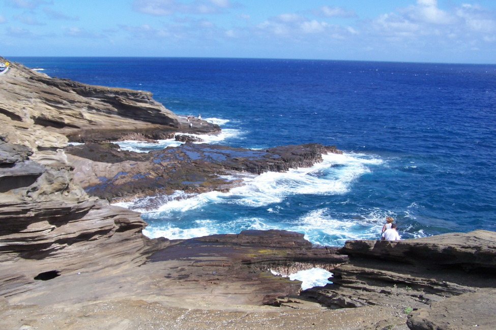
In the aerial view at left, you can see the next parking area where we stopped. The white strip in front of the parked cars is actually a walkway, and there is a low wall where you can sit and marvel at the view. Although there is a drop-off beyond the wall, it is not steep, and there is a plateau of pretty flat rock before you get anywhere near the edge of the water. Fred took two excellent pictures from that walkway, looking northeast along the shoreline. View them by clicking on the thumbnails below:
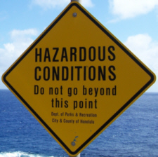 |
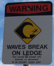
You might notice in the last picture that Fred took that there is some idiot who has gone way, way beyond the warning sign that is located just seaward from the parking area. I guess that some people will do anything for a picture. Fred took a
closeup of the idiot.
Oops, the idiot was me. As usual, I've gone where I wanted to go, and now I'd like to show you some of the pictures I took from MY vantage point. |
 |
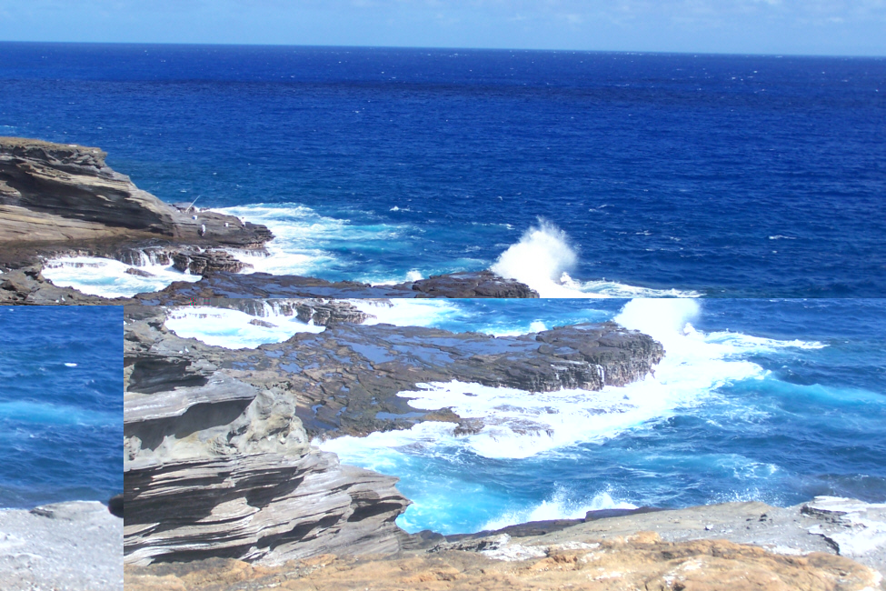
All of the pictures that I took from my vantage point down on the rocks were different from the ones we took above; I am looking along the shoreline at eye level, rather than from above, and I think this provides a different perspective. As an example, here is a beautiful view of the
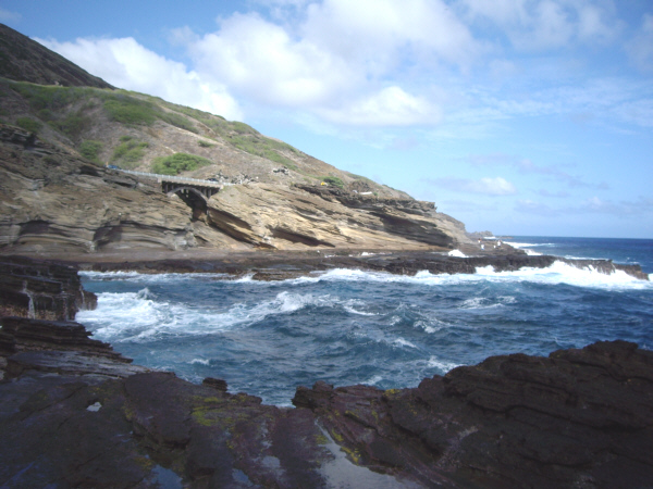
roiling blue water
as it pounds the shoreline here at Makapuu Point.
If you use the movie player at right to watch the movie of the waves, I think you'll get an even better idea of what the point is like. There was a shelf of rock next to me, and it was pretty easy to climb up on top of it where I could get a great view of
the coastline alongside Koko Head
(looking northeast).
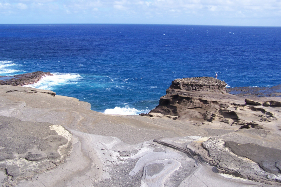
I wanted to get a little further out, so I walked across the top of the rock ledge (taking care to stay where it was relatively dry), until I got out to the
end of the promontory.
Here, I was able to get another good movie of the wave action at Makapuu Point, and you can watch it with the player below:
It was really neat out here, and I could have stayed much longer, just admiring the beauty and force of nature, but I reluctantly began to
climb back up to the parking area.
When I got there, of course I had to
tell the guys
about what it was like down there.
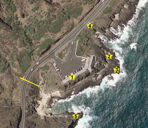
From this same parking area, it is possible to walk a little ways to get a view of the Koko Blowhole. There are two or three well-known blowholes on this side of the island; this is the easiest to view and the largest. For a blowhole to form, you need a rocky shoreline, and the lava here is ideal. You also need a fortuitous event that will form a hole in the rock up to the top and also out to the ocean. Finally, you need forceful waves that can force water through the underwater channel and up through the hole. I think you'll agree that result is spectacular when you watch Fred's movie using the movie player at right.
From the same point where we were viewing the blowhole, Fred got a good view of
Waimanalo Beach
up ahead of us along the coast road. We'll be heading that way shortly, but first I wanted to take another little hike.
On the aerial view at left, I'd like to note where the previous pictures were taken and where the ones you are about to see came from. In each case, I've marked a location with a numbered yellow star. First off, all the pictures that Fred took were taken from the walkway where the guys waited for me to get my adventurousness out of my system (#1). The first pictures and movies I took were from about halfway out the rocky outcrop (#2), and the last couple were from the furthest point I reached (#3). When we walked over to see the Koko Blowhole, we followed a short path to the viewpoint (#4). When we returned to the parking area, I climbed down to the beach and over to the other side and another rocky outcrop (#5). Finally, I've marked the location of the tunnel I went through with a solid yellow line, and the last picture I took here was taken in the middle of that tunnel, under the road.
Next to the parking area there was a
small beach
nestled between the rocky outcroppings. There were a few people on the beach, and I could see one or two people on the rocks on the far side of the beach so I climbed down to the beach, crossed over to the rocks and went out to the rocky point where Fred took a picture of
me on the rocky point.
Standing out here on the rocks I got an excellent picture of the
surf pounding against the rocks
west of me along the shore. Turning around, I could see the
guys back at the parking area
waiting for me, so I headed back.
As I was crossing the beach, I saw what looked like a cave back in the rocks, and I thought that I would take a look. It turned out to be a
lava tube tunnel.
It looked natural, but I couldn't be sure. I went partway into it and then I could see a light at the end, so I continued on. I think that parts of it were natural but parts had been opened up, for when I got to the end, I found myself on the other side of the highway. Obviously, the tube serves to drain water from the land side of the highway; I would like to have seen it during a heavy rain. I climbed up the other side of the highway and walked back to the parking area to explain to the other guys how I'd gotten back without their seeing me climb back up the trail.
An Island Circuit
It was still just after lunch, so I thought we would go as far north as we could along the east coast of Oahu; I remembered that there was a lot of good scenery, and I thought the guys would enjoy it.
As we started off, Fred had us stop at the next turnoff so he could get a picture looking back of the
Koko Head Lighthouse.
After about a mile, we left the rocky shoreline for a while and came out alongside a sandy beach just south of Waimanalo. There were quite a few people here, and I got an interesting picture of
the beach and Popoia Island.
As you can see from the aerial views at the left, the highway eventually turned north to avoid going all the way around Popoia Point (the easternmost point of Oahu), and the highway cut across the point itself until it came back to the shore and turned west for a ways. This is just south of Waimanalo.
Here, we stopped at an overlook to see more of the shoreline, and I noticed that there were some hangliders taking advantage of the onshore winds and the cliffs that forced the winds upward. They were certainly fun to watch. I made a movie of them doing their thing, and you can watch it with the movie player at right.
Now we were headed for a circuit of the eastern half of the island. We intended to keep heading along the shore northwestward, turn at the top of the island to visit the North Shore (fabled location of Waimea, the surfing capital of Hawaii) and then take the mid-island highway back south through the center of the island to the Pearl Harbor area and the expressway back to Waikiki.
Not only was there not time to make a complete circuit of the island, but that is impossible; there is no highway around the northwest corner of the island- at least there wasn't when I was last here. I know there are a couple of small settlements east of Waialua on the North Shore, and I think there is a resort out there also, but there isn't anything going south along the west coast of the island until you get to Waianae, so I guess a road wouldn't be a great investment. Anyway, that's our plan.
We continued northwest along the coast highway, passing through Kailua- the last big town on this side of the island and the terminus for one of the expressways back to Honolulu. Then it was a "drive in the country" from that point on, as we went through one town after another, enjoyed the ocean views and marveled at the lush mountains. Eventually, south of the town of Laie, we could see
the mountains at Laniloa Point
off in the distance. Between here and the point, the road curves around a
wide and shallow bay,
until you reach
Laniloa Point Park
and
Mokuauia Beach.
Here are some of the other pictures that Fred and I took here at Laniloa Point Park. To view a full-size image, just click on its thumbnail:
|
(Click on Thumbnails to View) |
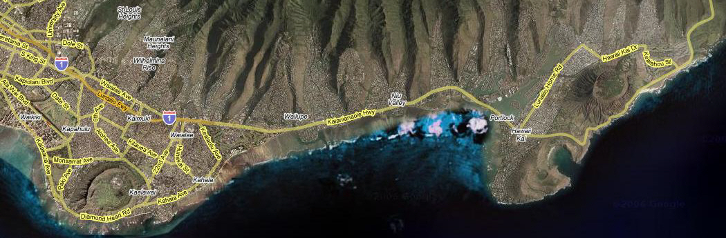
We had an afternoon snack in Laie, and then continued around the north side of the island. The ocean and shoreline were almost always in view, and always spectacular. The light was going quickly, though, and we didn't take any more pictures that turned out well. We followed the route marked on the map above, and about seven-thirty found ourselves back at the hotel.
This evening it was a local buffet in Waikiki, and then we ended up at a small, neighborhood karaoke bar right near the hotel.
You can use the links below to continue to another photo album page.
|
November 7, 2005: Hawaii Trip Day 3 |
|
November 5, 2005: Hawaii Trip Day 1 |
|
Return to Main Index for Hawaii Pictures |