|
November 9, 2005: Hawaii Trip Day 5 |
|
November 7, 2005: Hawaii Trip Day 3 |
|
Return to Main Index for Hawaii Pictures |
To the Big Island
 |
We had to get up early to get to the airport in time to turn the rental car in and get to the gate for our flight. Everything worked smoothly, and when we got to the gate our plane was just being opened up and readied for boarding. Even so, we had to wait for about thirty minutes at the gate before the flight was called.
The flight across to Hawaii was very pleasant, and Fred got some good pictures, like this one looking out ahead of the aircraft and this one of the coast of Hawaii.
During the flight, Fred also took a short movie of what it was like flying in this propeller plane, and you can view that movie using the left-hand player below. He also took a movie of our landing at the Hilo Airport, and you can watch that movie using the right-hand player, below:
|
|
We had also reserved a rental car, so the next item of business was to collect our luggage and go pick it up. And then it was off to find the hotel.
 |
Black Sand Beach
 |
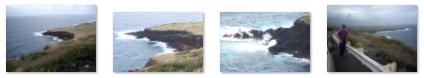
Driving south along the highway past Volcanoes National Park, we could see the result of all the eruptions over the years in just about every direction. We stopped at a couple of places along the highway to take a look, and this picture of Ron and Jay on a lava flow is pretty representative of what the land looked like as far as we could see. At another stop we made, Fred found this incredible Hawaiian native tree; it spread out like a banyan tree but it wasn't. The extremely wide canopy made it very interesting.
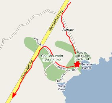 |
Beaches made of black sand are not uncommon in the Islands, and especially on Hawaii. They are formed when lava of some certain types flows into the ocean and becomes the shoreline. Then, the action of the waves will eventually break down the lava rock into fine sand- just as happens on every other beach in the world. Of course, you've already seen white sand beaches in our pictures of the Islands. White sand is the result when water acts on other types of rock that are thrust up when volcanoes erupt. White sand can also be deposited on a beach having been pushed there by ocean currents and wave action.
But here on the island of Hawaii there is lots of the right kind of lava (and, indeed, the island is still growing because the volcanoes are still active), and so there are quite a few black sand beaches. (Actually, later on today we will come across a beach that is composed of two kinds of coarse rock- one pure white and one pure black. The black will turn out to be lava while the white will be a quartz/granite material.) The black sand beach here at Punaluu is one of the largest and one of the most accessible, and that is why it is famous and attracts lots of visitors. But it is not the most beautiful of black sand beaches (perhaps for that very reason).
|
To view the slideshow, just click on the image at left and I will open the slideshow in a new window. In the slideshow, you can use the little arrows in the lower corners of each image to move from one to the next, and the index numbers in the upper left of each image will tell you where you are in the series. When you are finished looking at the pictures, just close the popup window.
Towards the end of our stop at the black sand beach, I took a movie to give you a better idea of what it was like, and you can view that movie using the player below:
|
|
Big Island Drive
 |
From Punaluu down to Honuapo Bay, the scenery was much the same. Inland, it was a continual contrast of dark lava and lush greenery with the mountains never far off in the distance. When the mountains were near the coast, you could easily tell that all the vegetation had been shaped by the wind. At times, we would encounter a relatively new lava field, and we could see that the vegetation had not had time to get much more than a foothold. I guess the owners of these homes were not particularly concerned that there might be another eruption here any time soon (and they are probably right as we learned the next day in Volcanoes National Park) or perhaps coastal sites with a view are at such a premium that it didn't matter much.
This particular area of the island is not heavily populated, perhaps because the most recent volcanic eruptions have been on this side, and for most of our trip between Volcanoes National Park and the Kona Coast the road was pretty empty ahead and behind.
|
|
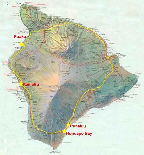
I also took another, shorter movie of the coastline at this point, and I almost didn't include it here for in the movie narration I got a couple of things wrong. First, I said we were at Punaluu when in fact we were at Honuapo Bay. And second, as you can see from the map, when I said in the narration that we were at the southwestern tip of the island we were actually still on the southeastern side. But I went ahead and included the movie, and you can watch it using the player below:
|
|
We took a few pictures here at the overlook, too, and you can look at them by clicking on their thumbnails below:
|
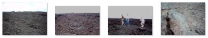
Leaving Honuapo Bay, we continued west on the Hawaii Belt road. In this area at the southern end of the island, the lava flows are more recent, and vegetation has not had much of an opportunity to get a foothold. The appearance of both sides of the road was more like the surface of the moon than anything else, and you can get a good idea of what the terrain was like by looking at the pictures we took of this barren land. As usual, to see a full-size image, just click on the thumbnails:
|
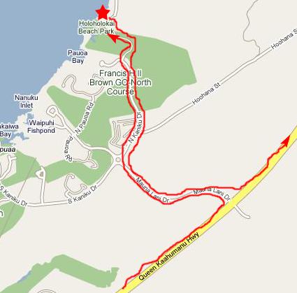
As we swung around to the western side of the island, the weather began to change and it began to clear a bit. I would imagine that this was due to the fact that the winds were coming from that direction and blowing clouds and weather onto the island. But we began to be able to see more, such as this view from Kauluoa Point and this view of Kealakekua Bay.
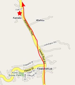 |
We had a leisurely lunch and enjoyed sitting outside. Ron and Jay were getting their fill of driving around the island, and they thought that they would take the highway that was coming up back through the center of the island to Hilo and let us go on to the Puako Petroglyph site that we wanted to visit. The wisdom of having two cars was borne out and after we left the restaurant, we both headed north for a few miles and then Ron and Jay took the highway back to Hilo.
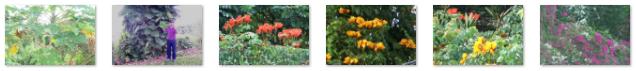
In the small towns we'd been passing through, and especially near the restaurant where we ate, Fred had been encountering new and varied flora- including poinsettias growing wild and in tree form. Here are some of the pictures he took and you can view the full-size picture by clicking on its thumbnail:
|
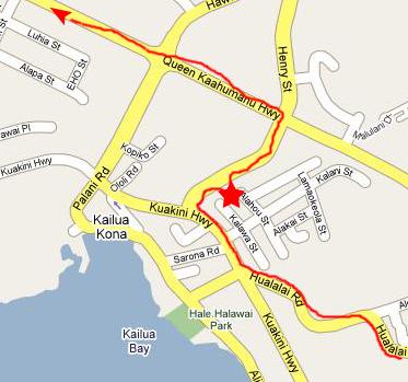 |
Then it was back on the highway and we continued north. North of Kona, the landscape changed a lot. It was still mostly lava, but the rocks had been broken up a great deal and there was some vegetation. The lava flows on this side of the island are much older than those on the eastern side, and this undoubtedly was the reason for the difference in landscape.
But the really odd thing was that the rocks were either coal black or bright white; there didn't seem to be much in-between. The white rocks were much less common than the black, and we found as we drove along that people had apparently come along the roadside, gathered up the white rocks, and then either made designs or wrote names or phrases near the roadside where passing cars could read them. Like graffiti made out of pebbles.
As we drove further north, we came to Kiholo Bay where Fred took a picture of me with Kiholo Bay in the background.
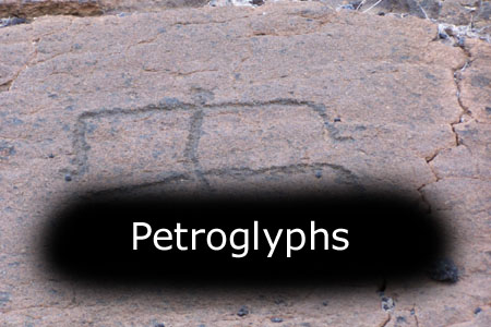
Petroglyphs and Sunset
 |
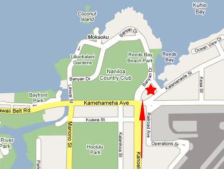
I would like to show you an aerial view of the site and mark the exhibit area, the actual petroglyph site and the walk we took so that you can get a better idea of how the pictures we took fit together:
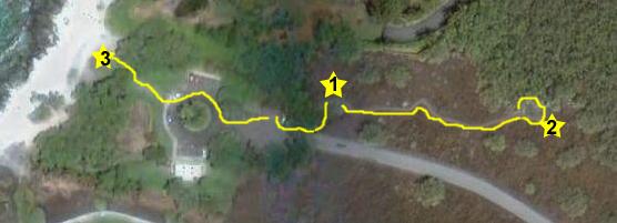 |
One thing that is misleading in the aerial view is that the path is actually quite forested now with low scraggly trees. It may be that the aerial photograph is very old but, more likely, the trees we were walking through had very little foliage at all, and so really didn't show up on the aerial view much at all.
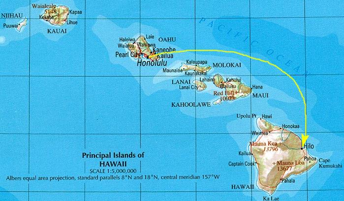
In any event, let's get to the pictures. As I said, I first walked over to the beach to take a couple of pictures. The view from here is of the Kawaihae Bay Coast, and you can see from the Hawaii map included earlier that we are looking in the direction of the extreme northern tip of the island; that is it, in fact, in the distance. Not only was the scenery beautiful, but the composition of the rocks on the beach was extremely interesting. Again, we had the white and black contrasting pebbles and rocks. Could one have been ancient ash and the other ancient lava? Or is there some other explanation? We never did find out.
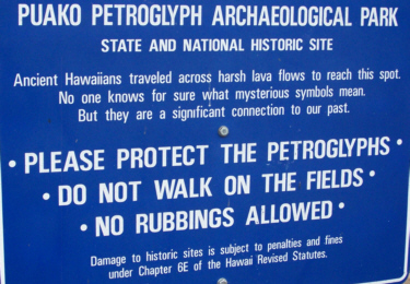
The Exhibit Area
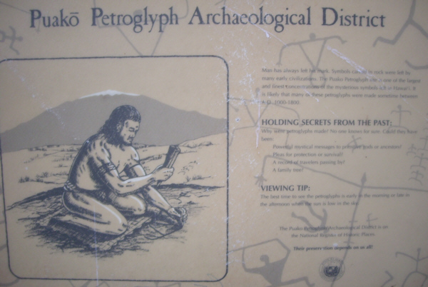 |
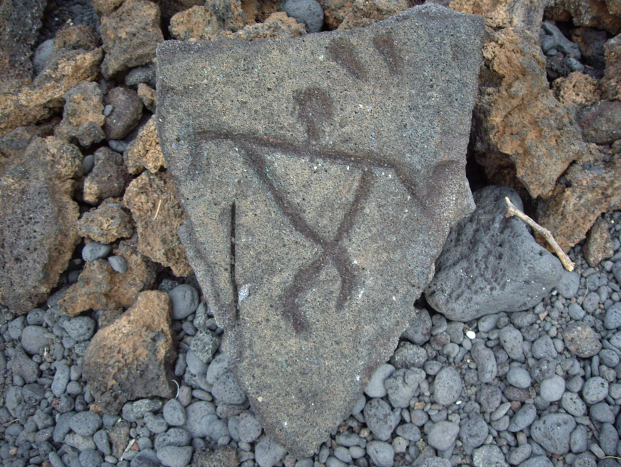
HOLDING SECRETS FROM THE PAST:
Why were petroglyphs made? No one knows for sure. Could they have been:
Powerful mystical messages to primitive gods or ancestors?
Pleas for protection or survival?
A record of travelers passing by?
A family tree?
VIEWING TIP:
The best time to see the petroglyphs is early in the morning or late in the afternoon when the sun is low in the sky.
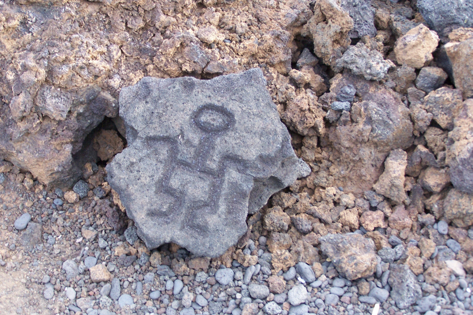
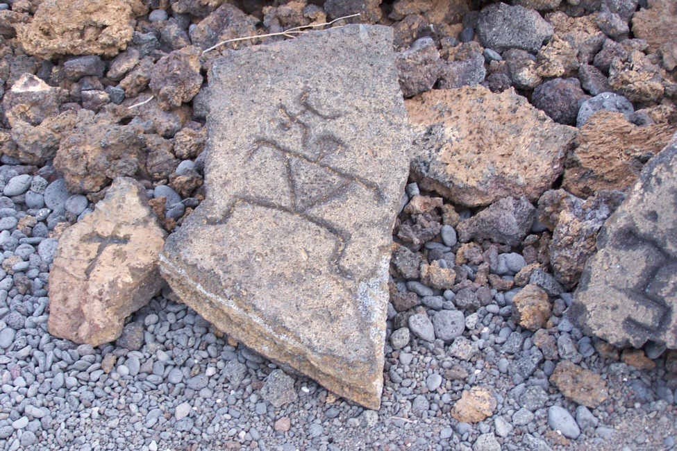
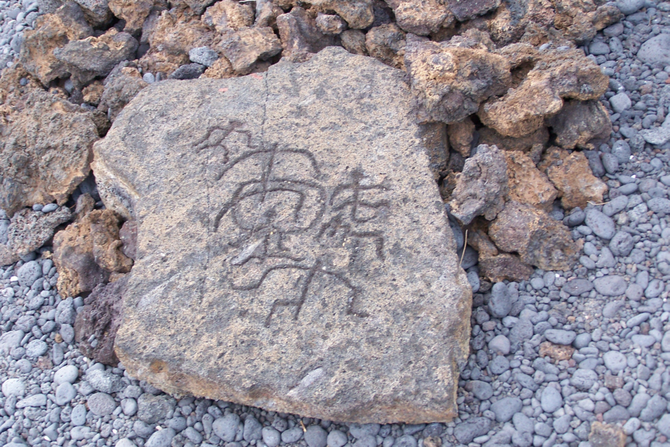
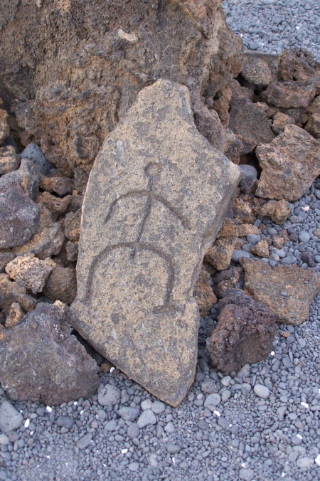
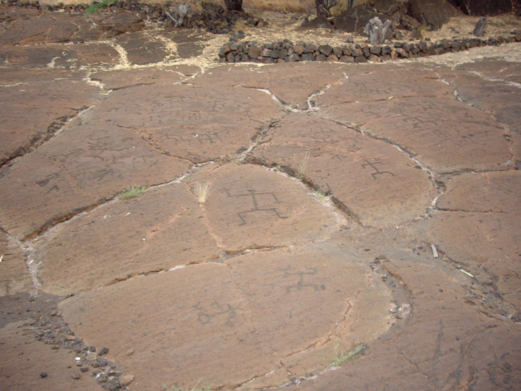
From the way that some of these petroglyphs look, and from the similarities to petroglyphs that we've seen throughout the American Southwest, I am tempted to add yet a fifth possible explanation (or perhaps offer a modification to the third). Maybe, just maybe, these carvings (and, in some locations, drawings or pictographs) record the arrival of travelers from off-world, rather from just over the next hill.
|
|
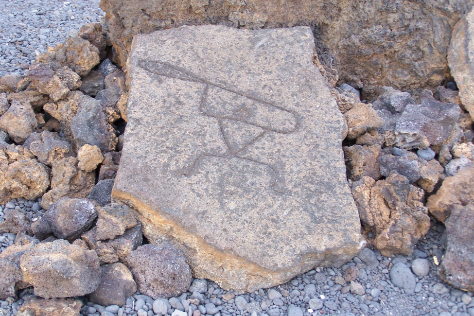
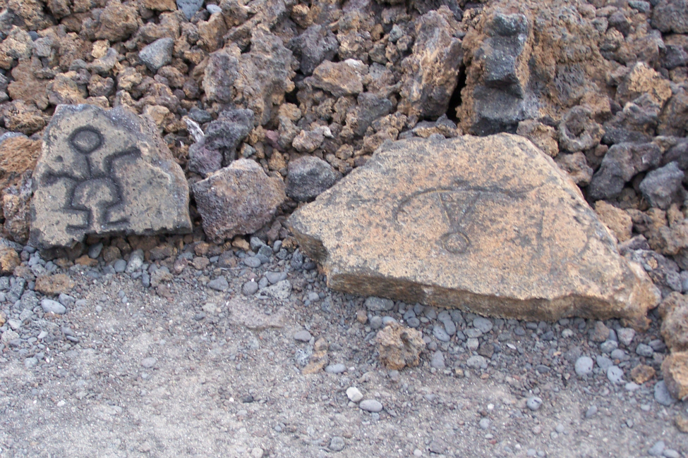
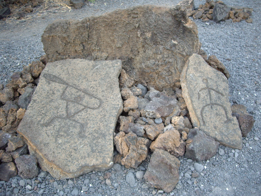
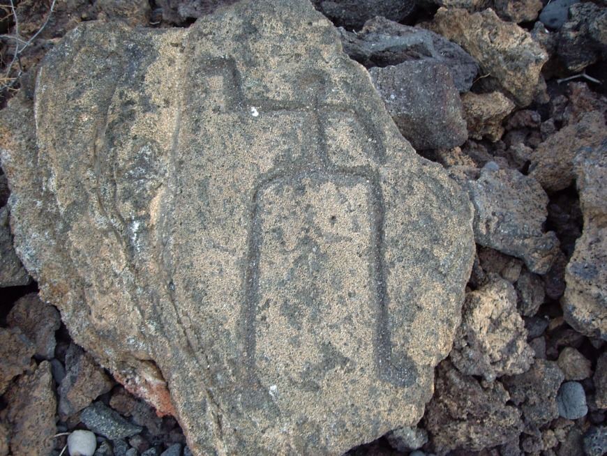
After we visited the actual petroglyph site, I found that I wasn't sure whether these displayed carvings were actually taken from the main site and brought here, or whether these carvings were just excellent reproductions of the different figures found at the main site. The main site didn't turn out to be but a tenth of a mile away, and there was a pretty good path, so I don't think that this was done for people who couldn't make the trip. Nor did I think that anyone would allow a site like this to be chopped up and pieces moved; part of the historical value is that the carvings are in situs. Nor did I remember seeing any obvious places at the main site where individual figures were removed (and I don't think you'll see any when we get there). So I am still a bit uncertain about these displayed carvings. In any event, if they were reproductions, they were very good ones, in that they looked exactly like some of the ones we saw at the main site.
 |
 |
 |
 |
 |
 |
 |
 |
 |
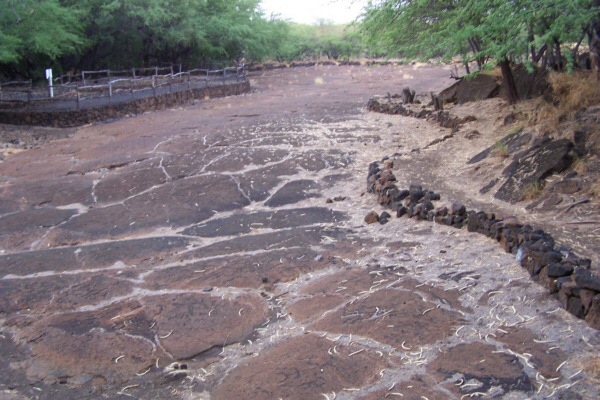
We left the display area and set off along the path to the actual petroglyph site. It was getting dark in the trees, but along the way I took a picture of Fred on the trail and he took a picture of me.
At the Petroglyph Site
 |
|
To view the slideshow, just click on the image at right and I will open the slideshow in a new window. In the slideshow, you can use the little arrows in the lower corners of each image to move from one to the next, and the index numbers in the upper left of each image will tell you where you are in the series. When you are finished looking at the pictures, just close the popup window.
It was getting dark, so we walked on back to the car. You can see how dark it was by watching this movie of us walking back using the player below:
|
|
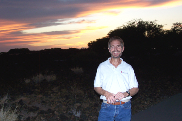
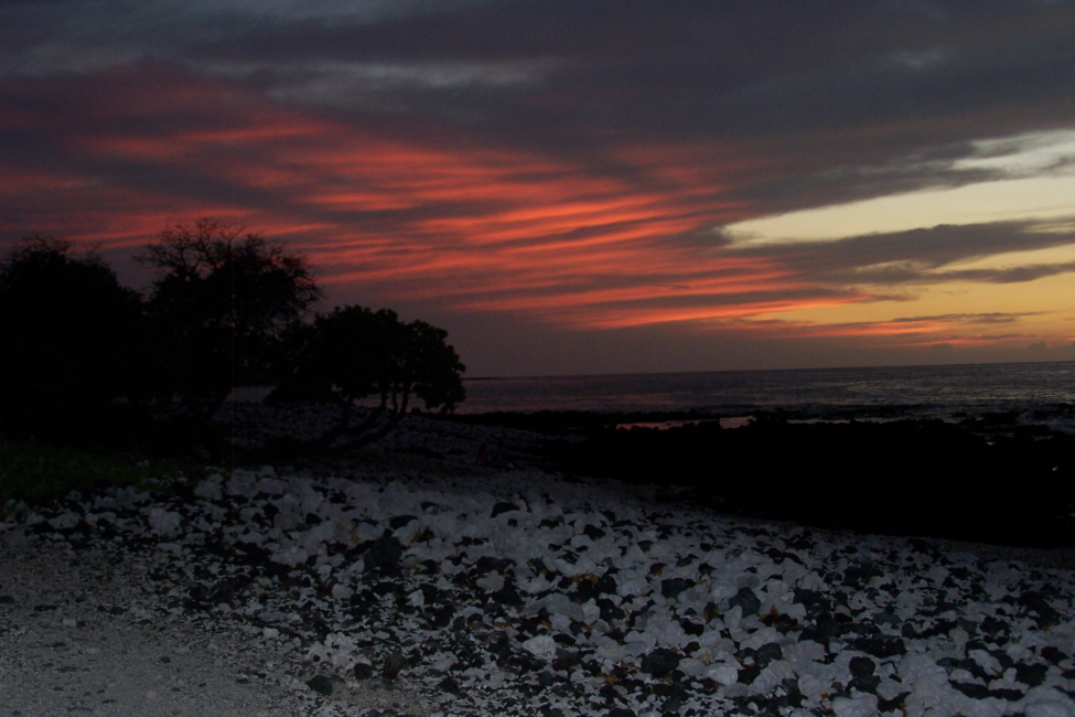
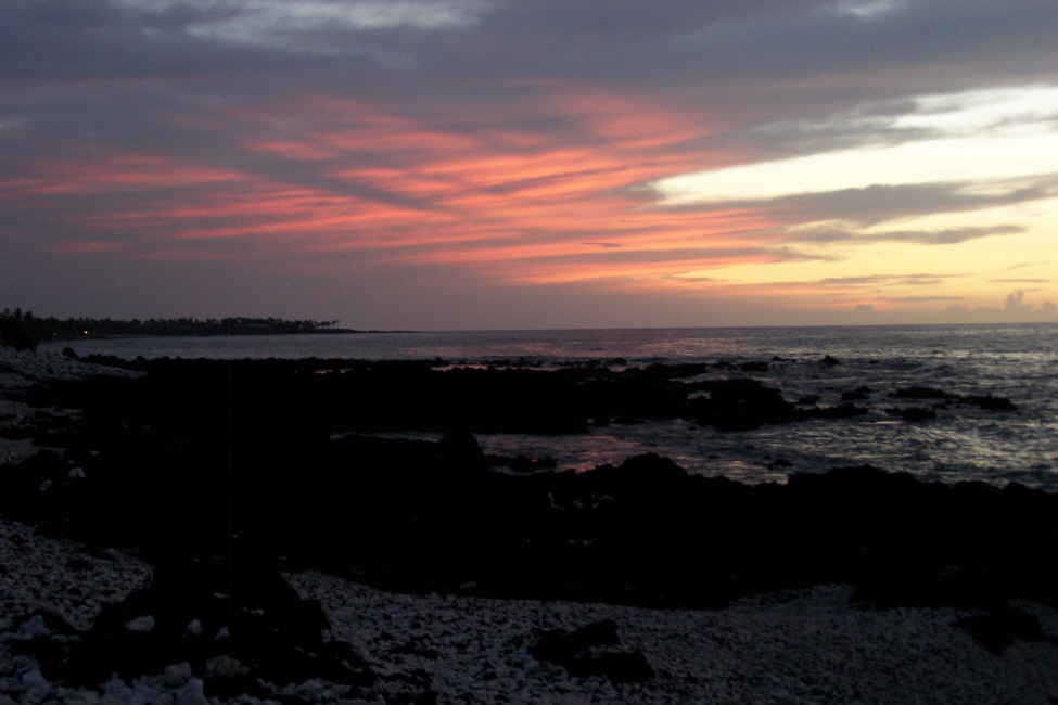
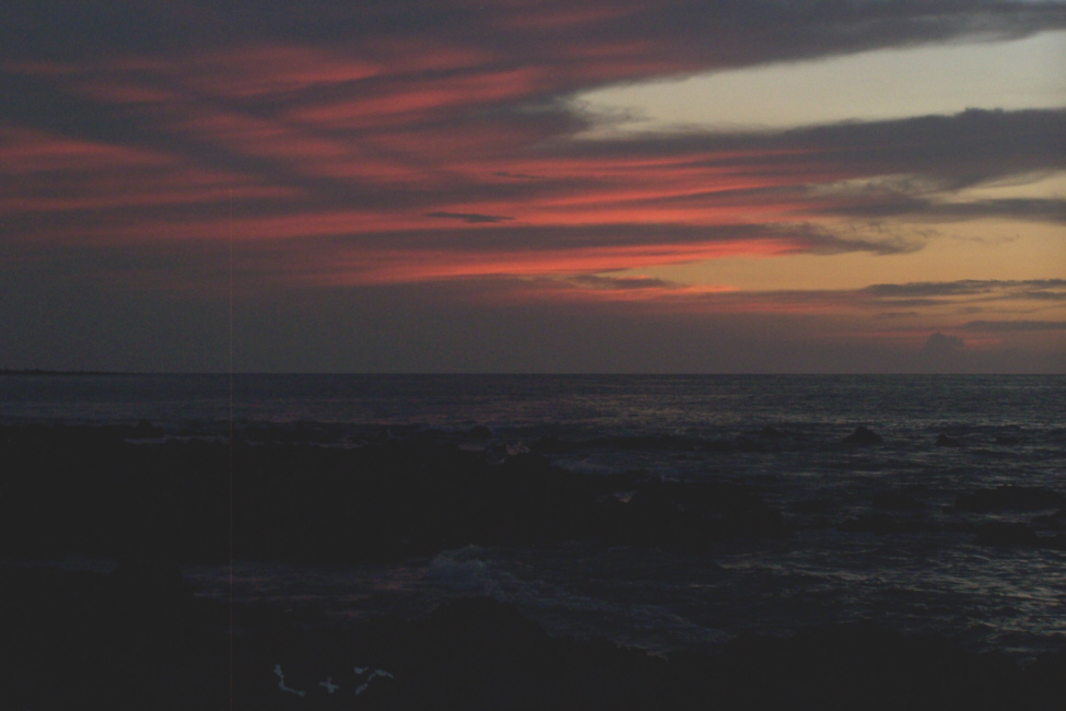
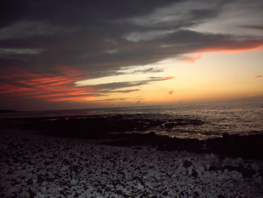
Sunset at the Beach
 |
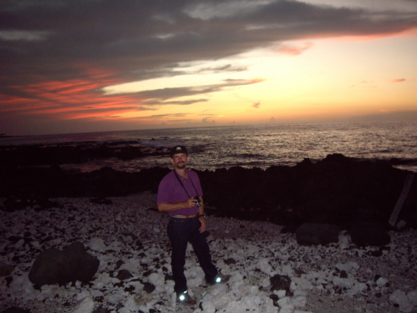 |
The first thing we noticed about the beach was that it wasn't sandy; it was made up of mostly small pebbles, stones and rocks on the shore, and bare lava rock sticking out into the bay. What was really interesting was the composition of the small rocks on the shore. It seemed as if they were either coal black or pure white; there wasn't much in-between color. They were very interesting and quite beautiful, so I took a couple of pictures just of the rocks and you can see those pictures here and here.
Now for the pictures of the sunset. Out of the many I picked a couple by Fred and a couple by me. Take a look at the ones you wish by clicking on their thumbnails:
 |
 |
 |
 |
Well, we'd had a very long day, and we'd seen and done quite a bit. But it was time to head back to Hilo to meet up with Ron and Jay for dinner. We went back out to the main highway and headed further north to meet up with the highway across the island, and then we took the coast highway back down to Hilo (unknowingly passing by many of the places we would visit the day after tomorrow). Ron and Jay were waiting for us and we had dinner together at a local dive that turned out to be quite good.
Tomorrow it's "volcano day."
You can use the links below to continue to another photo album page.
|
November 9, 2005: Hawaii Trip Day 5 |
|
November 7, 2005: Hawaii Trip Day 3 |
|
Return to Main Index for Hawaii Pictures |