|
July 7, 2006: Hyalite Canyon and Natural Bridge SP, MT |
|
July 5, 2006: A Day in Glacier NP, MT |
|
Return to Glacier National Park Trip Index |
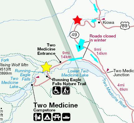
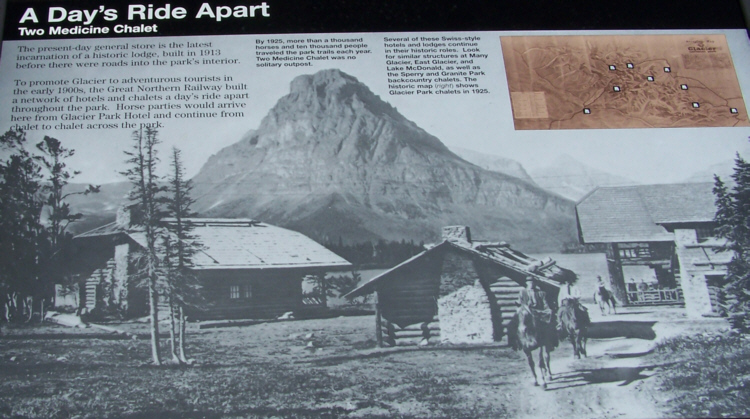
To Two Medicine
On the morning of July 6th, we broke camp in the St Mary campground. The campsite we'd had was a good one, and the camping weather perfect, so in a way, we hated to leave. But there was a long way to go to get home, from this, our furthest point from home, and also a lot to do on the way during the next four days.
 |
Although the scenery had been beautiful all the way down Highway 89, when we turned west on the winding road that is Montana 49, it got really spectacular. Just after turning at Kiowa, we wound around one of the first hairpin turns in the highway and were rewarded with a beautiful view of some of the southeastern mountains in Glacier National park. This and the following few pictures were taken near the red star on the map- at the turns prior to it and along the relatively straight road after it. Just a bit further, at another turn, there was a place to turn off and view the landscape, and this was an great place to take a panoramic movie of the southeastern part of Glacier National Park, and you can watch this movie with the player below:
|
|
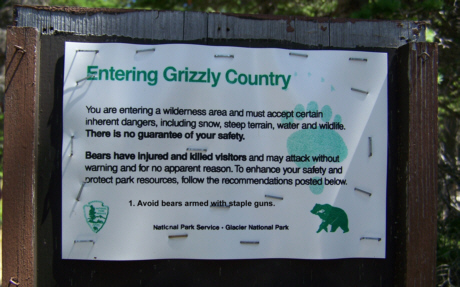
Just a bit further along this highway, we came around a curve and found a bunch of cars stopped on the highway in both directions. The reason became immediately obvious- some wildlife of the ursine variety (presumably mother and cub) grazing quite close to the highway. Since we were on the opposite side of the highway, we thought it safe to step out of the car to take a composed picture, but the folks in the cars right alongside the bears were, for the most part, heeding park advisories to stay in their cars when bears are encountered. This was only the second or third time in all our travels, I think, that we've encountered bears in the wild.
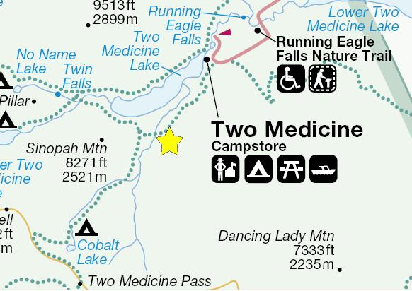
As we approached Two Medicine Junction, Lower Two Medicine Lake came into view (viewpoint #1), and stayed in our sights as we turned at Two Medicine Junction onto the park road leading to the Two Medicine entrance back into Glacier National Park. A short ways after passing the Two Medicine Entrance Station, we arrived at our first stop (marked with the yellow star).
Running Eagle Falls
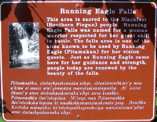 |
From the bridge, you can look down the shallow South Fork, or upstream towards Running Eagle Falls. Then the trail leads along the north side streambank to an overlook. There are good views of the falls from this overlook platform, and here is one with Fred and one without ('cause sometimes you feel like a nut and sometimes you don't). There were some park folks (summer hires, it looked like, or volunteers) working on extending the trail just a bit towards the falls, and putting in some bracing against the hillside. Unusually for me, I did ask whether continuing on a ways to the base of the falls was OK. It was (or they didn't feel they had the authority to say it wasn't) so I went a ways further. Nearer the falls, I could get an excellent view looking downstream, and you can see the overlook platform in the picture as well.
|
|
|
|
We stuck around for a while, and then headed back along the trail and across the footbridge again. The stream is quite shallow right at this point, and the water is crystal clear, allowing a really interesting view of the rocks in the streambed. I also got a good view of Fred, the falls and the stream.
Astor Park Falls
 |
As with all the trails in Glacier National Park, this trail was a scenic one. The day was warm, but not hot, and most of the trail led us through forest- although not the thick forest we'd encountered, say, at St. Mary Falls. We arrived at Astor Park Falls after about an hour's hike.
|
|
|
|
|
|
|
|
The falls and cascades continued as far as we could see. I explored a goodly way up the falls, but there was just no end to them. Finally, I reached this steep waterfall and, while I could probably have found a way to avoid having to climb the cliff face, get above these falls and continue on, it seemed that all I would find would be more and more falls and cascades, until the stream leveled out in some very high meadow. It would have been fun, but there just wasn't time. So I turned around and took one last picture looking all the way down the back of Astor Park Falls (Fred's not in the picture having already started back down) and reluctantly started back down the watercourse myself.
I caught up with Fred about halfway down this back side of the falls, and we continued on to the bottom together. From there, it was back on the trail to Two Medicine. On the way back down, we stopped briefly at a little footbridge that we'd crossed on the way up. After half an hour more, we were back at Two Medicine.
Two Medicine
 |
After we walked around the lake area for a while, we went over to the picnic ground to have lunch, and then headed off for Appistoki Falls.
Appistoki Falls
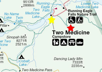 |
The trail led off through the sparse forest, and after a ways we could hear water falling, and continually thought that the falls would be right around the next bend in the trail. But it was quite some time before we arrived at Appistoki Falls (the red star on the map). What was disappointing was that the trail did not go all the way through the canyon to the falls. I guess I could see why, looking down into the canyon leading to the falls- it would have been a trail only mountain goats like myself would have liked. I found myself wishing that we'd gotten down into the canyon back near the trailhead where it was not so deep, but then working one's way up the streambed would have been time-consuming, I guess. But in the end, not even a movie did an appropriate job of conveying what the falls were like, although you can watch my attempt using the player below:
|
|
|
A little while before we reached the trailhead, we did get some spectactular mountain views, like this one of the mountains on the opposite side of the valley above Running Eagle Falls. When we reached the parking area, we'd completed all the hikes we wanted to do in Two Medicine and, in fact, had completed what we had time to do in Glacier National Park.
It goes without saying that Glacier National Park is one of the most beautiful places we have ever visited, or would hope to visit. I suppose one of its attractions is that it is so far away, and thus has relatively few visitors to spoil the experience. All in all, though, it was one of the best National Parks we've been to.
But now, we have to continue our trek homeward, even though there is still lots to do in the next four days. We have one more stop later today, and that is to see some "urban waterfalls." We are heading off towards Great Falls, Montana.
Great Falls, Montana
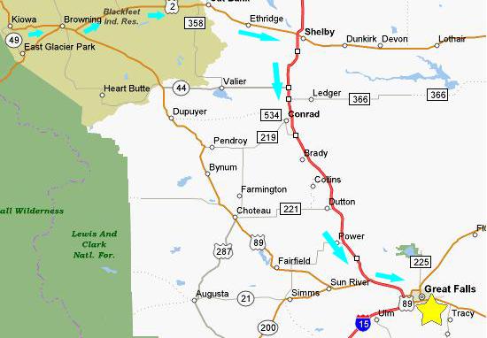 |
From Two Medicine, we went back out the park road to Montana 49, and then south to East Glacier Park. This town is the eastern gateway to Glacier National Park, much like West Glacier was on the western side of the park. When we entered the park two days ago, we had been driving on US Highway 2, but turned off it to go into the park. Vehicles that cannot make it across the Going-to-the-Sun Road must take US 2 around the southern boundary of the park if they wish to access the eastern side. We were told that US 2 is very scenic, but, truthfully, nothing could have matched what we saw in the last two days.
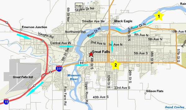
We headed east on US 2 through Browning. There was a set of falls we might have stopped to see west of Great Falls, but the directions to it were iffy, so we decided to go straight over through Ethridge to I-15, which we took south to Great Falls (the yellow star on the map).
 |
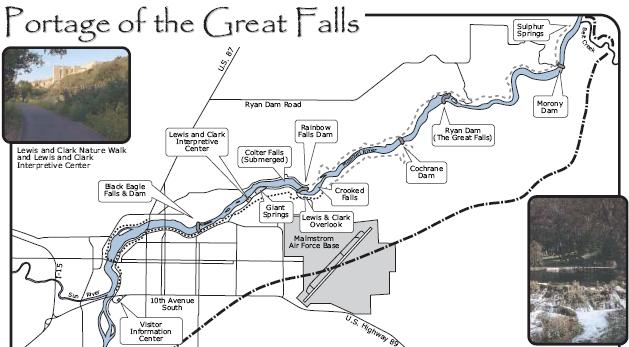
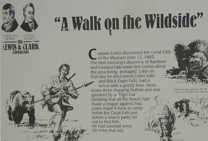
The Lewis & Clark Interpretive Center sits on a bluff above the Great Falls of the Missouri (yellow star #1 on the map). Although we didn't have time to explore it completely, the museum was very interesting. Just inside the main entrance, this wall plaque set the tone for many of the exhibits. You can read most of it; it is a quotation from Thomas Jefferson to Merriwether Lewis, setting the tone for the entire expedition. Of course, Lewis and Clark expanded a bit on Jefferson's admonition, and went all the way to the Pacific Ocean. (I can't help but wonder if even Thomas Jefferson didn't know the difference between the possessive "its" and the use of the contraction "it's" for "it is." I shall have to look up the quotation somewhere.) What looks like a painting or something in front of the inscription is just one of many full‑size dioramas that occur throughout the museum. This one, for example, is only the very front portion of a full-size replica of an actual portage, something the expedition had to do frequently. A little later in our trip through the museum, we found we could see the replica from above. In the museum, there were also many paintings and other exhibits, some of the touching on the relationship of Native Americans and the Great Falls. One other exhibit of interest was not really an exhibit at all, but rather a beautiful buffalo sculpture in the main lobby. As I said, we'd arrived late in the day, so we looked through the museum first and then, when it closed, went outside to the Great Falls themselves.
 |
Leaving the museum, we drove a short distance downriver from the Interpretive Center to Giant Springs State Park (which has to be one of the smallest State Parks we've encountered). I took a single movie of the entire State Park, and you can watch it with the left-hand player below. The Giant Springs are immediately adjacent to the Missouri River itself, as you can see clearly in the movie I made of the springs (right-hand movie player below). All around the springs are walkways and observation platforms where visitors can take pictures and look directly down into the springs. Fred and I wondered where the water comes from for the springs, and thought that it might just be an underground river or something like that. We were surprised to find out that it came from the mountains 38 miles away, and even more surprised that it takes hundred of years to get here.
|
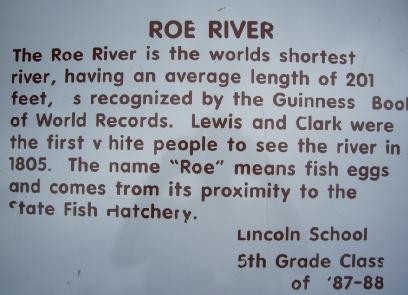 |
Right next to Giant Springs was the Giant Springs Fish Hatchery. We knew there were tours, and thought we'd simply missed the time for them, but as this sign indicates, they've been discontinued.
|
|
Leaving the overlook, we drove back towards town, and then south through the center of town to find the local Baskin-Robbins (yellow star #2 on the map above), and then headed west out of town and back to I-15.
To Bozeman, Montana
 |
 |
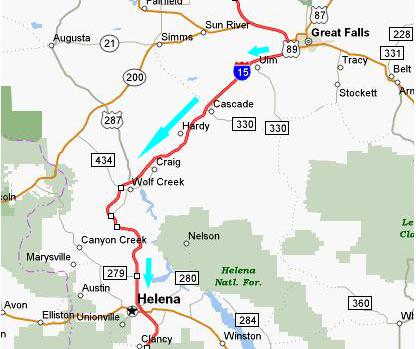
Now we had to get down to Bozeman, Montana, so we'd be close to our first hikes of the next day. We got back on I-15 and drove down towards Helena, Montana. Shortly after leaving Great Falls, the highway starts along Wolf Creek through Wolf Creek Canyon. The road was built in spectacular fashion, reminding us of Interstate 70 through Glenwood Springs, Colorado. At times, the road was "hung" off the mountainside, and it criss-crossed the river for many miles. Eventually, as we neared Helena, we came down out of the canyon onto the relatively flat high plains. Coming in to Helena, we were able to locate the local IHOP (and finally getting the omelette that I'd missed in Missoula three days earlier).
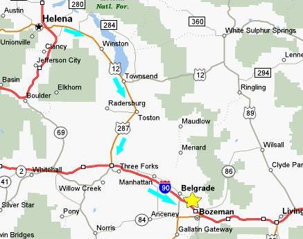
After dinner, we located US12 southeast from Helena (see map above) and connected with US287 south to I-90, and from there to a Super 8 Motel just west of Bozeman, Montana. Another day of incredible sights and sounds and experiences, but we weren't done yet.
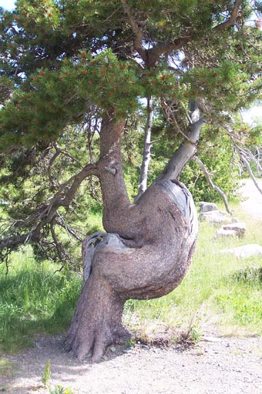
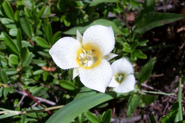
Today's Flora
|
 |
You can use the links below to continue to another photo album page.
|
July 7, 2006: Hyalite Canyon and Natural Bridge SP, MT |
|
July 5, 2006: A Day in Glacier NP, MT |
|
Return to Glacier National Park Trip Index |