|
July 15, 2007: New Mexico/Colorado Trip Day 2 |
|
Return to Main Index for New Mexico/Colorado Trip |
The Drive to New Mexico
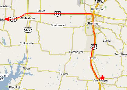
As we have done before, we decided to leave from Fred's house on Saturday morning, since it is easier to get across North Texas if you don't have to contend with Dallas/Fort Worth traffic. We got everything set on Friday night, and on Saturday morning loaded my car and were away from the house before nine.
 |
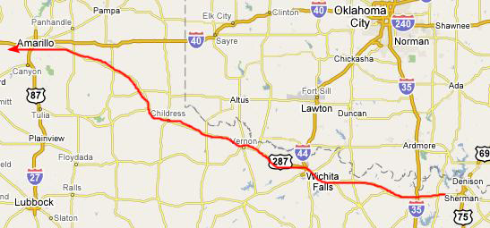 |
At Wichita Falls, we leave US82 and get onto US287, which now begins to angle northwest towards Amarillo. This is a long stretch- about 175 miles- which is more divided highway punctuated by the occasional small town or the small city- Childress and Vernon being the two largest. There is not much to do as we ride along except talk or listen to music. We reached the outskirts of Amarillo about one in the afternoon.
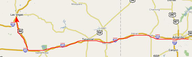 |
But as we were riding along, Fred was doing some checking as to what hikes and stuff we'd want to do our first full day in New Mexico and, as it turned out, the really interesting hikes and stuff were closer to Santa Fe than to Albuerqueque. So as we went west, we changed our minds as to where we'd want to camp the first night, and we chose instead to head for a US Forest Service campground about fifteen miles north of San Jose, NM, where Fred had read about a longish but interesting hike to a set of waterfalls. So, just west of Santa Rosa, NM, we headed north on US84 towards Las Vegas, intending to then go south on I-25 to the exit for the unpaved road to the campground.
As we drove north, however, we could see that there was a lot of rain in the direction we were planning to go, and so, worried about setting up the tent in the rain, we changed plans again and shifted our destination to Coyote Creek State Park, some thirty miles north of Las Vegas.
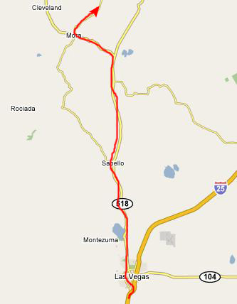 |
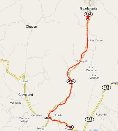
The drive to the little town of Mora was pretty scenic, but we missed the turnoff to the state park and had to stop and ask some locals where it was, but that didn't waste more than a few minutes.
 |
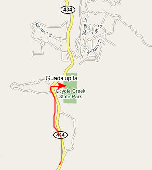 |
After about a half-hour's drive, we reached Coyote Creek Campground, only to find out from the campground host that all the spaces were already taken.
So, that kind of made our decision for the first night. It was too late to backtrack to Manzano Mountain SP, and it still looked as if it was raining in the mountains near San Jose, so we thought we'd just get a motel in Las Vegas for the night. We turned around and headed back down to Mora and on to Las Vegas.
The Victory Alpaca Ranch
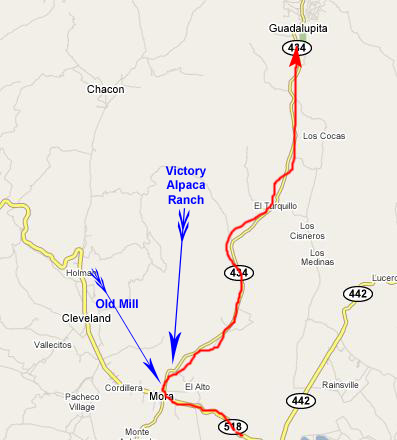 |
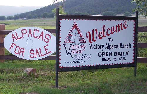
Shortly before we got back to the town of Mora, we passed an alpaca ranch. Both Fred and I have seen the TV advertisements that try to entice people into raising alpacas; I think it is the same kind of enticement that got Fred's friends from Arlington into raising ostriches out west of Fort Worth. I don't know what you do with alpacas other than shear them for their hair or sell them to other people to raise.
Anyway, we stopped at the entrance to the ranch so Fred could take some pictures of the animals that were out in a pasture about fifty or sixty yards away. Fred used his zoom lens, and captured a view of a few of the alpacas out in the pasture, and a closeup of a single alpaca. I think they had just been shorn, but I couldn't really tell from this distance. The valley around the ranch was certainly picturesque, so even if they don't sell many alpaca, I guess there are benefits to living out here to raise them.
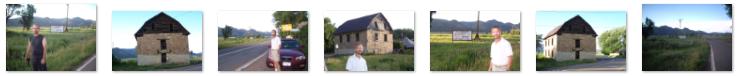
Mora, New Mexico
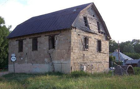 |
The building had obviously not been kept up, either as an historic site or anything else, for when we got around to the side of the building and took a close look, we could see that not only had the brick (not just a facade here, but the actual wall) separated along a jagged line up the side of the building, but you could see right through the structure, as we've tried to show clearly here.
We spent some time just wandering around the area and the building, taking quite a few pictures, and I've put thumbnails for some of the better ones below. To see the full-size image, just click on the appropriate thumbnail:
|
You can use the links below to continue to another photo album page.
|
July 15, 2007: New Mexico/Colorado Trip Day 2 |
|
Return to Main Index for New Mexico/Colorado Trip |