|
July 21, 2007: New Mexico/Colorado Trip Day 8 |
|
Return to Main Index for New Mexico/Colorado Trip |
Folsom Falls
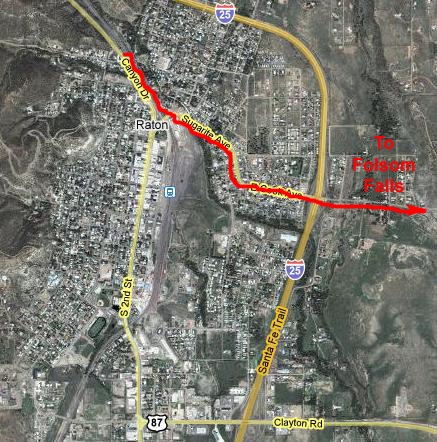 |
Jan served a breakfast in a room off the little office, and it was set up as if it were a little B&B. Everything was nicely done, and all the guests sat at one big table in the room, to get to know each other, I suppose. Jan was a very nice host. She gave us directions to the road out of Raton that would lead us over to Folsom, New Mexico, and our first stop of the day- Folsom Falls. We had a bite to eat and headed out.
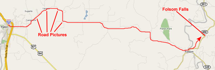
We passed under I-25 and headed east out of Raton. Soon after leaving town, the road started climbing, although it was nothing like the Rockies. Soon, we found ourselves in the high meadow, the entire area being surprisingly green for this time of year. The scenery that we saw as the road wound through the mountains was really beautiful, and this looked like another great place to live if you wanted to be out-of-the-way and self-sufficient. We saw a few good‑sized farms as we drove along with the windows down to let in the cool mountain air. Just before we came down out of the mountains into the flatter valley, the road followed along the base of some beautiful cliffs.
There was no traffic on this Sunday morning, and the drive over to Folsom was extremely pleasant. When we reached Folsom, we didn't see any signs for the falls, so we followed our noses trying to find it, eventually having to stop in town and ask some guys loading hay where they were. Even then, the directions were a bit imprecise, but we finally found them- about three miles north of town.
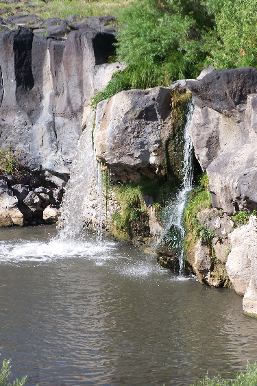 |
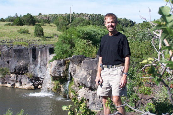
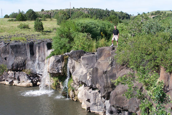
There is a small parking area along the highway, and then you have to walk a hundred feet or so to get to the falls themselves. Once there, you are treated to a small set of spring‑fed falls in what feels like a small oasis in the high meadow. I took a short movie of the falls, and you can watch that movie with the player below:
|
|
Here are a couple more good pictures that Fred took:
|
|
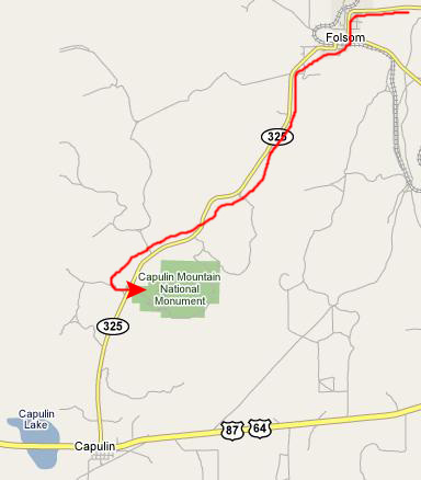
After spending some time at Folsom Falls, we headed back south towards Folsom and our next stop- Capulin Mountain. Just north of Folsom, we went past an old stone house that we thought was interesting because one of its walls was being propped up by a beam. Not an elegant solution to a structural problem, but perhaps the only alternative.
Exploring the Capulin Volcano
 |
Getting to the Top of Capulin Volcano
After stopping at the entrance, we headed up the road into the monument, arriving at the Visitor Center after about a mile or so. At the Visitor Center, we bought our admissions and looked around at the exhibits inside. Outside the Visitor Center, I got a picture of Fred and Capulin Volcano before we got in the car and headed up the long circular highway that led completely around the mountain to the top, ascending all the way.
On the way to the top, we stopped at a couple of points to read some of the informative signs and admire the views from the roadway. Here is another picture, looking off in a different direction, of Fred beside the road to the top of Capulin Volcano.
 |
|
|
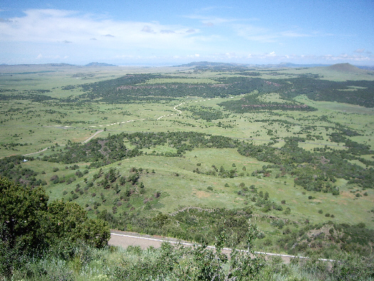
We'll be returning to the parking area after a couple of hikes, and I'll show you more pictures of the informative signs and the views from the mountain then, but, for now, take a look at some of the pictures we took when we first got to the top. In the first picture, you can see Fred and the view southwest from the top of the volcano. As you found out in the movie, all those peaks that you can see in the distance were, at one time, active volcanoes (this we learned in the Visitor Center). I can only imagine what the area must have looked like when many of these cones were smoking and spewing out cinders and lava.
In another view, we could look west to see the highway and entrance road into the National Monument. Using my zoom, you can also see the detail of one of the adjacent cinder cones; this area is mostly grazing farms now, but would have been entirely different eons ago. Finally, and again using the zoom, you can see the Visitor Center at the base of the mountain.
Hiking the Rim of Capulin Volcano
|
Next, the path to the top of the rim turns and heads more northeast and then eventually north. Once you get up that path a ways, you can look back down the path towards the parking area. This would have been a better picture if I'd been warned it was coming. (Incidentally, the battery in Fred's camera had not charged properly overnight, and we didn't know it until we arrived here. So, all of the pictures we took here at Capulin Volcano National Monument were taken with my little camera, either by myself, or by Fred, or, in one case, by some other tourists we met along the path.) Now that we are actually on the rim, the views are spectacular, as evidenced by this view looking northeast.
 |
The pathway continued around the north side of the mountain. Now we had views looking along the pathway northwest and we could look out from the mountain at a view north towards Folsom.
Just ahead of us we came to two informative signs that I will let you read for yourself. The first, Landmarks and Trails, talks about the trails through this part of New Mexico followed by settlers and ranchers. The second, Settlement and Discovery, will give you some information on the history of this area, including the town of Folsom.
Along the trail, there were two interesting informative signs that described the views in different directions across the Raton-Clayton Volcanic Field. I thought it might be interesting for you to, in effect, look down and read the sign and then look up and see the actual view. So I've paired up these two signs and their views. They are both views of the same volcanic field but looking in different directions. For the first pair, read the sign and then look up at the view. Then, for the second pair, read the sign and then look up at the view. My hope is that for you it will be almost as if you were there taking the walk with us.
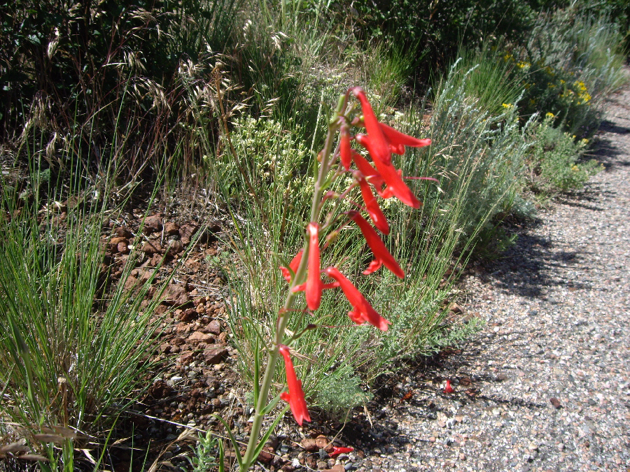
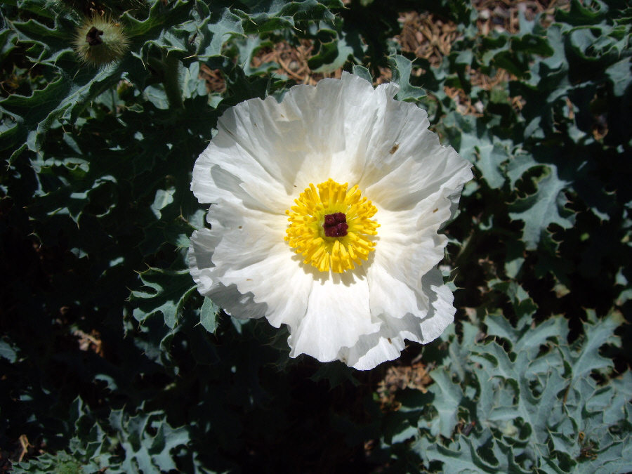
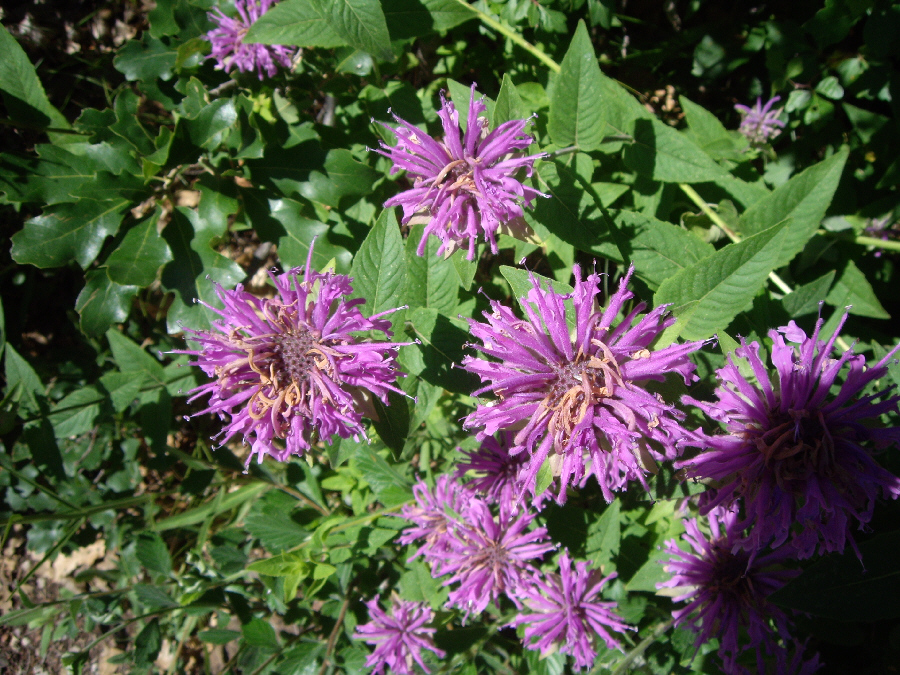
Along the walk, Fred also found some interesting flowers, so he used the camera to take pictures of them. Three of these pictures turned out very well, and you can view these pictures by clicking on the thumbnails below:
 |
 |
 |
 |
The path had turned southwest, now, and the vistas were really spectacular. Here are a couple of good views, first of Fred on the pathway and then one of me on the pathway. Just as the pathway turned around to the southeast again, a really great view opened up, so I got a really nice picture of Fred with the parking area and the view to the southeast, and you can look at that picture here.
|
|
Finally, about to the end of the Rim Walk, I captured a really good view to the south that also shows a bit of the road coming up to the parking area, and that is the picture that I've placed over at the right. Then, in another hundred feet or so we had descended back to the parking area.
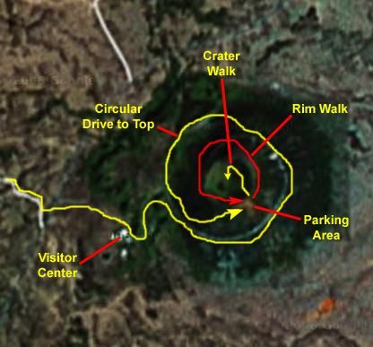
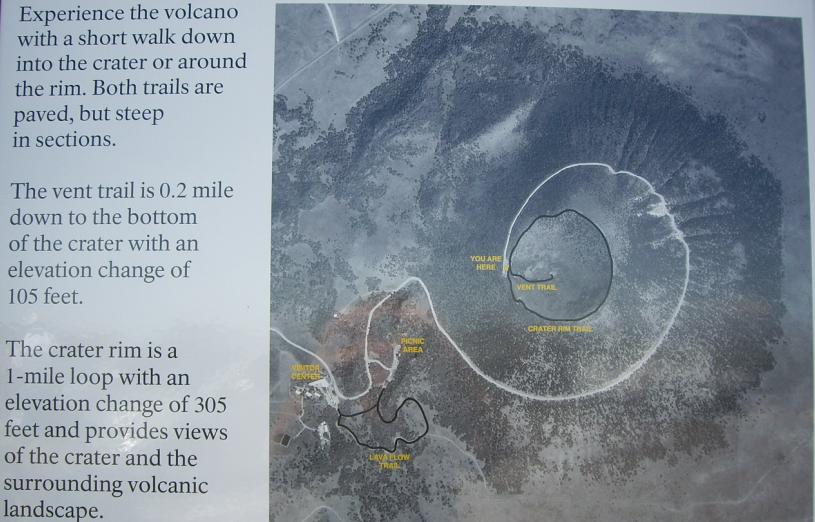
When we got back to the parking area, I noticed one sign that I hadn't seen when we arrived. Had I seen it, I might have used it instead of the aerial view of Capulin that I included towards the top of this section of the album. It provides a really good orientation for both of our hikes, so I am going to include it here:
Hiking the Vent Trail
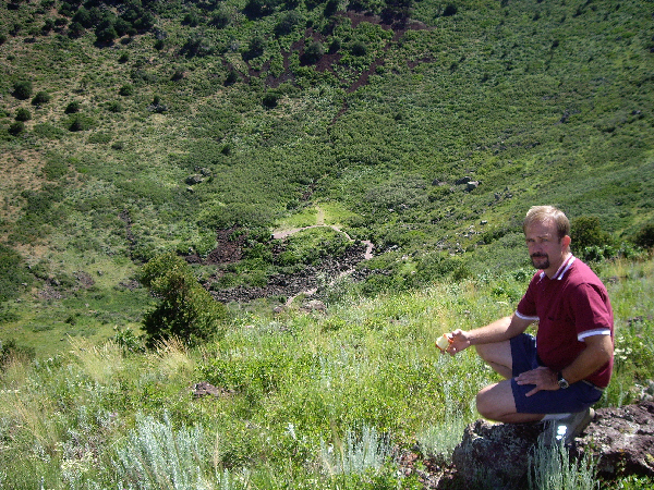 |
This trail was pretty short, and ended at an informative sign describing "volcanic plumbing", which I think you'll find interesting. From the bottom of the caldera, we had beautiful views up towards the rim; here is a view with Fred and here is a view with me.
|
|
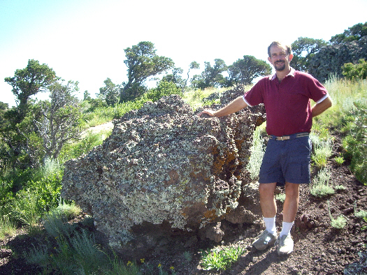
After that, it was back up the trail to the parking area. Along the way, I got a closeup look at a lava rock field right by the trail.
Before we leave the parking lot, I thought you might like to read the three informational signs that you haven't already been shown. So I took pictures of them, and you can read each of them by clicking on the links below:
We've come to the end of our visit to Capulin Volcano National Monument, so we got back in the car and headed back down the road circling the mountain, past the Visitor Center, and out to the highway. When we got to the highway, we got one more picture looking back towards Capulin Volcano.
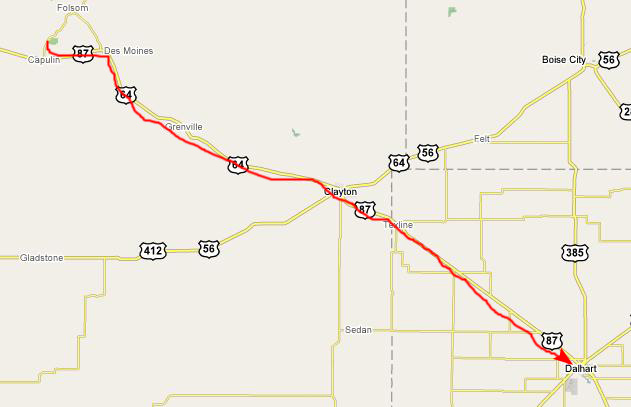
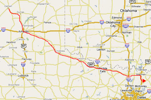
The Drive Home
 |
 |
You can use the links below to continue to another photo album page.
|
July 21, 2007: New Mexico/Colorado Trip Day 8 |
|
Return to Main Index for New Mexico/Colorado Trip |