|
July 22, 2007: New Mexico/Colorado Trip Day 9 |
|
July 20, 2007: New Mexico/Colorado Trip Day 7 |
|
Return to Main Index for New Mexico/Colorado Trip |
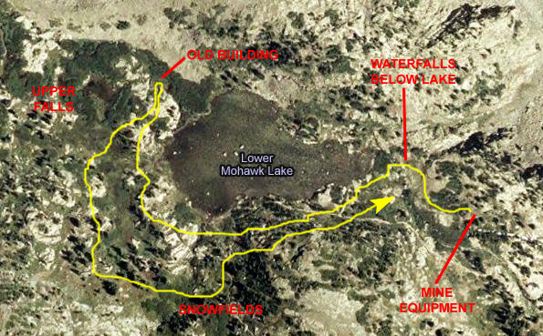
Hiking to Continental Falls
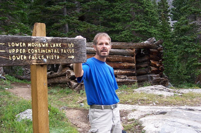
Getting to Continental Falls
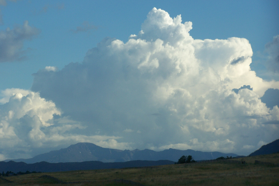
Well, it's Saturday morning and we have a lot to do today. The hike to Continental Falls is billed as a 3-4 hour hike, which we want to do before it starts raining (as it has most every afternoon). Then we have to drive to Raton, New Mexico, which is a minimum 5-hour drive from here- longer if the weather slows us down. So we were up early.
|
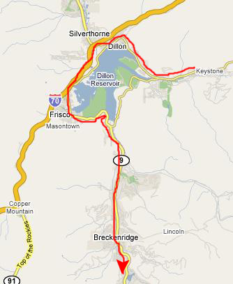
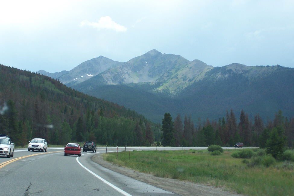
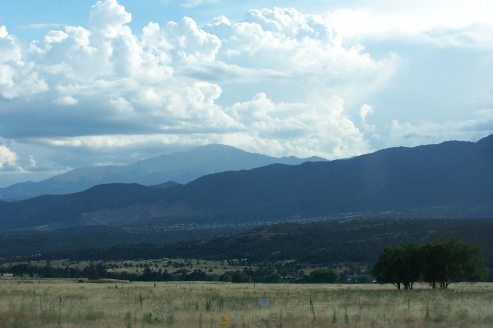
We headed back towards the interstate through Dillon, Colorado, even though we could have bypassed it and gone over a mountain road to Breckenridge. That mountain road was hard to find and we actually didn't know it existed until we were actually leaving Breckenridge after lunch. In Dillon, we stopped for a bite of breakfast, and then took the interstate up to the Highway 9 exit to Breckenridge. Driving south into Breckenridge, we had excellent views of the mountains all the way into town.
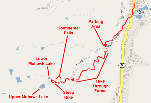
From there, our directions said to go all the way through Breckenridge and look for Spruce Tree Road "2.5 miles after the last traffic light." Problem was, we never knew which would be the last traffic light, so we had to repeat our counting a couple of times until we hit on the turnoff.
|
We parked the car, but hadn't gone but a few feet up the road to the trailhead before I was getting buzzed by insects, so I returned to the car and put on some bug spray. Whether it was the spray or the fact that the insects were only near the roadway I don't know, but I wasn't bothered for the entire rest of the hike.
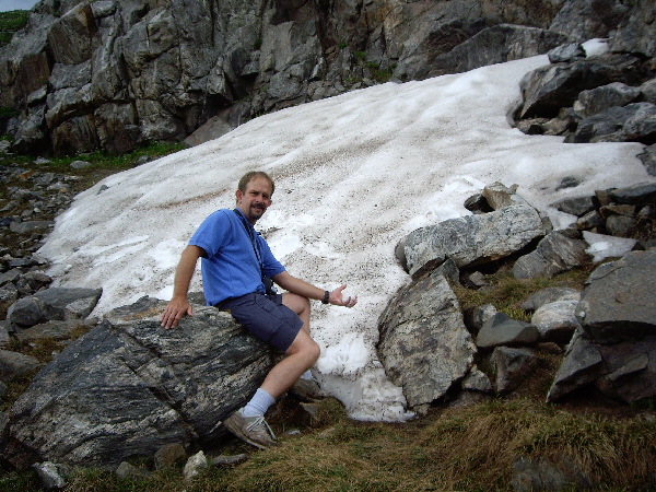
Up by the parking area, we found the trailhead for the hike, and here is a picture of Fred at the trailhead. Fred set his pedometer and off we went.
Hiking Through the Woods
The first half of the hike up to Mohawk Lake was through a dense pine forest. It was strenuous, since we were heading constantly uphill, but the trail was wide and shady. There were a lot of people on the Continental Falls trail, evidenced by the crowded parking area, and we were continually passing groups of hikers, and occasionally being passed ourselves. So there weren't too many opportunities early in the hike to take pictures, like this one of Fred on the trail.
For the most part, the trail simply wound through the forest, but there were some interesting things along the way. Pretty early in the hike, we had to cross a narrow wooden bridge, and a while afterwards had to cross a more substantial footbridge over a small creek. Another picturesque spot was a beaver lake, formed by a large dam, presumably built by beavers.
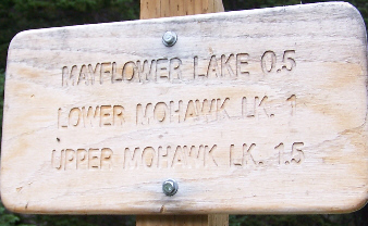 |
Crossing past the diversion, we found a trail marker that confirmed we'd come halfway. Our destination is going to be Upper Mohawk Lake. We'll pass Mayflower Lake, which is quite small, and we'll pass the turnoff to Lower Mohawk Lake. There is yet another small pond at the base of Continental Falls, and we'll see that too. For now, though, we are heading off on the second half of the trail, the first part of which took us through a thinning forest.
The Hike to Continental Falls
 |
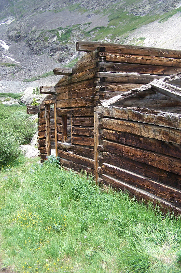
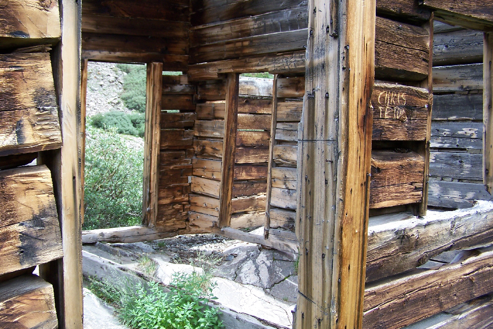
One of the interesting things about this entire hike was that there were quite a few very old structures left over from the days when this was a mining area, all of them build almost entirely of logs of locally-hewn wood. One example was and old house that had lost its roof, and we stopped to examine it. (There were none of the usual signs admonishing people to stay away from the structures.) Just past the old house, the trail dipped down to cross Spruce Creek on a dual‑log footbridge. And just before the turnoff for the overlook of the falls, there was another old house, his one seemingly intact.
This building seemed to be under someone's care. When we went inside, we found a lot of old equipment, some old empty cans and generally some items that might well have actually been used when the building was in use. People seem to have been very good about leaving everything there. Before we left the house, I wanted to get a good view of the wall detail.
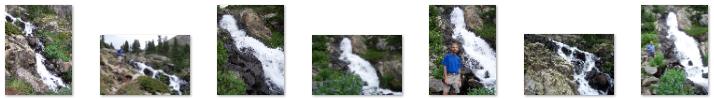
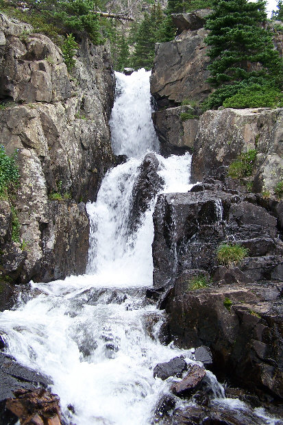
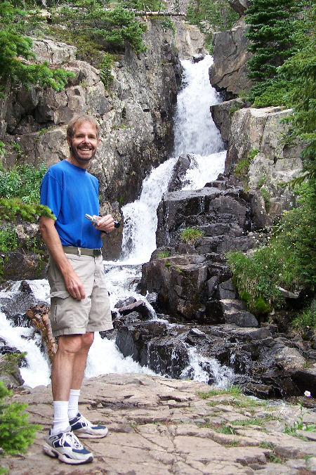
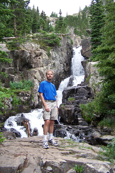
It has been my usual practice in this photo album to present the pictures to you pretty much in the order they were taken. Perhaps this is the Sagittarian in me, or perhaps it is just easier to write up the narrative that way, when I can replay the hike or the event in my mind. On this particular hike, we did take a quick look at Continental Falls on the way up, but we didn't spend much time at the overlooks as we wanted to ensure that we got to our goal of Upper Mohawk Lake before any rain got started. As it turned out, the rain held off until we got back down to the diversion, and we had plenty of time to spend more time at the falls on our way down.
But, rather than break up our look at the Falls (we saw the upper section on the way up and the lower section on the way down) to keep things linear, I've taken all our pictures of the falls and put them here. I don't think it will matter much to you, the viewer/reader. Moreover, I'm going to arrange the pictures and narrative so that you will see the upper falls first, followed by the pictures taken at the vista point for the lower section of the falls. So, let's take a look at Continental Falls.
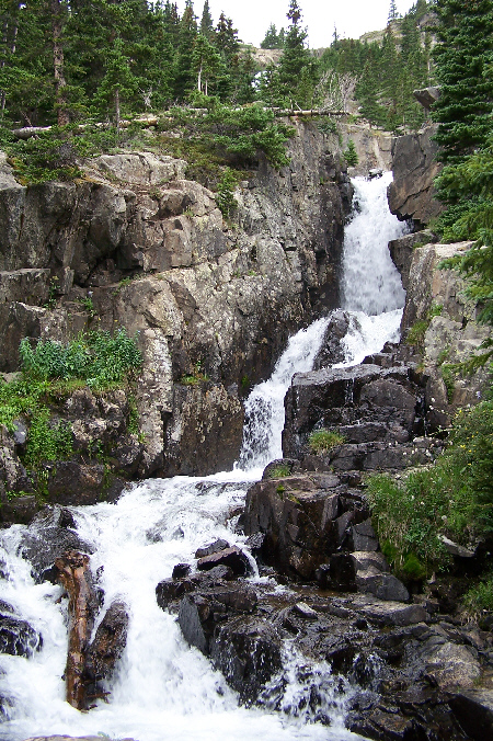
The upper section of the falls begins right at the edge of the meadow below Upper Mohawk Lake, and the section is about fifty or sixty feet high. The individual pictures don't need much explanation, except perhaps for this one. It looks down the upper section of the falls, and you can see both the lower section of the falls a hundred feet or so below where I am standing, but you can also see Lower Mohawk Lake, formed at the base of the falls.
For the rest of the pictures of Upper Continental Falls, I have taken a selection of the pictures we took and put thumbnails for them below. To view any of the full-size pictures, just click on a thumbnail that interests you:
|
I also took a couple of movies here at the upper falls. Both are good, I think, and you can watch them using the players below:
|
|
 |
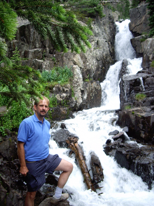
The lower falls were more "channeled" than the upper ones, and I thought more interesting; I liked looking at the small canyon through which the water flowed very rapidly.
Again, I took a couple of good movies of Lower Continental Falls, and you can watch those movies with the players below:
|
|
As I did with the pictures we took at the upper falls, I have selected some of the best pictures of the lower falls and put thumbnails for them below. View the full-size picture by clicking on its thumbnail:
 |
 |
 |
 |
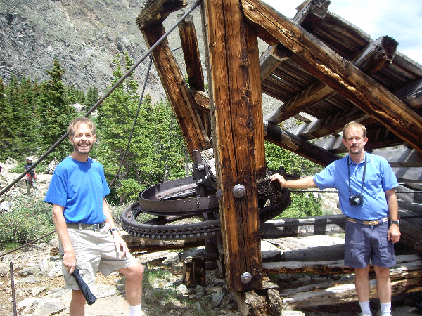
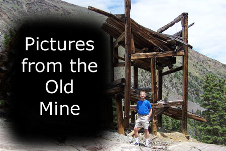
The Old Mine
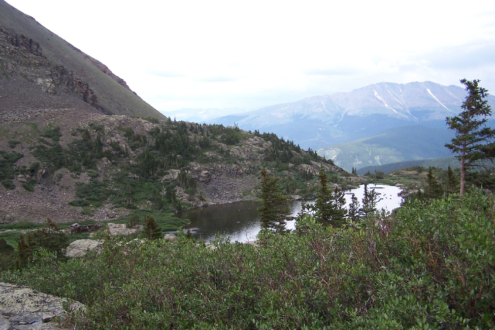
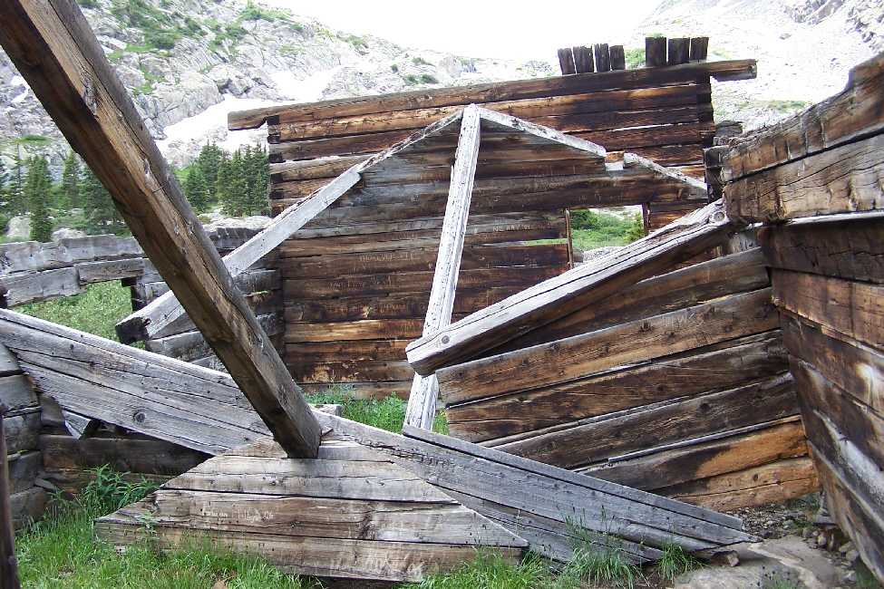
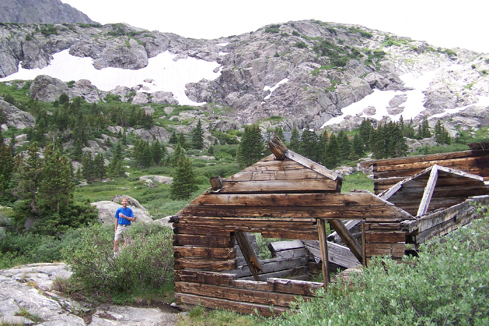
When we left Continental Falls, the trail began ascending very steeply in a series of switchbacks across the face of the mountainside. Looking back down the trail we could see just how steep it was. And, as we ascended, the view of Breckenridge and the views of the surrounding mountains got better and better. At one point, where the trail turned into another switchback, we could see the remains of an old mine shaft with the obligatory warning sign at the entrance. We had read that there had been a great deal of mining activity here a century ago, but we were a bit unprepared for what we encountered as the trail got to the top of the ridge.
|
I must also admit that there were beautiful views down to the valley from the site, and we spent a good deal of time looking around and marveling at the ingenuity of the builders, particularly knowing that they didn't have the benefit of the last hundred years of technology. There was a cairn here to show which way the trail went across the bare rock, and it was a good place to get a picture of Fred and the mountains to the southeast.
|
To view the slideshow, just click on the image at right and I will open the slideshow in a new window. In the slideshow, you can use the little arrows in the lower corners of each image to move from one to the next, and the index numbers in the upper left of each image will tell you where you are in the series. When you are finished looking at the pictures, just close the popup window.
The Falls Below Lower Mohawk Lake
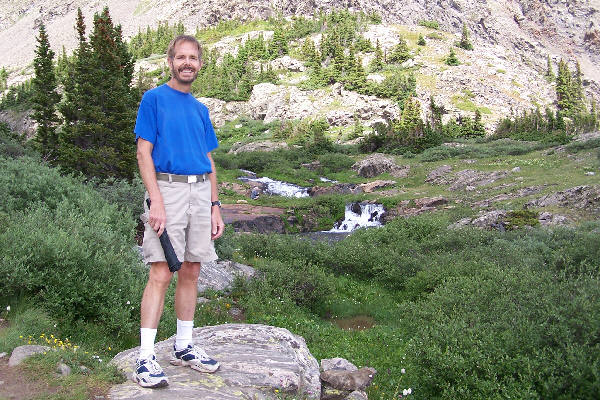 |
I suppose that to introduce these pictures taken here in the meadow, I should get you to watch a couple of movies that I took of the area. The first movie (left-hand player, below) will show you the two waterfalls just below the lake, and you'll see Fred wandering around them taking pictures. You can see the two closeup pictures Fred was taking of the two waterfalls here and here. The second movie (right-hand player, below) will show you not only the falls, but the watercourse as it flows through the meadow on its way to the edge of the mountainside and hence to Continental Falls.
|
|
Before I went down into the meadow to film the movies, I could see the entire area from my vantage point. Fred had already scrambled down to the two waterfalls, and I got a good view of Fred and the waterfalls with him looking back up at me. Then I went down to join Fred, where he got a picture of me and the lower waterfall, and I got pictures of the lower waterfall and the upper waterfall.
While I was doing that, Fred was following one of the little streams that seemed to be coming from the lake. Apparently, Spruce Creek was not the only water outlet, although the main creek and these other little streams all joined up in the meadow to head down to Continental Falls. The particular little stream that Fred was following was quite pretty, and along its length formed a number of little pools; here you can see Fred at one of these pools.
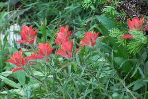
Fred was intrigued by these little pools, and they were certainly beautiful. The pools themselves were formed by the chance position of some pretty banded rocks, and Fred also found some white mountain flowers growing in among the rocks at the edge of the rivulet. Just beside the little stream were some different lavender flowers; I didn't bother asking what they were, as the vegetation is so different here from what we have at home.
We could hear the people who were up by the shore of the lake; rather than make our way back to the trail, we just followed the little streambed up to join them.
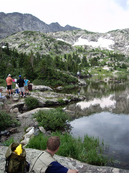
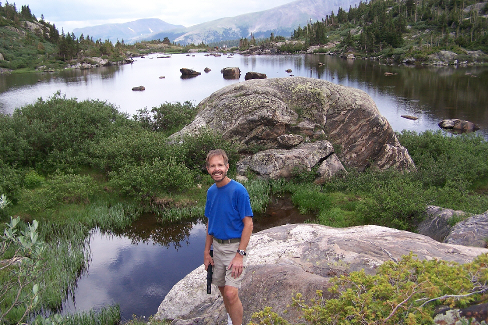
Lower Mohawk Lake
|
There were quite a few people up here; some were near to where we were standing, but there were others at various places around the shore of the lake. On the far side of the lake, there was another waterfall. All in all, it was one of the most beautiful lakes I've seen. I took a movie of the entire panorama of the lake, and I think it sets the scene very well. You can watch that movie using the player below:
|
|
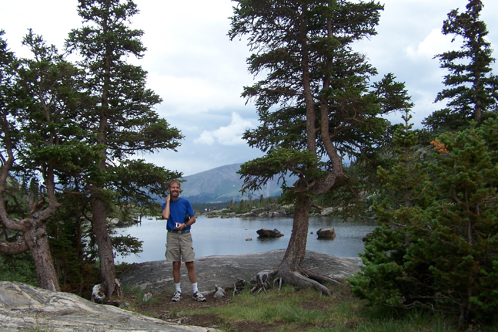
While I was taking the pictures and movie of the lake, Fred wandered around the shore of the lake to my right, taking pictures like this one, of the lake and distant mountains. While he was doing that, I took this picture of Fred on the shore of Upper Mohawk Lake.
We continued to see mining equipment here and there, as well as some more buildings. Actually, right in front of me there was an ore car right at the shore of the lake. Why it had been left right here, I am not at all sure.
While Fred and I were taking pictures from our vantage point at the east end of the lake, we could see and hear other folks- kids even- off on the other side of the lake (which was only about the size of two football fields). We could also see that there were some more waterfalls over on the other side, so we thought that we'd try to find a trail over there or, failing that, make our own, as other folks had obviously been doing.
Walking Around Lower Mohawk Lake
 |
From the east end of the lake, we returned to the trail to follow it around the south side of the lake, hoping to get over to the other side quickly (the clouds seemed to be thickening up, and we could already hear distant rumbles of thunder).
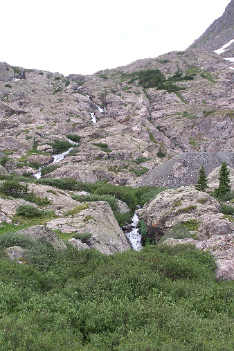
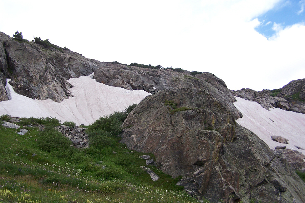
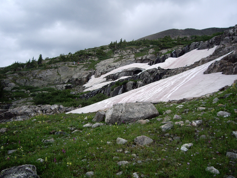
After a time, the actual path seemed to take a turn leftward up the mountainside, so we blazed our own trail and tried to hug the shore of the lake. Doing so, we crossed a medium‑sized creek and a small stream, both of them seeming to come from the melting snow up on the hillsides. Fred used his zoom lens to take a photo of one of these small snowfields, and in the picture you can easily see the runoff from the melting snow. Making our own trail was a bit adventurous; much of the shore of the lake was swampy, and we had to be careful to stay on dry patches or on the rocks.
As we were finding our way around to the other side of the lake, we passed through what appeared to be a campsite. It actually didn't look as if it were occupied, except that there was a tent set up. All we could think of was that someone was camping here for at least a few nights, and was off doing some hiking. As we were trying to blaze our own trail and keep our feet dry at the same time, we went up and down the hillsides trying to work our way over the the waterfalls that we'd seen earlier. Here are thumbnails for some of the pictures of Lower Mohawk Lake that we took as we were working our way around to the far side. Just click on the thumbnails to view the full-size pictures:
 |
 |
 |
 |
 |
We had no idea what the building had been, although it was a safe assumption that it had been living quarters of some kind. We also had no idea how old it was, although again we assumed that it was contemporaneous with the other mining-related buildings we'd seen.
We spent some time walking around the site, and took quite a few pictures; thumbnails for three of the best of them are below. To view each image, just click on its thumbnail:
 |
 |
 |
There were some boulders just west of the building, so Fred climbed up on them to get a good view of the building and lake. I was down below the building, also looking back across the lake. As you can tell, the clouds are steadily thickening, and at times it got quite dark and gloomy. We knew our time here was going to be limited, although the sky brightened up for a while longer.
|
|
So, we had to content ourselves with these pictures of the waterfalls taken from a distance. We took some others, as well, from various angles up and down the hillside, and you can see the three best of these here, here and here.
|
|
 |
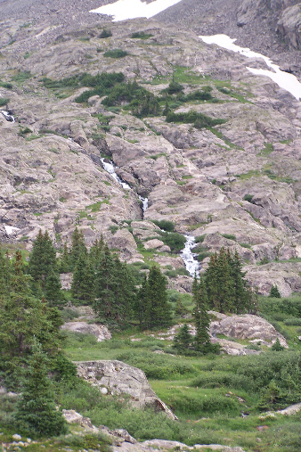
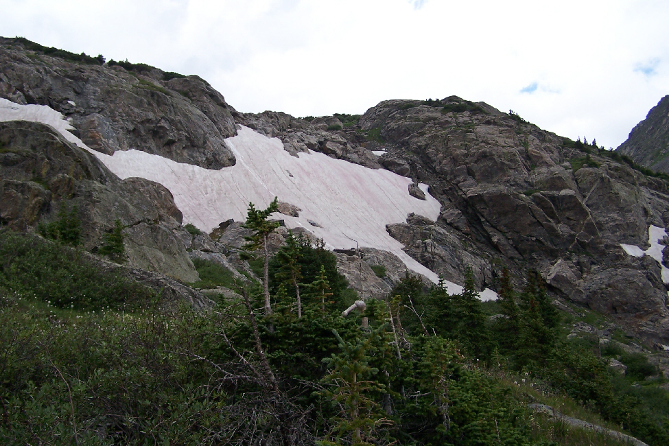
Here are thumbnails for some pictures of the little snowfields. Click on each thumbnail to view the full-size picture:
 |
 |
 |
From our perch high up on the hillside, we also got some excellent views of the lake and mountains to the east before we worked our way down the hillside and back around to the east end of the lake.
As we were walking back around the lake, I got a really nice view of the west end of Lower Mohawk Lake while Fred was looking ahead at the hikers on the rocks at the southeast corner of the lake. When we'd returned to the east end of the lake, Fred took one more picture of the waterfalls above the lake and one final picture of me at Lower Mohawk Lake.
And with that, and with a bit of thunder in the distance and perhaps a drop or two of rain, it was time to begin the trek back to the car.
The Return Hike
 |
As we started down the trail, we found ourselves overtaking another couple of hikers, and we could see other folks on their way up and down, so we took this opportunity to show the many switchbacks on the trail. A bit further on, I found a good shot of the trail winding down the mountain and off into the distance. The last picture we took on the trail as we got towards the bottom of the steep portion was of another group hiking up.
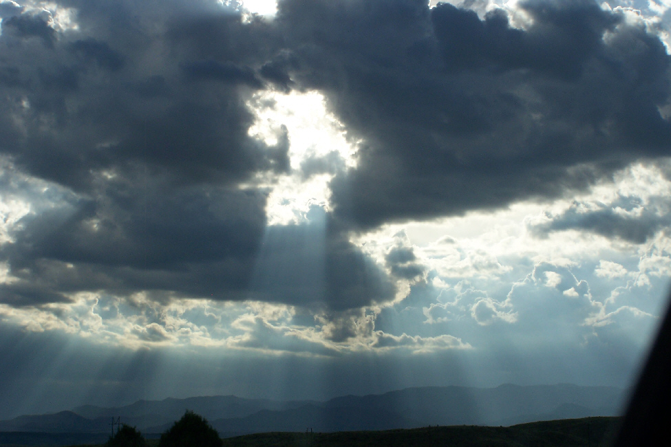
The rest of our hike back, which took about an hour, was uneventful, although when we reached the upper parking area and headed into the woods, it began to rain lightly. With our umbrellas we were fine, particularly when we were in deep forest where the rain wasn't heavy enough yet to get down to our level. I guess that the locals didn't think much about a little rain; we passed two or three groups on their way UP the trail, and they would have had a couple of hours at least ahead of them (presuming they were headed to the lake).
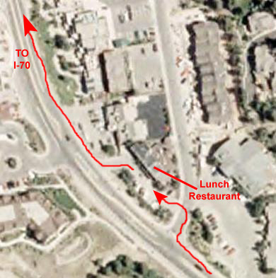 |
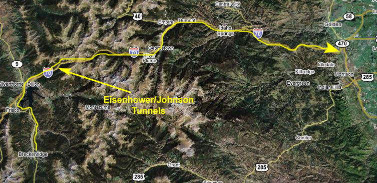
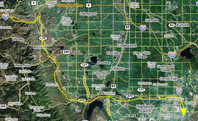
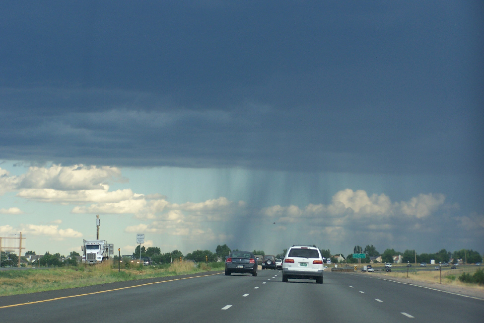
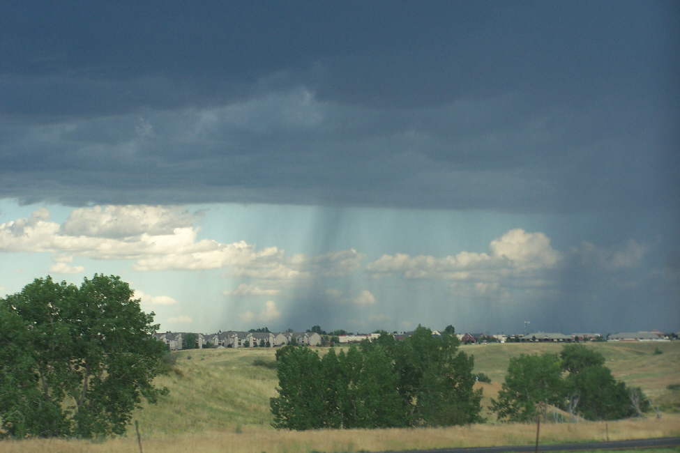
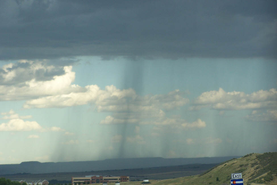
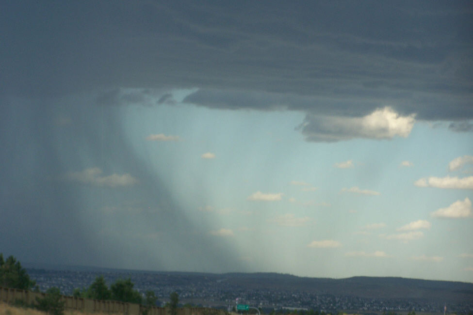
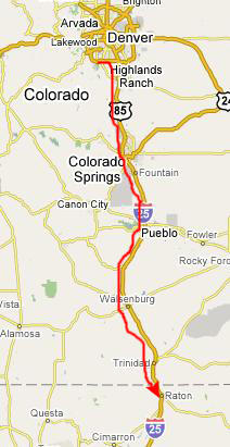
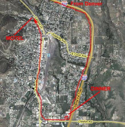
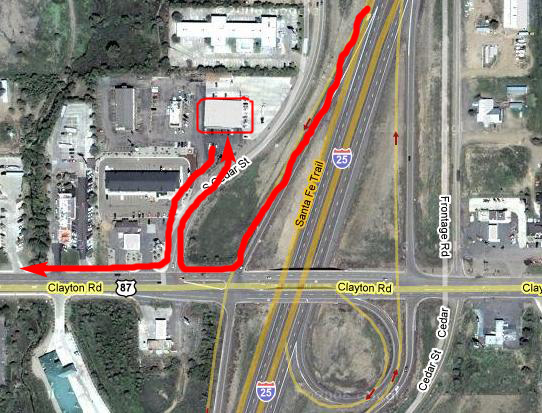
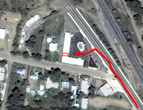
Driving to Raton, New Mexico
 |
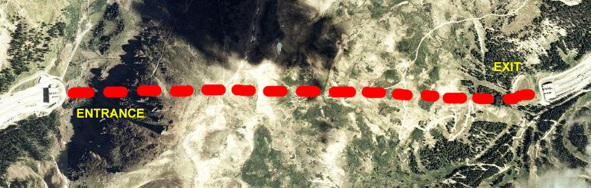
The aerial view spans about 75 miles from left to right. Getting from our lunch spot to the highway took about a half hour, and then it was another two hours to the outskirts of Denver.
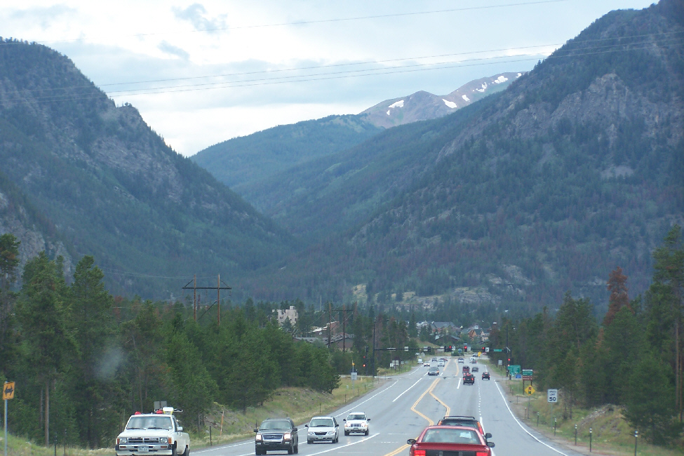
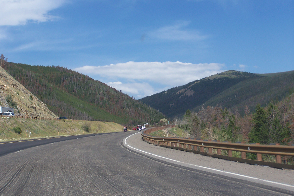
We got back on Highway 9 after lunch in Breckenridge, and headed north, towards I-70. Breckenridge, of course, is noted not just for its skiing, but also for the scenery in the summertime, and Fred got some good views of the mountains along the highway as we drove. I've put thumbnails for three of the best of the below; click on each of them to view the full-size picture:
 |
 |
 |
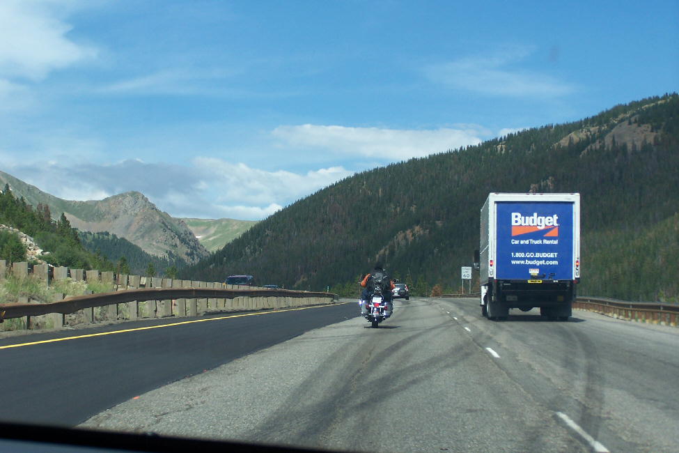
Once we reached I-70, we headed east, towards Denver. We traveled back through the valley where Dillon and the turnoff to Keystone were, and then we started climbing steadily. There was a lot of great scenery along the way, and it was fortunate that I had a passenger who could take some pictures of it. I've put thumbnails for four of Fred's best pictures of the trip from Dillon to the Eisenhower Tunnel below; click on each of them to view the full-size picture:
 |
 |
 |
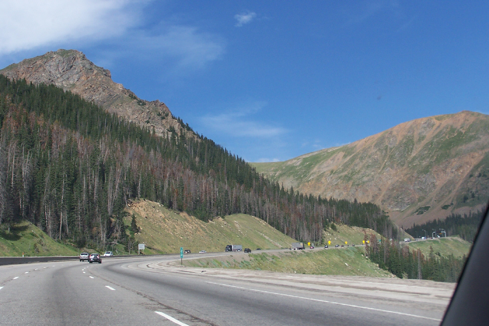 |
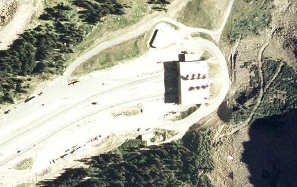
Of course, the one part of the highway that I was really looking forward to was the longest tunnel on the Interstate Highway System- the Eisenhower Tunnel- which is marked on the aerial view. It was only twenty miles or so east of the Breckenridge exit.
After climbing quite a ways from Dillon, we came around a curve and could see the entrance to the tunnel up ahead.
 |
|
|
A couple of minutes later, and we emerged from the tunnel with the road to Denver straight out in front of us. One of the interesting things that we saw on our way through the mountains were the many old mines. The mines, of course, are long gone, but you can still see the telltale signs of where they were. Here, you can see three or four mine tailings up on the mountainside. Fred was very interested in them, and took an additional closeup view of those same mine tailings. There were also some old mine buildings along the way, but none of the pictures of them turned out all that well.
|
To view the slideshow, just click on the image at right and I will open the slideshow in a new window. In the slideshow, you can use the little arrows in the lower corners of each image to move from one to the next, and the index numbers in the upper left of each image will tell you where you are in the series. When you are finished looking at the pictures, just close the popup window.
 |
 |
 |
 |
 |
 |
I have chosen five of the many pictures that Fred took to include in this album, and I have put thumbnails for them below. To look at any of the full-size pictures, which are quite nice, just click on the thumbnails:
 |
 |
 |
 |
 |
 |
 |
 |
You can use the links below to continue to another photo album page.
|
July 22, 2007: New Mexico/Colorado Trip Day 9 |
|
July 20, 2007: New Mexico/Colorado Trip Day 7 |
|
Return to Main Index for New Mexico/Colorado Trip |