|
November 5, 2007: Georgia/North Carolina Trip Day 3 |
|
November 3, 2007: Georgia/North Carolina Trip Day 1 |
|
Return to Main Index for Georgia/North Carolina Trip |
|
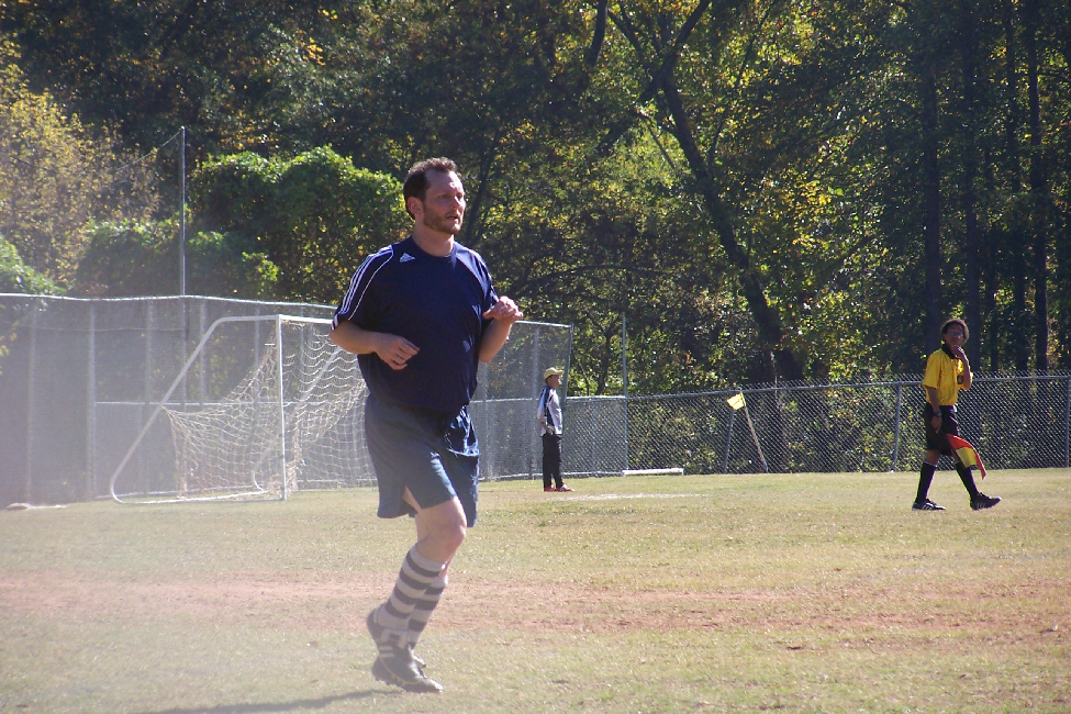
Michael's Soccer Game |
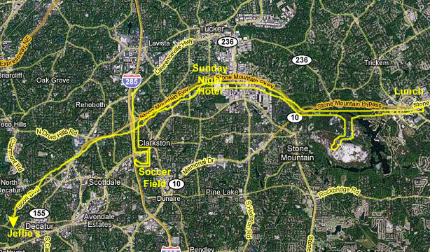 |
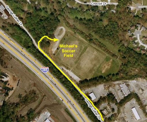
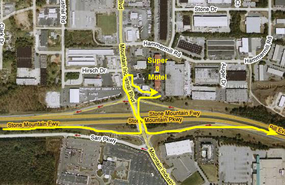
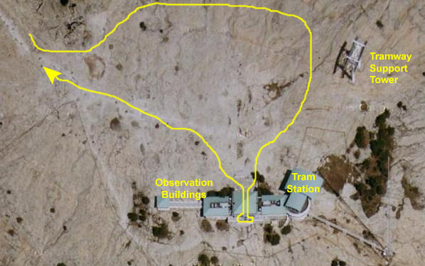
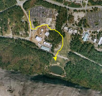
Jeffie drove out to our hotel early in the morning, the hotel being on Lawrenceville Highway just east of I-285 (the starting point of the yellow route line on the map). We followed her south on I-285 to Memorial Drive, where we headed first east and then south through suburban neighborhoods. Then we turned west back towards the Interstate and finally north along the Interstate access road to the soccer fields. (Had it not been for construction on the highway, we could have cut off the circular route through the suburbs.
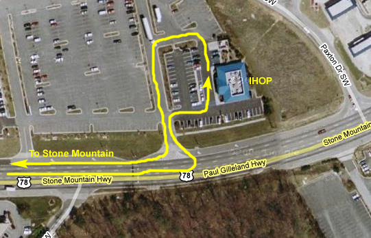
Once Michael's game was over, we retraced our route back up I-285 to the Stone Mountain Parkway, where we headed east to make a short stop so we could check in to our hotel and Michael could change out of his soccer stuff and we could all pile into one car. Since is was close to lunchtime, we headed further east past Stone Mountain to an area of restaurants and motels, and had brunch at an IHOP.
Next, we doubled back west to stop at Stone Mountain, where we spent quite a bit of time (see the section on the stone mountain visit below). When we left Stone Mountain, we simply continued west on Stone Mountain Parkway; it eventually merged with Scott Blvd. which intersects with Ponce de Leon Avenue and leads into Decatur and Jeffie and Michael's apartment.
Watching Michael's Soccer Game
 |
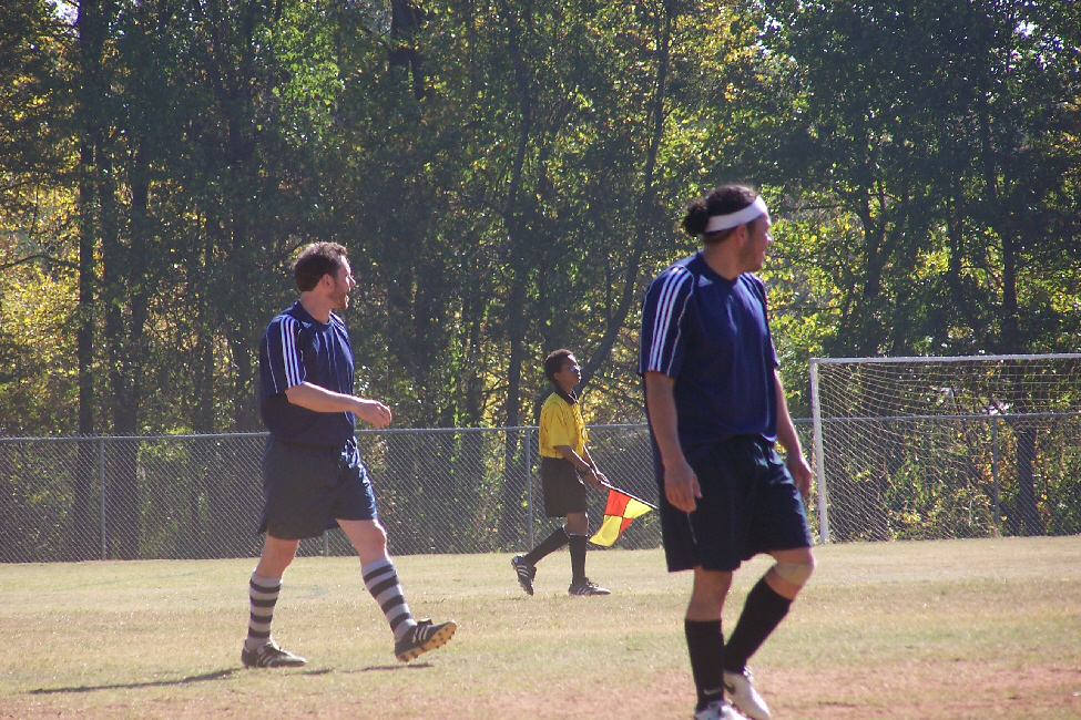
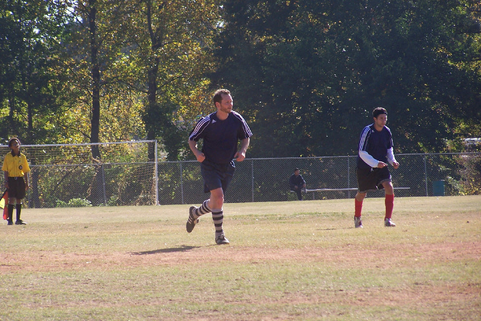
There is not much to say about the game itself; not being a soccer fan, I wouldn't know a spectacular play if the ball hit me between the eyes. The game lasted about an hour, and during the game Fred took a number of good shots, and I have put thumbnails for four of the best of them below. Michael is the prominent player in the leftmost of them, and you should be able to pick him out in the other three. Just click on the thumbnails to view the full-size pictures:
 |
 |
 |
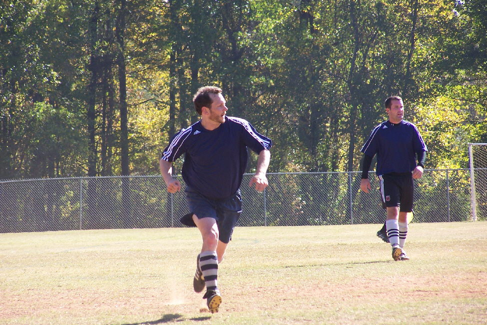 |
Once the game, which Michael's team won, was over we all headed back around to the Interstate so we could get up to Stone Mountain Parkway. We did make a stop near the expressway on Memorial so I could add a new Baskin-Robbins to my list.
Return to the Page Index
A Visit to Stone Mountain
 |
 |
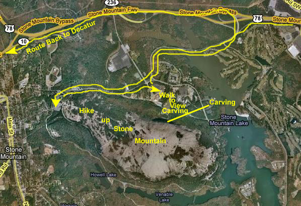
I won't bother putting another high-level hybrid map showing Stone Mountain at this point in the album; if you want an idea as to where it is located relative to our hotel or to our lunch spot, just look at the overall Sunday route at the top of this page.
 |
Once our hike up and down was done, then we came back down the mountain to the main parking area for both the amusement area and the walk to the lawn from which we could see the actual carving on the side of Stone Mountain.
When we were done, we just went out the same way as we had come in, and headed back to Decatur along Stone Mountain Highway, which turns into a main street that runs very close to Michael and Jeffie's apartment.
Hiking up Stone Mountain
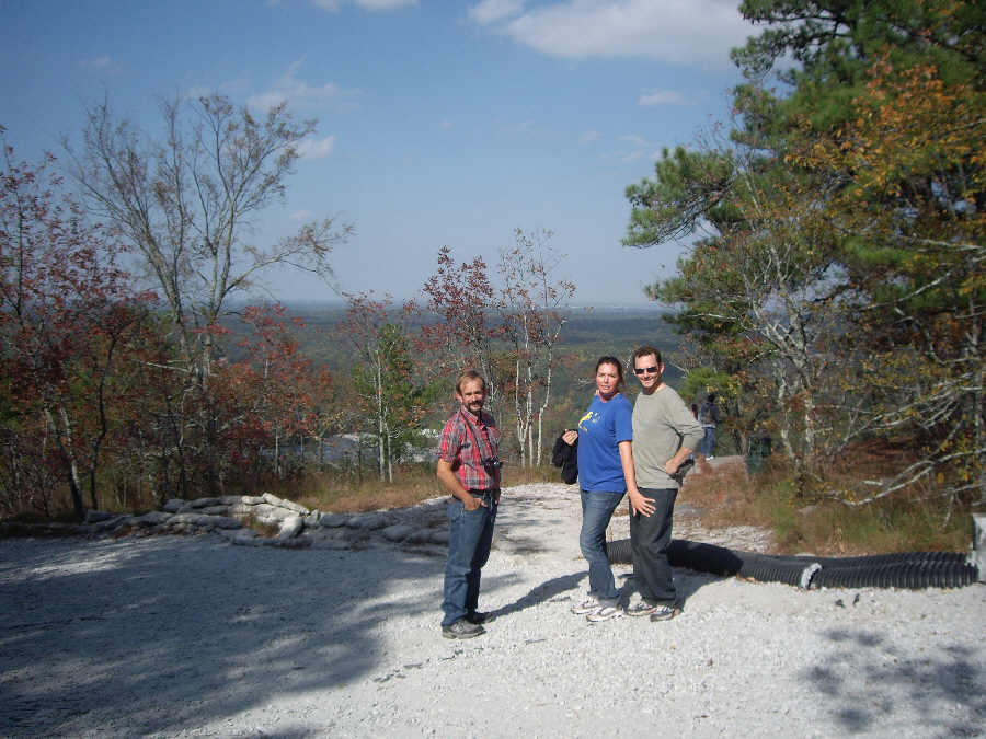
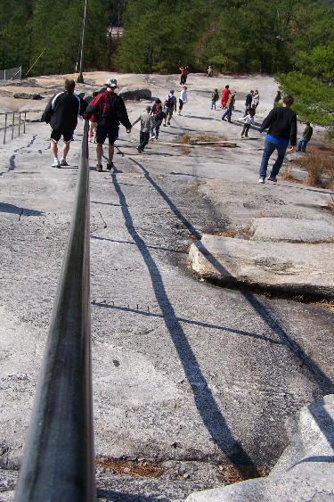
Right at the parking area, there is a kind of visitor center and an area where the train that runs around the base of the mountain has a stop. I first had another tourist take a picture of the four of us at this visitor center, and I also took a picture of Michael, Jeffie and Fred at the trailhead for the trail up the mountain. Then, we were off up the trail. The trail is not really a trail in the sense that it's a narrow pathway that everyone follows; most of the hike is just walking across bare rock, making the trail as you will. At some places, the expanse of bare rock does narrow down to a corridor perhaps fifteen feet across through the trees, but there is still plenty of room for all the people walking up and down.
A little ways up the trail, I found that someone had already carved my initials in the rocky floor of the trail, and I couldn't resist having Michael take a picture of me next to it. Actually, I laid down on the rock next to it, as the picture that Fred took of Michael photographing me shows.
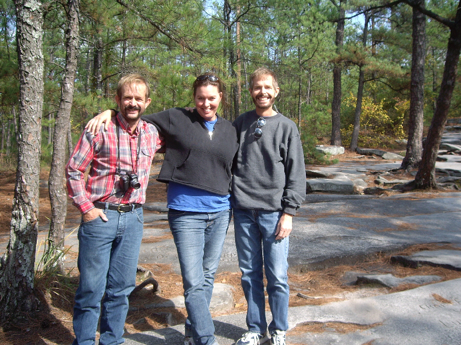
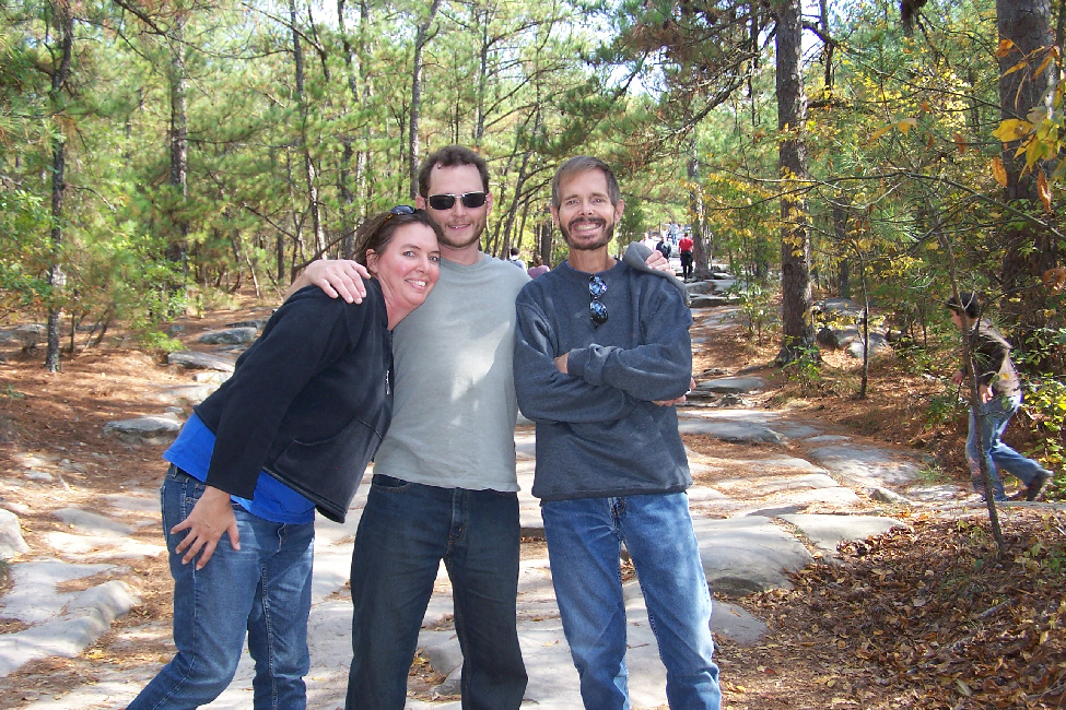
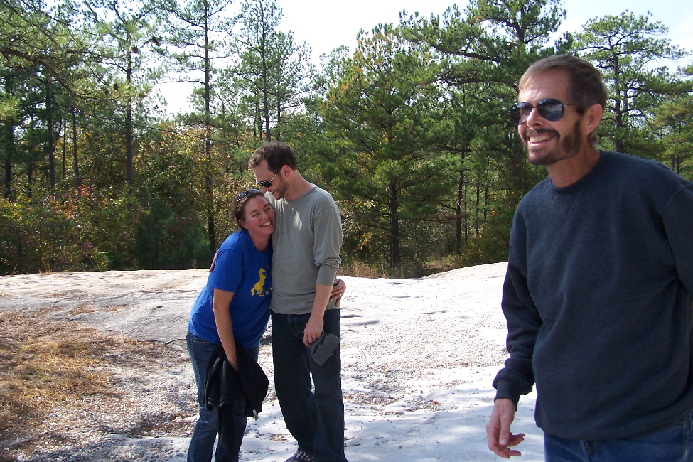
A ways up the trail we found a nice sunny spot to take some group shots and candids, and I have put thumbnails for some of the best of these below. To view the full-size pictures, just click on the thumbnails:
 |
 |
 |
 |
|
|
The Stone Mountain Summit
 |
The cable car was very interesting; if Jeffie hadn't been dead set against it, I would have suggested a ride down to the bottom and back up to the top. While we were on the north side of the mountain, I'd used the top support tower as a backdrop for a picture of Fred, Jeffie and Michael. When we got more towards the southern part of the mountaintop, we got quite close to the mountaintop terminal for the cable car. While we watched, one of the two gondolas was being loaded in the terminal and then the car left the terminal, moved level across the mountaintop for a hundred feet or so and then passed through the top support tower to begin its steep descent down the mountain.
|
|
We went inside the building for a while; there are the typical coffee shop and souvenir sales, as well as some exhibits regarding the flora, fauna and geology of Stone Mountain. There was also a neat balcony/patio out the southern side of the building, but the views to the hazy south were unremarkable. We just bummed around for a bit before leaving the mountaintop and making our way down.
Descent from Stone Mountain
 |
|
|
We just walked and talked along the rest of the trail, and at one point Fred snapped a candid picture of Jeffie and Michael as they sat on a rock and rested for a while. And, towards the bottom of the trail, Fred took a last picture of myself, Michael and Jeffie.
Viewing the Stone Mountain Carving
 |
Getting there was a bit confusing. There is an amusement area between the parking lot and the area in front of the rock face, and we weren't at all sure if we were supposed to pay any kind of fee to walk through. We ended up just strolling in through one of the open gates, although there was a line of people buying tickets. Just inside the ticket area, though, Fred did find an interesting clock; you don't find many that tell you the date and season as well as the time.
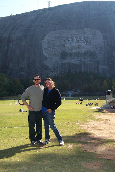
On the north side of the mountain, in front of the carving face, there is a large house and broad lawn; I am sure it is not a home, though. It must be some kind of park building- maybe housing a restaurant or shops or exhibits or something like that. But from anyplace on the broad lawn you have an excellent view of the relief, which depicts Confederate President Jefferson Davis and Generals Lee and Jackson. At the bottom of the lawn is the track for the train that runs around the mountain. You can cross the track and get closer to the mountain itself. At the base of the rock face there is a small park with a pond and fountain- an area already in shadow on this Fall day. Michael obliged us by taking a picture of Fred and I and the relief, and Fred noticed that the cable cars were running along their cable high above us. A ride must provide really great views of the entire area.
From some of the descriptive information we encountered, I learned an interesting fact that I had not known, and which would not have meant much anyway until we visited Mount Rushmore last year. The original sculptor for the Stone Mountain relief was Gutzon Borglum, the same sculptor who did most of the work on Mount Rushmore. He began the relief here at Stone Mountain, but a dispute arose between him and the association funding the work in 1925, he took his sketches and left for South Dakota. The relief was left unfinished for over 35 years, and indeed the land was returned to the Venable family. In 1958, the State of Georgia purchased the mountain and surrounding land, the relief was finished in the 1960s, and the park as we see it today began to take shape.
|
|
When we left Stone Mountain, we collected all our cars from the Super 8 and all headed back to Michael and Jeffie's apartment, to plan what we would do for the remainder of the afternoon.
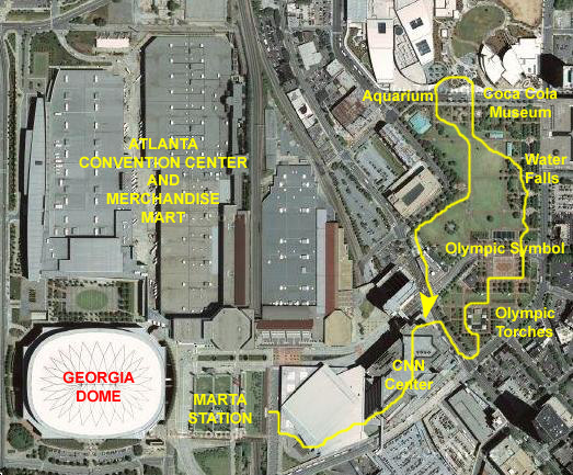
Visiting Olympic Park Downtown
Riding MARTA Downtown
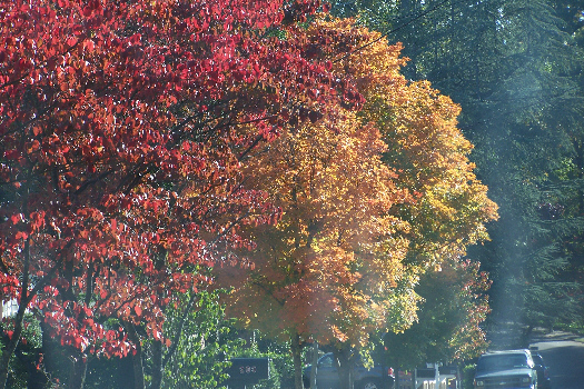 |
| Fall Color at the Decatur MARTA Station |
I have not ridden MARTA before. The system was built in the 1980s and, although I have been to Atlanta a number of times on business, I have never worked or stayed in an area served by the rail system. But it turns out to be much like many other new rail systems that I HAVE ridden on. I was a little confused by the automated ticket machine; I just wanted to buy a single round-trip ticket but ended up with a MARTA Pass worth $20 (of which I was only going to spend $3 today). I ended up leaving it with Jeffie and Michael, as I was sure they could use it. Once through the turnstiles, we went down to the inbound tracks to await the next train. We only had to wait a few minutes until a train pulled into the station.
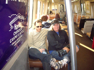 |
In stark contrast to the Decatur station, the platform for Olympic Park was very crowded. A football game had just ended in the stadium up above the station, and thousands of folks were using MARTA to either get home or get to outlying parking areas. Each train that pulled in had a crowd waiting to board. What with the crowds, it was tough taking pictures, but I did get a fairly decent shot of Fred on the MARTA platform.
|
|
By the time we got to the top of the escalator bank and were outside walking around, the crowds had dissipated, and we didn't have to contend with them. We did find ourselves just outside the Omni Arena, and to get to Olympic Park, we had to walk entirely around it. Fred was intrigued that the walls of the arena were made of some kind of reflective material, and took a number of pictures of himself reflected in the walls. I tried the same thing, with rather humorous results.
Walking Through Olympic Park
|
CNN Center
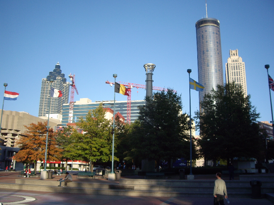
Our first bit of the walk took us from the MARTA station into CNN Center- the building from which Ted Turner's CNN is created and broadcast. Just before we went through the doors into the Center, we could see some of downtown Atlanta, with one of the many skywalks in the foreground.
The inside of CNN Center is a huge atrium, much like one of the Regency Hotels in the Hyatt chain- complete with elevators. The atrium is at least ten stories high, and impressive even for a "world traveler." On the first two floors of the atrium there are shops and a food court and even on this Sunday afternoon the area was busy. All of the flat screen televisions, of course, were tuned to CNN.
|
|
Olympic Torches
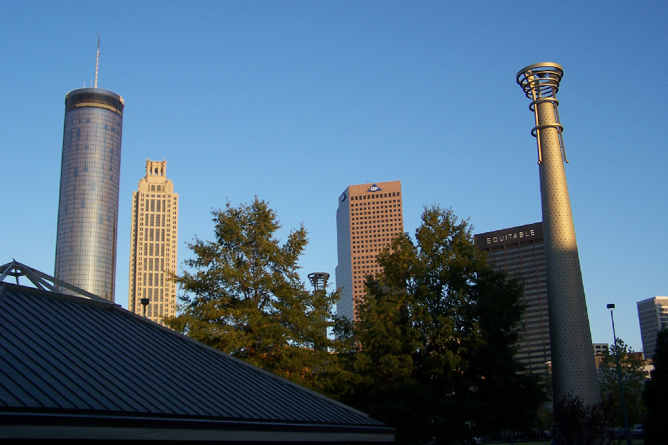
When we came out the other end of CNN Center, we were on the southwest side of Marietta St. NW, and Centennial Olympic Park was right on the other side of the street. We just walked down to the corner, crossed the street, and found ourselves in the area of the Park where the Olympic torches that burned throughout the Olympics could be found.
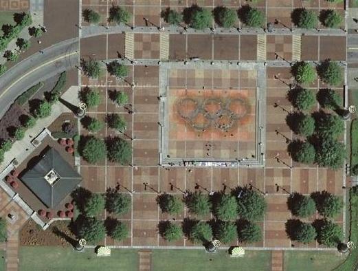 |
I should mention that the "checkerboard" pattern in all the walks here in the park is caused by sections of bricks that are inscribed with dedications, and which, presumably, were laid when sponsors ponied up a fee. There were many thousands of them all throughout the park.
Below are thumbnails for four of the pictures that we took; to see the full-size picture, just click on its thumbnail:
 |
 |
 |
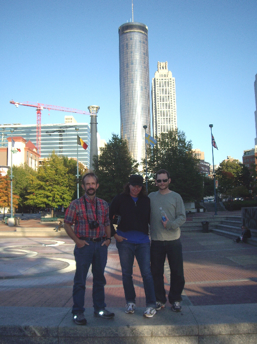 |
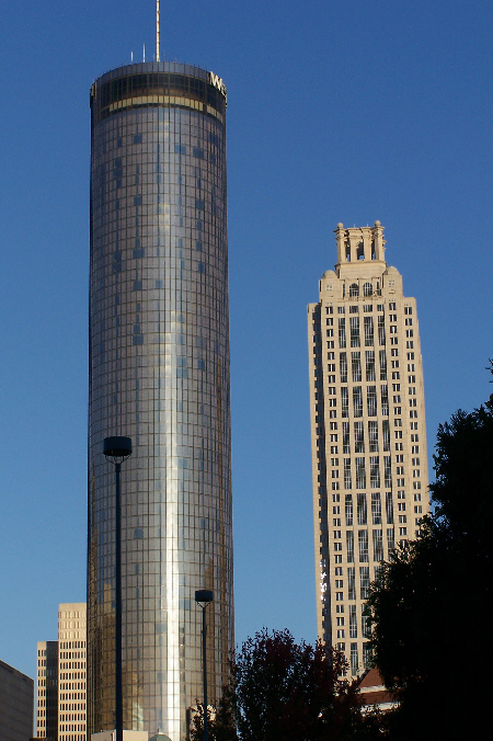
The circular Westin Peachtree hotel has been an Atlanta icon for more than twenty-five years; it was one of the five or six circular hotels that were built in the late 1970s in large cities around the country. Dallas didn't get one, but Houston, Los Angeles, Seattle and a few other cities did.
Leaves of Honor
As we walked north along the east side of the park, we were in an area that was designed with a number of waterfalls and artificial water courses that bordered a series of small plazas where the "Leaves of Honor" were found.
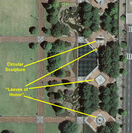 |
We never did find out the name or meaning of this interesting sculpture; all I can find out on the Web is that it is an "artistic installation." What is interesting is that the human figures go through the plane of the sculpture, as you can see in an angle view of the sculpture. Also, looking along the plane of the sculpture, you can again see how the figures are positioned within it- half on one side and half on the other. Certainly an interesting piece of artwork, but it would be nice to know what the artist meant to convey. Something inspirational, no doubt. Before we walked out of the plazas, we took a look back across the GreatLawn towards CNN Center.
Coca Cola Museum and The Aquarium
We reached north end of the park and temporarily left it, crossing the street to get a closer look at both the Coca Cola Museum and the Aquarium.
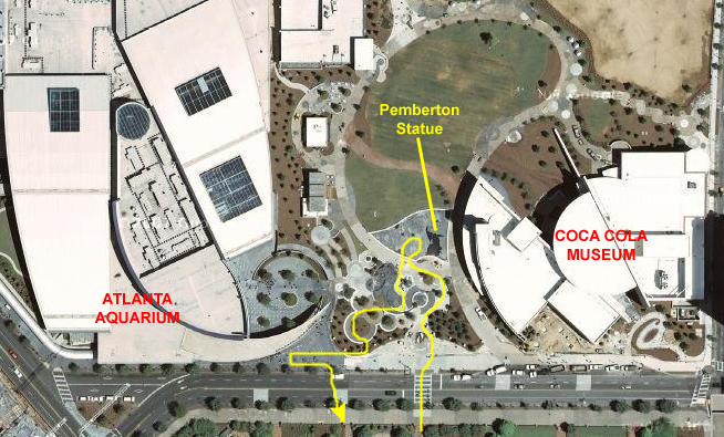 |
We had to content ourselves with some pictures taken near the Pemberton Statue, commemorating Dr. John Pemberton, the Atlanta pharmacist who is supposed to have invented the drink. It wasn't long before Asa Candler, an Atlanta entrepreneur, bought the rights to the mixture from the hapless pharmacist, going on to create the worlds second-largest beverage company and found one of the largest fortunes in America. Here is another view of the Pemberton statue with Michael and Jeffie.
Both Centennial Olympic Park and the area between the Aquarium and the Coke museum have a great many fountains and pools, but none of them were working this afternoon; nor was there any water at all in them. The reason was (and still is at this writing) that the Atlanta area is extremely short of water, due to a prolonged drought throughout the Southeast. In Olympic park, the fountains and water features were simply turned off an emptied; you could walk into them and pick up hundreds of rusted, decomposed coins- all quite worthless. Over here, the fountains have been filled with pumpkins, mums and other Fall color, as this picture of myself, Jeffie and Michael shows.
The other major attraction here was the Atlanta Aquarium, a huge complex located across the plaza from the Coke museum. Again, it was unfortunate that it was so late in the day for this would have been another interesting destination to visit. We headed back across the street into the Park, stopping briefly so Jeffie could pose with one of the many horse‑drawn carriages that were ferrying tourists around the area.
Returning Across the Great Lawn
It was getting late and it was getting dark, so we ambled back towards CNN Center across the Great Lawn, as the central open area of Olympic Park is known. We passed the memorial to Pierre Coubertin, the founder of the modern Olympics, and we took pictures of some surrounding buildings and the Atlanta skyline. On our way back through the CNN Center, I stopped for a snack before we boarded the train and headed back to Decatur.
Return to the Page Index
Evening and Our Hotel
While Michael took the dog for another walk, Jeffie made some margaritas and we sipped them while waiting for their return. For dinner, we went to a local place nearby. Then, we visited for a bit more before Fred and I took our leave and headed over to our hotel near Stone Mountain.
Return to the Page Index
|
November 5, 2007: Georgia/North Carolina Trip Day 3 |
|
November 3, 2007: Georgia/North Carolina Trip Day 1 |
|
Return to Main Index for Georgia/North Carolina Trip |