


|
November 6, 2007: Georgia/North Carolina Trip Day 4 |
|
November 4, 2007: Georgia/North Carolina Trip Day 2 |
|
Return to Main Index for Georgia/North Carolina Trip |
|
|
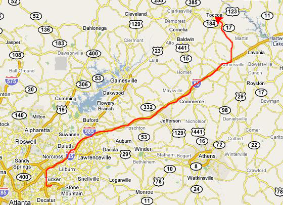
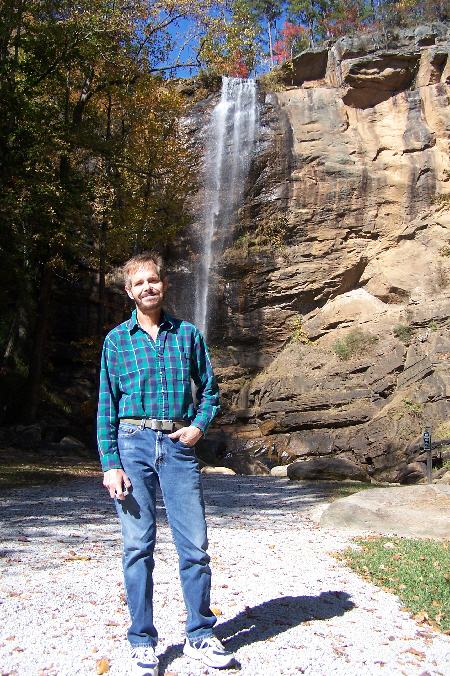
Toccoa Falls
 |
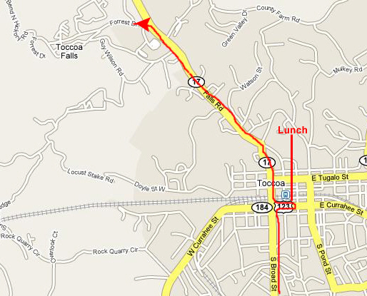 |
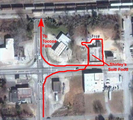
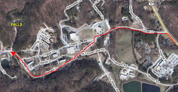
I tried some of Fred's stuff; it was all home-cooked comfort food and each thing I tried tasted great. No wonder they did so much business. While Fred was eating, I took the opportunity to ask a table of business guys who came in for lunch if they could direct us to Toccoa Falls. Their directions were spot on, and after lunch, it was easy to find.
 |
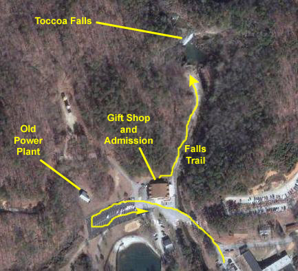 |
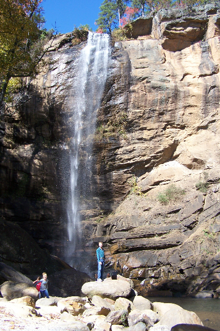
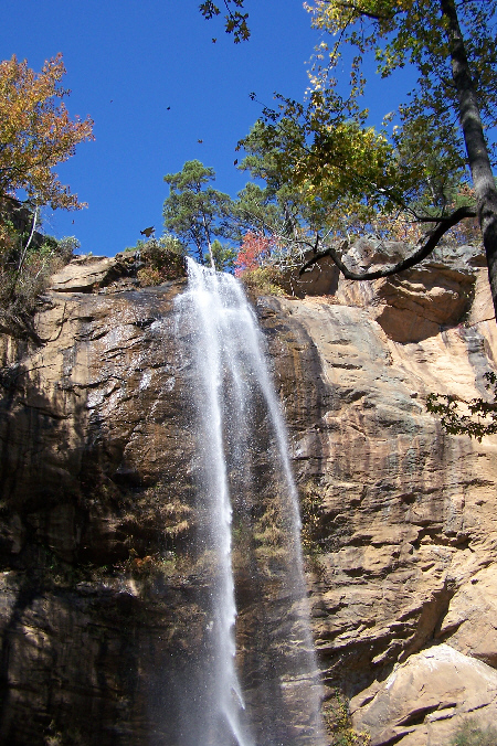
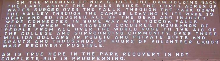
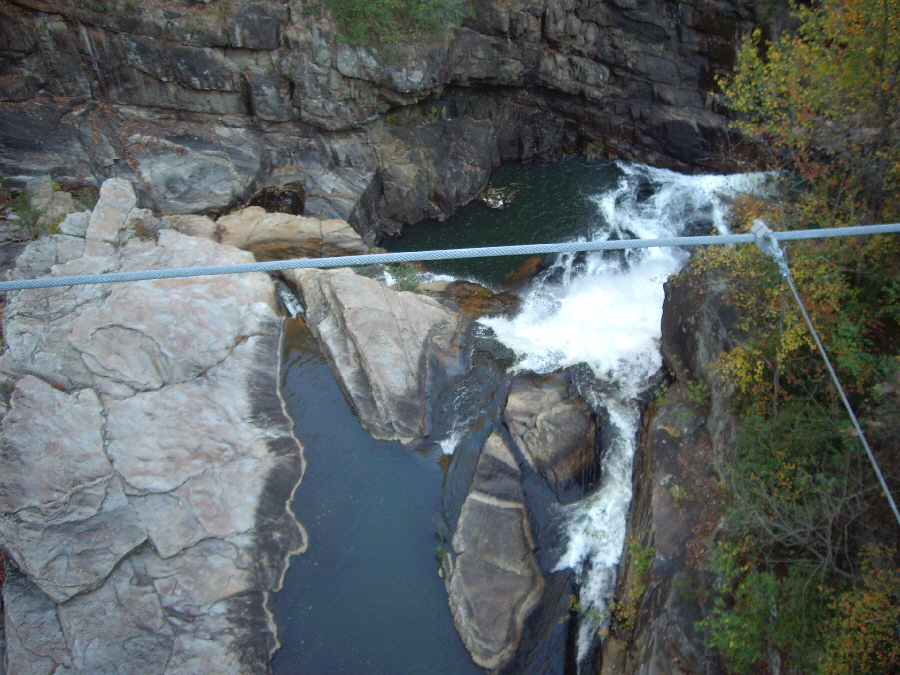
The falls, apparently, used to have a great deal more water in them, but that was before the stream that formed them was dammed for power, water supply and recreation. The actual lake behind the dam is a mile or so further up the highway, and we drove past it when we were done here. There are actually two reasons why there is not much water going over the falls these days. The second reason is a temporary one; Georgia and much of the Southeast are in the grip of an extreme drought and, as of this writing, rationing water in the city of Atlanta is being considered. The drought was a common theme throughout our trip, and was topic number one anytime we got a chance to watch local news. In the view of the top of the falls that you can see here in normal view and here in closeup, I think you can see that, even after the dam was build many years ago, more water used to flow over the precipice than we could see coming over it today.
|
|
 |
 |
 |
 |
 |
|
|
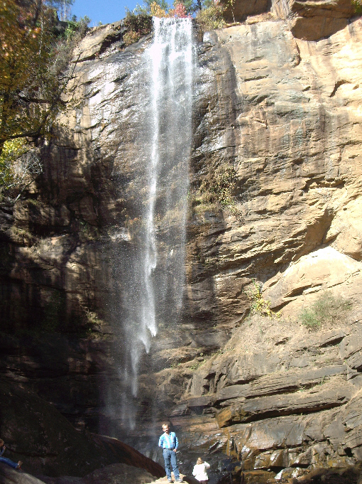
Fred went over on the opposite side of the falls, walking up through the trees and across some big boulders to get another angle on the falls. We spent maybe three-quarters of an hour at the falls. They WERE pretty and very restful, and it was good to finally get some exercise. When we were done, we walked back to the visitor center.
 |
Once we were done here, we headed back out to the highway and north again to our next stop at Talullah Gorge.
Tallulah Gorge
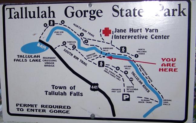
Getting to Tallulah Gorge
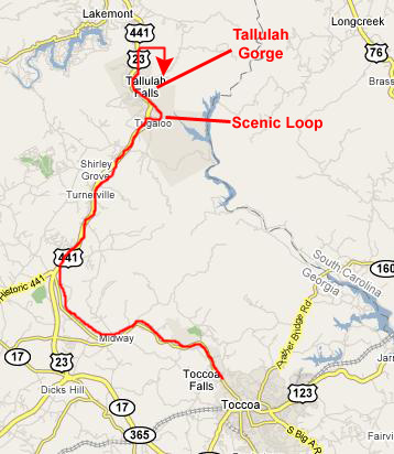 |
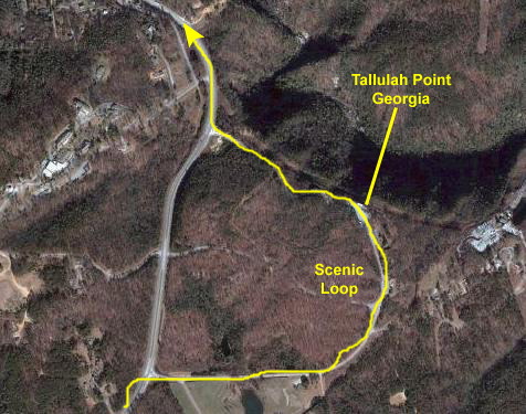
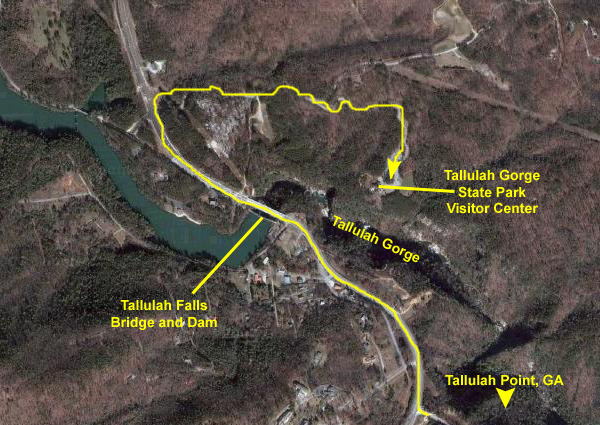
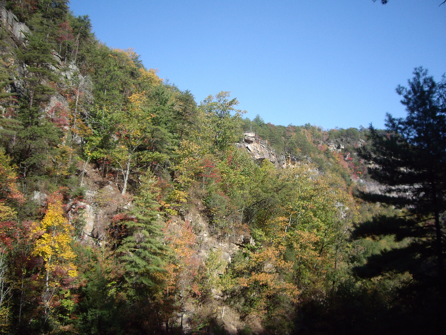
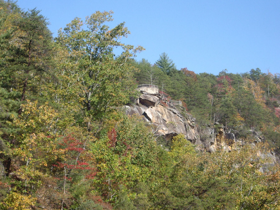
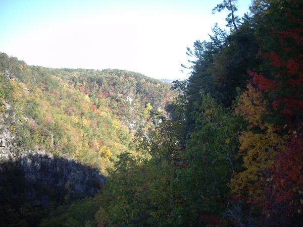
Just before we reached the bridge above Tallulah Gorge, we turned off on what was advertised as a "scenic loop," and the best place to view all of Tallulah Gorge. The road wound around about a mile and we came to Tallulah Point, GA (I assume someone got paid off to designate these few buildings as a town). There was the requisite gift shop, ice cream parlor, small restaurant and ancillary stuff, and, most importantly, a balcony out over the valley wall from which one could, indeed, see most of Tallulah Gorge, including some of the fall color that you can find up here in the foothill mountains for the Appalachians. You could also, we found out, see the lowest of the Tallulah Gorge waterfalls which was almost directly below our viewpoint and captured here by Fred with his zoom lens.
It was interesting to walk around here, but we didn't want to delay long, hoping to leave lots of light for some hikes in Tallulah Gorge itself. So we followed the loop road back to the highway, crossed the bridge above Tallulah Gorge, and quickly found the turnoff for Tallulah Gorge State Park.
Tallulah Gorge Visitor Center
 |
The inside of the visitor center was very nicely done and, to start the hike, you followed a spiral ramp that took you down three levels to the outside balcony where the trails begin. The first part of the trail is wheelchair accessible, and I imagine that was the reason for building the interior rampway, but it was certainly architecturally striking.
We sat and watched the movie first, to get an idea of what we might see, and then had our talk with the ranger to plot the route. Then, armed with our trail map, we set off on our hike.
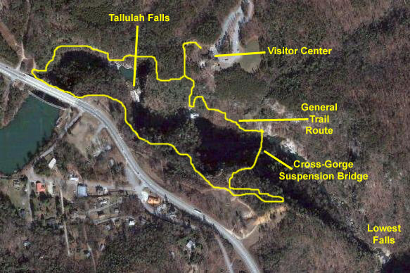
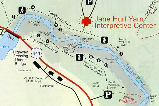
In the next section of the album, I will use an actual trail map to show you where the various pictures were taken, but I wanted to include the aerial view below that will give you an idea of how the gorge and its trails are situated relative to the bridge and dam as well as the visitor center:
The Tallulah Gorge Hike
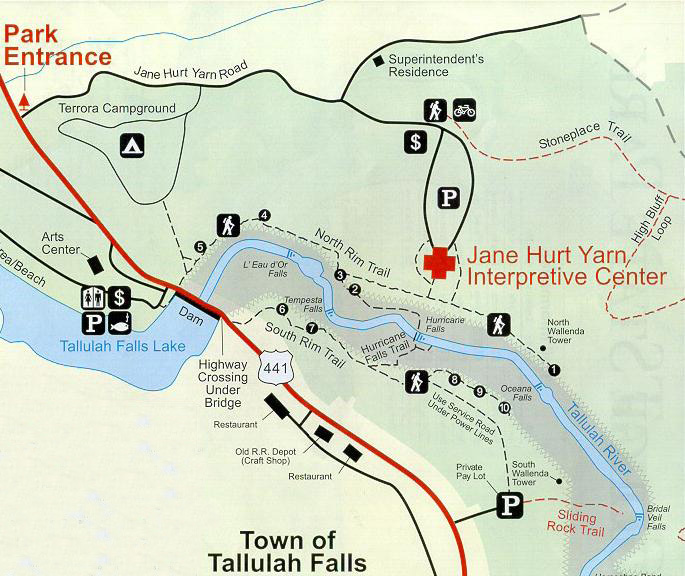 |
If you marry this hiking schematic up with the aerial views that I showed you earlier, I think you will get an excellent idea of just what the hike was like, and a much better idea of what we saw than just a long series of pictures would have given you.
The trail system is named for Helen Dortch Longstreet. Helen was born in Carnesville, GA, in 1863 and in 1897 married Civil War General James Longstreet- one of the most famous of the Generals fighting for the South. By the time she married him, the war was well in the past, and Longstreet was a hotel owner in Gainesville. After her husband's death, she took as one of her causes the protection of the Tallulah Gorge, which was by then becoming overrun with tourists arriving on a rail line that had been built from Atlanta north through Georgia. Hotels and commercial establishments abounded, and Helen though the area was being destroyed. She tried numerous times to have the State Legislature protect the area, but failed. As it happened, tourism began to fall off dramatically in the 1920s, and by the end of the decade most of the buildings lay abandoned. Helen's dream finally became a reality when the area was made a State Park in 1993, and funds became available to remove the old ruins and build the trail system that now bears her name. If you want to read more about Mrs. Longstreet, you can read the same sign we did by clicking here.
I hope you enjoy the hike as much as we did!
Overlook #1: Oceana Falls
So, we decided to just go as far as the first overlook for Oceana Falls. The trail led off to the southeast through the woods, and then eventually came to a long stairway that led down to the overlook. From Overlook #1 we got an excellent view of Oceana Falls as well as a view downstream through the Tallulah Gorge.
Overlook #3: L'eau d'Or Falls
Overlook #2: L'Eau d'Or Falls and Tempesta Falls
 |
 |
We took a few other pictures while we were here at this overlook. In one of them, Fred gives us a good closeup of the falls while in another I caught the falls in shadow.
From the vantage point of this overlook, one could also get a glimpse of Tempesta Falls, but that was all it was- a glimpse. We never did find a point from which we could get a good clear look at Tempesta Falls. While we were wandering around this overlook snapping pictures, I made a movie of L'Eau d'Or Falls and the overlook itself, and you can watch that movie with the player below:
|
|
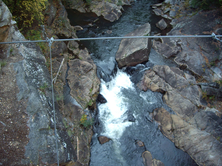
We spent a fair amount of time at overlook 2 before heading on down the trail to cross the Tallulah River on the suspension bridge.
The suspension bridge at Hurricane Falls
|
But we decided to go on anyway. Bad move. Just kidding. I assume the signs meant that the falls are a long way down, and that the hiker will have to climb back up either on this side of the gorge or the other, but, heck, Fred and I have done a lot worse.
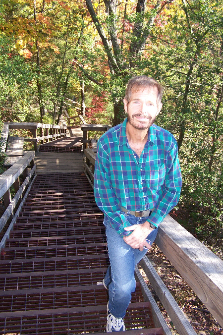
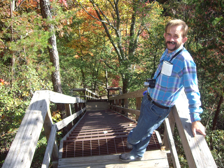
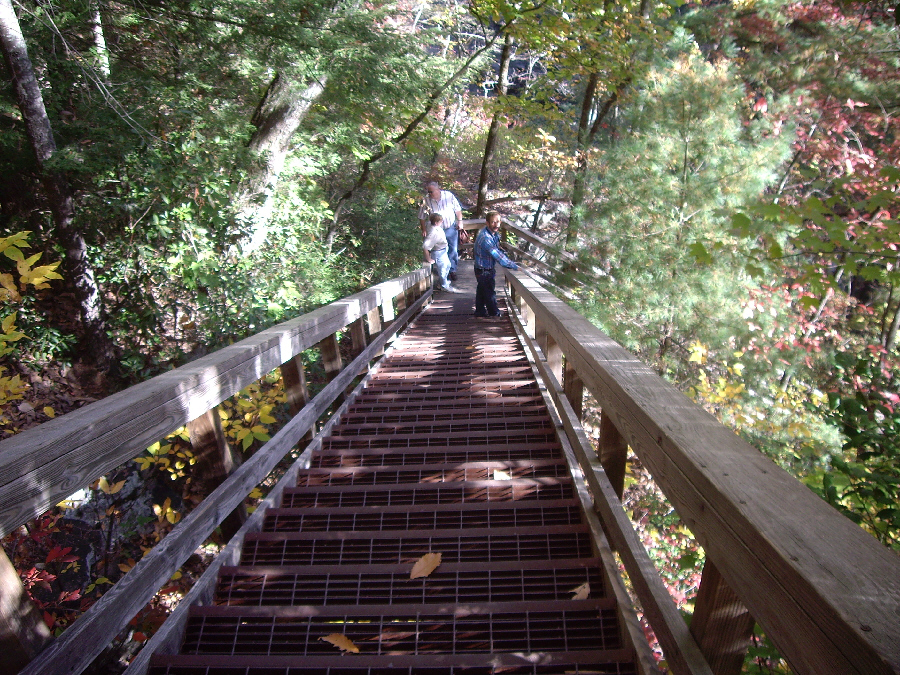
Before we started down the long sets of stairs to get to the suspension bridge, Fred found the first of many great examples of fall color that we were to encounter this afternoon on our hike. Then we headed down the extremely well-built sets of stairs that would take us to Hurricane Falls. We took quite a few pictures on the stairways, and I've put thumbnails for the best of those pictures below. You can view the full-size pictures by clicking on the thumbnails:
 |
 |
 |
 |
Towards the bottom of the stair sets, we found a landing that gave us our first view of the suspension bridge at Hurricane Falls.
 |
I went back up to join Fred on the bridge platform, and we took a number of pictures before starting across the bridge. In one of them, you can see an unobstructed view across the bridge; in the other two, you can see myself on the bridge and you can see Fred on the bridge.
|
|
After I filmed my movie of the bridge transit, I went back across to get my own pictures of Hurricane Falls from both sides of the bridge, and also some pictures of the other side of the gorge in the distance where we made our first stop at overlook 1. I've put thumbnails for the best of these views below; click on each thumbnail to view the full-size picture.
 |
 |
 |
 |
 |
The Hurricane Falls Platform
|
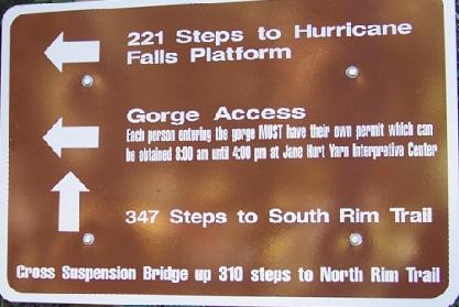
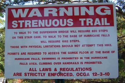
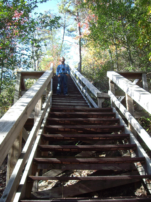
I'd been wondering how many steps we would descend and ascend on this hike, and here at the sign we could figure it out. We'd already come down the 310 steps from the north rim, and we had to ascend 347 to get to the south rim (from which it is pretty much a level walk back). That makes about 660. We are going down to the Hurricane Falls Platform, so the round-trip is another 440, and so we will have gone up or down almost exactly 1100 steps. Just like going up and down the steps in my house about 30 times.
On the trail map at right, you can see the very small trail that leads off the Hurricane Falls Trail right at the bottom of the gorge down to the water itself. That is the trail to the platform. We started down the stairs to the river, and reached it pretty quickly. The stairs ended at an expanse of sloping rock that led right down to the water.
 |
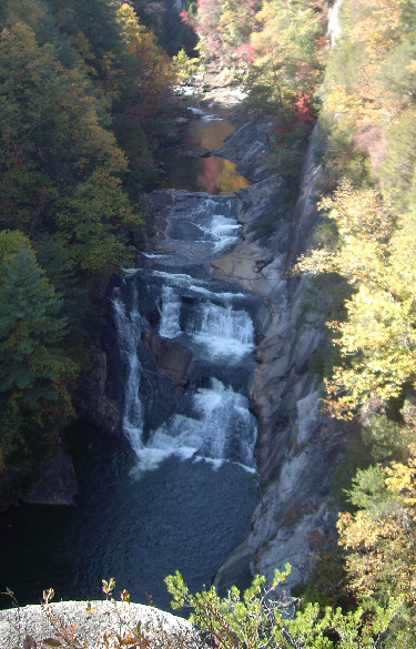
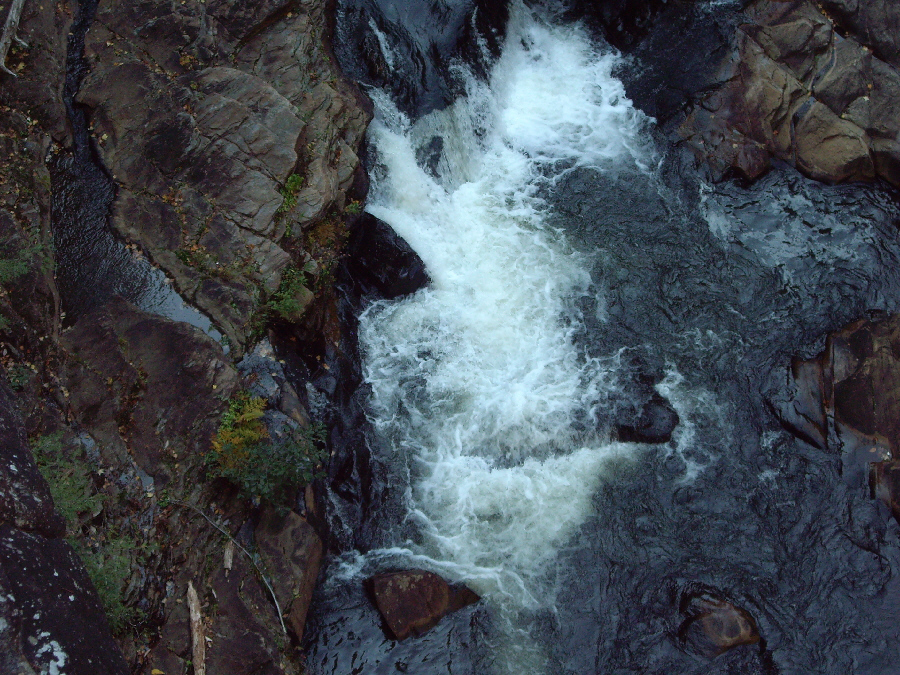
Here at the viewpoint for Hurricane Falls, we again took quite a few pictures, and it was hard to winnow them down to just a few. Between Fred and myself we took three good pictures of Hurricane Falls, and you can look at any or all of them here and here and here. The pictures are similar, but each is quite good in its own way. I, however, was the only one who took a picture looking downstream from Hurricane Falls.
|
|
Overlook #8: Interpretive Center and Gorge
|
When we got to overlook 8 we were treated to really great views of the entire gorge, lit by the mid-afternoon sun. Across the way, we could see the interpretive center, and right beside the overlook Fred found some more beautiful fall color.
I don't have nearly as good a zoom lens as Fred has on his camera, so when I pointed my camera northeast to look at the other side of the gorge, all I thought I was getting was a good view of the sheer rock face on the other side of the gorge. I've circled a small portion of the picture you just saw, and you can see how that same area looks from the same vantage point through Fred's 10x zoom if you click here.
Overlook #9: Tallulah Gorge
 |
After only a short walk, we arrived at Overlook #9, where we were again met with expansive views of the gorge, a view looking down of Oceana Falls and of the interpretive center across the way. Here is a view of Fred at Overlook #9 with the interpretive center behind him on the other side of the gorge.
Overlook #10: Hurricane Falls
 |
Fred took a picture of me at the edge of the overlook and also one of me on the steps leading down to a second viewing area. From my vantage point on the steps, I can show you Fred in the second viewing area.
From this overlook, we not only had good views of the north rim, but also of the Hurricane Falls suspension bridge and of the north rim trail.
This part of the trail ended at Overlook 10, and so we retraced our steps until we were back at the point on the South Rim Trail where the stairs up from Hurricane Falls had intersected with it.
Overlooks #7 and #6: Tempesta Falls and Fall Color
|
As we walked along the trail, Fred took quite a few pictures of the Fall color, and you can see two of the best of those pictures here and here.
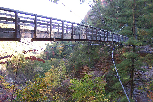
The Tallulah Gorge Bridge
The actual trail then goes across the bridge, but, before we crossed, we noticed that there was a sidewalk and some steps that took you down underneath the bridge to a kind of platform (probably not for viewing, specifically). But you could see the underside of the bridge and also get a good view of the Tallulah River Dam. There was also a plaque affixed to the road support underneath the bridge, and you can read the plaque here.
We came back up and started across the bridge on the pedestrian walkway. Midway across the bridge, we could see North Rim Trail and some of the overlooks that we would visit shortly. When we got to the far side of the bridge, we found a stairway down to the continuation of the trail around Tallulah Gorge.
Overlooks #5 and #4: The Tallulah Gorge Bridge
|
|
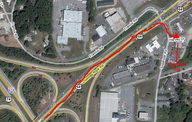
Getting to Hendersonville and Our Hotel
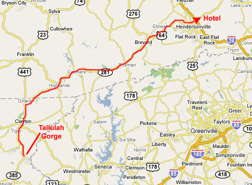 |
We headed up US 441, stopping at a Wal-Mart in Clayton to buy a cooler and some ice. At Dillard, GA, we turned off on the highway to Highlands, NC, arriving there just after dark. Highlands seemed very familiar, and then we realized that we had visited the town when we were camping and going to waterfalls a few years ago. We had actually stayed at Indian Creek Campground up near Franklin at the time, and one of the waterfalls was just south of the town of Highlands.
We continued on through Cashiers and on to Brevard, NC. There, we didn't find as many hotels of our style as I would have thought, so we decidd to head on over to Hendersonville, which is along I-26, expecting that there would be a great many hotels there. There were, and being midweek there seemed to be plenty of space. Even so, we took the first reasonable one we came to- a very nice Comfort Inn.
 |
|
November 6, 2007: Georgia/North Carolina Trip Day 4 |
|
November 4, 2007: Georgia/North Carolina Trip Day 2 |
|
Return to Main Index for Georgia/North Carolina Trip |