|
December 4, 2008: Casablanca, Morocco |
|
December 2, 2008: Cartagena, Spain |
|
Return to the Europe/Cruise Trip Index |
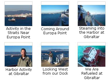
Docking in Gibraltar
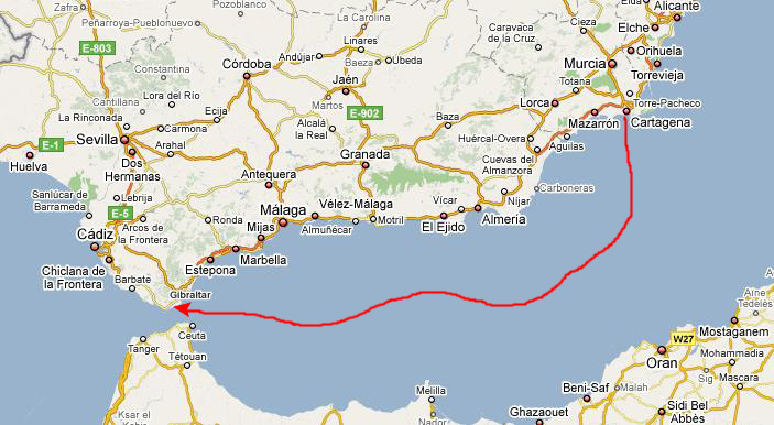 |
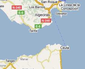
Before we zero in on Gibraltar itself, you should understand its position relative to the eponomously-named straits. Gibraltar is not the southernmost tip of the Iberian Peninsula, but it is close. Even though it is not the southern tip, the positioning of the small peninsula and the height of the rock make it ideal for a defense of the straits themselves. I understand that ships cannot go so far south that they are out of range of the defenses that have been established on Gibraltar, and that this has been true for many centuries. Gibraltar has always occupied a strategic position in the Mediterranean, which is why Britain has, understandably, steadfastly refused to give it up- even now.
 |
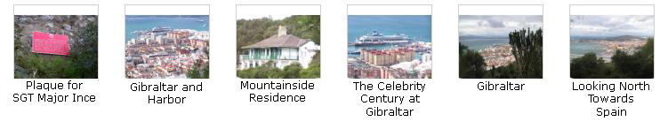
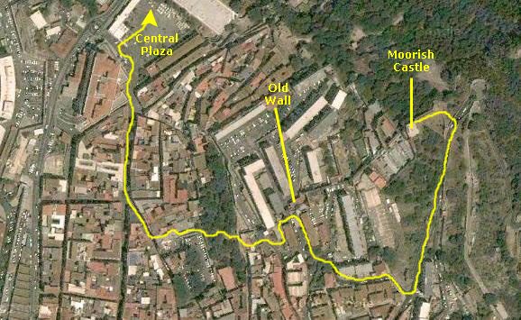
An Orientation to Gibraltar
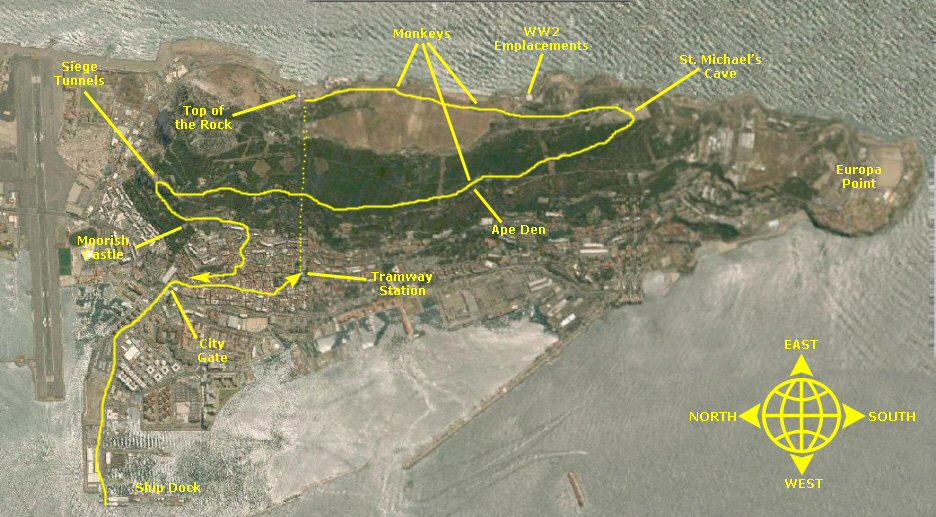 |
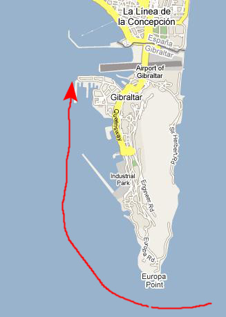
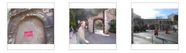
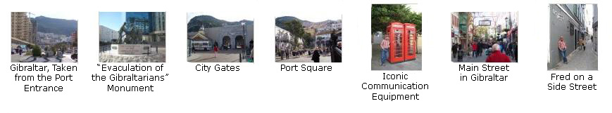
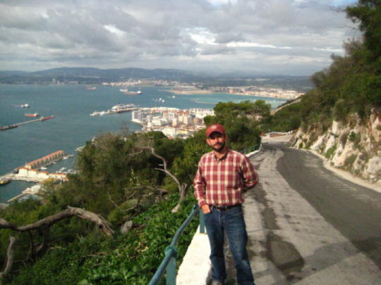
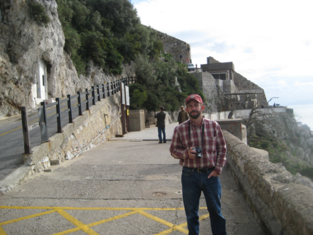
So this is what Gibraltar looks like. Our ship docked at the main cruise ship port at the bottom of your picture (the westernmost point in the colony). When we disembarked, we had to walk about a mile to get out of the port area and come to the bastion gate into the city proper. (Gibraltar is much bigger now than when the walls were built, so they are more of a curiousity than anything else. We went outside them again before we got to the tramway.) Through the gates we came into a large open square, and then took Main Street off to the east for quite a ways, angling slightly up along the hillside. Eventually, we got outside the gates again as we headed towards the tramway station we could see ahead of us.
We got tickets that also admitted us to some attractions on Gibraltar and we headed up the tramway to the "Top of the Rock," an observation point at almost the highest point. From there, we walked south along the crest of the mountain to St. Michael's Cave, and then back north across the face of the mountain (following the narrow roads) to the Great Siege Tunnels, another Siege Exhibition and the Moorish Castle. With only an hour or so to go before we had to be back on board, we worked our way down through the city and back to Main Street, then retracing our steps to the ship.
In the following sections, we'll look at the pictures from our day-long exploration of Gibraltar, and to show more clearly where we were, I'll probably include some higher-resolution aerial shots as well.
Walking Through Gibraltar to the Cable Car
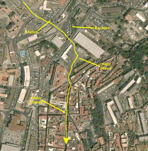 |
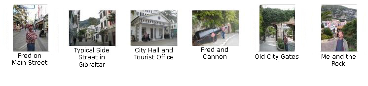
Just through the tunnels we came into a large, open plaza that was surrounded with businesses and restaurants. It seemed as if it would be a center of activity, although it was early in the morning and not too many people were here yet. Over at the southeast corner of the plaza (the aerial view at left is once again oriented with north to the top) we found the beginning of Main Street, which was the street we needed to follow to get to the tramway. Just as we got onto Main Street, we came across the first of those ubiquitous red phone booths that are so uniquely British.
As we walked along Main Street, we took lots of pictures, some of which you can see below, but I want to include some additional ones here:
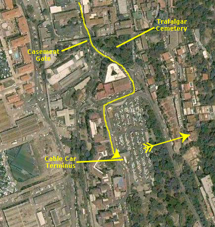 |
We went around the plaza and through the wall, where here there were beautiful wooden gates. On the other side, we came to Trafalgar Cemetery. The Trafalgar Cemetery was used for burials between 1798 and 1814, and subsequently fell into disuse. Although its name commemorates the Battle of Trafalgar, only two of those who are buried there died of wounds suffered during the battle. The cemetery was consecrated in June 1798, seven years before the battle of Trafalgar. It was then known as the 'Southport Ditch Cemetery'. The majority of the gravestones in the cemetery memorialize the dead of three yellow fever epidemics in 1804, 1813 and 1814 in Gibraltar. Also buried here are victims of other sea battles of the Napoleonic Wars - the battle of Algeciras in 1801 and actions of C�diz and M�laga in 1810 and 1812 respectively.
As we passed the cemetery, we could see the cable car up ahead of us, and so we walked on over.
The pictures I've included so far are good, but I've saved the best ones for now. If you will click on the thumbnail images below, you can see the best of the pictures we took on our walk through Gibraltar to the cable car:
|
|
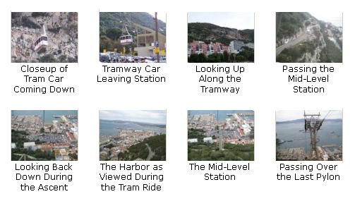
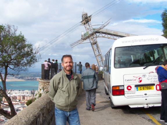
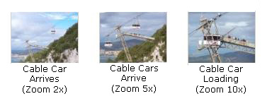
The Cable Car Ride to the Top of the Rock
In addition to the best pictures from the ride up that we've included below, there are three others of interest. About halfway up, we could begin to see northward into Spain, and we could also look southwest towards the straits, which are around the point of land that you can see diagonally across the harbor. That's the northern coast of Africa way off in the distance. Also, when we got about two-thirds of the way up, we could look back down at the middle station on the cable car route. Later on, when we are walking across the face of the mountainside, you'll see that station from below.
Now for the best of the pictures we took during the cable car ride up the Rock of Gibraltar. Click on the thumbnail images below to see these pictures:
|
|
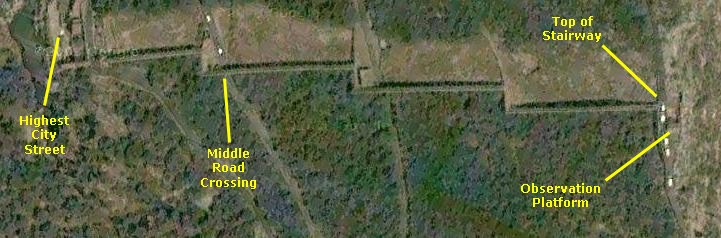
The Top of the Rock
From the observation platform, there was an outside spiral staircase that led down to a lower observation area. There were some pretty amazing views of the entire city of Gibraltar and our cruise ship docked in the harbor. Nearby this lower observation area was the old upper support for a tram system that used to bring supplies up to the emplacements here at the top of the mountain. It was taken down when the new cable car opened in the late 1900s. Next to the new cable car station we could see some of the older buildings here at the top of Gibraltar, some of them dating back more than 150 years. When we were done here at the first observation area, we began to follow the mountain road that zigzags down the cityside face of the mountain (the seaside, or eastern face, is almost a sheer drop).
Below are thumbnail images for more of the best pictures we took here at our first stop on Gibraltar. Click on those thumbnail images to have a look at them:
World War II Ruins
 |
 |
This area turned out to be pretty interesting. For one thing, the views were pretty spectacular from here. We could look all the way north along the cliff face, past the Gibraltar peak, and all the way into southern Spain. From the top of one of the buildings, we could see all the peaks of the Gibraltar mountain, and we had the feeling that we were on the roof of the world. Turning around and looking south past Europa Point, we could see, in the distance, the mountains of northern Africa. Finally, looking down the stairs in the middle of the complex of buildings (and from many other vantage points as well), we could see the city of Gibraltar and the harbor. So, from this one spot, one had clear views in all directions- ideal for a defensive observation position- and be in a spot that was virtually impregnable to surprise assault.
Probably for this very reason, quite a few buildings had been built here, and we wandered through them for some time. Some buildings were two and three stories with interior stairways, and there were many rooms (and lots of graffiti, much of it quite old) and gun/observation positions. If you will click on the thumbnail images below, you can see a few excellent pictures taken in the interior of some of these buildings:
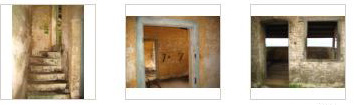
We wandered around here for quite some time before we headed back down the pathway to the road. This was a really interesting area. Although it is now, of course, deserted, one can still feel the echoes of the activity that must have taken place here or nearby in one era or another, culminating in the activities of the Allied Powers as they sought to keep control of the vital shipping into and out of the Mediterranean Sea. Click on the thumbnail images below to see more of the pictures that we took here:
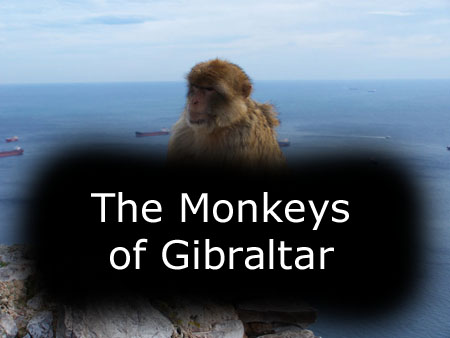
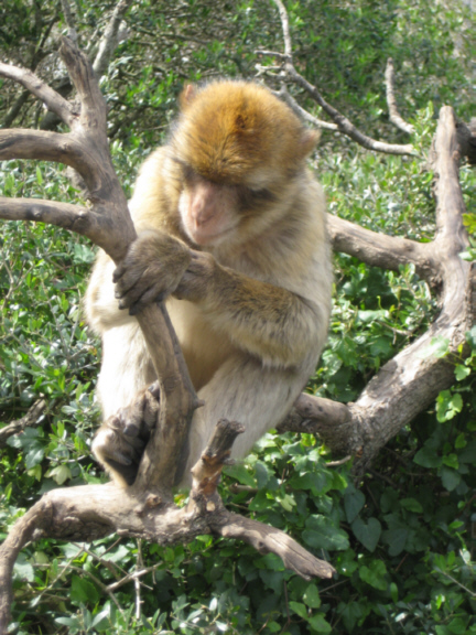
The Macaque Monkeys of Gibraltar and The Ape Den
 |
And they have grown so used to the kindness of tourists and tour guides that little will frighten them away, not even the sharp flick of a broom or the shrill screams of children. They'll even jump right up to sit in cars and taxis with the tourists. The monkeys - despite being called apes, they are really monkeys - have grown so adept that at the Caleta Hotel on Catalan Bay they can easily tell the difference between the uniformed employees (who are not likely to provide treats) and the tourists (who are). "People think they are cute, and they hand them crisps and biscuits, so the monkeys climb up and take the food," said Eric Shaw, who works for the nonprofit Gibraltar Ornithological and Natural History Society and is in charge of the monkeys. "I mean, if you want to buy me a free drink, I'll take it. It's not that they are so clever. It's that we are thick."
Like the adorable pint-sized pickpockets that abound in some European cities, often with the blessing of their parents, the monkeys do their utmost to charm and distract before making off with the loot. They have learned to preen in front of cameras and mimic snapping a picture; they jump on the heads of tourists for a laugh; they perch on the side mirrors of touring taxis and wait for their treats; they have even figured out how to unwrap candy bars. One of their favorite tricks is swiping ice cream cones from children, leaving behind a trail of crumbs and tears. (Not surprisingly, the monkeys now suffer from tooth decay.). Nobody is supposed to feed or touch the monkeys, which carries a fine of nearly $1,000. The last time someone was punished for the offense, though, was 1918.
They are Gibraltar's biggest tourist attraction, but the 30,000 residents here are growing increasingly impatient with the monkeys' hooligan antics. Residents are forced to leave their groceries in their cars, because the sight of a plastic shopping bag would almost certainly touch off a stampede. Windows stay shut and children indoors or, at least, under strict orders not to carry food. Cars near the mountain are dented and scratched because of the monkeys. They act as if it is the height of hilarity to snatch clothes off the line and scram. They also steal bread and fruit from kitchen counters and delight in disrupting a social gathering or two. In the middle of a pool party, they will come in and jump in the pool and ruin the party, residents have complained. Once, a monkey was found sleeping comfortably in a man's bed.
We, ourselves, were not the object of any of this "monkey mischief." Perhaps it was because the only thing we were carrying was our cameras. But we did see people feeding them all over the rock- at the top, at the observation areas, at St. Michael's cave, at the Ape Den and all along the roadways. We can sympathize with the residents' problems, but, darn it, they really are cute.
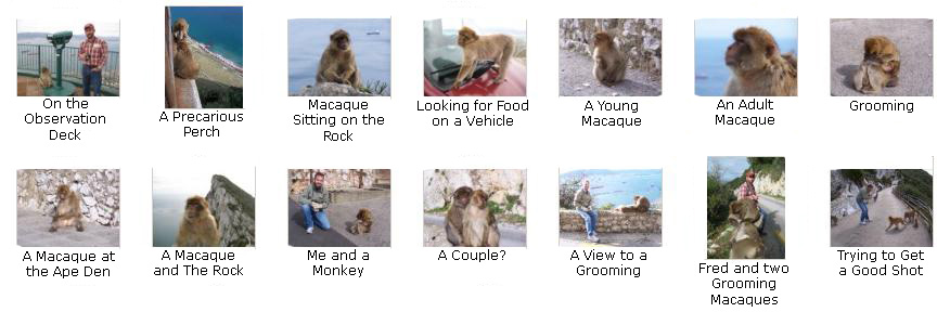
The monkeys really were interesting, and humorous at times, to watch, and we took a great many pictures and movies of them. To include them all here would be enormously repetitive, so we've selected only the best of the pictures and movies. First, if you just want a quick survey of the monkey types and the places where we saw them, you can use the set of thumbnail images below. Just click on these thumbnails to view the larger pictures:
|
To view the slideshow, just click on the image at left and I will open the slideshow in a new window. In the slideshow, you can use the little arrows in the lower corners of each image to move from one to the next, and the index numbers in the upper left of each image will tell you where you are in the series. When you are finished looking at the pictures, just close the popup window.
I took three good movies involving the Macaques.
|
|
|
|
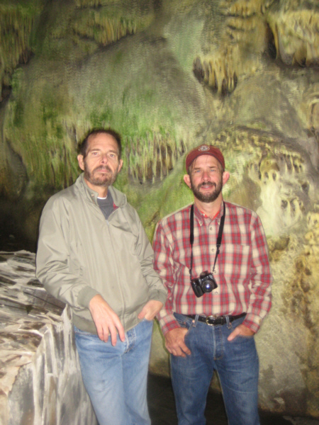
Spelunking in St. Michael's Cave
How early the caves were known or used is open to question. In 1974 a Neolithic bowl was discovered in the cave, one of many examples which prove that the cave was known to prehistoric man. Another would be the recently discovered cave art depicting an ibex drawn in charcoal on one of the cave walls. It has been dated to the Solutrean Period (15,000 to 20,000 years ago) based on the style used. However, since two Neanderthal skulls (you can see a replica here) have been discovered in Gibraltar, it is possible that they were among the first to set foot in the cave around 40,000 BC.
 |
During the Victorian era the cave was used as a venue for picnics, parties, concerts, weddings and even duels. The caves would be decorated for many of these events and even illuminated for distinguished visitors by soldiers who would perch on stalagmites with torches. The first official archeological excavation of the cave was carried out in 1867 by the Goveror of the military prison, Captain Brome. He discovered numerous prehistoric artifacts such as stone axes and arrow heads, shell jewellery, bone needles as well as a large collection of pottery. Officers looking for adventure during quiet times of service, would pass their time exploring the many passages witin the cave system. Sometime before 1840, Colonel Mitchell accompanied by a second officer got lost in the caves and were never seen again. Their dissapearance led to extensive explorations of the cave system in 1840, 1857 and 1865, but no evidence of the officers' whereabouts was found. Further exploration was carried out between 1936 and 1938, when a scientific expedition was mounted and every known part of the cave system was explored but again no human remains were found.
It is believed that St. Michael's Cave has had a military use since the Berber general Tariq ibn Ziyad led the Umayyad conquest of Hispania in 711 AD. This is assumed due to the defensive wall of Moorish origin which protected the cave's entrance until recently. Just after Gibraltar's capture by Anglo-Dutch forces in 1704, 500 Spanish soldiers concealed themselves within the cave overnight before an unsuccessful attempt at attacking the British by surprise. During World War II the entire cave was prepared for use as an emergency military hospital. Fortunately, it never needed to be used as such.
In 1942, it was decided that an alternate entrance was required to improve air circulation within the emergency hospital, as well as to serve as an emergency exit incase of airstrike. Whilst blasting the rock in order to create an extra opening, another deeper system of caves known as Lower St. Michael's Cave (or New St. Michael's Cave) were discovered. The series of descending chambers are riddled with almost all known cave formations, including a lake of crystal clear water.
The largest of the chambers, named the Cathedral Cave, currently serves as an auditorium. It was converted due to the chamber's natural acoustic properties, which according to experts, enhances and blends tones into a uniform and faithful rendition of sound. It is equipped with concrete seats and a stage and has a seating capacity of over 100. It has been a regular venue for musical and dramatic presentations, light and sound shows and even the annual Miss Gibraltar beauty pageant. Nowadays the cave is one of Gibraltar's top tourist attractions and is open daily to the public receiving almost 1,000,000 visitors a year. The cave formations are colorfully lit and visitors can read displays documenting the caves' history.
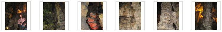
As for pictures of the cave, you can first take a look at some of the best pictures we took on our way through the cave by clicking on the thumbnail images below:
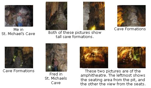
Secondly, if you are interested in more views of the formations within St. Michael's cave, you can click on the thumbnail images below:
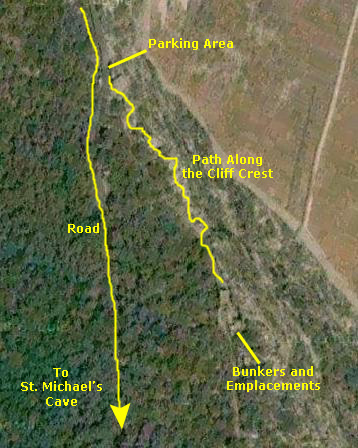
Walking Across the Western Face of Gibraltar
St. Michael's Cave to Queen's Gate
 |
Ahead of us, there were great views of Gibraltar, and a really spectacular view of the bay at Gibraltar; that's Puente Mayorga, Spain, in the background, and Algeciras, Spain is off to the left. As we walked, we could see the stairway/wall ahead of us, and we could also see that the road would be splitting somewhere up ahead.
Just a little distance later we found ourselves at the mountain's major road intersection. When we got to it, we found that the single road we were on split three ways, and we were in a quandary about which way to go. Fortunately, there was a pretty clear sign to give us our options. We didn't want to go to the right, for that would take us right back to the upper cable car station. If we took the middle road, we'd bypass Ape's Den- the nominal home of the Gibraltar monkeys- even though we were indeed heading to the Great Siege Tunnels. In the end, we decided to take the lower road, go past Ape's Den and through Queen's Gate and then, we hoped, find another way to get to the Great Siege Tunnels.
So that's what we did, and as we walked down the steeply-sloping road, we could see Phillip's Wall ahead of us, and we knew we were approaching Queen's Gate.
Queen's Gate
 |
We have three more good pictures of Philip's Wall, and there are thumbnail images below that you can click on to see them:
Prince Ferdinand's Battery
 |
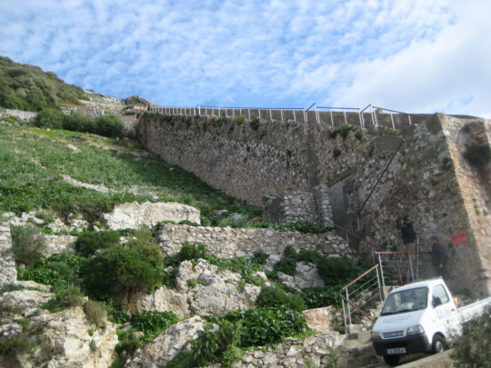
The history of the battery, which refers to the military group rather than the emplacement itself, has its origins in the Seven Years' War which broke out in 1756. No British Army units took part in Germany until 1758, when a contingent of about 12,000 men joined the Allied Army defending Hannover. The Allied Commander-in-Chief was one of the ablest generals of his day- General Field-Marshal Ferdinand, Prince of Brunswick and Luneburg (nephew of Frederic the Great). Prince Ferdinand's Batter originally consisted of six Cavalry Regiments, six Infantry battalions and three more companies of the Royal Artillery. Under Ferdinand the Artillery in Germany tried a new method of applying themselves; it was in fact the emergence of the Field Battery as we now know it- as the tactical fire unit. Prince Ferdinand's Battery achieved remarkable success, and the Battery has remained a celebrated unit of the British Army right up until the present day. The turn of the twenty-first century found the Battery serving in Kosovo.
The connection to Gibraltar is a simple one; Prince Ferdinand's Battery took part in the Great Siege, and was instrumental in winning the conflict for the British. Prince Ferdinand's Battery emplacement was built during the Great Siege, and has seen much use in the centuries since then, most notably during the Second World War. This particular emplacement had complete coverage of the city of Gibraltar and the bay beyond, as this view from the battery clearly shows.
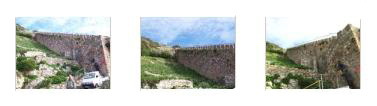
Below are thumbnail images for four more views taken in and from the Battery; click on them to have a look at the full-size images:
The Middle Cable Car Station
 |
These images were taken at quite a coincidental time, as it turned out. Since you have seen all of our traveling companions already (if you've been through this album in time sequence), you should take another look at the last picture by clicking here.
Fred also took a very good picture of the cable car on its descent to the lower terminus.
Walking to the North End of Gibraltar
The Great Siege Tunnels and Ruins
 |
The final military siege on Gibraltar followed many years later, in 1779. On this occasion the Spaniards and French combined forces and launched a massive onslaught, which was to last close to four years. It was a siege, known as the Great Siege, which was to test the ingenuity and will to survive of the garrison. The galleries were dug during this time, as Sergeant Major Ince attempted to drill a tunnel to place a gun in a vantage point on the Rock. On tunnelling sideways to make ventilations he realized that these exits would make perfect gun positions. Later, a Lieutenant Koehler designed a carriage, which allowed guns on the cliffs to be directly pointed down at the enemy. On the 21st November, 1781, the defenders of the garrison took the offensive and caught the enemy batteries on the isthmus by surprise, destroying them and setting back their progress: this event is commemorated as the Sortie.
In 1782, work began on the Great Siege Tunnels, which became the great and complex system of underground fortifications that today criss-cross the inside of the Rock. After the Siege, the fortifications were rebuilt and, in the following century, the walls were lined with Portland stone, which gives them their present white appearance. These tunnels were also put to use during World War II as part of the defense of Gibraltar by the Allies against the Axis powers.
Exploring the tunnels was really interesting, and there were a number of exhibits. Below are thumbnail images for some of the pictures we took inside; click on those thumbnails to view the full-size pictures:
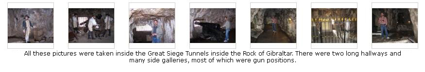
At most of the emplacements, we could get right up to the opening and see the view through it. Most of them looked north across the Spanish border (towards the current city of La Linea de la Conception). After he took this shot, Fred zoomed in on an area right below the Rock, which turned out to be a large cemetery. At the end of the tunnels, there was another lookout, and this one had an amazing view right along the side of the Rock of Gibraltar.
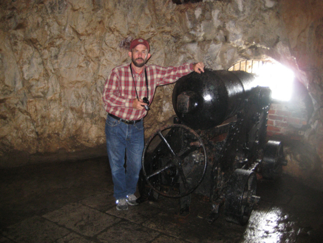
We came out of the Great Siege Tunnels and spent some time on the overlook outside. One of the cannon had been placed here, pointed right at Gibraltar, and here is Fred with the cannon. Fred also took a picture of me with Gibraltar in the background. We then walked down the road from the siege tunnels towards the City Under Siege Exhibition. On the way, we passed a lime kiln. This is actually the last remaining kiln in Gibraltar. These "ovens" were used to produce lime, for which there was a variety of uses, such as the white-washing of buildings, the painting of water cisterns to maintain the water free of bacteria and, most importantly in times of plague, for pouring over bodies in mass graves in order to prevent further contamination. This particular lime kiln dates to the late 1800s.
I took a couple of movies in the Great Siege Tunnels, and you can use the movie players below to watch them:
|
|
City Under Siege Exhibition
 |
The exhibition was free and open, and consisted of some of the original buildings from the time to which had been added some figures and explanatory signage. We came in through the buildings entry and immediately started exploring. The exhibit was very interesting, but I won't try to relate all of what we learned here, but we did take some representative pictures while we were walking around, including one of a spring‑fed fountain that was the primary water source for the defenders at this position on the rock. If you will click on the thumbnail images below, you can see the other pictures we took here:
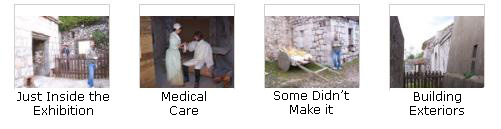
When we were done, we left by the exit and walked alongside the buildings and back to the road, heading off down it towards our last stop, the Moorish Castle.
I did take one movie here, and you can watch it using the movie player below.
|
|
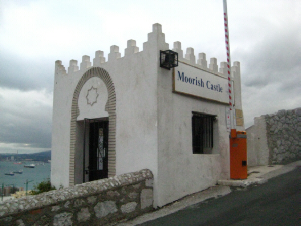
The Moorish Castle
 |
The importance of Gibraltar to both Moslems and Christians lies in the fact that the Moorish invasion and occupation of Europe started from Gibraltar in 711 and, through to its final re-capture by Spain in 1462, Moorish rule was gradually undermined until, with the fall of Granada in 1492, the Moorish occupation of Europe came to an end after an uninterrupted 781 years. (Gibraltar is reputed to have derived its present day name as a breakdown of Djebel Tarik, the Rock of Tarik.)
Little is known of the actual history of The Castle. Some chroniclers claim that its origins date to the 8th Century when The Castle, in its simplest form, is reputed to have been completed by Tarik in 742. In 1068, the Arab Governor of Algeciras, the city on the west side of the Bay of Gibraltar, ordered that a fort be built on "Jebel Tarik" (Gibraltar) to guard and watch events on the other side of the Strait. This could very well have been the origins of the present Tower of Homage since there always appeared to have been a castle on this very site around which the original walled town grew and to which the population withdrew in troubled times.
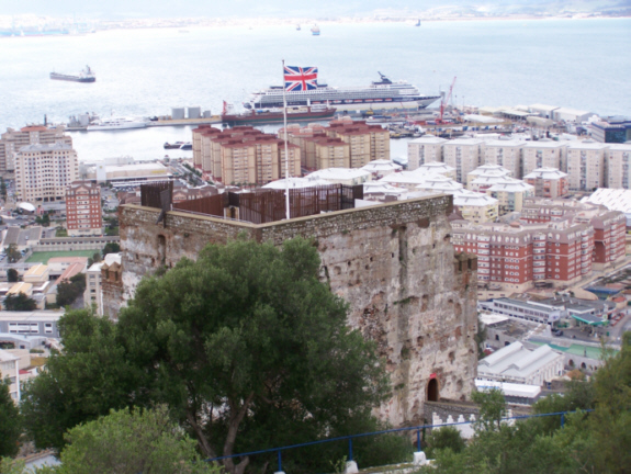
In the early 14th Century The Castle was rebuilt to its present form. It, therefore, stands on the actual site where the very first Moorish fortification ever constructed on European soil stood. It thus became the main fortification on the Rock of Jebel from where the conquest of Iberia had been launched in 711. But this is not the Castle's only important attribute since it also has the distinction of having the largest Castle Keep and the tallest Tower in the whole of the Iberian Peninsula.
The Moorish Castle Complex starts at its highest point with The Tower of Homage at its eastern extremity. Around The Tower lie the Inner Keep and the Outer Keep. West of the Keeps lies The Qasbah with its famous and unique Gate House. Further down the Rock we came to Villa Vieja (The Old Town) and from here to La Barcina with its Sea Gate at the site of the present Casemates Gates. La Barcina is the name given to the area where the original Moorish dockyard stood and where their boats were careened for repairs and protection. Great lengths of these Moorish fortifications and walls remain, providing us with excellent examples of Islamic architecture of the period. The Gibraltar Heritage Trust is now faced with the daunting challenge of protecting them for posterity by making good the ravages of time and neglect of man, and restoring them faithfully to their original style and design and with the same materials that were used at the time.
 |
From the battery, we got an excellent view of the Gibraltar airport and the Spanish city of La Linea de la Conception beyond it. One very interesting thing in this beautiful view is the road that crosses the airport runway. There is very little room here in Gibraltar for an airport but there almost has to be one, since it would be unacceptable for British citizens to be forced to go through some other country (flying in to the Algeciras airport, for example and driving to Gibraltar). So there had to be an airport here, and the only place to build it was on the flat lowland north of the actual rock of Gibraltar. This meant that the runway had to be oriented east-west. Since every foot of the distance across the isthmus would be needed for the runway, this in turn, meant that any road connecting Gibraltar to the mainland would have to cross it. And that's what has been done. Of course, this means that the road has to be closed when aircraft are landing or taking off, but fortunately Gibraltar's airport is not among the worlds busiest! Take another look at the same picture here and you will be able to spot the Spanish/British customs crossing just on the far side (the north side) of the airport.
After admiring the view, we headed down the long entrance ramp that led to the castle entrance. On the way, we took two pictures of the entrance to the castle, one with Fred and one with me. We also took two pictures of the outside of the castle, views that you can look at here and here.
The inside of the castle was very interesting. It was very spartan; I don't think anyone has much of an idea of what it might have looked like when it was in use. There were very few windows, probably because they might weaken the tower's defenses, but the windows the tower did have seemed all to have good coverage of the harbor area. We took a number of pictures inside the castle, some showing the small bit of renovation that has been done. You can have a look at these pictures if you will click on the thumbnail images below:
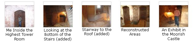
When we were done looking at the lower levels, we took the new stairs up and came out on an old landing. This led to another set of stairs to the rooftop. These, in turn, led us through an old doorway and out onto the rooftop of the castle. As you would expect, there were excellent views of Gibraltar from here, and we spent some time wandering around and taking pictures. When we were done, we went back inside and down the old stairway to the central stairs, and from there back down to the entrance. We left the grounds along the same road we'd been following, which led us back down towards the city. Looking back, we got one more view of the Moorish Castle.
Here are the movies I took while we were at the Moorish Castle:
|
|
Returning to the Celebrity Century
 |
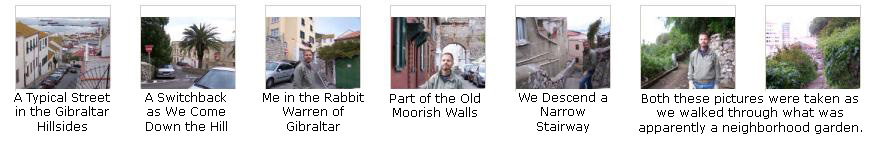
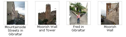
But we did make it back to the central plaza after seeing lots of Gibraltar along the way. If you want to see some pictures of the interesting streets, neighborhoods and pathways that we followed on the way down, click on the individual thumbnail images in the two sets of such images below:
|
|
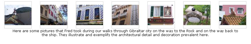
Before we head back down the street to the dock and the ship, I want to include a final set of pictures that Fred took during the day. He is always interested in architectural and decorative details, and we'll include some of the best he took today here. Just click on the thumbnail images below to take a look at these pictures Fred took during our trek around Gibraltar:
From the plaza, we made our way back through the casement gates and across the intersection to the road leading out to the dock. We had traversed about half the distance to the ship when we turned to get two final pictures of each of us with the Rock of Gibraltar in the background. If you want to take a look at them, you can find a picture of me here and a picture of Fred here. And just before we reached the actual dock area, we found an interesting object with no information as to why it was where it was, so we just took a picture of it. And then, in a few more minutes, we were back at the ship.
We had an excellent time in Gibraltar, and we saw about all there is to see. It is really beautiful here, and well worth a visit. About an hour later, the ship sailed for our next stop- Casablanca.
You can use the links below to go to another photo album page.
|
December 4, 2008: Casablanca, Morocco |
|
December 2, 2008: Cartagena, Spain |
|
Return to the Europe/Cruise Trip Index |