|
November 7, 2009: A Sea Day |
|
November 5, 2009: A Sea Day |
|
Return to the Index for Our Panama Canal Cruise |
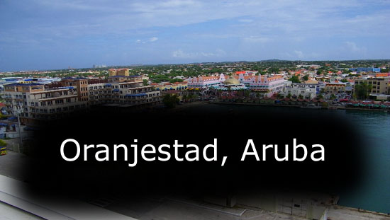
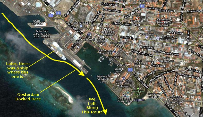
Docking in Oranjestad, Aruba
|
|
As the aerial view shows, the dock is big enough to hold two ships at once. When we arrived, we were the only ship there, and we took the southern berth. Not long after we arrived, a second cruise ship came in and docked behind us.
If you will click on the thumbnails below, you can see a few of the pictures that Fred took after he joined me on deck to watch the ship come into the dock:
|
A Bit of History
Spanish explorer Alonso de Ojeda is regarded as the first European to arrive in about 1499. Although he established a colony there, it was limited in scope. Unlike many other Caribbean islands, no plantation society evolved on Aruba. Instead, the Spanish sent many Caquetios to Hispaniola, where they were enslaved in the mines.
In 1636, Aruba was acquired by the Dutch and remained under their control for nearly two centuries. In 1805, during the Napoleonic wars, the British took control over the island, but it was returned to Dutch control in 1816. A 19th-century gold rush was followed by prosperity brought on by first the opening of a crude oil transshippment facility in 1924 and then in 1928 with the opening of an oil refinery. The last decades of the 20th century saw a boom in the tourism industry, which became Aruba's primary industry when the refinery closed in 1985. Because of the focus on tourism and the number of resorts on the island, Arubans enjoy a very low unemployment rate. Aruba has earned a reputation as the "Las Vegas of the Caribbean."
In 1986, Aruba seceded from the Netherlands Antilles and became a separate, autonomous member of the Kingdom of the Netherlands, under the Dutch crown. Movement toward full independence was halted at Aruba's prerogative in 1990. Aruba has a mixture of people from South America, Europe, the Far East, and other islands of the Caribbean.
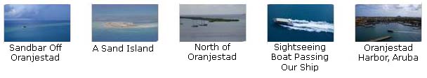
Oranjestad From the Ship
|
To view the slideshow, just click on the image at left and I will open the slideshow in a new window. In the slideshow, you can use the little arrows in the lower corners of each image to move from one to the next, and the index numbers in the upper left of each image will tell you where you are in the series. When you are finished looking at the pictures, just close the popup window.
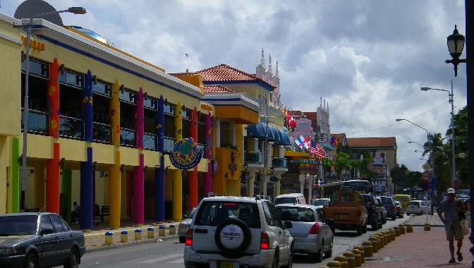
Walking Around Oranjestad
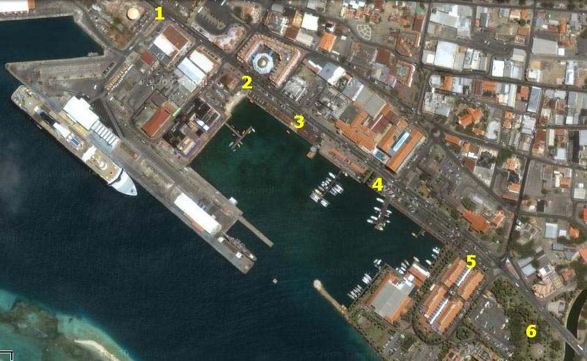
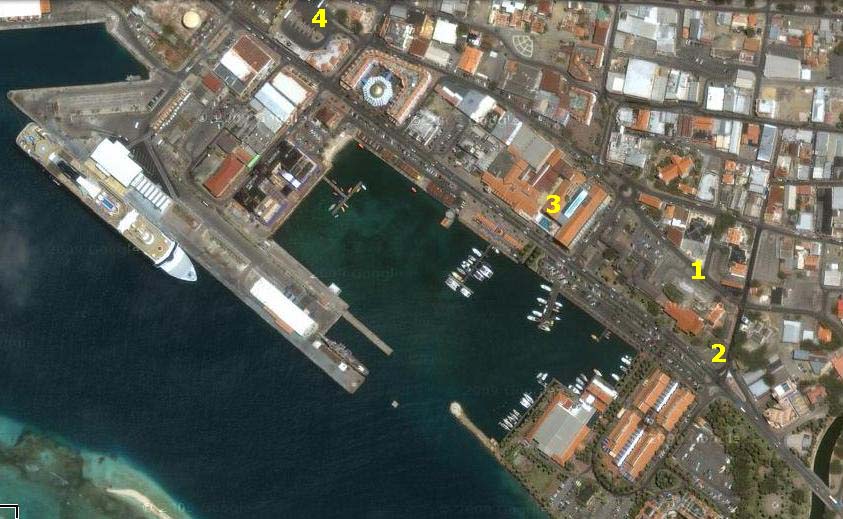
I won't clutter up the view with a path line, since we walked basically southeast along the main street by the harbor and then back again to the bus station. But what I will do is put the occasional marker to show you where we were when a particular group of pictures were taken, or we saw something particularly noteworthy. You can refer to the aerial view as you care to.
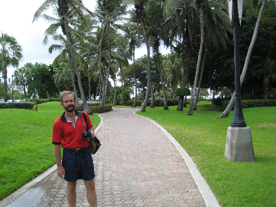
We actually got off the ship about nine-thirty, and after walking the length of the pier and then two blocks inland, we found ourselves on L.G. Smith Boulevard, the main road running along the side of the harbor.
|
We continued to walk southeast along the street until the Renaissance Marina Hotel was across the street on our left, and we crossed over a small bridge to what appeared to be a tiny park (4). The bridge crossed over a narrow channel that seemed to run under the street towards the hotel. A bit later on, we found out what it was for. But when we stopped in the little green area, we got some very pretty views of the Oosterdam. Just a short ways further down the street (5) there was a shopping plaza that, oddly enough, had one of those red phone booths that you usually associate with England rather than the Netherlands. From here, there was another nice view of some of the boats in Oranjestad harbor.
|
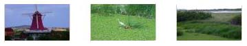
The park was also interesting in that it seemed to be inhabited by a large number of iguanas. Fred, with his incredible new zoom, was able to capture one of them from twenty feet away, and it's a pretty amazing picture. You can have a look at it here.
We crossed to the other side of the street for our walk back towards the center of town. Here is another copy of the aerial view so you can follow us along this part of our walk:
|
|
|
Coming back along the north side of the street, we discovered what the little canal was that we saw earlier. We walked right through the lobby/shopping arcade for the Renaissance Marina hotel (3), and we found that they had a boat service that brought people in from the harbor, through the small canal under the street, and right into a small turnaround and boat dock in the middle of the building. By the street, there were gardens and a waterfall, and between the street and the open central area there was a very interesting fountain. In the central area of the building, open to the sky, was the shopping, boat turnaround and hotel lobby. It was all very nicely done.
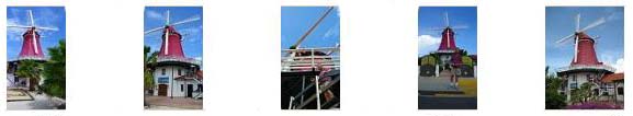
We continued walking along northwest along the street, thinking about what we might do next. We stopped in at the Renaissance Mall to have a look around, and while we were there we got out our little guide map and decided that we would go and see the famous "de oude molen" (the old windmill). To get there, we walked back up the street to the bus terminal, investigated the bus route information, and then sat down to wait for a few minutes for the right bus to come along.
|
|
This little movie I made while the bus was going along near the western beach area might not be all that interesting, but it will give you a little sense of what it's like to be an Aruban local. Have a look with the player at left. |
|
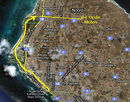
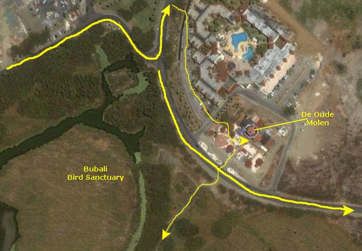
Perhaps the aerial view at right doesn't add much, but you can see about where the bus dropped us off and where the mill is in relation to that. You can also see the bird sanctuary across the street and where we walked a bit later on to get there. Finally, you can see the route that the return bus took to get us back to the harbor.
We actually expected something of a tourist destination, with at least a small crowd of people from the ships or even locals milling about. We expected a souvenir shop or two, some tours and perhaps even an admission to go into the building or climb up the windmill tower.
|
In any event, the windmill itself seemed boarded up and abandoned, although the stairs up to the top were open. There were some little buildings scattered about, but I think that they were sales offices for some of the local condo or vacation developments. There was one little convenience store in one of the buildings, and it seemed to be the only thing open here. Next door, there was a resort complex.
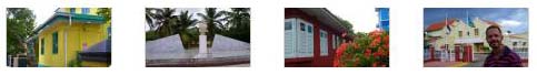
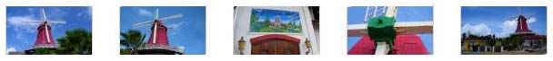
We took quite a few pictures around the old windmill; many of them were very repetitive and I have tried to eliminate most of them. If you will click on whichever of the thumbnail images at left look interesting, you'll be able to see the best of the pictures we took here.
|
Obviously, if there are stairs to the top of something, I just have to climb them. I made a movie from the top (well, not really the top) of the windmill, looking around at the surrounding countryside. |
|
|
|
When we finished at the bird sanctuary, we went back over to the highway near the windmill and waited for the bus back to town. It came along presently, and in fifteen minutes we were back at the bus depot. I had seen something earlier in the day that I hadn't mentioned to Fred, so before we went back to the ship I asked him to make a short stop with me. Up on the second level of a small shopping mall building, I had spotted a Baskin-Robbins! (It was combined with Dunkin Donuts.)
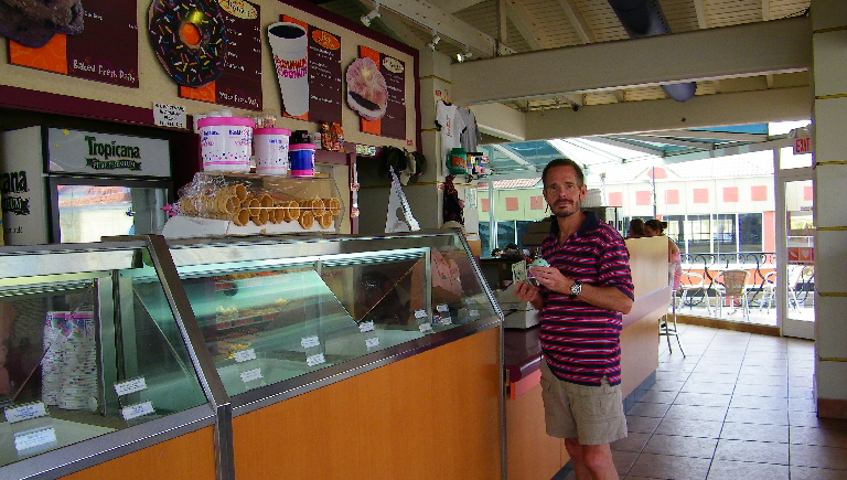
So, when we got back to the ship, I did just that. I had two hours before the ship sailed, so I had plenty of time. When I got all set up at the Dunkin Donuts, I had trouble getting online. Everyone else was having trouble too, including the fellow I'd talked to earlier. I was about to give up when I noticed that there seemed to be another network in range that was not security-enabled. I didn't recognize the name, so I asked someone about it. It turned out to be a restaurant/bar located in the Renaissance Mall across the street. So I packed my stuff up and went over there, sat down on a bench outside the bar and was able to get online. I did all our email, sent out some messages (one to Mario and Steve asking after the kitties) and did some other stuff. I even got a reply from the guys before I closed up shop to return to the ship.
When I got back to the dock, I still had some time, so I walked to the stern of the ship to take a picture. I think this picture is interesting because you can see clearly the two levels of the Vista Dining Room. The windows on the lower level look right out beyond the stern, but on the deck above, the Promenade Deck, the dining room windows look out on the promenade deck walkway. You can see this picture here. I continued to walk along the port side of the ship to get back to the gangway and reboard.
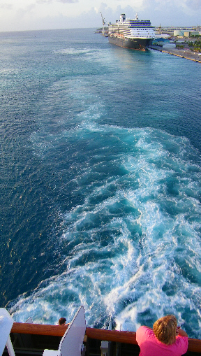
When I got back on board, I dropped off my stuff in the cabin and went up on deck for the sailing. I met up with Fred at the stern of the ship when I took my first picture of the Oosterdam's sister ship- the Zuiderdam- which had docked behind us while we were ashore. In the fading afternoon sun, I got another picture of the harbor at Oranjestad.
There are two other pictures I'd like to show you before the ship sails. I took a picture looking back directly towards the old windmill. The picture turned out well, although you can't see the windmill itself. I have, however, circled where it actually is. Have a look at this picture here. Fred, of course, has his new camera with a 15X optical zoom (which is much better than a digital zoom). He took a picture in exactly the same direction on his highest zoom level. I think you'll be amazed at what you see here.
|
The last thing I did before we sailed was to make a final movie of the beautiful little harbor here at Oranjestad, including a view of the Zuiderdam behind us. |
|
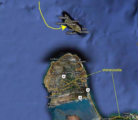
Most of what there is to do in Aruba involves beach or water activities. It is an excellent resort island, although kind of far from the United States (it is only about 30 miles off Venezuela). There aren't too many attractions; we saw the most famous, but didn't have an opportunity to go inside any of the good museums of Caribbean history. There was one thing we had wanted to see- a natural bridge that we had read about. That was just as well, though, because we had not noticed on the Internet when we were researching some of our ports of call that the bridge had collapsed in September, 2005. Had we gone across the island to see it, we would have been disappointed.
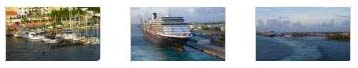
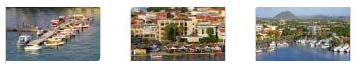
As we sailed out, Fred took some more good pictures of the harbor here at Oranjestad, and you can have a look at them if you click on the thumbnail images below:
|
|
I made one final movie here in Aruba as the ship pulled away from the dock to begin its all-day sail to the entrance to the Panama Canal. |
Evening Activities
You can use the links below to continue to the album page for different day.
|
November 7, 2009: A Sea Day |
|
November 5, 2009: A Sea Day |
|
Return to the Index for Our Panama Canal Cruise |