|
November 15, 2009: Hualtulco, Mexico |
|
November 13, 2009: Puerto Quetzal, Guatemala |
|
Return to the Index for Our Panama Canal Cruise |
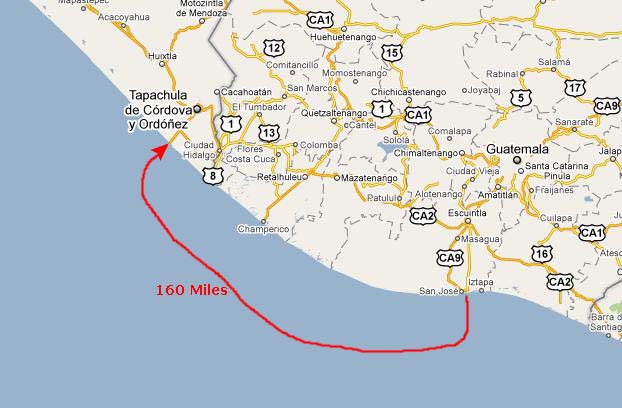
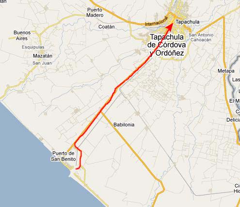
Arriving at Puerto Chiapas, Mexico
|
|
|
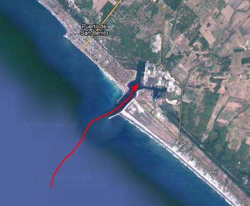
I sometimes find it interesting how the aerial views get so quickly out of sync with what actually exists; this isn't the first time in this album that this has happened.
In any event, the captain brought the Oosterdam directly in to the harbor and then, short of the dock, he pivoted the ship 180 degrees so that the bow would be pointed out to sea for departure. Once he had done that, he literally backed the ship up at the same time as he brought it closer to the dock- not quite like parallel parking, but close. While he was doing that, I snapped a picture of some of the harborfront houses at Puerto Chiapas.
|
When we got closer to the dock, I shot a movie. This port had the loudest, highest-energy welcoming music of any port yet. |
As we were actually docking, Fred shot a movie showing our dock, the ship behind us and the inlet. |
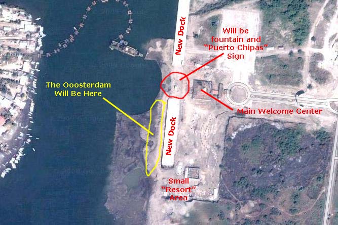
We went and had our breakfast and got ready for our own shore excursion, and then came back to the observation deck for some more pictures. Fred did take one interesting picture of the new Puerto Chiapas gate.
|
Before we went to join the guys for our excursion, Fred made a movie of the passengers beginning to disembark as well as all the new port facilities here. |
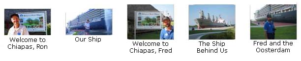
Then we, ourselves, got off the ship to meet up with Greg and Paul. Before we left on the excursion, I took one picture of Fred at the Puerto Chiapas fountain.
The Ride to Tapachula
|
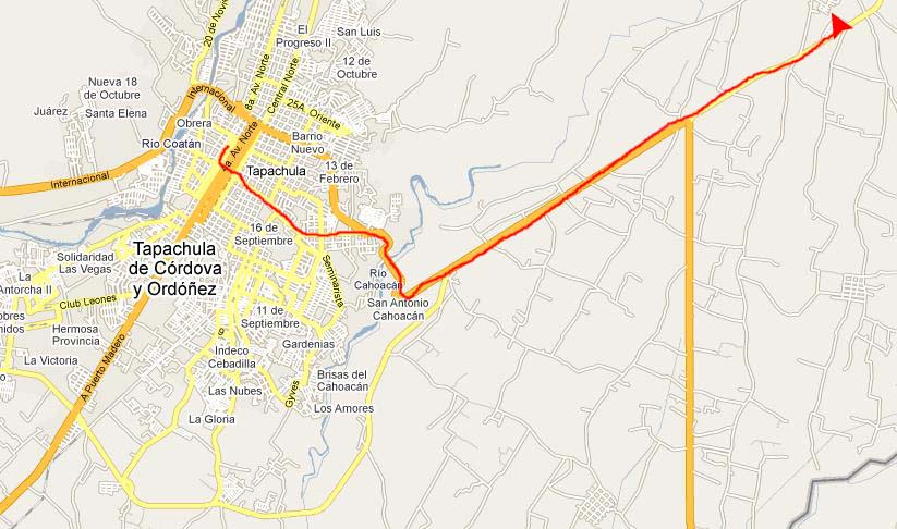
Getting to Tapachula was pretty simple, once I got to look at a map. The new road to the port goes right into the center of town, so all we had to do was relax and listen to our tour guide tell us a little about the area.
Tapachula is the second largest city in the Mexican state of Chiapas. It has a hot, humid climate, located as it is on the Soconusco coastal plain about as far south as you can go in Mexico. There are about 300,000 people living in the city and its environs. The city has one of the highest GDP per capita in Mexico, and it is known sometimes as "Perla del Soconusco" ("Pearl of Soconusco").
The population mix is culturally diverse. From Native Americans and Mestizos to Spanish, German, Chinese, Japanese, French and several others. The city has an International Fair each year in March. During the history of the city several foreign cultures had great influence. The Germans came during the coffee boom and created German villages and haciendas where their descendants live today. The Japanese and the Chinese also left a strong influence in Tapachula, in the cuisine and architecture. They came to construct railroads and were the first Asian immigrants in Latin America. Italian, French and other expat descendants still live along the Spanish, Mestizo and Indians of the region.
Tapachula is also known as the point at which the undocumented migrants from Central America begin their trek northward in search of jobs, and a better life. Before Hurricane Stan devastated the Soconusco region, a train system carried large numbers of these migrants weekly to the north. Tapachula has an extensive metropolitan zone that includes several suburbs, beaches like Playa Linda, Puerto Madero, Viva Mexico in downtown Tapachula and even a new cruise harbor named Puerto Chiapas (2005). When the new port was built, its name was changed from the old Puerto Madero.
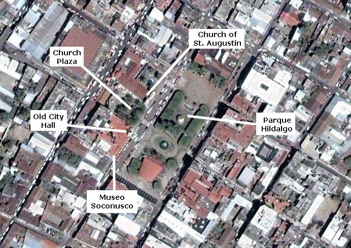
We will be visiting half of the city's main attractions- the Church of San Agustin, the Soconusco Archaeological Museum, the pyramids of Izapa and the central park- Parque Hildalgo.
|
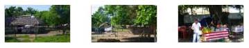
As we got into the urban area, though, everything changed and, other than the language, you could be in any urban area of the world (no small thanks to franchises). Fred took some interesting pictures of the roadside commerce, thankfully eliminating pictures of the Home Depot, McDonald's and the local Holiday Inn. Have a look at his pictures by clicking on the thumbnail images below:

|
Tapachula and Parque Hildalgo
|
As soon as we had gotten off the bus and it pulled away, I made a movie of our surroundings, showing the places we'd be visiting while we were here in town. |
Just before we left for the Izapa ruins, I made another movie from the center of Parque Hildalgo. I'm including it here, even though it was taken a bit later in our stay downtown.
|
I made a movie from the center of the Parque Hildalgo square looking around at the area. |
|
Right in the middle of Parque Hildalgo was a nice fountain, and it divided the park into two sections. In the northern half of the square, it seemed as if there was going to be some sort of concert. As you can see, the banner at the top of the performance stage indicated that this was part of something called the "Cultural Festival of Mesoamerica," this part being the Third Cultural Festival of Soconusco (which is the name of this area of the coastal plain of Mexico).
Nearby, at the north end of the square, stood the statue of Father Matias de Cordova, whose contribution according to the statue's plaque was the "Liberator of Chiapas." Father Matias was born in Chiapas in 1768 when the area was part of Guatemala. He was a religious and political leader who proclaimed the independence of Chiapas in 1821. He was the prior and vicar general of the convent of Santo Domingo de Chiapas. He was also an accomplished writer; he founded a printing house and published a newspaper while living in Spain in the early nineteenth century.
|
While we were near the performance stage, Fred made a movie that captures some of the music being played and shows you this part of Parque Hildalgo. |
There actually wasn't a great deal in the other half of the park; there was a little gazebo/bandshell, some vendors and lots of places to sit and walk. If you want to see more pictures taken in and around Parque Hildalgo, just click on the thumbnail images below:

|
Although we actually went to the museum first, I'd like to postpone that to its own section that you can reach using the index at the top of this page. I'd like to go ahead and show you the three other distinct areas that we visited here in Tapachula, beginning with the Church of St. Augustin.
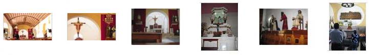
Officially known as the Parroquia de San Agustin (The Parish Church of San Agustin), this modest and beautiful church was probably built in the late eighteenth century and its facade shows traces of an emerging neoclassical style, with Ionic columns of striatum to the sides of the door. It has a wooden roof covered with mud tiles. We went inside the church from its front entering into sanctuary. We admired the interior decoration, and then exited out a side entrance that led to the plaza between it and the old city hall. If you would like to see additional pictures of the interior of the Church of St. Augustin, please click on the thumbnail images below:
|
The small plaza between the church and the old city hall was filled with people. It was bordered by the church on one side and stores on the other. At the back of the plaza was a memorial to Benito Juarez Garcia- the first full-blooded indigenous national ever to serve as President of Mexico and to lead a country in the Western Hemisphere. He served five terms as president of Mexico. For resisting the French occupation, overthrowing the Empire, and restoring the Republic, as well as for his efforts to modernize the country, Ju�rez is often regarded as one of Mexico's greatest and most beloved leaders. Several towns, schools, parks, streets and monuments have been named to honor and remember him.
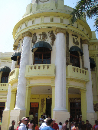 The Municipal Palace |
Inside the building, standing on the broad staircase that led to the second floor, were a number of young women in national costume. I never did find out why they were there, except that I would think they were tied in to the cultural aspects of the city. Tourists were snapping away like mad. I went past the girls up to the second floor to look around, and took a number of pictures of the interior of the building and its atrium. From the landing at the top of the stairs, I could get a nice view of the offices on the second floor as well as see some of the artwork that adorned the walls around the second floor balcony.
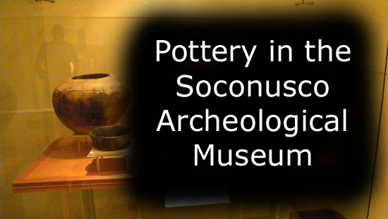
The Soconusco Archeological Museum

|
|
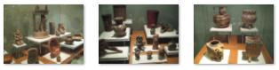
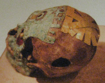
We took quite a few pictures in the museum, mostly of the various exhibits. Flash photography was only allowed in certain areas, so I have had to eliminate many of our pictures because they were too fuzzy. (I should also point out that Fred was using a different light setting than I was, so his pictures will always be golden in tone, whereas mine will mostly be bluish-gray. If memory serves, the actual coloring was more to the gray end of the scale.) Where we took pictures of the artifacts but no descriptions, I'll just describe them as best I can. Where we did take a picture of the description as well as teh artifact, I will either add the description as an inset picture, such as the one at right, or, if the description is short enough, copy it directly into the text or use it as a caption for a thumbnail.
We didn't always photograph the description, of course, so where no description is available I'll just try to describe them as best I can and then give you a set of thumbnail images you can click on to see the full-size pictures.
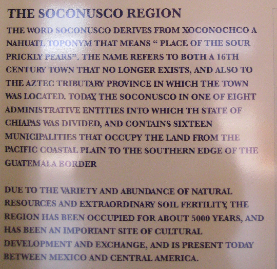
You can begin your tour with us by reading about the Soconusco Region. This information was the first that we encountered in the museum.
|
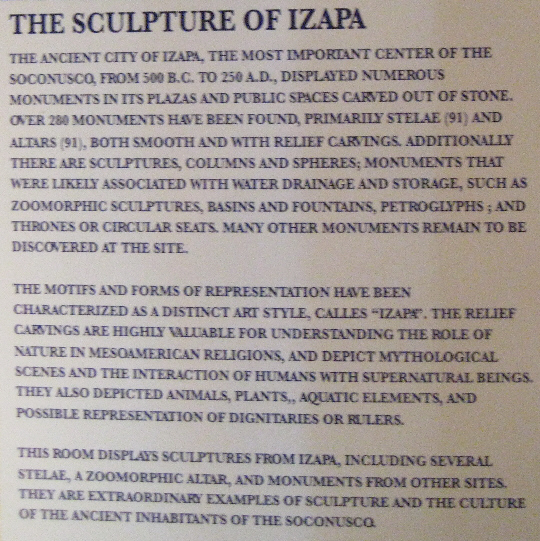
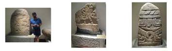
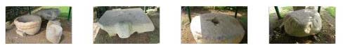
Some of these vertical blocks of stone had single figures on them, such as this one with what appears to be an athlete or perhaps a runner on it. Others were had much more intricate designs. The Maya people were great astronomers and this last stelae (25) shows a scene from the maya cosmogony. Some archaeologists believe it is a representation of the Milky Way and the Big Dipper. I took pictures of three of the most interesting stelae in the hall, and if you will click on the thumbnail images below you can have a look at them:
|
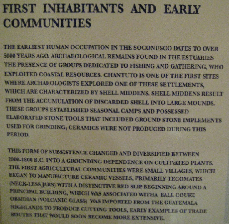
The exhibits actually began with a narration of the earliest inhabitants of the Soconusco Region.
 |
 |
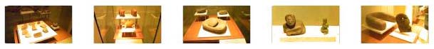
Below are some thumbnails for the exhibits in this area of the museum that dealt with some of the earliest inhabitants of the Soconusco Region. Click on them to take a look at the selection of artifacts:
|
|
Even early on, the peoples of Central America, and particularly those of Aztec or Mayan ethnicity, began carving intricate figures. Whether these represented people, or deities (or, as some have suggested, off-worldly entities) is unclear, but the statues, stelae and totems must have had special significance. In this figure, it is almost possible to imagine that the detail in the lower portion is some representation of the internal organs of a human being, making one wonder about the purpose of the carving. If you will click on the thumbnail images at right, you can see more of the artifacts from these early eras that were on display here.
From these earliest inhabitants, the exhibits came forward in time to the city of Izapa. Some researchers believe that the Olmec culture started in Izapa and then spread north to Veracruz while others see a spreading of the Olmec culture from Veracruz to the Isthmus.
 |
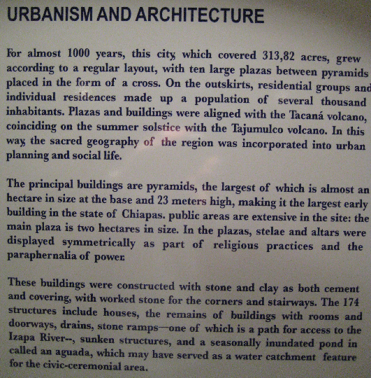 |
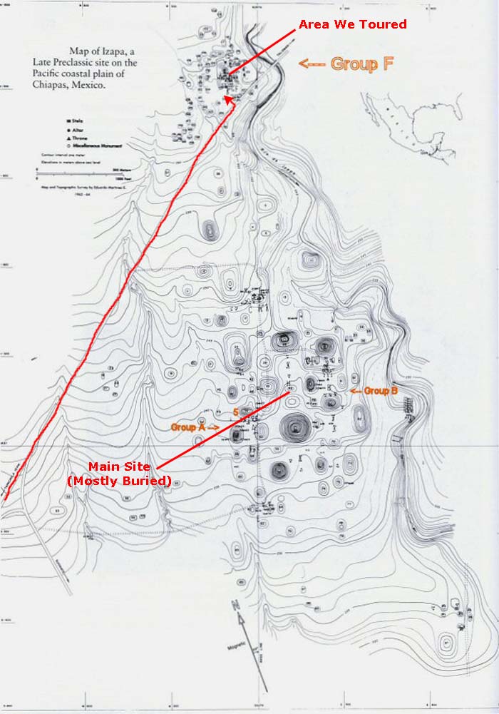
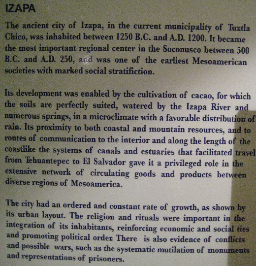
The ruin of Izapa, an ancient city with Olmec influence that was settled by 1500 BC and reached its peak from 600 BC to 300 BC, is near Tapachula. The map that you can see here shows the extent of ancient site as it spread over 400 acres with a population estimated at 10,000. The area borders present day Guatemala. Three parts of the site are now open, group F, Group A, and Group B, marked in red on the map. Modern roads now cut through the site and join the three groups. Collectivo taxis stop at the ruin on their way to and from Talisman and the modern city of Tapachula.
 |
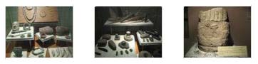
For example, there was one display of musical instruments, which were apparently routinely used for both religious and secular festivals and ceremonies. Instruments such as tambourines, trumpets, flutes and ocarinas were richly decorated with human and animal figures. I also found it interesting that there was an entire display of special vessels used for drinking chocolate. These vessels were typical of the Maya region; cocoa beans were originally from this area but were transplanted to Africa. For Mayans, chocolate was the drink of the gods and considered sacred, a feeling with which many modern-day people can sympathize.
Also prevalent during this period were representations of humans and human faces, and large numbers of these have been found at the Izapa site- more than at other sites in Central America. Most of them were quite small, but very intricate and of wide variety.
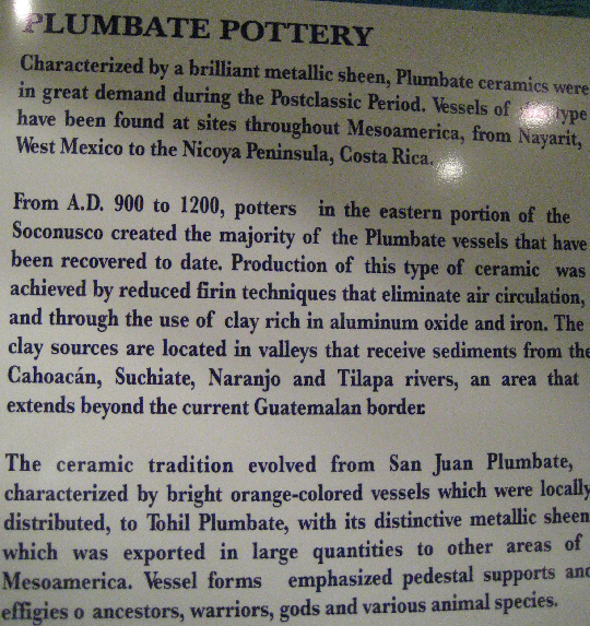
Of course, as the signage at left tells you, one of the most prized products produced in the area around Izapa was a particular type of pottery that had a metallic sheen to it- plumbate pottery. Unlike the typical clay pottery that we routinely see, and still produce today, this pottery was unusual in that it was sometimes hard to distinguish it from metal- at least from a distance or until you picked it up. The museum had quite a lot of this type of pottery on display. Some of it was plain, while some of it was richly adorned. If you would like to see some of these displays, just click on the thumbnail images below:
|
 |
 |
As we wandered through the exhibits of items and artifacts from the Soconusco Region, we took quite a few pictures of the interesting items.
|
In any event, we took quite a few pictures of these interesting ceramics, and I'd like to give you the opportunity to easily and quickly look at them. So I've put the best pictures into a slideshow.
To view the slideshow, just click on the image at left and I will open the slideshow in a new window. In the slideshow, you can use the little arrows in the lower corners of each image to move from one to the next, and the index numbers in the upper left of each image will tell you where you are in the series. When you are finished looking at the pictures, just close the popup window.
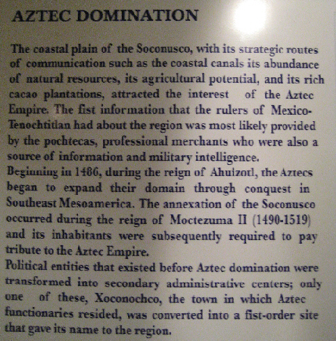
The history of the Izapa area after the peak of the civilization there is the story of a very slow decline, and the eventual assimilation of the area into the Aztec Empire. One imagines that new life might have been breathed into the area with the expansion of trade and the consolidation of political systems.
 |
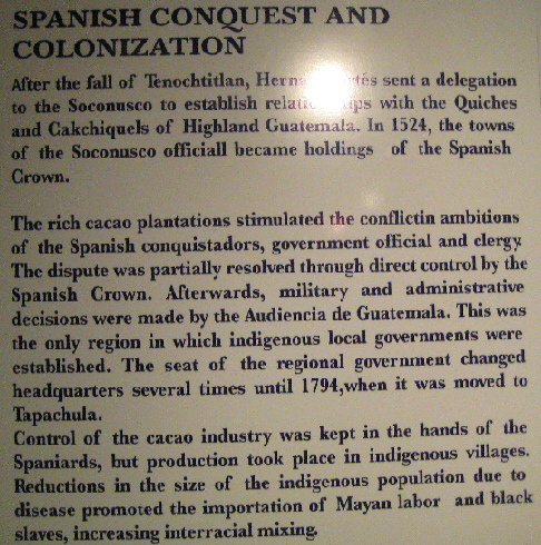 |
All of this came to an end with the arrival of the Spanish. The story of what happened in the short span of time subsequent to the arrival of the Spaniards in Central and South America is well known. Suffice it to say that the empires of the Aztecs and the Incas and the Mayans began a quick decline. Many died from sickness or conflict. The culture of those that remained was subsumed into the culture that the Spanish brought with them.
For example, take a look at this piece that was one of the last we saw during our visit to the museum. "Although it looks quite simple, it is very significant because of the fact that, like many Maya buildings and artifacts, it was transformed into a Christian symbol of cult, which came to represent the religion of the new conquerors and the blending of the old and new religion of the Maya people." (The quote was taken from the sign next to the piece.)
We thoroughly enjoyed our informative visit to the Museo Soconusco, and the subsequent visits to the Parque Hildalgo, the Church of St. Augustin and the old city hall. At about 1:45, our group reassembled on the street outside and our tour bus arrived to take us to the archeological site of Izapa.
Visiting the Ruins at Izapa
 |
|
But if you will scroll the diagram down, you will see that the area we toured was just a small fraction of the almost 300 acres that the original city of Izapa covered. In fact, the main part of the city was off to our south. When I saw this map for the first time, I wondered why we hadn't gone to that part of the site, since it looked as if there were many more buildings to see there. The first hint came when I tried to find those buildings on an aerial view at Google maps. No buildings. The answer was found by doing some searching on the Internet.
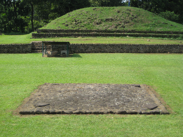
It turns out that most of the constructions at Izapa are actually still buried, or have deteriorated to an extent that they are hard to recognize. The diagram you see here shows where these constructions are, but you can't necessarily see them on the surface. In fact, the area we toured is an area that has been excavated and partially restored just so visitors can get an idea of what the constructions were like. This is not an area like Chichen Itza with tall, stairstepped temples and other completely excavated buildings. That was a little disappointing, but the area was extremely interesting nevertheless.
 |
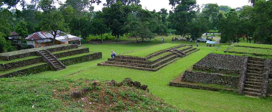
I'm including this aerial view simply because I think it is interesting to show where the site is in relation to some local farmhouses and other buildings. If this site were in the United States, I think it would be in a fenced perimeter, at least, and perhaps with a small visitor center and a park ranger. Here, though, there is no one- just the few people who live nearby. It's as if this incredibly important archaeological site was simply in someone's backyard. (Indeed, there were chickens from the house next door wandering around part of the complex.)
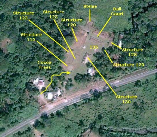
Although I have marked some of the structures here (as seen from the air), I am going to use a different bird's-eye view that I found on the Internet to key our pictures to.
Before we take a closer look at the structures here at Izapa, let's review some of its history.
Izapa History
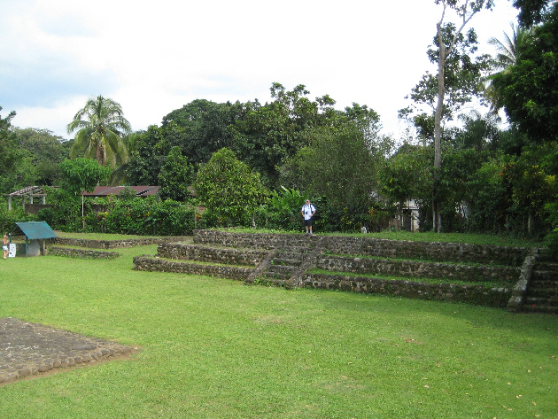
Izapa was probably an outpost on the southeast edge of the Olmec Empire. It changed from simple village life to being a civic-religious center sometime about 850-300 B.C. The Group B Complex still remained the center of the town, but at this time the large platform mounds rose around the plaza. Then the early stages of Group A and C were erected. Izapa's role as an outpost town became increasingly more important since to the east of town the early stages of the Mayan Civilization began to show its influence. It was at this time that the first large stone monuments at Izapa were carved.
Izapa reached its apex around 300-50 B.C. Contacts with the Olmec culture disappeared and Izapa rose in its own glory and power. Groups A, B, C, and D reached their present forms and the great stone monuments of Izapa were carved at this time. Izapa was the dominant civic center of the Soconusco region. Oddly, neither the Long Count Calendar nor a writing system have been discovered at Izapa. The buildings of Group F, where we visited, date from approximately this same time. Group F at the Izapa site is oriented 21� east of true north, which is the sight line to the peak of Tacan� volcano. Also this alignment is perpendicular to this main axis as sighted on the Winter Solstice Horizon. Research is now being done which may lead to the conclusion that the Long Count Calendar may have its roots from observations completed at Izapa.
In about 50 B.C. Izapa's growth suddenly stopped. There are signs of some further building at Group F which appeared to be the new civic religious center of the area. Ceremonial use of groups A, B, C and D stopped. Ceramic evidence then shows a strong influence from Guatemala. Between 100-200 A.D. influence from the East seems to end. After 250 A.D. the ceramics then show a strong Soconusco style and the only group that seems to be inhabited is group F with the rest of the groups becoming garbage dumps. Finally, Izapa was abandoned by 1200 A.D.
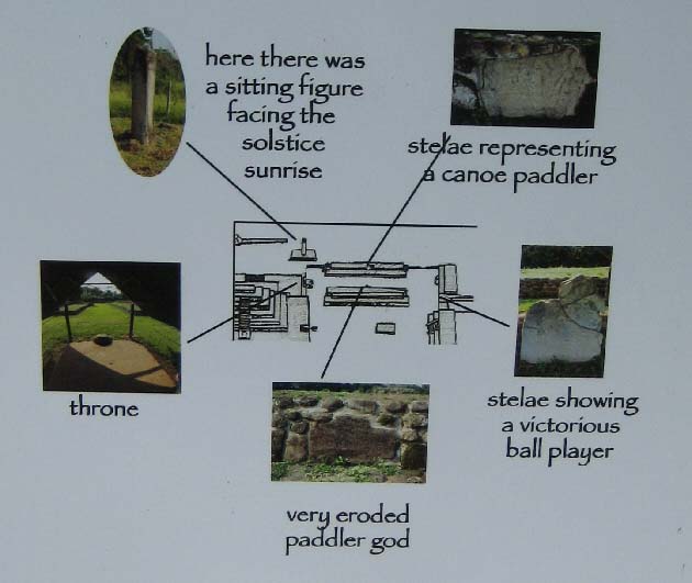
Izapa Group F contains the Great Ball Court that is said to be the Origin Place of the Mayan Calendar and of the 2012 Mayan Prophecy which some say predicts the end of the world on December 21, 2012. Basically, this prophecy is due to the alignment of the monuments at the East and West ends of the Great Ballcourt with the Rising Sun at Winter Solstice and also with the Dark Area or Bow of the Milky Way. The Snakes Head in the North cornfield also will align at the same time. That will take place on December 21, 2012 at about 6:29 AM in the Morning. While it would be interesting to be at Izapa to see this galactic allignment, if the speculation is true, I'd rather be at home.
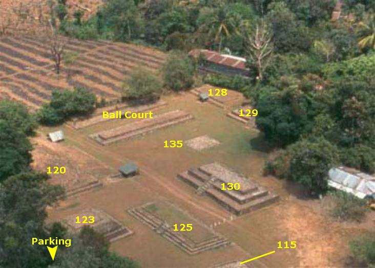 |
I am not going to attempt to show the route we took through the complex. It wasn't just one path; we all separated and went different ways and saw the same things at different times. But I am going to use this view as an index into the pictures that we took. (For your reference, the long axis of Structure 130 points NNE towards the top of the view.)
The labels I have used here are taken from a paper I found on the Internet written by a Dartmouth archaeologist; he labeled the various archaeological features using names such as "Structure 128" or the "Ball Court." As a matter of fact, the Ball Court was the only group of structures that got a distinct name, probably because the purposes of the other structures is less clear.
When our tour group came through the thicket of cocoa trees, we came out in the southwestern corner of the complex. From there, we just wandered around from one structure to another. All I am going to do for the structures is to select the best picture(s) of each and group them together. I won't attempt to write here what the speculated purpose or background of each structure is; the answers aren't definite and there is a wealth of information on the Internet about this site.
With the historical background out of the way, and with a good aerial view for you to look at, let's just look at some of the pictures we took during our couple of hours here at Izapa.
At the Entry
|
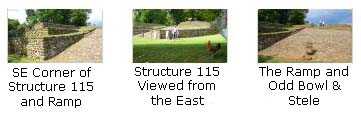
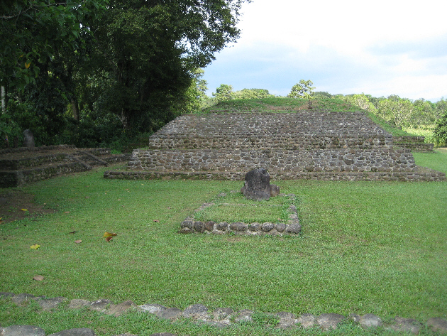
Structure 115
 |
Click on the thumbnails below to see three more views of Structure 115:
|
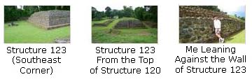
Structure 123
 |
The sides of the structure are interesting in that there is a first vertical wall, then an inset, and then a sloping wall with no more insets until you get to the top level of the structure. As you can see in the pictures, the slope of the upper part of the side changes angle partway up. This structure was unlike the others here in this respect.
If you click on the thumbnails below, you can see some other views of Structure 123:
|
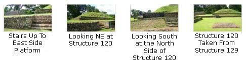
Structure 120
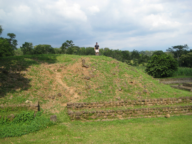 |
Actually, Structures 115, 123 and 120 were all three on a large raised area at the west side of the complex; you can see that in this picture of Structure 120 and the Ball Court as seen from the top of Structure 123. The picture at left of Structure 120 (with Paul standing on top of it) was also taken from the top of Structure 123. The top of Structure 120 was the highest point in this Group F complex.
Click on the thumbnails below to see some more views of Structure 120 and nearby constructions:
|
|
When I got to the top of Structure 120, I made a movie from this highest point in Group F. I begin looking south back at Structures 123 and 115, and then pan slowly counterclockwise to take in all of the structures, ending looking north at Fred and one of the stellae here in Group F. |
The Ball Court
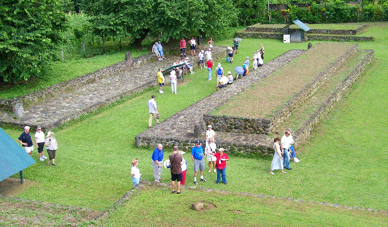 The Ball Court From the Top of Structure 120 |
We didn't see any of that here, leading us to believe that the game differed somewhat throughout the empires, although the basic idea was the same. Great players were lionized, much as they are today, but success was a double-edged sword. Players had to consistently prove themselves, and death was a possible outcome of losing.
 |
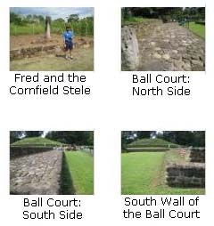
One item that does remain is one of the stelae. This one stands right out at the edge of a cornfield. Again I was struck by how seemingly casually the country treats these amazing archaeological artifacts; here, I would think, the whole area would be a park and we would have bought up the surrounding land and controlled access to it.
If you'll click on the thumbnails below, you can see some more of my pictures of the Ball Court:
|
And if you want to click on the thumbnail images below, you can see some additional views of the Ball Court taken by Fred from various angles:
|
Structures 128 & 129
|
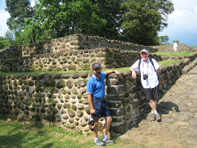
Structure 129 is a three-level, rectangular structure with two sets of stairs, both on the west side. The logitudinal axis of the structure runs north-south (although the entire site is 21 degrees off north, sighted instead on the nearby volcano). This structure was well-preserved, as you can see by looking at the northwest corner and stairway.
While it did not have a clear view of activity in the Ball Court, it had great views of the rest of Group F. I could have taken another panoramic movie from here, but I settled for a picture of Fred looking up at the rest of us on top of the structure. I was again struck by the differences between such a site here and such a site at home; at home, you probably wouldn't be able to climb all over the structures as we were doing.
Click on the thumbnail images below to see three of Fred's pictures of us on Structure 129:

|
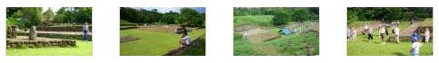
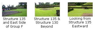
Structure 135
 Structure 135 (Foreground) |
We didn't take any pictures of just this structure, but if you'll click on the thumbnail images below, you can see some additional pictures that include this structure:
|
|
While he was standing right next to Structure 135, Fred made a good movie panning around the complex here at Group F of the Izapa site. |
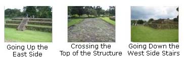
Structure 130
|
By clicking on the thumbnail images below, you can follow along with me as I cross up and over the structure going west across the Group F complex:
|
Click on the thumbnail images below to see some of Fred's views of this structure:
|
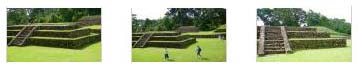
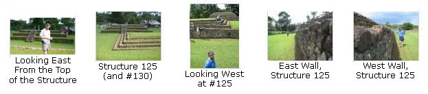
Structure 125
As you can see from the above picture, Structures 125, 120, 123 and 115 are all on a one-level raised platform at the east side of the complex. Why these four structures are raised up, I do not know (nor, apparently, does anyone else). We took some interesting pictures of and from the top of this structure, and if you will click on the thumbnail images below, I can show you some of them:
|
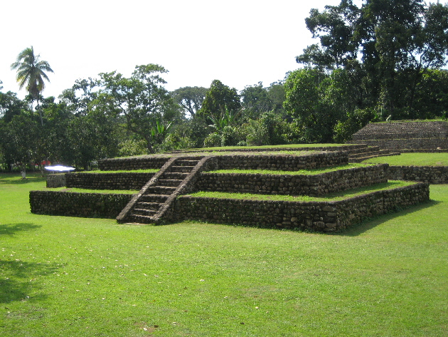
A Final Look at Group F of the Izapa Archaeological Site
|
"Group F" Portion of the Izapa Archaeological Site |
Returning to the Oosterdam
|
The Oosterdam Leaves Puerto Chiapas
|
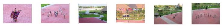
The dancers show up better in movies, so here are some of the ones we took:
|
Fred's movie makes excellent use of his incredible zoom capability to show us the dancers close up. |
This is the first of two movies that I took, showing some of the early dancing they did. |
|
This is the second of my movies that; here they are doing some kind of line dance. |
Just after five o'clock, the ship began pulling away from the dock. We passed the small resort that passengers who don't take shore excursions can go ashore and use, and as we nosed out into the harbor, we bid farewell to Puerto Chiapas.
Our activities for the rest of the evening were pretty normal- our stint at the gym, dinner with the rest of the guys in the Vista Dining Room, and then the show in the Vista Lounge- a performer named Jim Curry (shown here). He looked a lot like and did a tribute show to John Denver. He was actually quite good. (We also stopped by the Queen's Lounge for the Oosterdam Talent Show that featured passengers.)
We were actually looking forward to Jim Curry; here's what the Daily Program had to say about him:
| "From 'Country Roads' to 'Rocky Mountain High,' Jim Curry brings the vast legacy of John Denver's popular music back to the stage. The blending of time-tested hits along with new songs, offers up a show that you are sure to remember." |
As it turned out, Jim Curry was a "tribute artist." Such artists use makeup, clothes, hairstyling and so on to look as much like the person they will be portraying, and then use their physical talents, such as singing, to try to mimic, as closely as possible, that same person. The most common examples, I suppose, are the multitude of Elvis impersonators. Jim Curry's object was, of course, John Denver, and he did a very, very good job in both looking like and sounding like the deceased country/folk superstar.
We enjoyed Jim Curry's performance a great deal, perhaps because he was portraying someone we'd grown up with; most of the other performers were just doing their own versions of standard songs- vocal and instrumental. Curry made an effort to evoke the actual performer, and he succeeded nicely. He also did two duets of John Denver songs, accompanied by Randall Powell.
|
Fred made a movie of a portion of this John Denver song, done by Curry and accompanied by Randall Powell. |
Jim Curry does a good job with this John Denver classic. |
|
One of my favorite songs of all time, especially the version done by John Denver, is also done here very well by Jim Curry. |
John Denver's tribute to Jacques Cousteau is here also done admirably by Curry, with the addition of background movies and scenes of the Calypso, Cousteau's ship. |
You can use the links below to continue to the album page for different day.
|
November 15, 2009: Hualtulco, Mexico |
|
November 13, 2009: Puerto Quetzal, Guatemala |
|
Return to the Index for Our Panama Canal Cruise |