|
October 21, 2010: The Drive Home |
|
October 19, 2010: Meteor Crater, Arizona |
|
Return to the Index for our Western Trip |
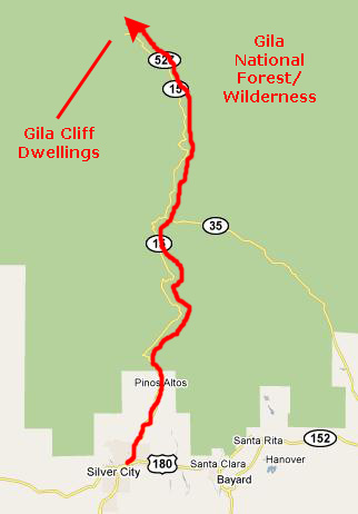
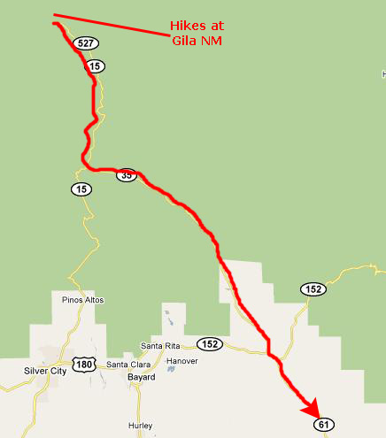
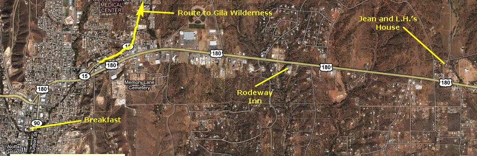
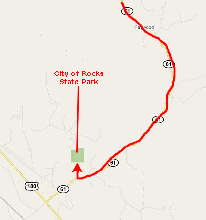
Today, I'm going to meet Jean and L.H. Rodgers in Silver City. Jean is one of Fred's stepmother's sisters, and he has talked about them a lot. After that visit, we will drive to the Gila Cliff Dwellings National Monument, north of Silver City. There, we plan to see the cliff dwellings themselves, some petroglyphs nearby and also hike to some hot springs on a small creek in the northern part of the park. After that, we are aiming to camp at City of Rocks State Park, which is down towards US 180 that connects Silver City and Deming, NM. It may rain, though, and if it does, we will just get on I-10, head east, eat dinner when we can and stay somewhere east of El Paso.
Meeting Jean and L.H. Rodgers
|
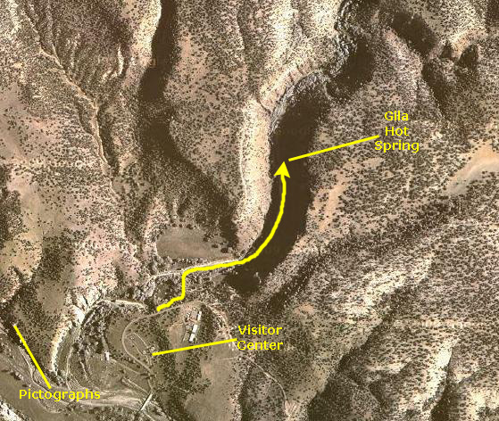
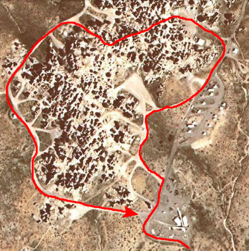
Above is an aerial view of Silver City with the places we visited this morning marked on it.
|
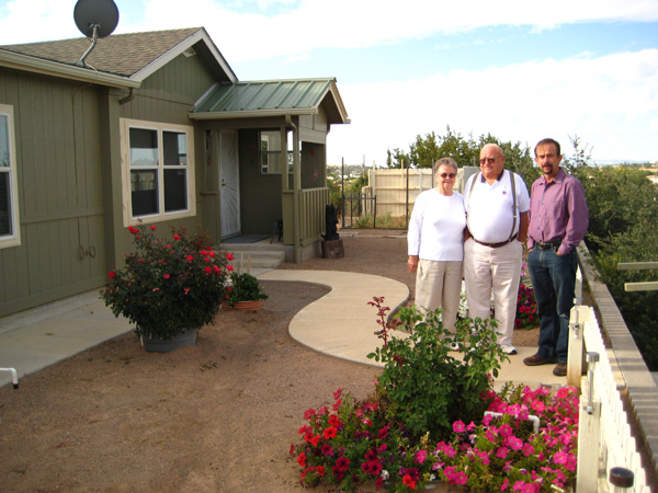
Jean and L.H. live in a manufactured home that they've added onto over the years, and around which they have done a great deal of landscaping. Before we went inside, I took a picture of Fred, Jean and L.H. on their back patio. We spent an hour or so with them just conversing; they are very nice people. They have a cat who in coloring was reminiscent of Tanner; he was friendly enough, but was more concerned with looking out the window than nuzzling the guests.
We took our leave of Jean and L.H. around ten-thirty, and as we were leaving, I took another picture of Jean, L.H. and Fred in front of their home, and that is the picture that you can see at left. Then, we got in the RAV4 and headed back into Silver City to find Route 15 north to the Gila Wilderness.
The Gila Cliff Dwellings National Monument
|
|
|
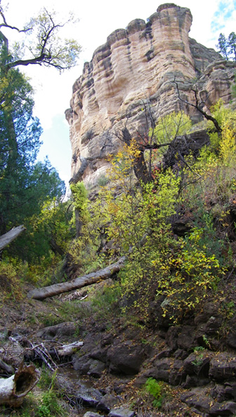
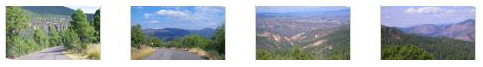
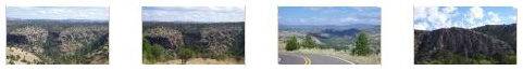
The road started out as a two-lane road leaving Silver City, but after a few miles it became became just a wide, single-lane country road called The Trail of the Mountain Spirits Scenic Byway. We had go a bit slow as there were lots of blind turns on the twisting road. In places it opened up, but still in all it took us the better part of an hour to reach the National Monument.
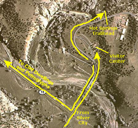
When we reached the National Monument, we decided to go directly to the Visitor Center to find out about the activities that Fred had already researched on the Web.
|
There were a couple of small monuments right by the center. One of them was for Aldo Leopold, a naturalist who had a primary role in the establishment of this particular National Monument. You can read the plaque here.
The other monument commemorated Geronimo, who was, according to the monument, born by the headwaters of the Gila River that flows through this wilderness.
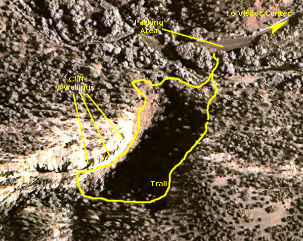
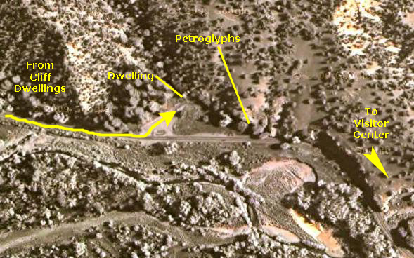
After looking around the Visitor Center, we headed off to the Gila Cliff Dwellings. To get there, we went back across the bridge and turned right back onto NM Highway 15 and took it all the way to the end, where we found the parking area for the cliff dwellings trail.
|
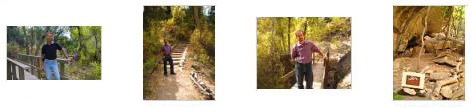
As you can see from the aerial view, the cliff dwellings themselves were on the north side of a small canyon, and the trail up to them made a loop that first ascended along the southern side of the canyon, through shady forest and across numerous short bridges back and forth across the mostly dry streambed the the trail paralleled. After a while, we came to another streambed, this one complete with picturesque stream.
Below are some thumbnails for other interesting pictures we took of the trail as we were hiking along it towards the end of the canyon. Just click the thumbnails to view the pictures:
|
|
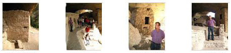
Fred took a number of really good pictures of the cliff dwellings from our vantage point along the trail, including some excellent ones with his zoom lens. I've selected the best of these to include here, and you can have a look at them if you click on the thumbnails below:

|
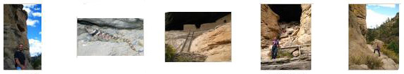
We finally came around to the end of the canyon where the trail ascended steeply up to the level of the dwellings. When we came up the final set of stairs, we could get some excellent views down the cliff face to the dwellings. We stopped to take some photos of each other; you can take a look at the pictures of Fred and myself. Fred also used his zoom to get an early look at the cliff dwellings ahead of us.
We could hear some other folks already up here waiting for the scheduled tour to start, so we walked over to join them. As we came down the path along the cliff face, we found the guide and visitors waiting for the scheduled start time. The visitors were sitting on a rock ledge or relaxing in the shade of a rock overhang, and the volunteer guide was chatting with some of them. Fred and I joined the group, and in a few minutes the guide began his presentation.
|
|
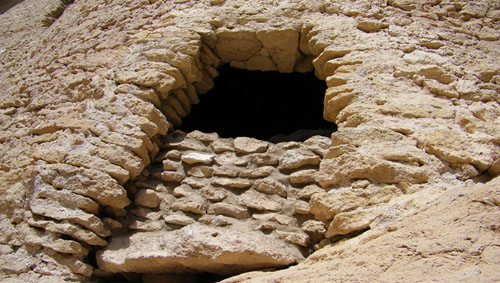
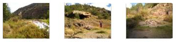
After these introductory remarks, our guide led us down the trail along the cliff to the first of three or four stops we made at various dwellings. When we got to the first area he wanted to show us, we gathered around as he told us about one particular area where either the walls of dwellings were never built, or they were built and then removed. This area was under a rock overhang, and would have seemed to be an excellent place for living, although the current thinking is that the area was used for storage. In any event, all that is left here now are some foundations and places where, apparently, grain or other foods were prepared. You can see some of those foundational remains here and here.
|
|
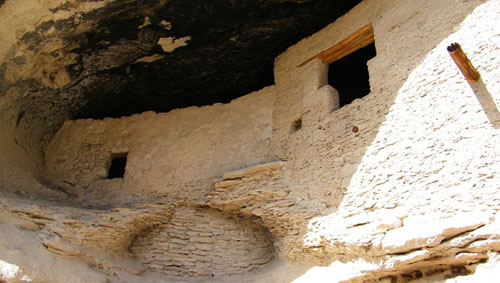
Next, we moved down the path along the cliff and came to the first of the actual walled rooms that still remain.
|
When we got to the first actual rooms, our guide explained that they were probably used for storage, and you can listen to some of his explanation in this movie that Fred made. |
While we were listening to the guide and his explanation, Fred took some close-up pictures of the wall and window detail:
|
|
|
When the guide had finished speaking and most of the folks had moved on with him, I stopped to make a movie of the actual storage rooms. |
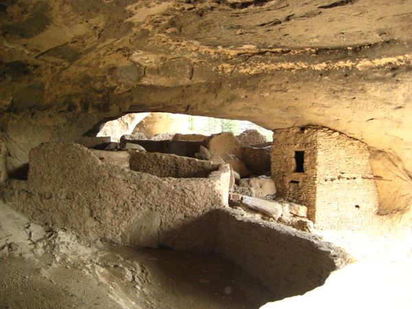
Fred and I then followed the guide down the path, and Fred looked back to take a picture of me at the storage rooms. Then we walked along the path to the final area of cliff dwellings. This turned out to be the main residential and work area, and there were a great many rooms and lots to see.
|
|
To view the slideshow, just click on the image at right and I will open the slideshow in a new window. In the slideshow, you can use the little arrows in the lower corners of each image to move from one to the next, and the index numbers in the upper left of each image will tell you where you are in the series. When you are finished looking at the pictures, just close the popup window.
|
To supplement all the pictures that you've seen, you might want to watch this movie that pans around the entire area from its vantage point inside the dwellings. |
|
Finally, though, it was time to head off, and we went back down to the path and continued around the face of the cliffs. As we came around to the front of the cliff, we could look up and see the cliff dwellings that we had just left.
|
|
The hike down was fairly quick. The path led from the dwellings themselves down and below them and then around the end of the cliff and down into the canyon we'd hiked up along the far side earlier. We took some interesting pictures along the way- the dwellings and a big lizard among them. Have a look at some of these pictures by clicking on the thumbnails below:
|
|
From the path below the dwellings, I made a movie that pans up the cliff face and then across the dwellings above us. |
In twenty minutes, we were back at the parking area, and ready to head back down Highway 15 a short ways to the pictographs.
Pictographs at the Gila National Monument
|
We got out of the RAV4 and walked over to the trailhead to read the trail information sign. First, we took the short trail to the small cliff dwelling just a short distance up the trail. Again, you could get right inside the cliff dwelling. Also, you might want to read the cliff dwelling information sign.
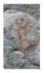
From the dwelling, we went back down the short trail to take a second trail over to the pictographs. (I know the label is wrong on the aerial view; I often confuse pictographs (rock painting) with petroglyphs (rock etching) since both are often found together.)
|
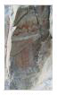
While Fred took some pictures, I read the informational sign that you can see right next to him. I've selected six of the best of Fred's pictograph photos to include here. To have a look at them, just click on the thumbnails below:

|
The pictographs and dwelling were interesting to see; when we were done, we headed off again back to the Visitor Center and to a trailhead beyond it for the hot springs.
The Gila National Monument Hot Springs
|
|
At our first crossing, I went first so that I could get a movie of Fred crossing behind me. Sadly, his crossing was without incident, and so the movie is pretty boring. |
|
|
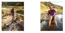
At this crossing, Fred had gone first and he made this movie of me gingerly stepping across the slick stones to get back to the east/south side of the river. I guess I look pretty nerdy.
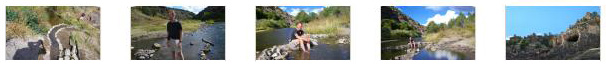
Once I'd gotten across, I sat down by the river to change back into my tennis shoes so the walking would be easier. Then we headed up the canyon towards the hot springs. It was just another few hundred feet along the banks of the Gila River before we reached the hot springs.
|
|
|
The hot spring was really interesting and very relaxing. I must have sat by the cold river with my feet in the warm water for at least fifteen minutes while Fred wandered around and also did the same thing. The light was beginning to leave the canyon, so we eventually picked ourselves up and headed back. It was a very nice hike to the hot spring and, as it turned out, the last hike we took on our Western trip.
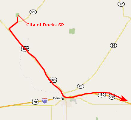
The City of Rocks State Park (NM)
|
|
|
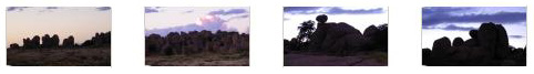
Below are thumbnails for some of the pictures Fred took from the RAV4 as we drove through the park; as you can see, the campsites are sprinkled among the rocks and boulders. The light had almost gone, so Fred was lucky to get the pictures he did. Click on the thumbnails to view:
|
We finished making a circuit of the RV area and campsites as the light faded, and then headed out of the park. On the way, the clouds broke to the west, and Fred got a couple of very nice sunset pictures that you can see here and here. As we got back on Highway 61 heading down to US 180, we ran into the first shower, and all along Highway 180 heading south towards the Interstate we were in and out of them.
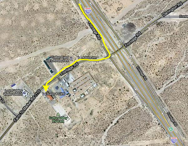
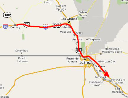
Driving to Our Overnight Stay in Clint, TX
|
|
|
You can use the links below to continue to another day of the photo album.
|
October 21, 2010: The Drive Home |
|
October 19, 2010: Meteor Crater, Arizona |
|
Return to the Index for our Western Trip |