|
October 20, 2010: Silver City, NM |
|
October 18, 2010: Sedona to Winslow, AZ |
|
Return to the Index for our Western Trip |
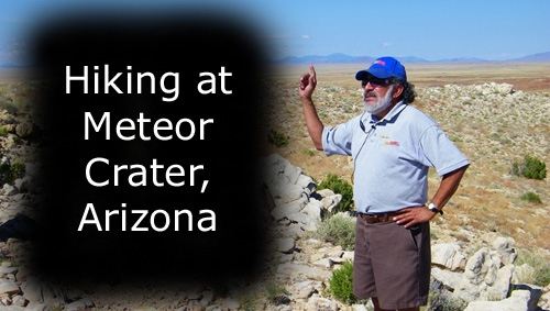
Today we had planned to do two thing, but we added a third after dinner last night. First, we'll backtrack a few miles and visit Meteor Crater National Natural Landmark. Then, as a result of what we saw last night, we'll return to Winslow, Arizona, and make a stop in the center of town at an historic corner. Finally, we will drive over towards Silver City, New Mexico, and do a hike in the Gila Wilderness at Whitewater Canyon before staying in Silver City for the night.
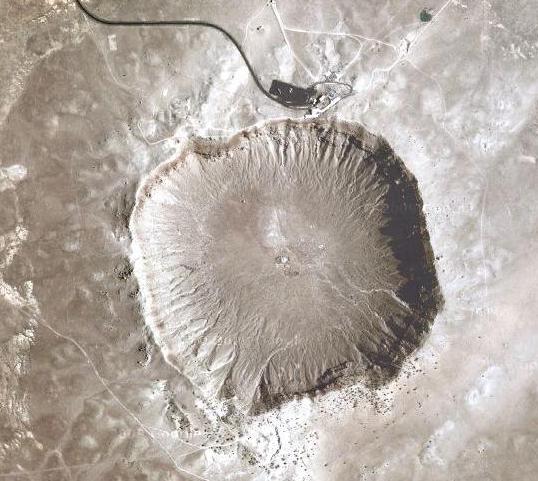
Meteor Crater National Natural Landmark
What is Meteor Crater?
|
The crater was created about 50,000 years ago during the Pleistocene epoch when the local climate on the Colorado Plateau was much cooler and damper. At the time, the area was an open grassland dotted with woodlands inhabited by woolly mammoths and giant ground sloths. It was probably not inhabited by humans; the earliest confirmed record of human habitation in the Americas dates from long after this impact.
The object that excavated the crater was a nickel-iron meteorite about 160 ft. across, which impacted the plain at a speed of several miles per second. The speed of the impact has been a subject of some debate. Modeling initially suggested that the meteorite struck at a speed of up to 45,000 mph, but more recent research suggests the impact was substantially slower- 28,600 mph. It is believed that about half of the meteor's 300,000 ton bulk was vaporized during its descent, before it hit the ground. The meteor itself was mostly vaporized; very little of it remained within the pit that it had excavated.
History
In 1891 Grove Karl Gilbert, chief geologist for the U.S. Geological Survey, investigated the crater and concluded that it was the result of a volcanic steam explosion. Gilbert had assumed that if it were an impact crater then the volume of the crater, as well as meteoritic material, should be present on the rim. Gilbert also assumed a large portion of the meteorite should be buried in the crater and that this would generate a large magnetic anomaly. Gilbert's calculations showed that the volume of the crater and the debris on the rim were roughly equivalent, so that the mass of the hypothetical meteor was missing. Further there were no magnetic anomalies. Gilbert argued that the meteorite fragments found on the rim were coincidental. Gilbert would publicize these conclusions in a series of lectures in 1895, although in 1892 he would be among the first to propose that the moon's craters were caused by impact rather than volcanism.
In 1903, mining engineer and businessman Daniel M. Barringer suggested that the crater had been produced by the impact of a large iron-metallic meteorite. Barringer's company, the Standard Iron Company, received a patent signed by Theodore Roosevelt for 640 acres around the center of the crater in 1903. The claim was divided into four quadrants coming from the center clockwise from northwest named Venus, Mars, Jupiter and Saturn. In 1906 Roosevelt authorized the establishment of a newly named Meteor, Arizona post office.
Standard Iron Company conducted research on the crater's origins between 1903 and 1905. It concluded that the crater had indeed been caused by an impact. Barringer and his partner, the mathematician and physicist Benjamin Chew Tilghman, documented evidence for the impact theory in papers presented to the U.S. Geological Survey in 1906 and published in the Proceedings of the Academy of Natural Sciences in Philadelphia.
Barringer's arguments were met with skepticism, as there was a reluctance at the time to consider the role of meteorites in terrestrial geology. He persisted and sought to bolster his theory by locating the remains of the meteorite. At the time of first discovery by Europeans, the surrounding plains were covered with about 30 tons of large oxidized iron meteorite fragments. This led Barringer to believe that the bulk of the impactor could still be found under the crater floor. Impact physics was poorly understood at the time and Barringer was unaware that most of the meteorite vaporized on impact. He spent 27 years trying to locate a large deposit of meteoric iron, and drilled to a depth of 1400 ft., but no significant deposit was ever found.
Despite Barringer's findings and other excavations in the early 20th century, geologists' skepticism continued until the 1950s when planetary science gained in maturity and understanding of cratering processes increased. Professor Herman Leroy Fairchild, an early promoter of impact cratering, argued Barringer's case in an article in Science in 1930.
It was not until 1960 that later research by Eugene Merle Shoemaker would confirm Barringer's hypothesis. The key discovery was the presence in the crater of the mineral stishovite, a rare form of silica found only where quartz-bearing rocks have been severely shocked by an instantaneous overpressure. It cannot be created by volcanic action; the only known mechanism of creating it is through an impact event (or artificially through a nuclear explosion). Shoemaker's discovery is considered the first definitive proof of an extraterrestrial impact on the Earth's surface. Since then, numerous impact craters have been identified around the world, though Meteor Crater remains one of the most visually impressive due to its size, young age and lack of vegetation cover.
Geology
Coconino Sandstone (sandstone formed 265 million years ago) nearest the top of the rim
Toroweap Formation (limestone formed 255 million years ago)
Kaibab Formation (dolomite formed 250 million years ago)
Moenkopi Formation (mudstone formed 200 million years ago) nearest the outer foot of the rim
In the interior of the crater the layers are in the expected order.
Meteor Crater Today
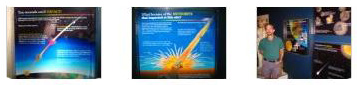
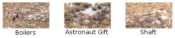
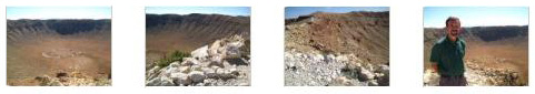
Meteor Crater is today a popular tourist attraction privately owned by the Barringer family, with an admission fee charged to see the crater. The Meteor Crater Visitor Center on the north rim features interactive exhibits and displays (some of which you can see if you click on the thumbnails at left) about meteorites and asteroids, space, the solar system and comets. It features the American Astronaut Wall of Fame, and such artifacts on display as an Apollo boilerplate command module (BP-29), a 1,406 pound meteorite found in the area, and meteorite specimens from Meteor Crater that can be touched. I would have taken more pictures, but the lighting was iffy, and even some of the pictures I did take were a little fuzzy. Formerly known as the Museum of Astrogeology, the Visitor Center includes a movie theater, a gift shop, and observation areas with views inside the rim of the crater.
Recent History and Trivia
On August 8, 1964, a pair of commercial pilots in a Cessna 150 flew low over the crater. On crossing the rim, they could not maintain level flight. The pilot attempted to build up speed by circling in the crater to climb over the rim. During the attempted climb out, the aircraft stalled, crashed, and caught fire. It is commonly reported that the plane ran out out of fuel, but this is incorrect. Both occupants were severely injured but survived their ordeal. A small portion of the wreckage not removed from the crash site remains visible to this day. The crater was used as the setting for the climax of the 1984 film Starman. The crater is used in the game Civilization V as a natural wonder that the player can find.
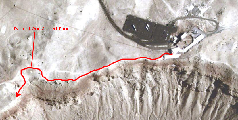
Our Guided Tour
At the left is an aerial view of the north edge of Meteor Crater, including the Visitor Center and Museum. I have marked on the view the approximate route that we took on our guided tour. Essentially, we walked along the north rim of the crater and then around the northwest corner and a bit further south. Along the way, our tour guide stopped to offer information on the history of the crater, the geology of it, interesting facts and figures, and so on. About the only thing to do in offering you the pictures and movies of the tour is to take it in sections, as near as I can, with each stop the tour guide made being the end of a section. I think you'll be able to tell from the perspective of the views down into or across the crater how we are moving along its rim. For the first section, the guide led us perhaps 200 feet out along the rim trail from the visitor center. Along the way, we passed the previous tour returning on the path.
About 200 feet out there was an overlook where we could all gather around and listen to our guide, and here he talked about the initial excavations conducted by Berringer.
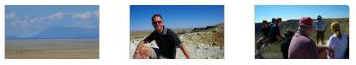
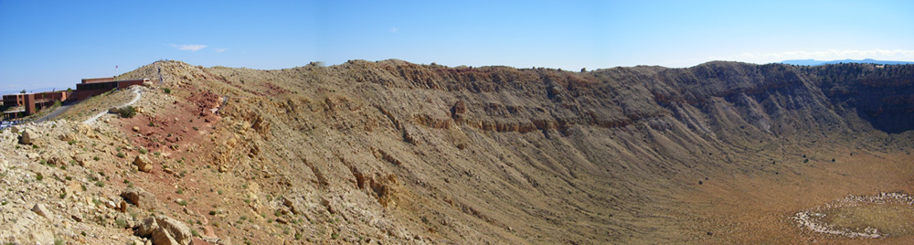
When we got to the overlook, Fred took some pictures as we all gathered around. One looks north from the crater, and the other two are of our tour group. Click on the thumbnails at right to have a look at these pictures. Fred also took the opportunity to stitch together a couple of pictures in his camera to get a nice panoramic shot of the crater, and you can see it below:
As I said, it was at this first stop that our guide gave us some of the history behind Meteor Crater, and especially the role that Daniel Berringer played in its investigation and development.
I wanted at least a couple of movies of our guide; in this one, he is talking about the investigation that Berringer carried out trying to locate the mother lode iron meteorite that he thought existed. As he talked, Fred used his zoom to take some pictures of the equipment and other things down in the crater, and if you will click on the thumbnails below you can see them:
|
I also took some pictures from our first stop on the tour, and if you click on the thumbnails below you can have a look at them:
|
The next section of the tour took us all the way to the northwest corner of the crater rim. Along the way, our guide stopped a couple of times with some very interesting (and entertaining) information. At the last stop in this section, we got a geology lesson about the crater, and looked at some rocks and fossils.
|
At one stop, our guide waxed eloquent about what it's like living and working at Meteor Crater and on the ranch where it's located. Fred made an excellent movie of his sentiments, and you should really watch it. |
I made a movie while our guide was telling us about a desert plant called "Mormon Tea," and about how it got its name. Very amusing! |
Fred took a number of good pictures along this leg of the tour, and they are the first half-dozen pictures in the slideshow below.
|
To view the slideshow, just click on the image at left and I will open the slideshow in a new window. In the slideshow, you can use the little arrows in the lower corners of each image to move from one to the next, and the index numbers in the upper left of each image will tell you where you are in the series. When you are finished looking at the pictures, just close the popup window.
|
From the last stop on our guided tour, I made this movie, panning back and forth across Meteor Crater. |
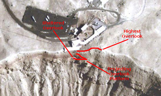
When we returned to the visitor center, we thanked our tour guide and then went out to the observation platforms.
|
So when we went out the back of the museum, we found ourselves at the beginning of both sets of stairs. We decided to go down first, but before we did so, Fred snapped a picture of me at the top of these stairs. I returned the favor, and you can see a picture of Fred with the stairs leading down to the sheltered overlook here. So we first walked down to the sheltered overlook, where I sat down to admire the view.
Then Fred had me walk out onto the cantilevered platform so he could take a picture of me. I got Fred to join me on the platform so I could get a picture of him with the northern rim of the crater in the background, and you can see that picture here.
To complete our tour of the overlooks, we walked back up the stairs to the visitor center and then up the long sidewalk stairs to the high overlook. From here, there were amazing views of Meteor Crater. And I took a picture, looking west and down into the crater, of Fred, on this beautiful day at Meteor Crater.
|
|
We'd seen about all there was to see here, so we went back through the Museum/Gift Shop out to the courtyard entry area. There, I just happened to see a pretty tabby cat, so I sat down and coaxed it over to get petted. Fred snapped a candid of me petting the cat. The other interesting feature here in the courtyard was the "window" in the north-facing brick wall, through which you could look out many miles across the high desert to the mountains in the background. We each wanted a picture here, so I took one of Fred and he took one of me.
That was it for Meteor Crater. I'd always wanted to visit here, and I am glad that I finally got the chance. We went back to the parking area to head back east again for a short stop in Winslow.
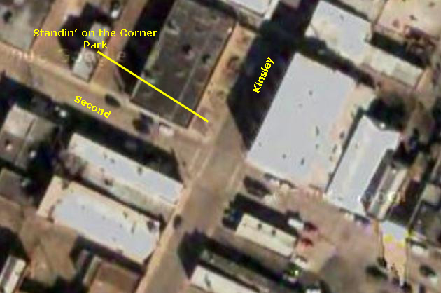
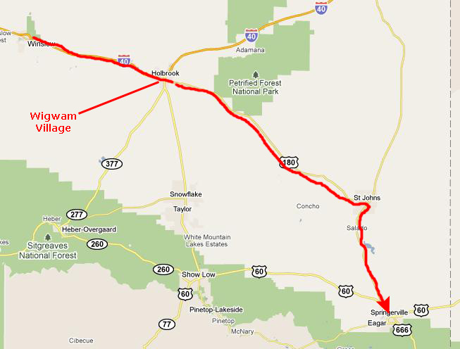
Standing on a Corner in Winslow, Arizona
That's right; we are going to the center of Winslow and stand on the corner made famous in the song. To get there, we went back out Meteor Crater Road to I-40 and headed east. We got off at the same exit we'd used last night to get to the Super 8; that exit is Route 66.
|
Anyway, we drove into town and parked a block west of Standin' on the Corner Park, the official name for the strip of land on the northwest corner of the intersection. The park is a small one, actually consisting almost entirely of the statue representing the person who was standing on the corner in the song. In one of the pictures that Fred took, you can even see the girl in the bright red Ford painted on the store window behind the statue.
It was a little kitschy, but when you're Winslow, Arizona, you take advantage of such fame as comes your way. Nearby, there was a stenciled plaque identifying Second Street as part of Historic Route 66, and across N. Kinsley was the Standin' on the Corner store. It was a neat place to stop, kind of in the same category as Cadillac Ranch or the World's Largest Ball of String.
We headed out of Winslow going east, stopping at a small park at the east end of town to have a bit of lunch.
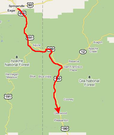
Hiking Up Whitewater Canyon
|
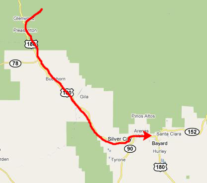
We continued down US Highway 180 all the way through St. Johns and on to Springerville. The road was just two lanes, but we could easily do 70 or 75 (as were the other few cars we passed). And the scenery was quite nice, with low rolling hills and a decent amount of fall color.
|
|
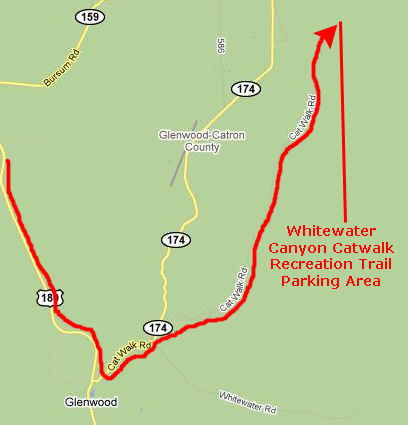
Catwalk road took us about five miles into the Gila Wilderness to the parking area for the Whitewater Canyon National Recreation Trail.
|
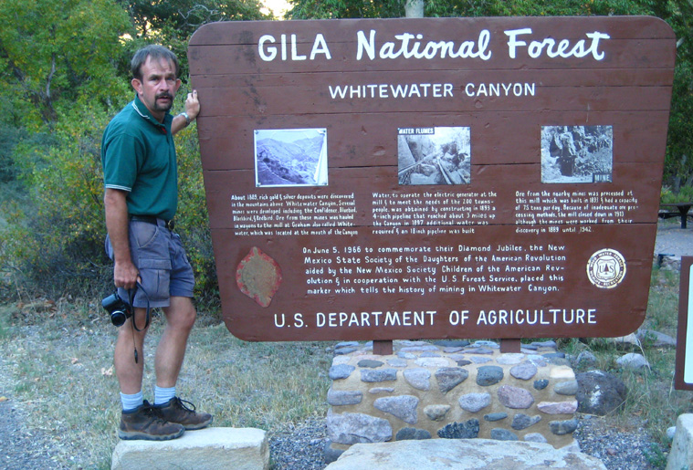
At the left is a picture I took of Fred at the trailhead. If you want to look more closely at the small pictures on the sign and read their captions more easily, just click on those small pictures, and each will open in larger size in its own window. Don't forget to close those windows when you are done.
We got started on the 1 mile hike about 6PM, New Mexico time. The canyon itself was already in shadow, although the mountaintops around us were still in sunlight. That would change as we went along; as it turned out, there was just enough light to get the pictures we wanted, although when we were done with the hike we thought that it would have been much more spectacular had we been able to do it in the middle of the day when the interior of the canyon is illuminated. But the canyon was narrow, and the window of opportunity for those perfect pictures would be only an hour or two, even in summer.
Before you look at a lot of pictures of the catwalk and the canyon, I think it might be helpful to give you an appreciation of just what the hike was like, and the best way to do that is to watch the best movie that I made.
|
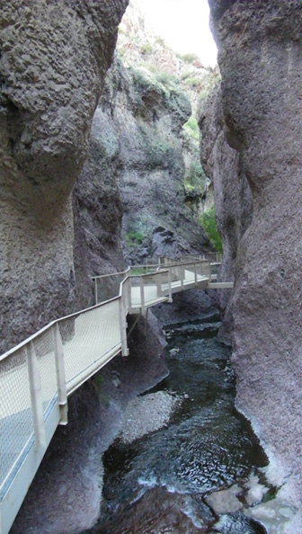
In this movie, I can show you what it was like to walk along the catwalk through Whitewater Canyon. The catwalks were over half of the hike; the rest of it was on trails between catwalk segments. So walk along with me for a ways and you'll see what the hike was like. |
As we started off on our short hike in the fading afternoon light, the trail quickly rose to hug the side of the canyon as I followed Fred up the canyon. And, pretty soon, the trail turned into metal walkways that were suspended from the rocks.
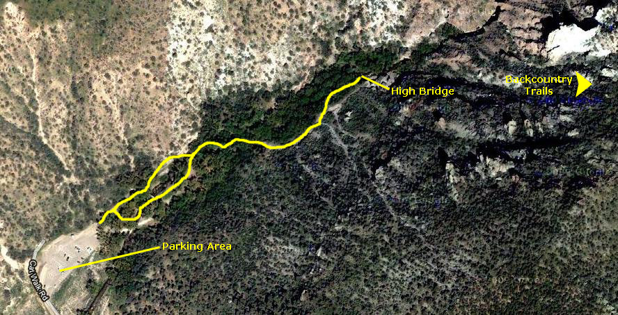
Below is an aerial view of the area we were hiking in, and I've marked the approximate route of the catwalk trail:
|
And now for the hike itself:
|
At one point, there was a neat suspension bridge that crossed the canyon. There was a section where the trail divided and you could go up the trail one way but come back a different way on your return. Why they did that I am not sure, except that you could see both sides of the canyon that way. One of the last features on the trail was a high bridge that crossed over the canyon and brought you presently to the end of the catwalk trail. From that point, you could continue up into the National Forest on some longer trails, and we presumed that was where the occupants of the other cars in the parking lot had gone. The light was getting dim down in the canyon, and we didn't want to be hiking in the dark, so we just went to the end of the catwalk trail and headed back. Even so, by the time we were on the last quarter mile of the trail we were using the flashlights we'd brought along.
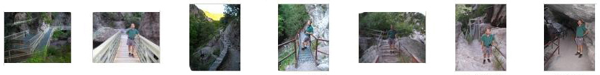
We took quite a few other pictures on the hike. I've eliminated the fuzzy ones (mostly mine) and the duplicates and can show you the rest here. Just click on any of the thumbnails below to have a look at these pictures:
|
From Fred:
|
|
And from me:
|
Well, that was it for our hiking today- and just in time for it had gotten quite dark.
|
You can use the links below to continue to the album page for different day.
|
October 20, 2010: Silver City, NM |
|
October 18, 2010: Sedona to Winslow, AZ |
|
Return to the Index for our Western Trip |