|
September 30, 2011: Boston and the Massachusetts State House |
|
September 28, 2011: Montpelier and the Vermont State Capitol |
|
Return to the Index for our New England Trip |
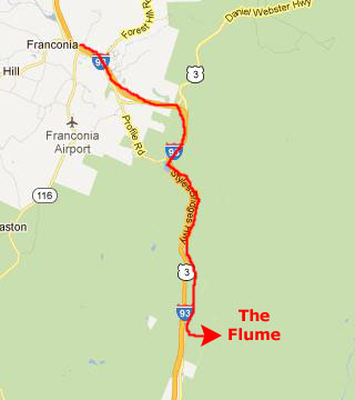
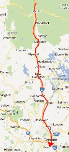
Well, today is Thursday, and we are more than halfway through the roster of State Capitols to visit. Remaining are the New Hampshire capitol in Concord, and the Massachusetts State House in Boston. We'll visit Concord later today, and Boston on Friday. But before we get to Concord, we will pass right by the Flume Gorge- a very interesting hike that Fred and I took many years ago. We want Steve and Mario to see it, and so we'll stop there before we get to Concord.
|
We found the entrance to the parking area for the Flume Gorge Visitor Center with no problem. It was raining lightly when we got out of the car and went into the Visitor Center, and I thought we might have a problem with the hike. But fortunately the rain slowed while we were in the Center and really only lasted for the first third of our hike- although we still needed, on and off, the umbrellas we carried.
The Flume Gorge Hike
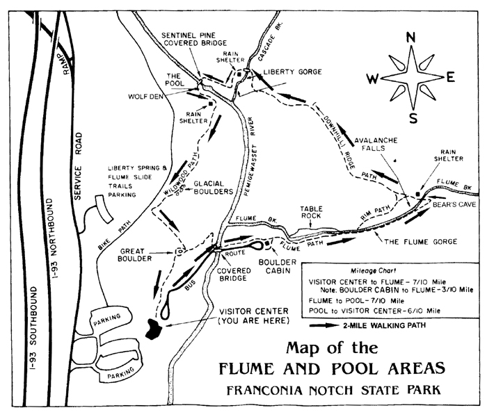
The Flume is a natural gorge extending 800 feet at the base of Mount Liberty. The walls of Conway granite rise to a height of 70 to 90 feet and are 12 to 20 feet apart. A trip into the Flume begins and ends at the Flume Visitor's Center. Guests can choose to walk through just the Gorge or do a two mile loop. The walk includes uphill walking and lots of stairs. The boardwalk allows one to look closely at the growth of flowers, ferns and mosses found here.
|
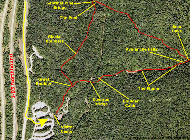
First, we'll look around the Visitor Center, and I'll show the pictures we took there. Then, we'll look at the first part of the hike- from the Visitor Center to the covered bridge that takes you across the Pemigewasset River to the Boulder Cabin. After that, we'll hike up the Flume itself, and you'll see some amazing views of the Gorge and the metal walkways that have been installed in the side of it. Then, when we get to the end of the Gorge, we'll take a look at Bear's Cave and Avalanche Falls. The next part of the hike will take us northwest through the thick woods to end up at The Pool and Pine Sentinel Bridge, where the next section of pictures will cover that picturesque area. Finally, we'll look at the last section of the hike back towards the Visitor Center through the woods, past the glacial rocks and the Great Boulder. You can refer back to this diagram as often as you like.
|
But I think it is interesting to match up the individual views; the trail map seems to be pretty accurate.
Anyway, with that overview out of the way, let's begin our visit to Flume Gorge by looking around the Visitor Center.
The Flume Gorge Visitor Center
|
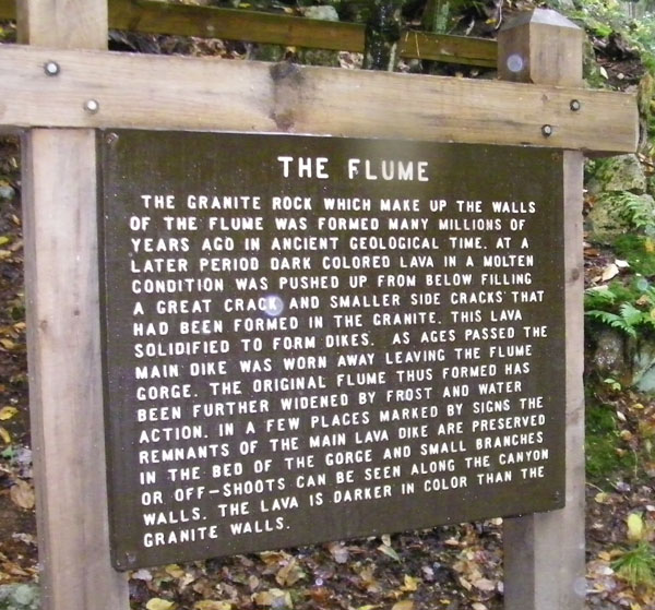
It was here, looking at the various exhibits in the main room of the Visitor's Center, that we learned the history of Flume Gorge. The geologic history begins nearly 200 million years ago, when the Conway granite that forms the walls of the Flume today was deeply buried, molten rock. As it cooled, the granite was broken by closely spaced vertical fractures which lay nearly parallel in a northeasterly direction. Sometime after the fractures were formed, small dikes of basalt were forced up along the fractures. The basalt came from deep within the earth as a fluid material, and because of pressure, was able to force the Conway granite aside. The basalt crystallized quickly against the relatively cold granite. Because of this quick cooling, the basalt is a fine-grained rock. Had this material ever reached the surface, it would have become lava flows.
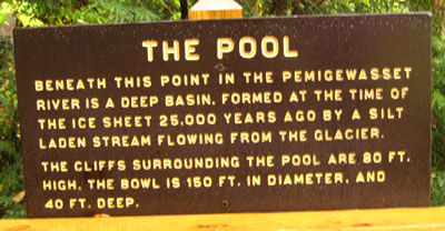
Erosion gradually lowered the earth�s surface and exposed the dikes. As the overlying rock was worn away, pressure was relieved and horizontal cracks developed, allowing water to get into the rock layers. The basalt dikes eroded faster than the surrounding Conway granite, creating a deepening valley where the gorge is now. The gorge was covered by glaciers during the Ice Age, but the ice sheet did not greatly change the surface. It partially filled the valley with glacial debris and removed soil and weathered rock from the vicinity. After the Ice Age, Flume Brook began to flow through the valley again.
Historically, the Flume was discovered in 1808 by 93-year-old �Aunt� Jess Guernsey when she accidently came upon it while fishing. She had trouble convincing her family of the marvelous discovery, but eventually persuaded others to come and see for themselves. At that time, a huge egg-shaped boulder hung suspended between the walls. The rock was 10 feet (3m) high and 12 feet (3.6m) long, but a heavy rainstorm in June of 1883 started a landslide that swept the boulder from its place. It has never been found. The same storm deepened the gorge and formed Avalanche Falls.
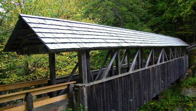
Walking from the Visitor Center to Boulder Cabin
|
|
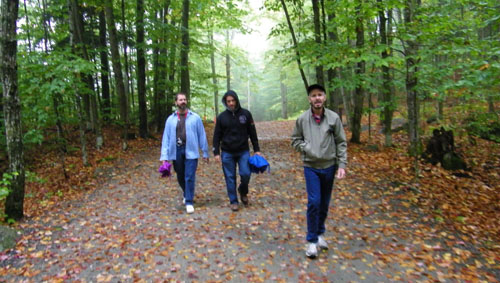
Once we got into the woods, Fred looked back to snap a photo of the three of us; it is below:
|
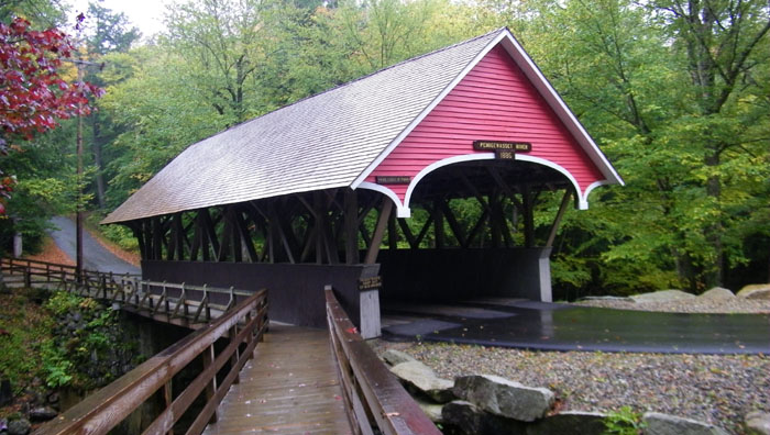
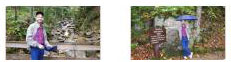
I also thought I would take my own picture of Mario and Steve. We continued walking along, climbing as we went, until we could look down to our right and see the first covered bridge down below. From the crest of the hill, the trail descended steeply down to the river and the bridge.
|
The bridge, of course, crosses the Pemigewasset River. This river comes from the north, out of The Pool that we will visit in a while. Flume Brook, the waterway through the flume itself, joins the Pemigewasset just a short ways upstream from where we are standing.
|
The Lobby of the Statehouse |
When I got to the other side of the bridge and ended my movie, I turned around to have a look back at the Pemigewasset River bridge.
We walked the few feet up the hill to the Boulder Cabin, which is a combination museum and hiker's rest. We wandered around the inside of the Cabin for a few minutes, looking at the various exhibits and displays. You can take a look at the inside of the Boulder Cabin here and here.
One of the interesting exhibits in the cabin was a posted description and explanation of the huge boulder that used to be suspended between the walls of the narrow canyon- the same boulder that was washed away in the hurricane of 1938 and never located again. If you would like to read the explanation, it is below:
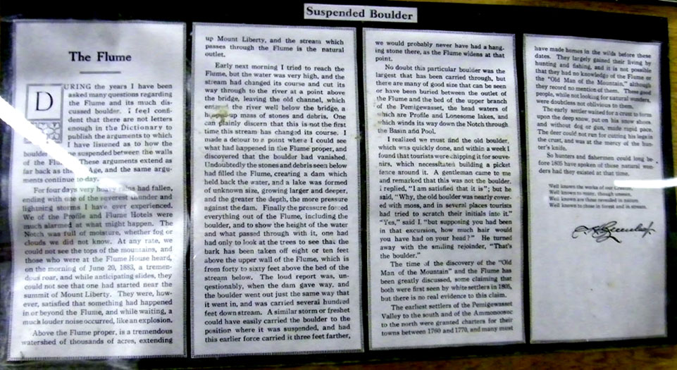
The Flume
|
|
|
We walked up alongside the part of the brook that flows across Table Rock. Over time, the rushing waters of Flume Brook exposed this large outcropping of rock. Table Rock is a section of Conway granite that is 500 feet long and 75 feet wide. Above Table Rock, Flume Brook becomes more like a typical mountain stream and our path wound up the hill alongside it. As we neared the Flume itself, there was a wooden bridge across Flume Brook where Fred stopped to take a picture of the three of us with our umbrellas (and where I returned the favor by taking a picture of Fred on the same bridge). We crossed that bridge walked a few more feet along Flume Brook and then crossed another bridge to the entry to the Flume itself. On that last bridge, I stopped to take a picture looking back the way we'd come.
|
As we was standing on the bridge, we could see that Flume Brook began to quickly narrow as we approached the lower opening of the crevasse, and from that bridge, Fred took a picture of a group of folks negotiating the walkway on the right hand side of the brook. Fred, Steve and Mario went on ahead while I stayed on the bridge to get my own view of the beginning of the crevasse and flume. I did not know it at the time, but while I was taking my picture, Fred was taking one looking back at me.
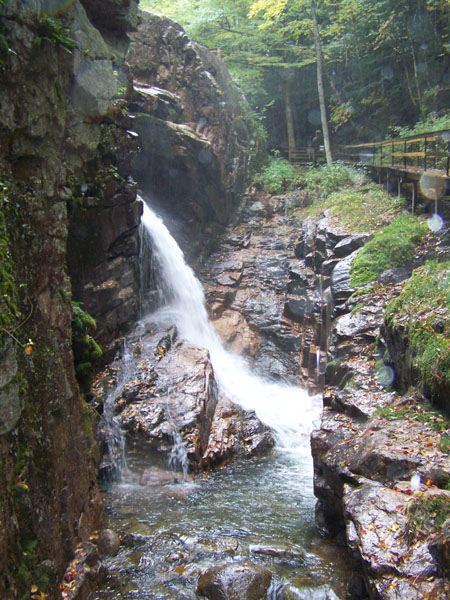
Approaching the crevasse, the walkway was on the right-hand side of the stream, but right at the opening of the crevasse, a bridge takes you over to the left hand side of the canyon. As you can see from the bridge, the wood and metal walkway is literally hung on the canyon wall for the trip up through the flume. You can get perhaps a better idea of this if you look at the picture Fred took of the flume from the middle of that lower bridge. You can see that view here.
|
|
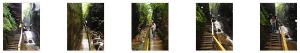
We crossed that bridge at the bottom of the gorge and headed up the walkway through the Flume Gorge. About a third of the way up, I made a movie of the Flume itself, and you can watch that movie with the player below:
|
|
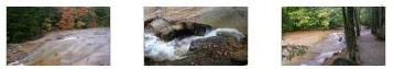
Now we negotiated the walkway up through the Flume Gorge. There were lots of stairs and the trip was really very interesting; the state park has done an excellent job on the construction of the walkway to make it accessible and allow as many folks as possible to see this amazing watercourse. We took a number of good pictures while walking along this part of the walkway, and you can see some of these if you click on the thumbnail images below:
|
|
|
When we reached the top of the narrow portion of The Flume, the walkway opened out into the upper forest, and once again, we crossed a bridge to the other side, where the walkway continued upward. After I'd crossed that bridge and gone up that walkway almost as far as Avalanche Falls, I turned around to look at the view back down towards The Flume.
Avalanche Falls and Bear's Cave
|
Our first view of Avalanche Falls came when we were coming up the walkway on the south side of the gorge, and the falls seemed to be coming out of the rock cliff to our left. When we got abreast of the falls, and could see the entire height of them, I made a movie- and you can watch it with the player below:
|
Into the Senate Chamber |
The trail continued along the rock face, up and around by the entrance to Bear's Cave, and eventually out on top of the falls. wound up to of the falls, which was actually a huge bare outcropping of rock over which Flume Brook ran until it reached the edge and became the falls. On the way up, I wanted to investigate Bear Cave, which was just off the walkway, and so I climbed up into it. When I got completely under the overhang, I found that it wasn't really a cave at all, but just a deep indentation in the rock created by a few boulders lodged together in such a way as to provide a sort of shelter. I took a picture of one of the young kids ahead of me in the "cave," and you can have a look at that picture here. As it turned out, at the back of the cave there was an opening in the rocks that allowed you to climb up out of it onto the top of the falls. I would have done that, but with the umbrella and camera and such, I was carrying too much to make it an easy go. The kid ahead of me went through it, however. I contented myself with taking a picture of the view looking back down the gorge from inside Bear Cave, and you can see that view here.
|
|
From the top of the falls themselves, the trail lead around to a viewing area about fifty feet west of the top of the falls; from here, you could look back at the folks milling around at the top of Avalanche Falls, and you could look down onto the falls themselves, shown here in a picture that Fred took.
Before we left this viewing area, I took a picture of Fred, Mario and Steve.
The Pool and Sentinel Pine Bridge
|
The trail continued, trending downward, until we came to the Sentinel Pine covered bridge and The Pool, and our first stop came at an overlook platform that was reached by going down a few flights of wooden stairs. (Although this picture was taken a bit later, from the other side of the Sentinel Pine bridge, it will give you a good idea of where the overlook was in relation to The Pool. Both were downstream from the bridge about a hundred feet or so. Take a look at the picture here.)
|
We climbed back up to the trail, and continued down to the Sentinel Pine Bridge.
|
When we came down the stairs from the woodland trail and arrived on the bridge, I stopped to take a picture of the rest of the group on the Sentinel Pine bridge, and you can see that picture here. We hung out on the bridge for a while looking at the river upstream and down. Fred went on to the other end of the bridge to look back and get a shot of Steve and I on the bridge.
|
|
When we left the bridge on the other side, the trail changed direction and headed south back towards the Visitor Center. But right at the end of the bridge there was a stairway down to a path that led into Wolf Den. This feature was a narrow, one-way path that involves squeezing through rocks and eventually crawling on your hands and knees to arrive back at your starting point. I would have liked to explore it, but the slow rain meant I'd have to try to hold my umbrella while crawling along, and it didn't seem worth it. So I settled for Fred's picture of me at the beginning of Wolf Den.
Once again, the path led through the woods, but now we on the bluff above the Pemigewasset River, and so we shortly had a good view looking back at Sentinel Pine bridge and, a little further on, a different view of The Pool.
The Return Path and Glacial Boulders
|
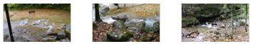
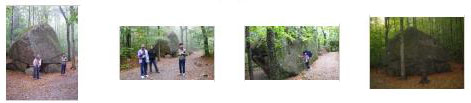
Some of them were relatively small, but some were huge, and we stopped to take pictures at some of them. You can click on the thumbnails at left to have a look at these pictures.
Eventually, we arrived back at the Visitor Center. Although the weather had been bad, it wasn't always raining hard enough to make the hike unenjoyable. Certainly Fred and I enjoyed hiking once again through the Flume, and I think that Steve and Mario enjoyed it as well.
We headed out of the Visitor Center, got back in the vehicle, and headed off to Concord, New Hampshire, and a visit to the State Capitol there.
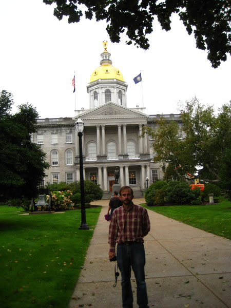
Touring the New Hampshire State Capitol
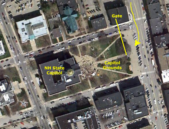
Getting to the New Hampshire State Capitol
|
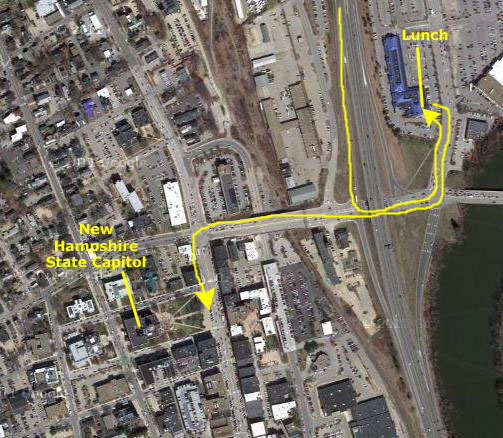
When we got into Concord, we could see the Capitol building in the middle of downtown off to our right, but before we headed over there, we stopped at a restaurant in a shopping plaza at the downtown exit to have some lunch:
|
|
A Bit of History
The penurious New Hampshire legislature saved money by building the Capitol of granite from quarries right at the north end of town and by having prison inmates cut, shape and face the stones. The Capitol was graced by a gold‑leafed dome, and, on top of that dome was placed a huge gold‑painted wooden eagle, which was raised to the top of the dome in 1818. At the dedication ceremony, Governor Plumer made a typical eaceful, hopeful toast by saying: "The American Eagle. May the shadow of his wings protect every acre of our united continent and the lightning of his eye flash terror and defeat through the ranks of our enemies." The new building�s actual cost was only $82,000, but it provided adequate quarters for the legislature and committees, the Governor and Council, the Secretary of State, the Treasurer, and the library. 1819 saw the first legislative session held in the new building. The first talk of expanding the building did not come until 1857; there were new state departments and more offices needed- and the library was bursting at the seams. By 1863 the problem was acute. The city of Manchester upped Salisbury's ante and offered $500,000 and a new building if the Legislature would move the state capital there. Hard to imagine a legislature turning down such an offer today, but turn it down they did. At a cost of $200,000 an expansion and remodeling project was completed in 1866.
|
When the enlargement was consideredd in detail, the result was what amounted to an entirely new state house; by 1909 a bill authorizing the expenditure of $1 million had been introduced. (Undaunted, Manchester again offered to supply the million dollars if the capital were moved there, but the legislature again voted to stay in Concord.) Under Governor Quimby and his Council the building was expanded and remodeled into the building we see today- fire-proof and with elevators, modern lighting, vaults and an up-to-date heating system.
At the same time, the statues of General John Stark, Daniel Webster, President Franklin Pierce, John P. Hale (Hale, from Rochester, was the first US Senator to take a stand against slavery, and you can read the inscription at the base of his statue here) and Commodore Perkins were properly cleaned and made tarnishproof by a modern professional process. Also, the gilded wooden eagle, the Capitol's long-familiar emblem, was replaced by an element-proof metal replica which now adorns the dome.
Architectural Design
The Grounds
|
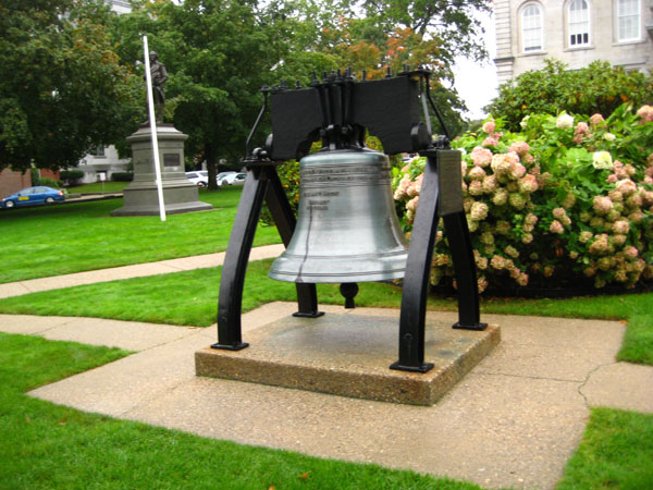
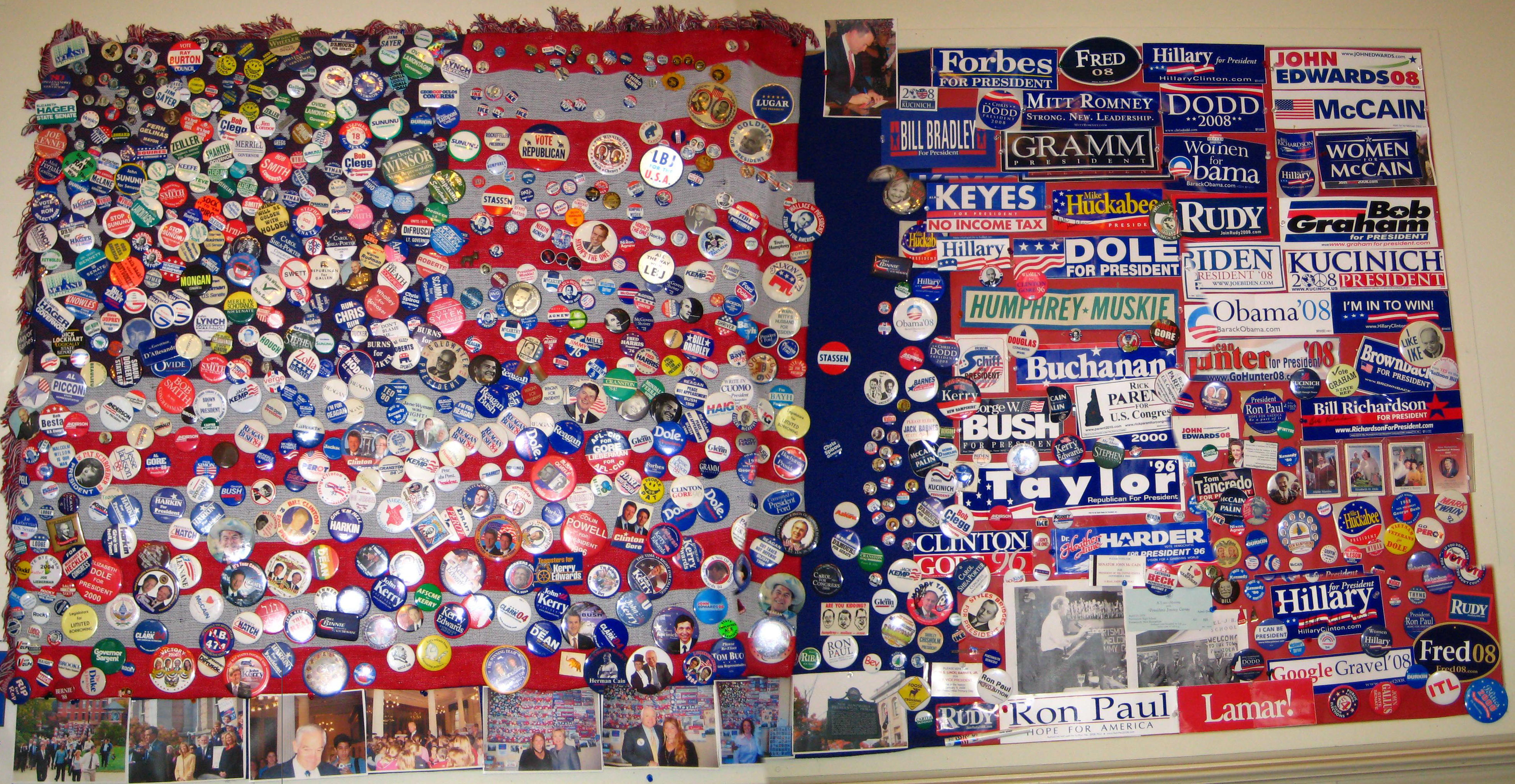
As we've seen in the four Capitol buildings we've visited thus far, each of them has on display somewhere within the building its own replica of the Liberty Bell. But only here in New Hampshire did we find the replica outside; it is located just off the front steps of the building in front of a small garden. You can see it at right.
In a panel over the main entry to the Capitol, one finds a stained-glass version of the early State Seal. The seal was first created in 1775 and comprised a pine tree and an upright fish, on each side of a bundle of five arrows. The design reflected the state�s then two major economic resources, and the arrows symbolized the strength of unity among the then five counties. When the present state constitution became effective in 1784, the new Legislature revised the seal, to depict a ship on stocks, with a rising sun in the background, to reflect Portsmouth having become a major shipbuilding center during the war years. Details of this 1784 seal became muddled over the next 150 years; each time a new die was made or a new image created, the artists seemed to inject new elements, or remove old ones. So in 1931 a Legislative committee spelled out what the official seal should look like. The frigate Raleigh was put on the seal, the year 1784 was changed to 1776, and the old Latin phrase "Neo Hantoniensis Sigillum Republica" around the circular seal was replaced with the English translation: "Seal of the state of New Hampshire." The 1931 seal law spelled out that only a granite boulder could be shown in the foreground, as symbolic of the Granite State�s rugged terrain and the character of its citizenry.
Having wandered around the grounds for a bit, we went on into the building to take what we had discovered could be a self-guided tour.
Visitor Center/Gift Shop
|
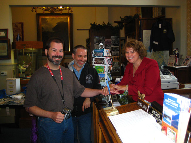
It was here that Steve found out that there is a collector's book specifically for people who make a hobby of visiting state Capitols. It looks like a little passport and there are places to get stamps for each state. We also found out that each Capitol has such a stamp- kind of like a customs stamp (think inked rubber stamp rather than postage stamp). So Steve bought one of the passports and got his first official stamp (the ceremony has just concluded at left). When he told Virginia that he'd already visited seven or eight Capitols (including four already this trip) she helpfully pointed out that if he sent the passport to each one of the Visitor Centers for the capitols he's been too, it's likely that they will believe him, stamp the passport and send it back. So maybe he will do that at some point.
It was here that we picked up our self-guided tour brochure, where much of the information on this album page comes from. The Visitor Center also had a number of exhibits (you can see a couple of them here and here) and also souvenirs for sale, and Virginia was only too anxious to point everything out. (I suspect that the Capitol here is not overrun with out-of-staters; after all, there are courthouses in small Texas counties that are larger than either the Vermont or New Hampshire capitols.)
Virginia was very helpful, and pointed out a number of things that we should see here in the capitol building.
|
|
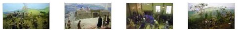
At one end of the room was a large diorama depicting scenes from the Revolutionary War. Fred took some pictures of the various sections of the diorama, and you can have a look at them by clicking on the thumbnail images below:
|
We said good-bye to Virginia, and went off to explore the Capitol building.
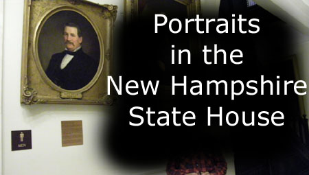
The Hall of Flags (Doric Hall)
|
|
Originally named Doric Hall, after the stylization of the eight central wooden columns (four of which are shown here), it contains, in a series of display cases, 103 flags from the New Hampshire military units that participated in The Civil War, the Spanish-American War, the Mexican Border Incident, World Wars I and II, and Vietnam. There are also flags commemorating the POW/MIA soldiers from all conflicts.
There are a number of exhibits here in the Hall of Flags, including Space Age exhibit; Commander Alan B. Shepard of Derry, NH, was the first American astronaut and there are memorabilia of his moon landing in Apollo 14. There is also a state flag and moon rock from the first moon landing in Apollo 11. There is a tablet upon which are inscribed the names of the 59 New Hampshire citizens who have been awarded the Congressional Medal of Honor, and another the records the names of the 697 New Hampshire citizens who gave their lives in World War I.
|
One such portrait is that of Harriet Patience Dame (1815 - 1900) by Caroline L. Ormes Ransom. Born in North Barnstead, Dame is most known for her service as a Civil War battlefield regimental nurse (1861 - 1865). When the Second Regiment of Volunteer Infantry began forming in New Hampshire in 1861, Harriet Dame was working in a Concord hospital, but she wanted to accompany it as nurse to the unit. By the time Dame had convinced the medical establishment in Concord that she should do so, the regiment was already embroiled in the First Battle of Bull run. When Nurse Dame caught up with "her boys," she had a sudden immersion in the catastrophe of battlefield medicine. Dame stayed with the Second Regiment throughout the Civil War, except when on duty at field hospitals. Between 1861 - 1865 the Second Regiment marched more than 6,000 miles, fought in more than 20 pitched battles, and lost more than 1,000 of the 3,000 men who signed up or were assigned to the it. Harriet Dame's fame as nurse on the front lines spread far and wide. She repeatedly declined high government office to recruit more nurses; twice captured in battle, she was promptly released with apologies and high praise by her captors.
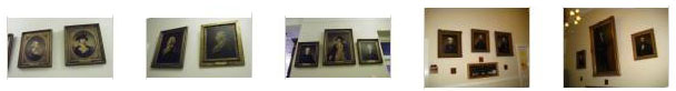
As I said, there were more paintings in the Capitol than we could count. If you would like to see a selection of those just in the Hall of Flags, click on the thumbnail images below:
|
There were other paintings down the transverse corridors here on the first floor, which is also where we found the stairs and elevator to the second floor.
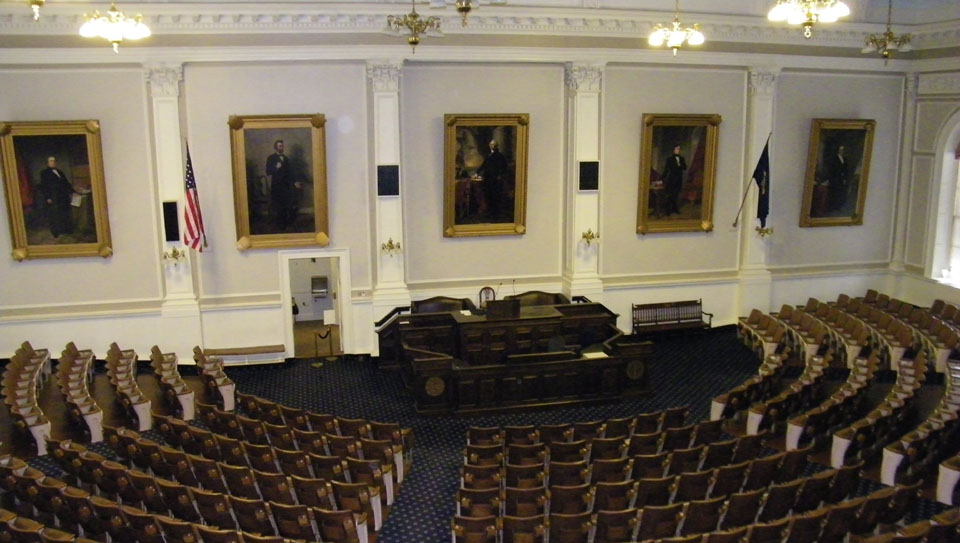
Representatives Hall (The House Chamber)
|
|
Representatives Hall dates from 1819; it was enlarged in 1864. There are 400 House members here in New Hampshire. This makes New Hampshire's House the larged of all fifty states- even states like California, Texas and New York. This seems odd, since New Hampshire ranks 46th in size by population. But the roots of the size of the New Hampshire House go back to Revolutionary times, when it was thought that the Republic should maximize Democracy by having a large number of citizens actively involved in the legislative process. As a matter of fact, the New Hampshire House is larger than the lower Houses of all but three English-speaking countries in the world that have representative democracies.
The most unusual thing about the House Chamber was that, unlike every other state capitol that we have visited, New Hampshire representatives don't have desks in the chamber; nor is there electronic voting for that matter. I would very much like to have the opportunity to see this House in session.
The chamber itself is a handsome one, although not an ornate one- perhaps harking back to the notion of New England simplicity and directness. Being in the middle of the building, the House chamber has large arched windows on two sides. Behind the rostrum hang portraits of John P. Hale, former Speaker of the New Hampshire House, US Senator and presidential candidate in the mid-1800s, Abraham Lincoln, 16th President of the United States, Franklin Pierce, 14th President of the United States and the only New Hampshire citizen elected to that office, George Washington,the first President and also the first portrait hung in the building (1835), and Daniel Webster, Congressman from New Hampshire, US Senator from Massachusetts and US Secretary of State under three Presidents.
|
The Lobby of the Statehouse |
As I said, there were a couple of ways into the House Chamber. The other was was from the front of the chamber, through one of the doors behind the rostrum. We couldn't walk through the chamber to get down there, but a bit later on in our tour we found ourselves outside those doors, and we went in to see what the chamber looked like as viewed from the rostrum. Fred took that previous picture while I busied myself making a movie of the chamber from this vantage point. You can watch that movie with the player at left.
You can also get into and view the chamber from the Gallery that is entered from doors on the third floor. Even though we didn't get into the House Gallery until later in our tour, it makes sense to include here the pictures and movies we took from up there. This might be a good time to mention the way the stairs are arranged here in the New Hampshire Capitol. First of all, they are a far cry from those we saw in New York; there are no intricate carvings, no grand sweeping ascent and not much width to speak of. The stairs are marble with wrought‑iron railings, and they wind around the central elevator like a European apartment house. (The elevator itself is open and in a large wrought-iron enclosure.) This is one capitol that was not built or rebuilt specifically to accommodate an elevator; one was simply installed in the center of the building and the stairs rerouted around it. It works, although it's not particularly aesthetic.
|
The Lobby of the Statehouse |
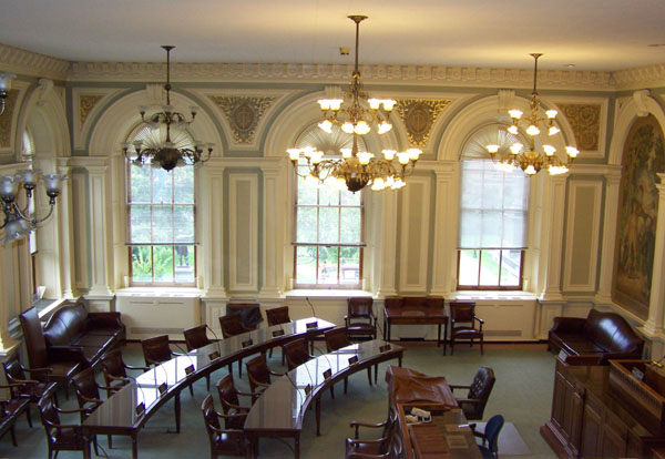
There was quite an impressive view of the House Chamber from here in the gallery; click on the thumbnail image below and you will see what I mean:
|
I took a picture of Fred in the gallery, but it didn't turn out well. Fred's picture of me was better, and you can have a look at it here. When we left the gallery and were back outside, Fred took a picture of me and some of the 200 portraits here in the Capitol; take a look at that picture here.
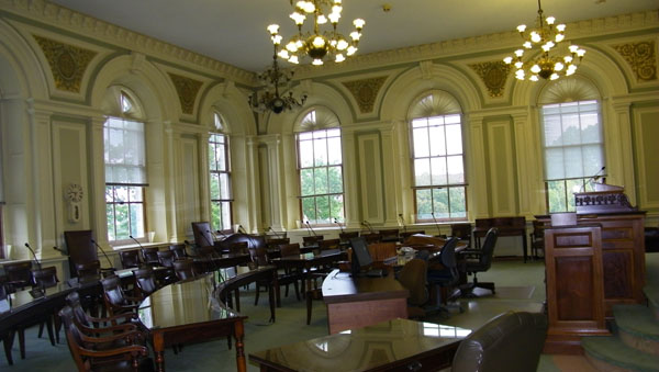
The Senate Chamber
|
|
The Lobby of the Statehouse |
Before we leave the Senate Chamber and head up to its Gallery on the third floor, you might want to look at the movie I made inside the chamber. Watch it with the player at right.
We didn't get to the Gallery for the Senate Chamber until a bit later, but since we are on the subject of that chamber, let's go ahead and look at the pictures we took in and of the Gallery. Just outside the third-floor entrance, I thought you might find this cautionary sign amusing.
|
Fred took some other good pictures here in the Senate Gallery, and you can have a look at them by clicking on the thumbnail images below:
|
The Governor's Reception Room
|
The Governors Reception Room |
In the center of the room is a long table- much like a dining room. At the far end of the room there was a crystal reproduction of the original model for the Statue of Liberty; this was presented to New Hampshire in 1986 for the 100th anniversary of the dedication of that American symbol. (I think that Virginia Drew told us that, in the same way that the original thirteen states received replicas of the Liberty Bell, all states received one of these replicas, although this is the first one we have seen.)
The elegant simplicity of this room seems to reflect yet again the nature of government in New Hampshire- simple, direct and with few frills. The portraits adorning the walls are of Royal Governors and early Constitutional Governors. Matthew Thornton and Josiah Bartlett (a name you might recognize if you watched the TV show "The West Wing" that was on from 1999 through 2006) were signers of the US Declatration of Independence. General John Sullivan was George Washington's Quartermaster and John Langdon was a signer of the Ratification Document for the US Constitution.
On the left side of the room as you come in was a beautiful wood‑framed fireplace, and mounted on the wall over it a nineteenth‑century Federal‑style clock. The opposite wall is the back of the capitol building, and through the window we could see the Legislative Office Building on the other side of State Street.
The Executive Council Chamber
Other Views of the Capitol and Artwork
|
The Lobby of the Statehouse |
In that movie, you will see, in order, Ralph Metcalf from the Know-Nothing Party (1855-1857), Democrats Nathaniel Baker (1854-1855), Noah Martin (1852-1854), Samuel Dinsmoor, Jr. (1849-1852), Jared Williams (1847-1849), Whig Party member Anthony Colby (1846-1847), Democrats John H. Steele (1844-1846), Henry Hubbard (1842-1844), John Page (1839-1842), Isaac Hill (1836-1839), William Badger (1834-1836), Samuel Dinsmoor (1831-1834) (New Hampshire's 14th Governor and the father of the 22nd Governor you saw in this same movie), Matthew Harvey (1830-1831) (Missing from the sequence is Joseph M. Harper, who was actually Governor between Harvey and Dinsmoor but whose portrait is probably somewhere else as he was not actually elected but served out the remainder of Harvey's term when that Governor resigned to take a seat on the US District Court for New Hampshire.), Benjamin Pierce (1829-1830) (Pierce actually served two non-consecutive terms, the previous one being as a Democratic-Republican from 1827 to 1828. And I am wrong in the movie about his being the President; that was his son, Franklin Pierce.), and, finally, National Republican John Bell (1828-1829). Reviewing this movie now makes me wish that I had filmed all of the Gubernatorial portraits in order, just for the heck of it.
|
To view the slideshow, just click on the image at right and I will open the slideshow in a new window. In the slideshow, you can use the little arrows in the lower corners of each image to move from one to the next, and the index numbers in the upper left of each image will tell you where you are in the series. When you are finished looking at the pictures, just close the popup window.
With those pictures, our tour of the New Hampshire State Capitol was done, and since we had some time left in the day, we thought that a walk around downtown Concord would be in order.
Walking Around Concord
|
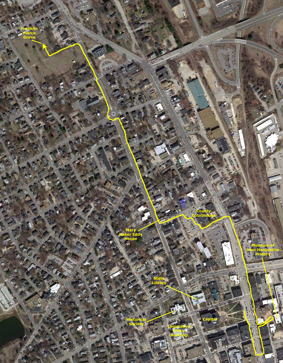
You will find that we began on Main Street, just in front of the Capitol. We walked a bit south, crossed the street, and then walked back north. We continued north along Main Street for a ways until we reached the Merrimack County Courthouse. Then we angled over to State Street, going through the parking area for the Courthouse and coming out on State Street at the corner of Court and State.
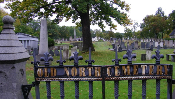
Then we continued north on State Street all the way to the Old North Cemetery. I might point out here that we had gotten about halfway to the Cemetery when I thought that it might be prudent, since rain was threatening again, if I let Mario, Fred and Steve continue on to the Cemetery while I walked back down State Street to the Capitol to get the vehicle and drive it up to the Cemetery. There, I could park it and then rejoin them.
So let's have a look at the sights of Concord, New Hampshire.
|
The Lobby of the Statehouse |
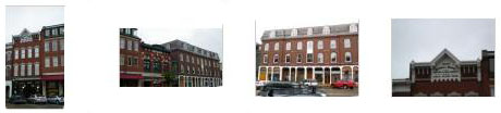
Right in front of the Capitol there was an interesting sign- I suppose that New Hampshire has its share of "peaceful assembly." Below are thumbnails for a few other pictures we took along Main Street near the Capitol; click on them to have a look:
|
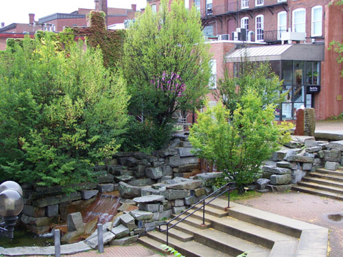
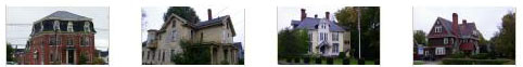
When we came up State Street on the side opposite the Capitol, we found the Museum of New Hampshire History, which is run by the Historical Society. It was kind of in the center of a block- behind some of the buildings that lined the east side of Main Street. When walked from the street to the Museum, you went through a kind of passageway about thirty feet wide to come out into a small plaza in the interior of the block. Here, there was not only the Museum, but entrances to some additional shops and cafes. We walked back down to the Museum, but didn't go in because we didn't think we'd have time to make the entry fee worthwhile.
|
When we walked back out to Main Street, we stopped to admire a really handsome street clock. Of course, you've seen such clocks before, but they are usually small affairs on lampposts- like the one we found in Montpelier that was stuck on 5:07. But this one was huge, with the large clock face at the top of the brick structure and the glassed-in mechanism viewable. Although we didn't hear it ring, I suppose the bell at the bottom can be attention-getting. Here is another picture of Fred and the street clock.
The clock was right across the street from the southeast corner of the Capitol grounds, and so there was a good view of the Capitol from here. We continued north on Main Street, going about six blocks until we came to the Merrimack County Courthouse. We knew we had to get over to State Street, so we turned left and walked along the south side of the courthouse, then cut across the parking area in back of it to Court Street, and then walked west to State Street. At the corner of Court and State we found the Mary Baker Eddy house- she of Christian Science fame.
|
Meanwhile, I was heading back to pick up the vehicle and rejoin the guys at the Cemetery. Instead of going back down Main Street, I headed south on State, coming to the Capitol at its northwest corner. To get back to the car, I walked right in front of the State Library and I could also see the Historical Society right across the street. I got the vehicle and drove back to the Cemetery, parking along its west gate.
|
If you would like to see some of the other pictures Fred took here in the Old North Cemetery, just click on the thumbnail images below:
|
|
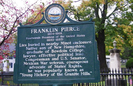
You can see the best picture that any of us took of Pierce's gravestone here. In case you can't read the inscriptions in the three sections, they are as follows:
|
Jane M. Appleton wife of Franklin Pierce Born Mar. 12, 1806 Died Dec. 2, 1863 |
FRANKLIN PIERCE Born Nov. 23, 1804 Died Oct. 8, 1869 14th President of the United States 1853 - 1857 |
Their Children Frank R. Pierce Born Aug. 27, 1839 Died Nov 14, 1843 Benjamin Pierce Born Apr 13, 1841 Died Jan 6, 1853 |
Well, we timed the walk just about perfectly, because while we were at the Pierce gravesite, we started hearing thunder, and just about the time we got back to the car it started to rain.
|
|
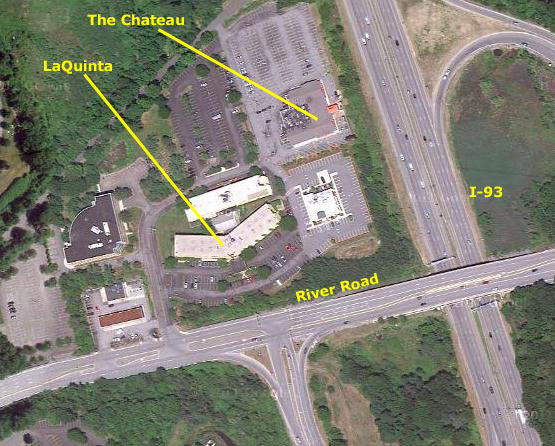
We checked in, relaxed for a while, and then walked next door to a restaurant called The Chateau, which turned out to have really good Italian food.
You can use the links below to either continue with the New England Trip or return to the Index Page to continue through the photo album.
|
September 30, 2011: Boston and the Massachusetts State House |
|
September 28, 2011: Montpelier and the Vermont State Capitol |
|
Return to the Index for our New England Trip |