|
May 30, 2013: The Badlands of South Dakota |
|
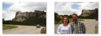
May 28, 2013: Rapid City and Mt. Rushmore |
|
Return to the Index for Our South Dakota Trip |
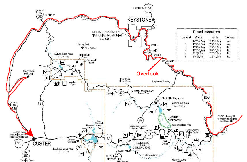
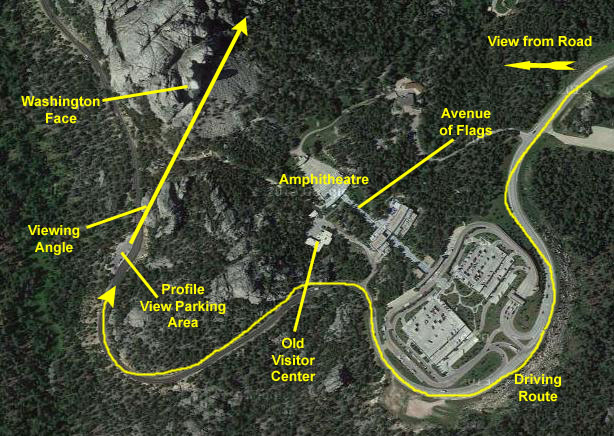
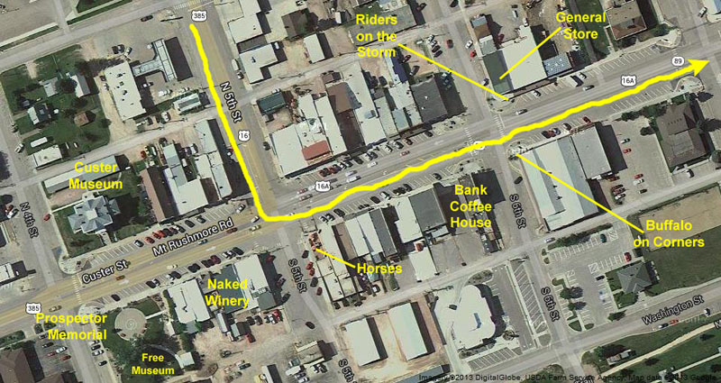
On Wednesday, we'd planned a day with Guy driving through Custer State Park, going to see the Crazy Horse Monument, and, for the benefit of Ron and Prudence, visiting again the town of Custer, SD. Guy will have to drive back to Chamberlain this evening, so we planned a fairly early dinner. The four of us will stay one more night, and visit the Badlands on our own way back to Chamberlain tomorrow.
A Drive Through Custer State Park
|
It would bring us northwest to end in Keystone, near Mt. Rushmore. Then, we'd follow Highway 244 around the back side of Rushmore and over to US Highway 385. We might take a detour to Hill City, but then we'll head south and stop at the Crazy Horse National Monument, which we've wanted to see for quite a while.
Finally, we'll take Ron and Prudence into Custer, SD, and let them wander around that picturesque town for a while before heading back to Rapid City.
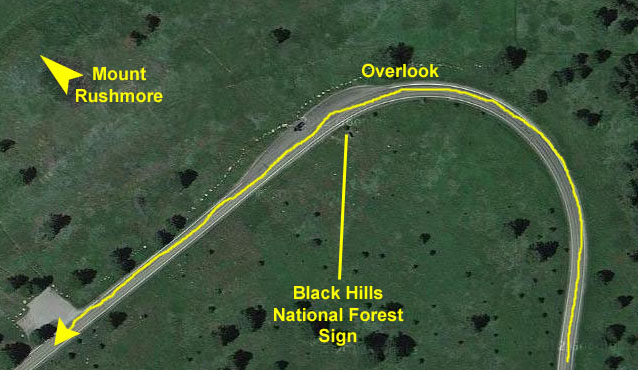
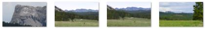
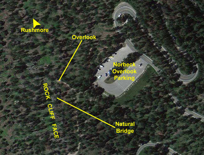
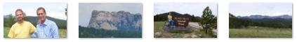
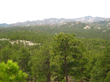
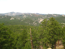
So, we headed down to the east entrance to the park via Highway 79. We were treated to nice views of the mountains in Custer SP. We turned into the park and then north on Highway 16A- following the route I'd suggested. Our first actual stop was at an overlook on the crest of the ridge from which we could see Mt. Rushmore off in the distance.
|
 |
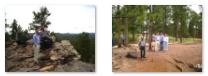
We all got out at the overlook and wandered around taking pictures and enjoying the cool morning. I made a movie as everyone was reading the signs and looking over towards Mt. Rushmore in the distance. You can watch that movie with the player below, left.
|
|
|
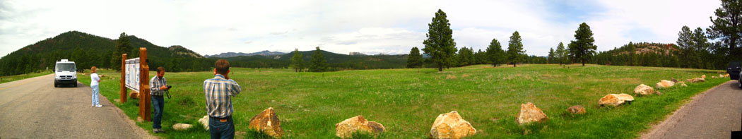
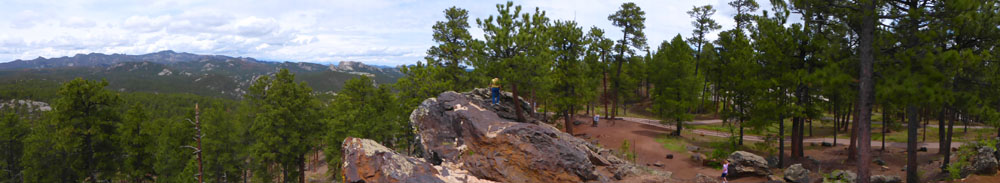
As I am fond of doing, I tried my hand at a panorama, putting five different pictures together. Fred happened to move between two of the pictures, so that's why he shows up twice:
 |
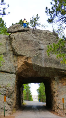
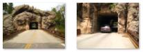
If you scroll back up a bit and look at our route, you'll see our next stop- Tunnel #3 (There are six or seven tunnels on the various roads through Custer State Park.)
|
When I got to the top, I found that there were indeed wonderful views- both out across the Black Hills and, of course, back down to where everyone was looking up at me. In fact, Fred used his zoom to photograph me on top of the tunnel.
As I was coming back down to rejoin the group, Fred walked closer to get a nice picture of Tunnel 3. Then we piled back into the car and headed off to see more of the Park.
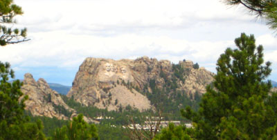
Once we had driven through the tunnel and reached the point a short ways down the road to the curve, we found that the road was pointed directly at Mt. Rushmore, so there was an opportunity for Fred to get a picture of Mt. Rushmore through the windshield. Then, as the car turned the curve, he used his zoom to get a really nice view of Mt. Rushmore, and you can have a look at that picture here.
We drove about a mile further on, following the beautiful highway as it snaked through the forest. Then we came to a large parking area for the Norbeck Overlook. The overlook was named for the engineer who designed both the scenic highways that wind through Custer State Park. You can read about the effort involved in building the highway and the engineer responsible by using the link below:
We parked the car and we all got out to read the signs you saw above and wander over to the overlook itself, which consisted of a walkway to the overlook as well as a long rock face that you could climb on for views of the valley in front of you.
|
 |
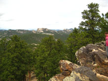
From the overlook, Fred, Guy and I walked over to what appeared to be a rocky ridge, and we wanted to climb up and have a look.
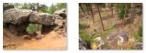
The ridge turned out to be a cliff face, perhaps thirty feet high, from the top of which there were beautiful views in all directions- including down. Below are clickable thumbnails you can use to see some of the pictures that Fred and I took from the top of the ridge and of the "natural bridge" that was a part of it:
 |
 |
 |
We also made some panoramic views. Fred used his camera's automatic features to create this one:
 |
I did the same thing, although I had to take a series of pictures and stitch them together afterwards. I thought you might be interested in seeing both the original pictures and the panoramic result; this will give you some idea of what the program that stitches pictures together has to do to match them up where they overlay each other. Once it does that, since I am never holding the camera at exactly the same height for all the pictures, I usually have to crop out the usable image. This time, I wasn't off by much. So below you will see five the original pictures in the first row, and then the resulting panoramic view by itself on the row beneath:
 |
 |
 |
 |
 |
 |
You can see that as I was taking the pictures from right to left, I seemed to be raising the camera on a slope, for the program had to lose more and more of the pictures as it moved to the left stitching them together. When I cropped the resulting image, I lost those areas.
|
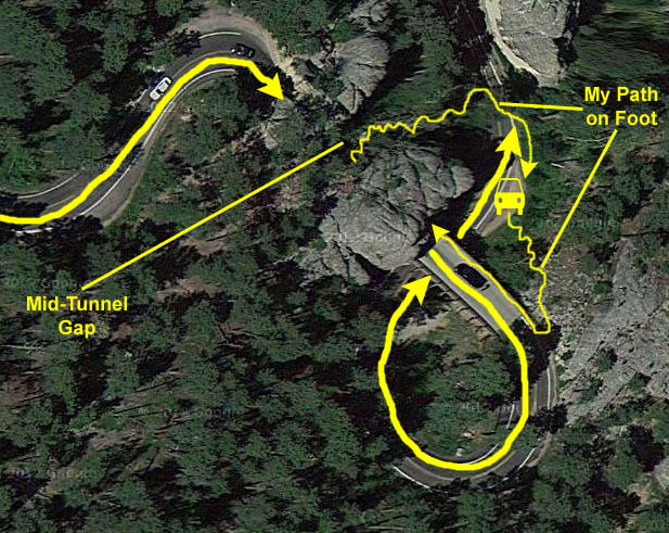
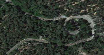
This tunnel is nicknamed "the pigtail" because of the way the road curves around. The only way to explain the tunnel is to look at it in an aerial view, and I've supplied one at left, marking the route the car took. We entered the tunnel from the northwest and when we came out at the southeast end, we were actually on a bridge over the continuation of the highway below. Coming off the bridge, the road descends in a complete circle to come back around under the same bridge. As we came around the south side of this circle, Fred leaned out the window to show you the bridge we just crossed.
After we came around under the bridge heading north, we stopped at the side of the road to get some pictures. Fred got an interesting one of the bridge as it begins at the end of the tunnel, and you can see that picture here. And I took a couple of good pictures from down below the bridge; there are clickable thumbnails below that you can use to have a look at them:
 |
I wanted to get up on the bridge to get a picture or two, so I scrambled up the hillside to the roadway and walked out onto the bridge. There, I got a picture looking down at the group. While I was doing that, Fred was taking a picture of me from down below, and you can see that picture here.
|
|
|
This particular tunnel is actually two short tunnels with an open space in the middle, and I wanted to see what it was like inside (as we couldn't stop in the middle of it when we drove through). As I walked into the tunnel and into the open space in the middle, I made a movie, and you can watch that movie with the player at right.
As the movie shows you, when I got to the middle of the tunnel I found that I could get back to the car by going through that open space to the northeast, scrambling down the hillside to the road below, and then walking back up the road a hundred feet or so to the car. I just made a big circle. The excursion was fun, but as soon as I got back to the car everyone was ready to head off.
|
|
 |
We came off the Iron Mountain Highway near Keystone, and turned west to go past Mt. Rushmore on its south side, heading over to US Highway 385 and the Crazy Horse Monument.
|
|
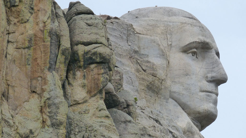
When we stopped to get out and have a look, Fred used his excellent zoom to get an excellent picture of Washington's profile. Click on the image below to expand to full size:
 |
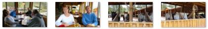
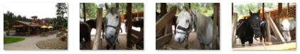
We continued down the highway towards US 385 and after a few miles we came to a complex that included a hotel, campground, RV park, restaurant, shops and horserides. We hadn't had any lunch, so we stopped in and had lunch at the Ponderosa Restaurant. It was an interesting lunch, mostly due to the weird wine list that the restaurant had. After lunch, we walked around the shops and the stables for a bit, just taking pictures.
|
|
Below are clickable thumbnails for some of the pictures we took here in the restaurant and walking around after lunch:
 |
 |
A short while later, we reached US 285 and we headed south towards the Crazy Horse National Monument.
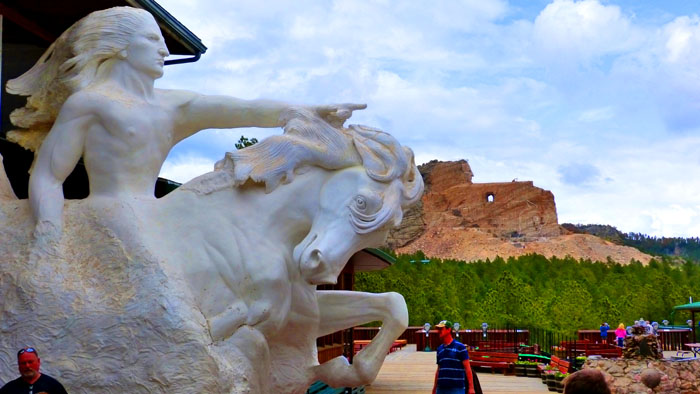
The Crazy Horse Memorial
|
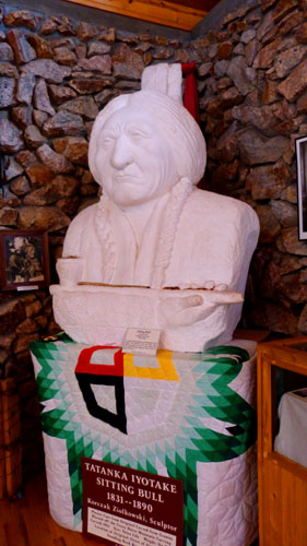
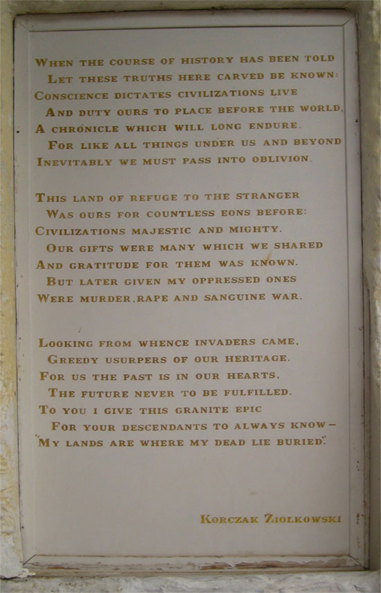
The memorial is a non-profit undertaking; the owner of the complex- the Crazy Horse Memorial Foundation- charges fees for its visitor centers and earns revenue from its gift shops. Ziolkowski died in 1982, but his family (including his wife Ruth and seven of their ten children) and associates have carried on the work. Indeed, their daughter Monique Ziolkowski, a sculptor, has modified some of her father's plans to make the sculpture work better. In 1998, the face of Crazy Horse was completed and dedicated.
|
Note:
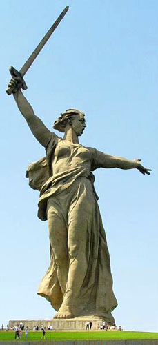
When The Motherland Calls was dedicated in 1967 it was the tallest sculpture in the world, measuring 279 feet from the tip of its sword to the top of the plinth. For comparison, the figure itself is some 20 feet taller than the statue of liberty (including her torch), but the entire sculpture, including the sword, is over 100 feet taller. Unlike Lady Liberty, the sculpture is made of reinforced concrete- 8000 tons of it.
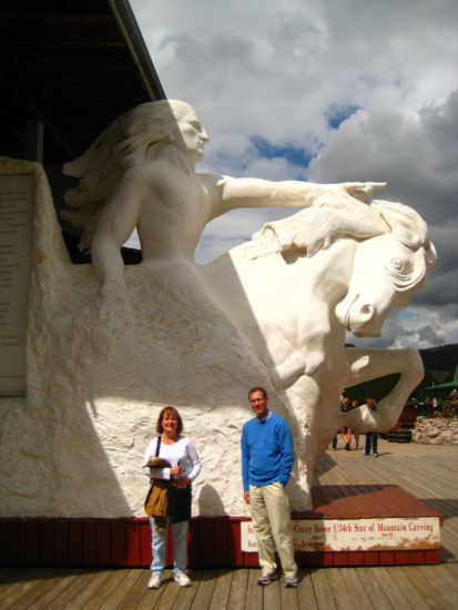
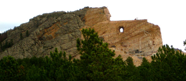
The memorial consists of the mountain carving (monument), the Indian Museum of North America, and the Native American Cultural Center. The monument is being carved out of Thunderhead Mountain on land considered sacred by some Oglala Lakota, between Custer and Hill City, roughly 17 miles from Mount Rushmore.
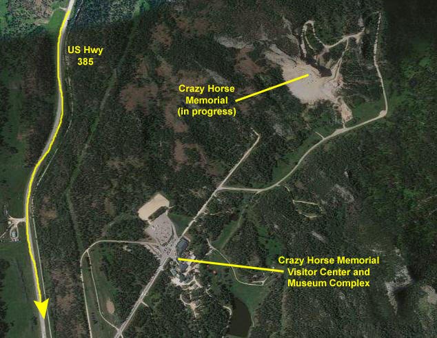 |
We drove in through the entrance from US Highway 385, paid our carload admission of $27, and parked in the huge lot near the Visitor Center.
|
Outdoor Sculpture
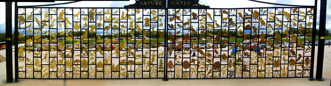 |
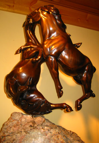
The rectangular lattice of the gates are filled with gold-colored metal fauna and flora; these are attached to the framework but are cutouts of a very large number of different ones. Fred, of course, located the buffalo, and you can see that in the sections surrounding it there are other, different animals and plants. Nearby, there were two large sculpture installations. One was a life-size copy of one of Ziolkowski's most famous pieces- " Fighting Stallions". He actually did a number of pieces with this title, but this is the largest. While the picture you just saw of this piece is probably the best, you can get a different perspective on it with another of my pictures here. On the lawn near this sculpture was another, whose title I cannot locate. It is of an Indian and his fallen horse.
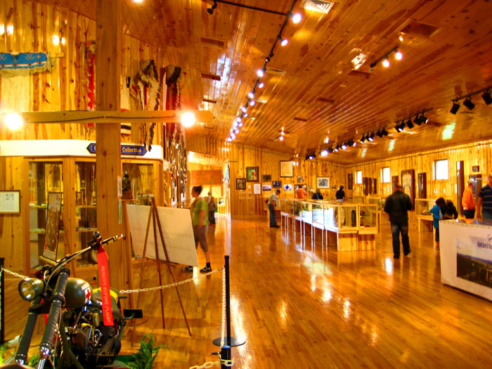
In the Indian Museum
|
Close to 90 percent of the museum collection has been donated, both by Native Americans and non-Natives. Many individuals and families have decided that the Indian Museum of North America is where their American Indian artifacts and art should find a permanent home.
Korczak designed the museum, and his family built it during the harsh winter of 1972-73 when no work was possible on the mountain. In keeping with Korczak�s do-it-yourself philosophy, the family did all aspects of the construction, holding cost to a minimum. The museum incorporated Korczak�s love of wood and natural lighting. The museum was dedicated on Memorial Day, 1973. On that particular May 30th, there was still 6 feet of snow on the ground.
In the early 1980s Korczak planned the new wings of the museum but did not live to see his plans realized. Under supervision of his wife, Ruth, the new wing was built in the winter of 1983-84 by family members and a small permanent building staff. Funding for this expansion came, in large part, from a $60,000 check left in the Crazy Horse contribution box in late August, 1983. The check cleared the bank on what would have been Korczak�s 75th birthday. The Michigan contributor said he was moved by the purpose of Crazy Horse, Korczak and his family�s great progress, and by the sculptor�s reliance on free enterprise and refusal to take federal funds.
|
|
To view the slideshow, just click on the image at left and I will open the slideshow in a new window. In the slideshow, you can use the little arrows in the lower corners of each image to move from one to the next, and the index numbers in the upper left of each image will tell you where you are in the series. When you are finished looking at the pictures, just close the popup window.
The gallery at the northeast end of the building had a very pretty set of windows that offered a great view of the memorial.
Outside on the Patio
|
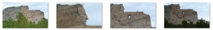
Actually, over on the back wall of the patio there was a photograph of the mountain as it currently exists, and overlaid on that photo are sketch lines showing the major outlines of horse and rider. It is very interesting to look at, and you can see it here. I assume that it would be helpful if these same lines were first painted onto the stone of the actual mountain, but I assume there are reasons why that was not done. There are some thinner lines drawn on the rock itself, though, to guide the blasting and carving process at this early stage.
The back of the patio was under roof, and here we found other exhibits and artwork, including a beautiful eagle sculpture. There was also a model of what the entire campus will look like when the memorial is completed. The sculptor and his family envision a large complex devoted to the American Indian, and you can see that model here.
|
 |
Korczak Museum and Craft Center
|
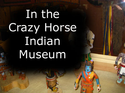
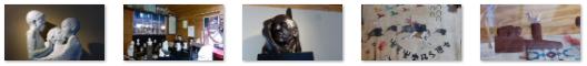
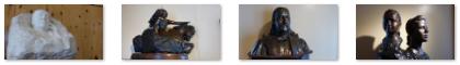
There was also an Indian cultural/craft center, where artisans were actually at work creating their craft items, and where these items were available for sale. Fred took a couple of pictures of some of the more interesting pieces.
There are clickable thumbnails below for some of the pictures that Fred took in this area of the complex:
|
When we were all done looking around, we met up with everyone in the gift shop, and soon after that headed on down the road to visit the town of Custer.
In the Town of Custer, SD
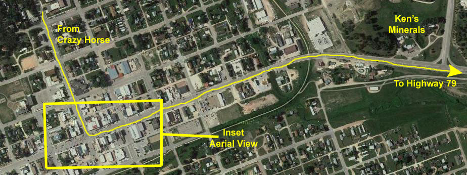 |
On the map, the area we walked in downtown is outlined, and we'll zero in on that area in a minute. When we were done in Custer, though, we continued east on Rushmore Road; this took us again past Ken's Minerals, where Guy, Fred and I stopped yesterday. Then there is the road that leads into the State Park to the Sylvan Lake Campground where we camped in 2006. We continued on east through the park, eventually coming out the same way we entered earlier today.
|
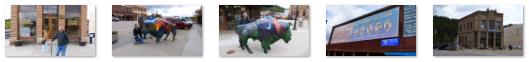
After we crossed the street, I stopped to take a picture of one of these buffalo sculptures and the museum behind it across the street. There are about thirty of these buffalo throughout town, each done by a different artist. Some are permanently installed; others are changed out periodically (much like Baskin Robbins ice cream flavors). You will see a few more of them today, but if you really want to survey a lot of them, go look at the album page for our visit to Custer in July, 2006. There, you will find pictures of most of them, and information about the artist and his inspiration.
When I took that last picture, I was standing at the corner of Mt. Rushmore Road and 4th Street, in front of the new Custer County Courthouse and across the street from the 1880 Courthouse Museum; on this corner is Way Park. In the center of the park is a memorial dedicated to the memory of Horace N. Ross, discover of gold in the Black Hills at Custer, South Dakota on July 27, 1874. Also in Way Park is Dr. Flick Cabin, which was donated to the City of Custer in 1875 along with the land for Way Park. The Dr. Flick cabin was the first building erected in the Black Hills. Dr. D.W. Flick built it of substantial hund-hewn logs and designed it as a home for his family.
|
We walked a few more blocks east on the south side of Rushmore Street, passing some interesting shops and stores and three or four of the thirty-odd buffalo that are scattered about downtown. Below are clickable thumbnails for some of the pictures Fred took along the way:

|
Eventually, we crossed the street so Ron and Prudence and Guy could go into one of the stores and look around; Fred and I sat on a bench outside to wait for them. Just in front of me was another of the painted buffalo for which Custer is famous- "Riders on the Storm" by Colorado artist Ross Lampshire. Each buffalo has beside it a sign descriptive of the artist and their work, and you can read the sign about this particular buffalo and its artist here.
We returned to the car and in the light sprinkle headed on east through the park and back to Rapid City for dinner. Guy had to be back in Chamberlain late this evening, and we didn't want him to be on the road too late at night, so that's why we had a fairly early supper and a nice steakhouse recommended by one of the desk clerks at the MicroTel. It was a nice place with a good, though somewhat upscale, menu. We all enjoyed it.
Back at the hotel, we sent Guy off on his way. We will stay one more night and travel back to Chamberlain tomorrow, stopping at the Badlands National Park on the way.
You can use the links below to continue to another photo album page.
|
May 30, 2013: The Badlands of South Dakota |
|
May 28, 2013: Rapid City and Mt. Rushmore |
|
Return to the Index for Our South Dakota Trip |