|
May 31, 2013: A Day in Chamberlain |
|
May 29, 2013: A Day in the Black Hills |
|
Return to the Index for Our South Dakota Trip |
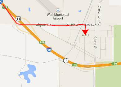
Today, Ron and Prudence and Fred and I are going to drive back to Chamberlain from Rapid City. On the way, we're going to tour through Badlands National Park. As it turned out, we also made a stop at Wall Drug.
A Stop at Wall Drug
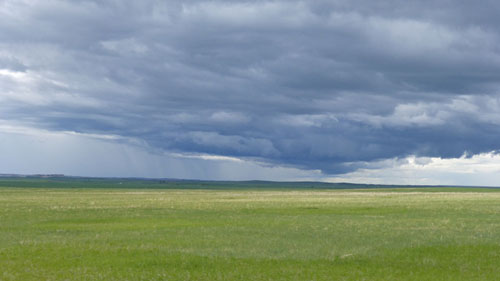
The drive to Wall, South Dakota took a while, but with our conversations the ride was very pleasant. There wasn't a lot to look at out the window, though, just the endless rolling hills under a very big sky. I don't think that Ron actually intended to stop at Wall, SD, but he needed gas anyway, so we thought we'd kill a couple of birds with one stone and show Wall Drug to them.
|
 |
I first became aware of Wall Drug in 1976 when Tony Hirsch and I drove across country from Chicago. We traveled along I-90, and just west of Minneapolis we began to see large billboards for Wall Drug. There were a lot of them, even though Wall was over five hundred miles away. (That would be like seeing signs for San Antonio hotels just south of Oklahoma City!)
|
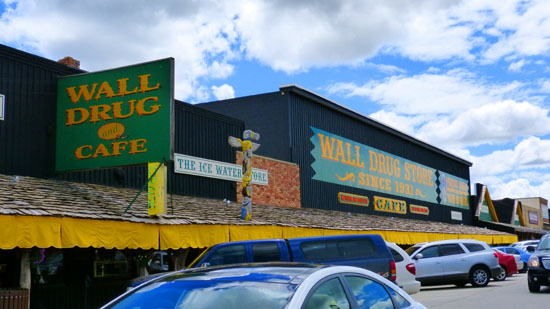 |
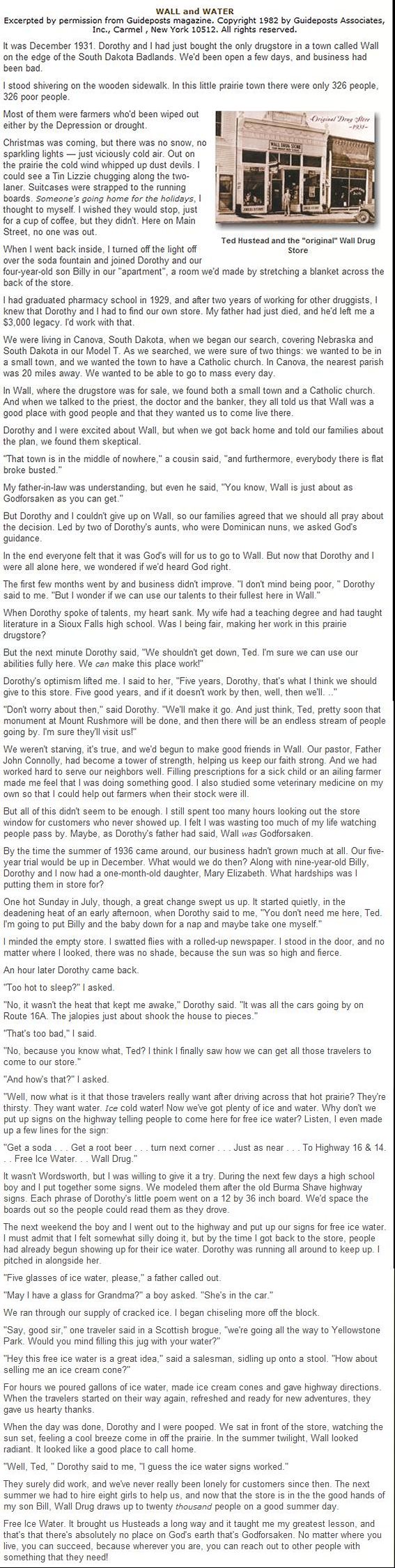
Actually, Wall Drug wasn't a surprise for any of us by the time we got there. If you are curious as to where, exactly, "there" is, you can have a look at the sign on the side of the building.
|
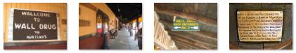
Anyway, we found a place to park and walked down the street to an entrance. The building extends for a long block, and we took a few interesting pictures outside; there are clickable thumbnails for some of them below:
 |
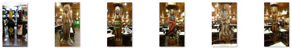
We thought this would be a good place for lunch, so we got in line to order some burgers and stuff. (Good thing we did, for no sooner had we queued up than a couple of large tour buses apparently disgorged their contents and the line quadrupled in length.) While we were waiting for the food to come up, I thought I'd go see if I could find the child-size moccasins that Guy had been looking for, so I wandered off through the amazing building. They had EVERYTHING it seemed, in the series of connected buildings that is Wall Drug. I found the moccasins- rather a large selection of them, so I called Guy to describe them and see which ones he wanted. Back in the dining room we had our lunch. (We even found that same rhubarb wine Fred had yesterday.) There were a number of carved Indians in the room, and Fred took pictures of most of them. Use the clickable thumbnails below to have a look:
 |
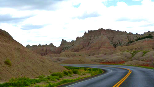
After lunch, we headed off through town and south on South Dakota Route 240 to the Badlands National Park.
Badlands National Park
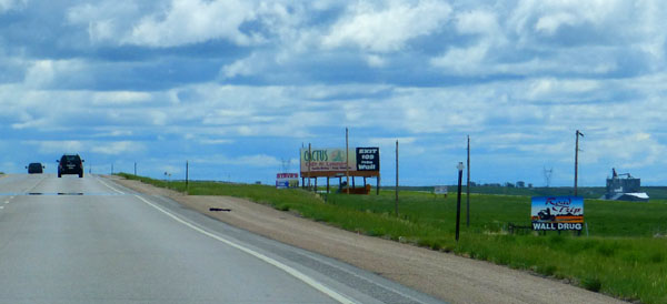
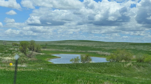
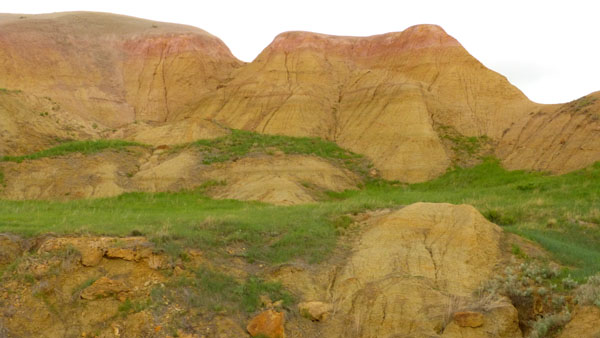
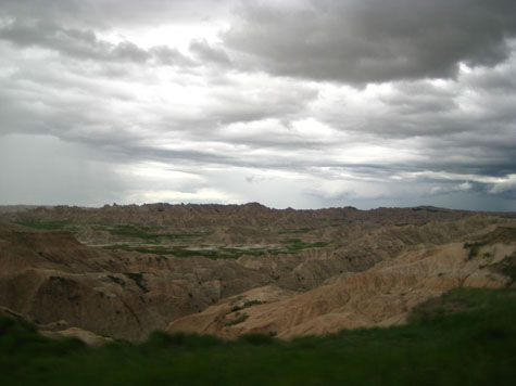
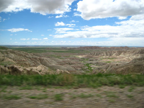
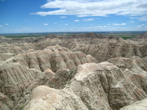
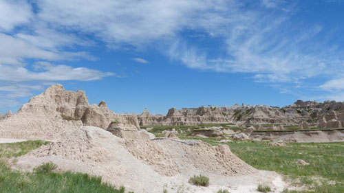
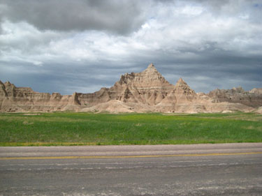
As we drove into the park itself, Fred was taking pictures out the car window of the incredibly diverse scenery that we drove through, and here are two typical views:
|
|
|
Today, the four of us are going to repeat the drive that Fred and I made in 2006- going west to east on the Park Loop Road from the Pinnacles Entrance station to the Northeast Entrance. This is, essentially, South Dakota highway 240.
|
For our drive through the Park, I'll just put each major stop under its own heading, and, if you want, you can follow along by returning to this map to see just where each point of interest was.
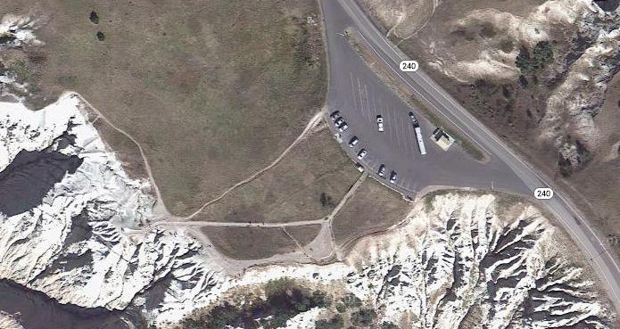
Occasionally, I may include an aerial view of the overlook or feature, although I should point out that the aerial views don't show either the incredible colors that we saw or give a really good impression of the topography. But they are interesting sometimes because you can see from the air some of the same features we photographed from the ground.
So with that said, let's make our first stop at the Pinnacles Overlook.
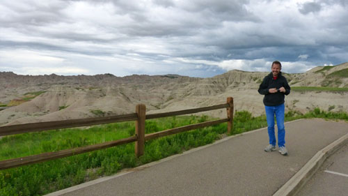
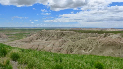
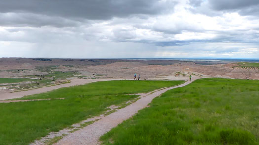
The Pinnacles Overlook
|
 |
Fred and I have been here before, and I have to point out that the weather today was much cloudier and more dismal than it was on our first visit. I could see that the weather was trying to clear, and I hoped that it would do so soon, for it is the sunlight that brings out the spectacular color of this wild area.
|
 |
You will find more excellent pictures taken from the actual overlook in the slideshow at the end of our tour of the Badlands.
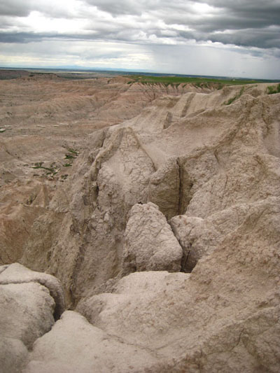
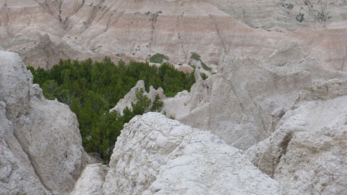
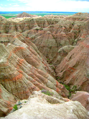
It was at this overlook that we learned that, instead of being purely sedimentary in nature, the Badlands formations were actually volcanic in origin, although water action certainly played a part. We also noticed that, in many a small valley in the Badlands there can be some relatively thick vegetation, although it is more normal to see very little.
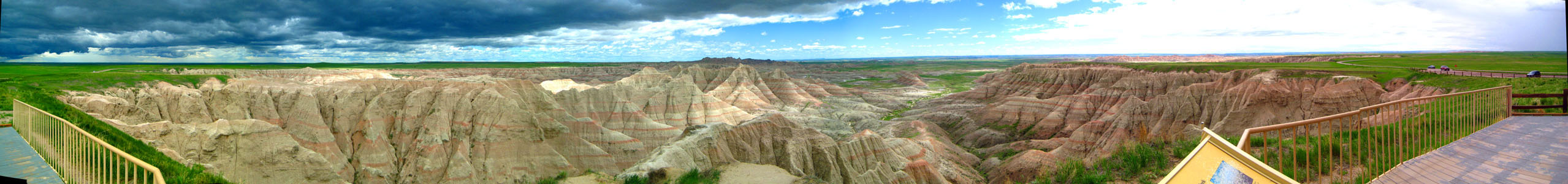
Both Fred and I made panoramic pictures from here. Fred's panoramas are done inside his camera; all he has to do is slowly sweep his camera across the area he wants to photograph. The panorama he took is below:
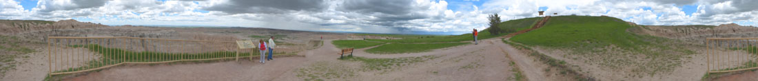 |
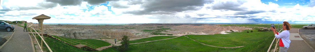
For my panorama, I took five pictures and stitched them together later. The result is below:
 |
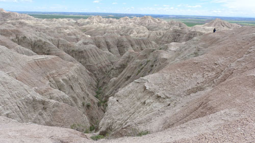
There was a long walkway out to a viewpoint, and I noticed Fred had already headed out there, so I went out to join him. Here is Fred at the end of the walkway. I'll wind up our stop here with two more pictures Fred took from the end of the walkway; you will find more of them in the slideshow at the end of our Badlands visit:
|
|
He made two other panoramas of note, and you can see them below:
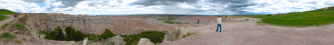 |
 |
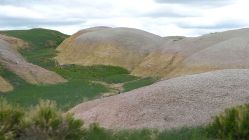
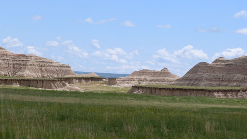
The Yellow Mounds Overlook
|
Fred must have taken fifty pictures on the way to our next overlook; here are a couple of good ones:
|
|
You will find more of the good pictures that Fred took as we traveled from the Pinnacles Overlook to the Yellow Mounds Overlook in the slideshow at the end of our visit.
|
The views from here at the overlook were pretty neat, and there was again a walkway you could take out away from the road for better views. Here are a couple of the views from here:
|
|
I have more pictures taken from the Yellow Mounds Overlook, but I have put them into the slideshow that you'll find at the end of our visit to the Badlands NP. I also took a series of pictures to construct a panorama of the view from here, and you can see the panorama below:
 |
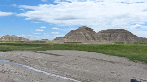
The Burns Basin Overlook
|
|
I took a series of pictures to show how the weather cleared up between Yellow Mounds and Burns Basin. The first and last of them are above, and the remaining six are in the slideshow at the end of our visit.
|
It was just after we arrived at the Burns Basin Overlook that the skies really began to clear. Off to the north, it was still cloudy and a bit threatening, but, actually, the cloud formations were quite beautiful. Below is one picture that Fred took to show the clearing sky; it was taken shortly after we arrived at Burns Basin.
 |
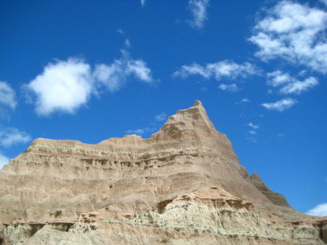
All four of us walked out to the viewpoint and the three of us took quite a few pictures. I tried a movie, but the wind was fairly brisk and so there was too much wind noise for me to include it here. Our pictures will have to suffice and below are two of the best of them.
|
|
There are more pictures from this overlook, but I have chosen to put them in the slideshow that you'll find at the end of our visit to Badlands National Park.
I thought this would be an excellent place to take a large panorama. There was a fixed railing that I could lean against to hold the camera at the same height, so I carefully took a series of seven pictures, merging them together into the panoramic view that you can look at using the scrollable window below:
The White River Valley Viewpoint
|
|
From the White River Valley Viewpoint |
The scene was so beautiful that between Fred and myself we must have taken forty or fifty pictures. I certainly can't include all of them here, but a couple of representative views might suffice:
|
In Fred's picture below, you can see more clearly how the stone has been eroded away into gullies, washes, and shallow canyons. The rock here is weathering rapidly, geologically speaking:
 |
As I said, we took a large number of very good pictures here at the White River Valley Viewpoint, and I want you to be able to see more of them, so I will put another ten or so into the slideshow that you'll find at the end of this section devoted to our visit to Badlands NP.
I also set something of a record here at the viewpoint- I took 18 separate pictures and was able to merge them all together successfully into a single panoramic view that sweeps from the northeast end of the parking area and loop road, all across the view in front of me to the south and west and continuing on to the northwest end of the parking area. I'd never attempted to stitch together so many pictures before, but I think the result turned out well. You can use the scrollable window below to survey the scene:


A Drive Out Into the Badlands
|
|
Eventually, we turned around to return to the main road. Fred was taking pictures all the while, and in addition to the two above he took a number of other very nice pictures, and I have put them into the slideshow that you will find at the end of our Badlands visit.
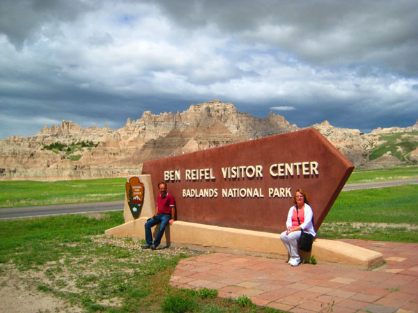
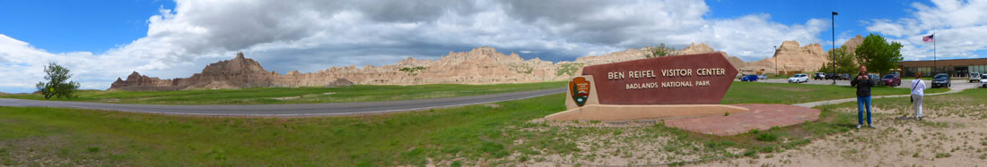
At the Ben Reifel Visitor Center
|
|
As with the other sections of our visit to the Badlands, I have other pictures from our drive to the Ben Reifel Visitor Center, but will put them into the slideshow you will find at the end of our visit.
|
The scenery around the Visitor Center was just as pretty as any we'd seen on the way along the loop road:
 |
We took a number of pictures before we went into the Visitor Center; a few were members of our party posing at the Visitor Center sign, but we also took more good pictures looking around at the landscape. Inside, Fred took some very good pictures of a few of the exhibits. I have put all these pictures into the slideshow that appears below at the end of our visit.
We wandered around in the Visitor Center for a while; I think that Ron sat in on a movie about the Badlands while Fred and I walked through the small museum and the gift shop. Fred is interested in all things buffalo, and found some artwork and artifacts depicting them. After forty-five minutes or so, we were all ready to head on out on the Loop Road, heading back to I-90. Before we leave, though, I want to show you another of the panoramic views that Fred created with his camera:
 |
The Big Badlands Overlook
|
The Loop Road in Badlands NP |
 |
There are some other good pictures I want to include from the drive from the Visitor Center to our last stop, and I will put them in the slideshow that is coming up shortly.
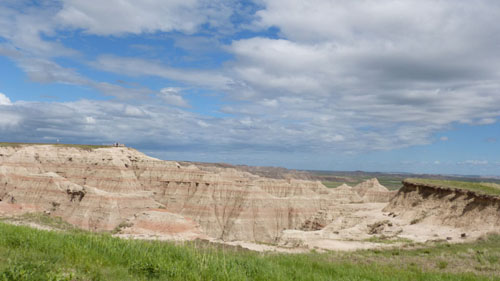
Our last stop was at the Big Badlands Overlook, where we were again treated to expansive views of the northeast corner of Badlands National Park. I think you'll agree that the vistas were amazing:
|
|
The Badlands National Park Slideshow
|
While, that time has arrived and the slideshow is at left. There are almost a hundred pictures in it, grouped by the various stops we made. Each group has a "title slide" so that you can remember where each group of pictures was taken. Since you don't have to open and close a window for each image, you will be able to move through the slideshow in just a few minutes- depending on the interest you have in examining each image. I hope you will look at the entire show, for each picture is worthwhile.
To view the slideshow, just click on the image at left and I will open the slideshow in a new window. In the slideshow, you can use the little arrows in the lower corners of each image to move from one to the next, and the index numbers in the upper left of each image will tell you where you are in the show. When you are finished looking at the pictures, just close the popup window.
Soon after the last overlook, we passed out of the National Park via the northeast portal, and a few miles later reached I-90 once again. Then we headed east to arrive in Chamberlain about an 90 minutes later, and soon we were back at St. James Church.
Dinner in Chamberlain
|
On our way out, Fred snapped this picture of the Cedar Shores Resort lobby.
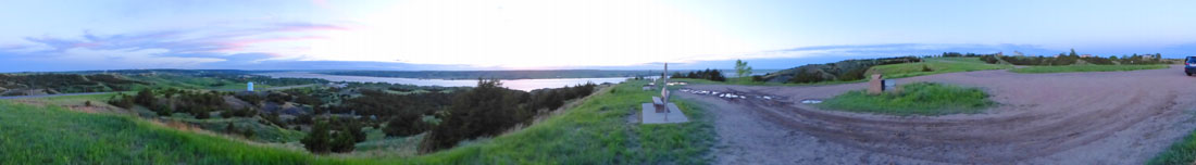
Evening at the Chamberlain Overlook
The view of Chamberlain in the evening was pretty impressive- and quite beautiful. If I were Guy and lived here, I'd come to this overlook frequently- just to sit and admire the view and nature's handiwork. Fred used his camera to make a panoramic picture of the scene, and I have put that view below:
 |
This brought our long day to a close. Tomorrow, we'll be spending another day here in Chamberlain with Guy.
You can use the links below to continue to another photo album page.
|
May 31, 2013: A Day in Chamberlain |
|
May 29, 2013: A Day in the Black Hills |
|
Return to the Index for Our South Dakota Trip |