|
May 11, 2016: Big Bend: Santa Elena Canyon |
|
May 09, 2016: The Trip to Marathon, Texas |
|
Return to the Big Bend Trip Index |
We will be spending the second day of our trip out west in Big Bend National Park. The highlight will be the Boquillas Canyon hike in the southeast portion of the Park.
A Morning Walk in Marathon
|
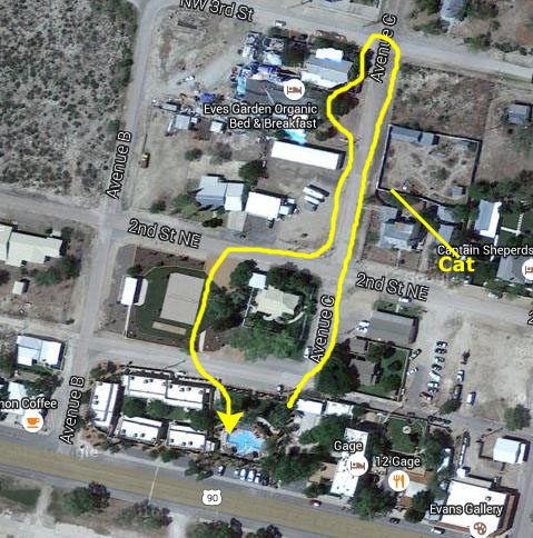
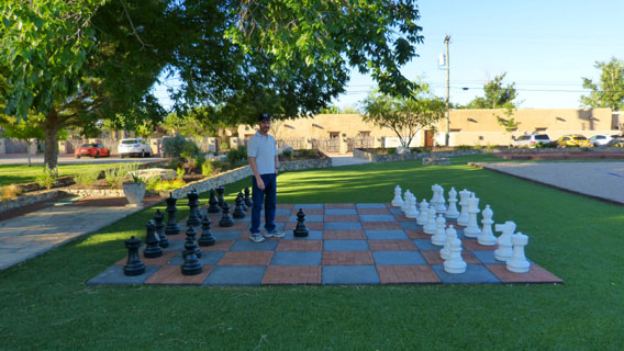
Basically, we just walked up the street past Eve's Garden B&B (where Nancy and Karl have stayed before), turned, and came back down to the Gage through a little park that had a volleyball court, an outdoor chess board and a bunch of benches and tables.
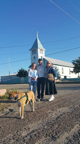
I met Prudence just outside their room over in the casitas, and she was just getting Jax leashed up and ready for his walk.
|
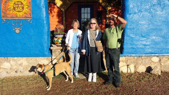 |
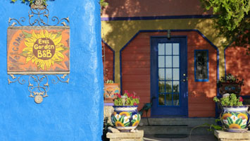
I think that Nancy said that she and Karl had stayed at Eveĺs Garden some years ago; it is a bed & breakfast unlike most others (only Chicken Paradise in San Antonio seems t. The B&B has o be in the same vein). Eve's Garden is an innovative Organic Bed & Breakfast and Ecology Resource Center. Eveĺs Gardenĺs large indoor organic gardens are filled year-round with blooming roses, bougainvillea, and countless flowers. Apparently, the entire B&B was built mostly by hand by its first owners. Nancy says that the guest rooms open to a central covered courtyard with a pond and tea room. From the B&B's website, we discover that "Our wish is to provide a comfortable Bed and Breakfast environment and a conversational forum to address issues regarding the ecology we live in."
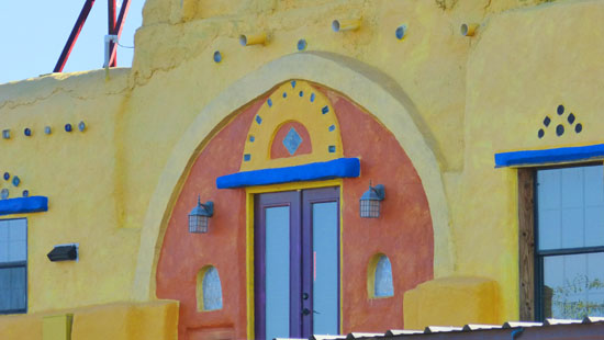
On the website, I also discovered that "a large amount of recycled content, paper adobe/fiber-cement buildings, high Mexican contemporary color treatments, and a focus on locally produced food, conspire to create an aura of 'thoughtfulness'." Whether the environment is 'thoughtful' or not is not anything I can confirm or deny, but one thing was certainly true: those 'Mexical contemporary color treatments' were certainly colorful.
 |
 |
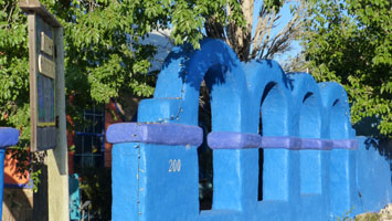 |
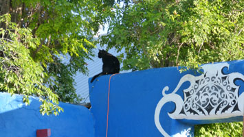
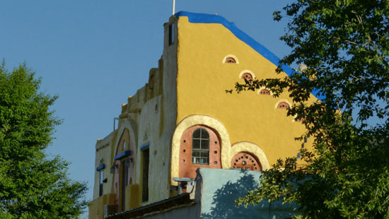
Just across from Eve's Garden there was a piece of property with a high fence around it, and Fred spotted a cat sitting on top of it. I took my phone over to the fence to try to get a closer picture, but the cat turned and walked away from me along the top of the fence. Walking back towards the Gage, we passed another building whose colors were pretty neat:
 |
 |
We continued on back to the Gage, detouring down the street to walk through a little park:
 |
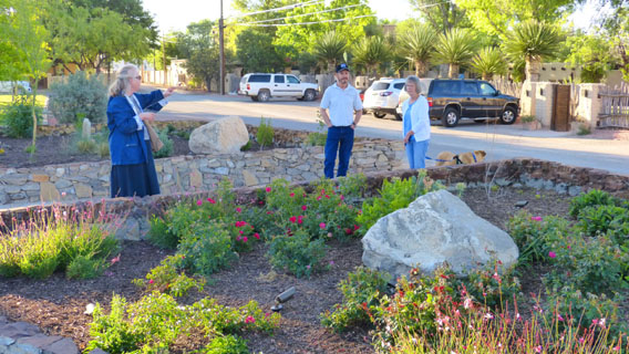 |
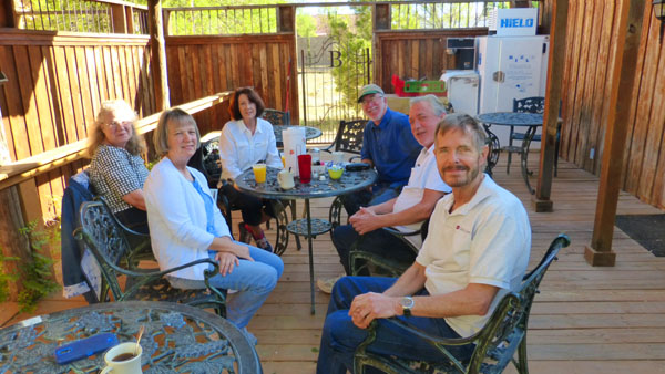
We ended up back at the Gage after our 30-minute walk to find that most everyone else was now ready to head off to Big Bend. Before we did that, though, there was the matter of breakfast.
|
Too little, too late, as we were almost done with breakfast anyway. While the rest of us finished up, Ron took Jax back to the Gage.
The patio was pretty neat, shaded as it was from the morning sun. Fred noticed and photographed some colorful pots and a planter.
Back at the Gage, we made a quick pit stop and then piled into two of our three cars to head off for a day in Big Bend.
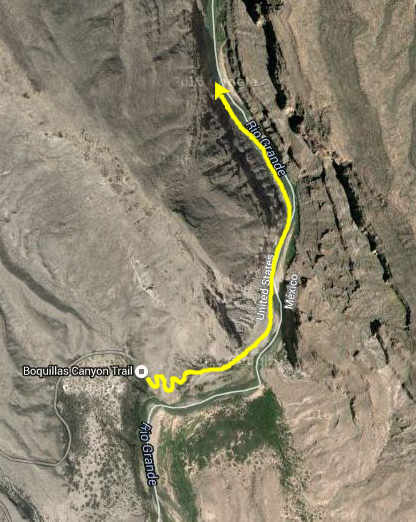
The Drive to Boquillas Canyon in Big Bend NP
Big Bend National Park has national significance as the largest protected area of Chihuahuan Desert topography and ecology in the United States. It contains more than 1,200 species of plants, more than 450 species of birds, 56 species of reptiles, and 75 species of mammals. The park covers 800,00 acres of mountains, valleys and desert; its southern boundary is the Rio Grande River and so it borders the country of Mexico. A variety of Cretaceous and Cenozoic fossil organisms exist in abundance, and the park has artifacts estimated to be 9,000 years old. Historic buildings and landscapes offer graphic illustration of life along the international border in the 19th century.
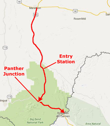
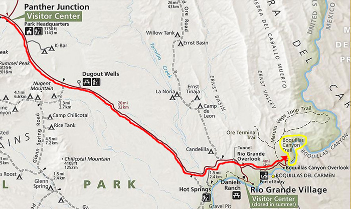
From Marathon, we headed south on US Highway 385; that highway actually ends at the entry station for Big Bend. From there, we continued south on what was now a Park road; this road continued south until it intersected with the main Park road in Big Bend, which runs from the west entrance to the Park down to the southeast and Boquillas Canyon. At this intersection, called Panther Junction, we intend to stop at the Visitor Center.
|
|
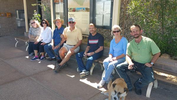
After about a 90-minute trip, our little caravan arrived at Panther Junction, and we all got out to have a walk through the Visitor Center, and learn a bit more about some of the hikes we planned to take.
|
During the early historic period (before 1535) several Indian groups were recorded as inhabiting the Big Bend, including the Chisos and Conchos Indians and the nomadic Jumano. Around the beginning of the 18th century, the Mescalero Apaches began to invade the Big Bend region and displaced the other Indian groups; the last Native American groups to use the Big Bend was the Comanches, who passed through the park along the Comanche Trail on their way to and from periodic raids into the Mexican interior. These raids continued until the mid-19th century.
The first Spanish expedition passed through circa 1535, and others followed. Some were searching for gold and silver, others for farmland and still others had a missionary purpose. A line of presidios (forts) was established along the Rio Grande in the late 18th century, although many of them were abandoned less than fifty years later.
Not much is known about the Spanish occupation of the Big Bend following the abandonment of the presidios, until English-speaking settlers began arriving following the secession of Texas during the latter half of the 19th century.
|
In the late 19th and early 20th centuries, valuable mineral deposits were discovered and brought settlers who worked in the mines or supported the mines by farming or by cutting timber for the mines and smelters. Communities sprang up around these mines. Boquillas and Terlingua all resulted from mining operations. During this period, the Rio Grande flood plain was settled by farmers. Settlements developed, but they were successful only to the degree that the land was able to support them.
In the 1930s, many people who loved the Big Bend country saw that it was a land of unique contrast and beauty that was worth preserving for future generations. In 1933, the Texas Legislature passed legislation to establish Texas Canyons State Park. Later that year, the park was redesignated Big Bend State Park.
In 1935, the United States Congress passed legislation that would enable the acquisition of the land for a national park. The State of Texas deeded the land that it had acquired to the federal government, and on June 12, 1944, Big Bend National Park became a reality. The park opened to visitors on July 1, 1944. Well, it was time to head off for our first hike, so when we got back in our vehicles, we headed east and then south on the park road towards Boquillas Canyon.
|
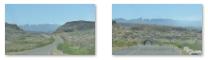
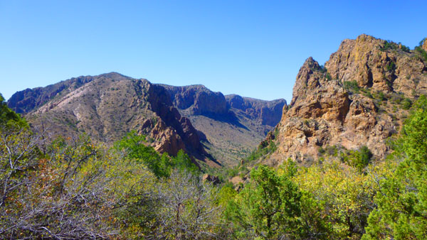
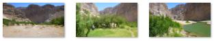
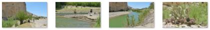
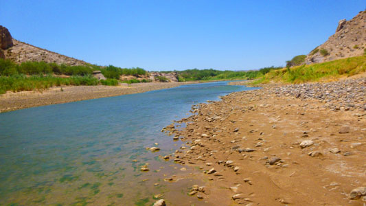
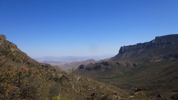
The scenery on the way down to Boquillas Canyon was typical of the Chihuahuan Desert. This ecosystem forms the largest portion of the park; only the Chisos Basin is a different type of terrain. The Chihuahuan Desert is basically dry; the only vegetation to speak of is along the Rio Grande. There is low scrub, but little else. Here are some views of the scenery along the park road down to Boquillas Canyon:
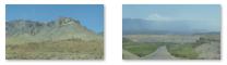
(Click Thumbnails to View) |
Hiking in Boquillas Canyon
|
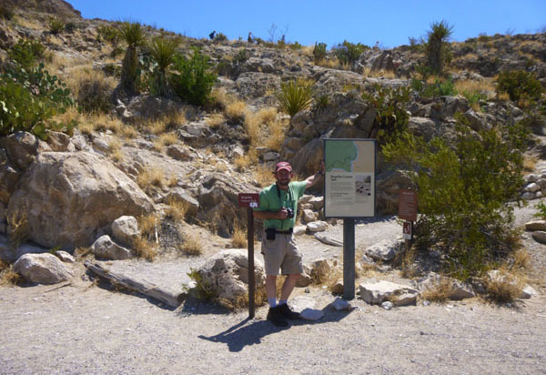 At the Boquillas Canyon Trailhead |
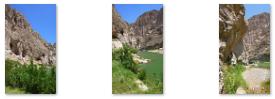
From the trailhead parking area, all eight of us headed up the trail; it ascended quickly via a series of switchbacks to the top of a rock outcrop, and from there I got my first view looking back down at the parking area. There was a spot here to rest and catch one's breath and then we continued along the trail that crossed the top of the outcrop. Fred and I let the others go on while we walked south to the crest of the outcrop where we got our first beautiful views of the Rio Grande.
|
 (Click Thumbnails to View) |
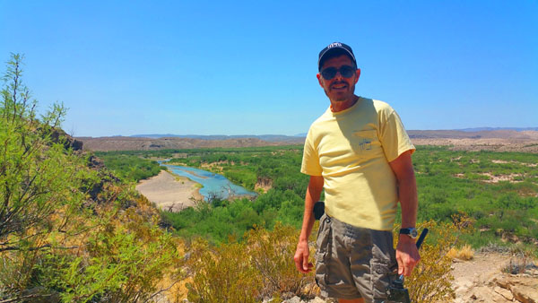
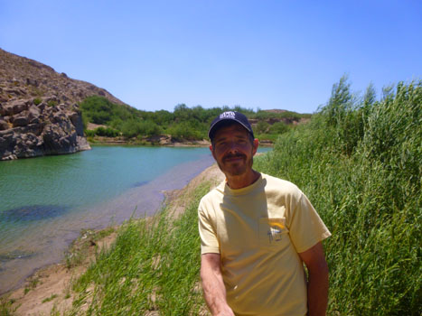
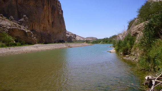
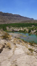
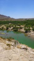
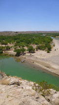
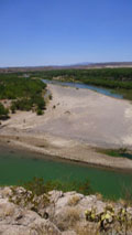
The Rio Grande/RÝo Bravo, one of the park's most visited features, forms about a thousand miles of the boundary between the United States and Mexico; a bit over 100 miles of that boundary lies within Big Bend National Park.
The park was named after the area where there is a large bend in the river and, consequently, the Texas-Mexico border. The beginning of the boundary that lies within the park is at the point where the river enters the park from the west, flowing through Santa Elena Canyon on its way southeast.
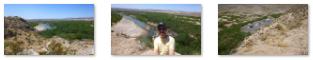
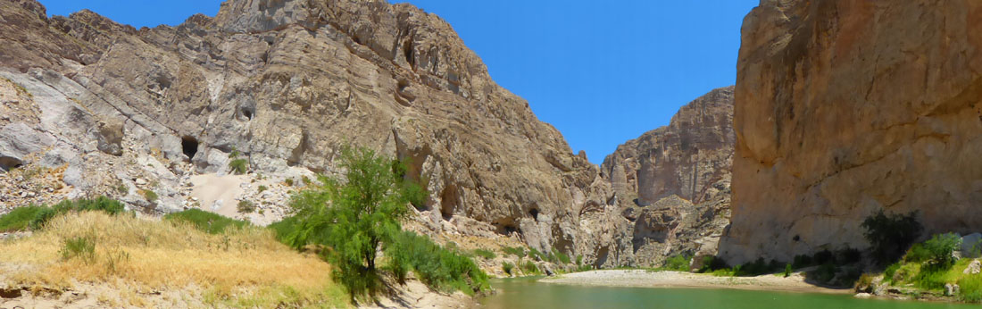
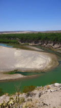
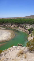
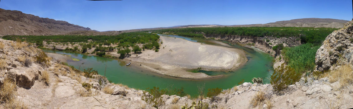
Then, for most of the park border, it flows between medium-sized hills and mountains, until it exits the park here at the eastern boundary at Boquillas Canyon. I took two separate series of individual pictures to create panoramic views from the promontory. The first one looks basically south:
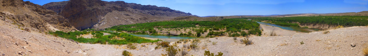 The South View from the Promontory of the Boquillas Canyon Trail |
You can see the river coming up from the south, making a sharp turn to the east, and then another sharp turn to the north to flow into Boquillas Canyon itself. Across the river is Mexico, of course.
|
Because the Rio Grande serves as an international boundary, the park faces unusual constraints while administering and enforcing park rules, regulations, and policies. In accordance with the Treaty of Guadalupe Hidalgo, the park's territory extends only to the center of the deepest river channel as the river flowed in 1848. The rest of the land south of that channel, and the river, lies within Mexican territory. The park is bordered by the protected areas of Parque Nacional Ca˝on de Santa Elena and Maderas del Carmen in Mexico. Even so, the Rio Grande is so shallow in many spots the one can easily wade across, and so I can only imagine that border-jumpers are frequent.
The 118 miles of the Rio Grande that form the southern park boundary include the spectacular canyons of Santa Elena (which we will visit tomorrow) on the west, Mariscal on the south, and Boquillas here in the east. The Rio Grande, which in Big Bend is meandering through the Chihuahuan Desert, has cut deep canyons with nearly vertical walls through three uplifts made primarily of limestone. Throughout the open desert areas, the highly productive Rio Grande riparian zone includes numerous plant and animal species and significant cultural resources. The vegetative belt extends into the desert along creeks and arroyos.
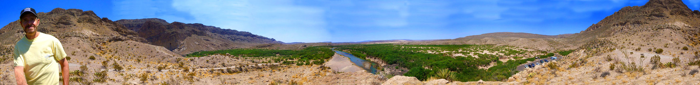
Before we left the promontory to follow everyone else down the other side of this rocky crest, I thought I would try one more panorama- this one a 360° effort beginning with the mountains behind me to the north and then panning around all the way through the east, south and west. I think it turned out rather well, and it is in the scrollable window below:
 |
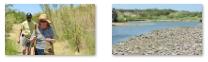
While is was doing my 360° panorama, Fred had gone on back to the trail and was catching up to Karl, Nancy and Prudence, who were hiking together. I think that Ron, Mike and Vickie had gone on ahead of them. I could just barely see the group down below me, and I lit out across country (eschewing the trail) to catch up with them. Fred was up with them, and he took a picture of Karl, Prudence and Nancy as they were coming to the bottom of the descent from the promontory. Here, Fred got a picture of Prudence picking out a walking stick from an array of them for sale. The woman who left them there (who we ran across later) did so on the honor system; customers were just supposed to leave $10 for each stick they took. I was still a good deal above the group, but I got another picture of them as they were heading off on the level portion of the hike along the river to the north. You can see that picture here.
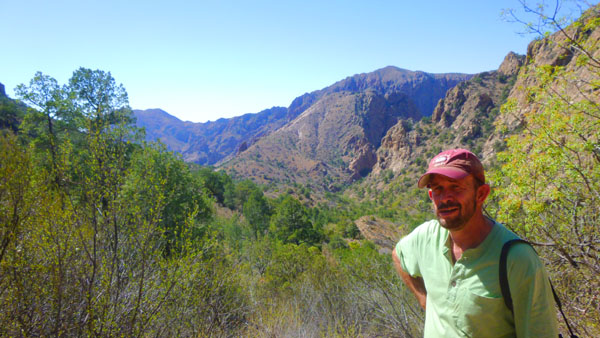
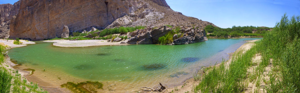
Frop the top of the outcrop, the remainder of the trail is easy as it descends to follow the river on fairly level ground. We walked through some tall grasses and along a sandy path for a while until we came along beside the Rio Grande itself. I'd been here before, the the others were impressed not by how wide the river was, but rather by how narrow it was. I left the sandy path for a time and walked down to the shore of the river, where I created a panoramic view of the river flowing from the Chihuahuan Desert, past me, and into Boquillas Canyon:
 |
Then I went back to join our group as we continued walking north along the trail towards the canyon itself. As we got closer into the canyon, it got a bit cooler, although it was still quite warm. At times the trail is open and sandy, but at other times you have to walk through some groves of bamboo-like reeds, almost a forest.
|
As we were walking along, I made a movie (trying to be a bit funny). It's not especially good, but it will give you a good idea of what this part of the trail was like. We also took a few pictures along the trail here:
  (Click Thumbnails to View) |
At another point, I took my selfie stick back down to the river's edge to get a couple of views looking upriver and down:
 Upriver |
 Downriver |
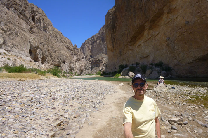
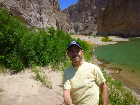
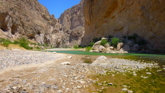
Soon, we were entering Boquillas Canyon proper. Although there was still a good deal of flat ground to hike on, the canyon walls were closing in on either side. On the Mexico side, they rose right out of the water with only a narrow sandbar at the base, but on our side, the flat ground was only now narrowing. With Ron in that picture, you can get some perspective on just how high the canyon walls are here. I would estimate that the walls are between 700 and 1000 feet high, much of that a sheer cliff face.
|
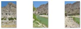  (Click Thumbnails to View) |
In Boquillas Canyon there was a trail and maybe a hundred feet of fairly level ground, sloping up to the canyon walls on our side. On the Mexican side of the river, there was almost no land at all- just sheer cliffs dropping right down into the water. Fred did one of his panoramic shots from here:
 |
For my part, I didn't quite follow the trail, but instead went down as close as I could get to the river to walk along it. When I got to a place that I thought would offer a good perspective, I stopped to make a movie.
|
Still, if the jumpers planned ahead and were in good shape and very motivated, it is hard to see how the flow of aliens could be stopped. After all, back atop the promontory we were looking down across the river a the Mexican side, and there were a half-dozen Mexicans down there with some horses and a small boat; everyone else thought that they were there to ferry tourists to the other side for a little while (for a fee, of course). But maybe they were just camping in the Mexican version of a national park that lies across the river at this point.
It was really interesting being down here by the Rio Grande in the stark beauty of Boquillas Canyon; one usually thinks of the Rio Grande being a major river, but it turns out that at least here, it is really kind of small. But it is pretty- especially set against the rocky canyon.
|
I walked further on into the canyon until I reached a point where I had to get up above the river itself, at which point I had an even better view into Boquillas Canyon. From that point, the trail continued forward, although it narrowed continually.
Here are some of the views ahead as I walked beyond where Ron and Mike had stopped:
 (Click Thumbnails to View) |
There was much less vegetation across the river, and up above me on my side of the river I could see the little cave and the sand dune that Frank, Joe, Fred and I had climbed when we were here in 1993. Frank, Joe and Fred walked directly up through the sand, but I climbed up the rocks that you can see to the left of the dune in this picture of the cliff face. There were a couple of places along the trail I was following where I could get back down to the level of the river, and I took a couple of other pictures from that vantage point, both looking upriver and out of Boquillas Canyon:
 |
 |
I went as far as I could along the trail, until it basically petered out as the US-side cliffs came right down into the water, and then turned around to head back to catch up with everyone else, already making their way out of the canyon. I took a couple more pictures before I caught up with them.
 Looking North Into Boquillas Canyon |
 Looking South Out of Boquillas Canyon |
I finally did catch up with the other folks. Actually, Ron and Mike had gone ahead back to the vehicles, Prudence, Karl, Vickie and Fred were a bit further ahead, and Nancy was bringing up the rear (except for me).
|
As I was walking along with Nancy, we got back on level, sandy ground, and I got out my selfie stick so I could make a movie of her and I walking along.
When we got back to the base of the promontory, Prudence, Karl and Fred were there, so I left Nancy to walk with them and I left the trail and climbed up around the south face of the promontory to get back up to the top to investigate some man-made pestles in the rock that I had seen when I was up there before. On the way up to the top, I took a series of three pictures as I got higher and higher:
 (Click Thumbnails to View) |
At the top, I thought I would try my hand at another panoramic picture, like the one I made on the way into the canyon. But this time, I would stitch together nine vertical pictures, to get more of the sweep of the river below me. I did take those pictures, and they did stitch together nicely. I was going to just put that panorama into a scrollable window, but then I got to thinking that you might be interested in seeing the original nine pictures from which the panorama was constructed. So below are the nine separate pictures:
 |
 |
 |
 |
 |
 |
 |
 |
 |
And here is the resulting panorama:
It is always interesting to me to try to put pictures together like this. I have two software packages that will do it, but the free one from Microsoft does the best job, particularly when perspective and lighting changes are involved. Here, where the lighting in each pictures was identical (the sun basically being directly overhead), either one would have worked, but I liked Microsoft's treatment a bit better.
Done with the panorama, I heard Fred calling out to me, and I turned to find Vickie sitting on a boulder, with Nancy, Prudence and Karl nearby and Fred calling to me. Fred motioned for me to come down there, and when I did, I found that Vickie had gotten too much heat and too much exertion. She needed some water, and I volunteered to go back down to the vehicles where Ron and Mike were to get some. I called on the way down, hoping they would hear me and meet me halfway, but they didn't. I myself was pretty exhausted when I got the couple of bottles of Gatorade that Mike had given me up to Vickie.
|
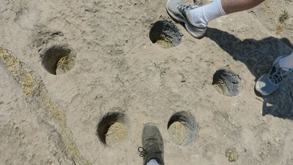
Fred and I went back up on top of the promontory to investigate the mortar holes, and we took a few pictures of them (in addition to the one at left):
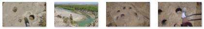 (Click Thumbnails to View) |
The mortar holes were interesting, and we found out later that they have been discovered throughout the park, but mostly near water sources or other places where early Americans may have set up camp.
After a few minutes, Fred and I headed off to catch up with Nancy and Karl, and we basically all got back to the cars at about the same time. The hike into Boquillas Canyon was neat- even better than I had remembered it. And Fred and I were impressed (not for the first time on this trip, as it turned out) just how much walking and climbing and hiking our friends were capable of.
Lunch in the Chisos Basin
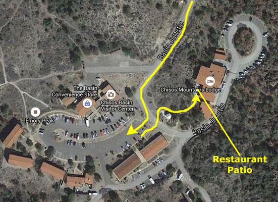
|
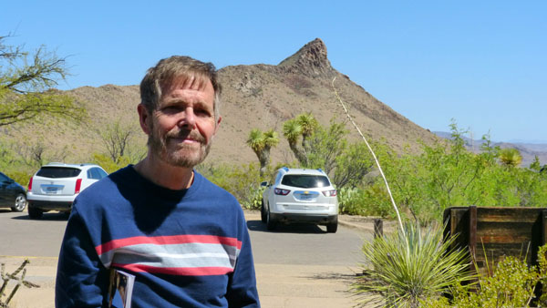
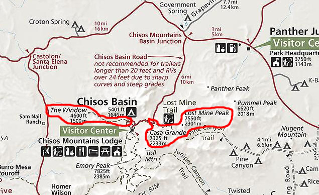
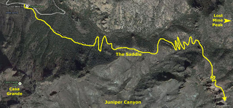
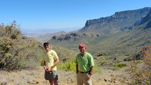
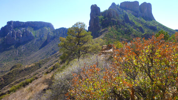
But then we all headed down the Chisos Basin Road. On the diagram, I marked a couple of hikes that I thought we might do after our late lunch- The Windows Trail and The Lost Mine Trail. I thought we might discuss these potential hikes while we had some lunch at the Chisos Mountain Lodge.
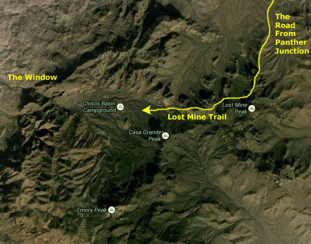
The seven-mile drive into the basin takes about twenty minutes, as the road is fairly winding as it ascends over the Chisos Mountains and then descends into the Basin itself. About a half hour after turning off the park road we were parking near the Lodge. The Chisos Basin is essentially a valley, and the Chisos Mountains basically form a ring around it.
|
 |
The Window is a notch in this ring of mountains, and it is essentially the "drain" for the valley, as such water that flows out of it (not much, except in a very rainy season every few years) goes through this notch and pours down into the Chihuahuan Desert below.
|
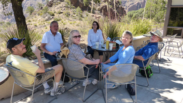
We discussed doing the hike to The Window (that picture was taken from the restaurant patio using Fred's incredible zoom lens), but the park brochure said it would be a 3-hour endeavor- easy on the way out but harder coming back uphill. The consensus was that few of us felt up for it. Fred and I had done it before, and would have done it again had the group wanted to. Another consideration was the fact that Mike had gotten us tickets to this evening's Star Party at the McDonald Observatory, and counting the time we'd need to return to Marathon, get cleaned up, have dinner and get to the observatory (about sixty miles from Marathon), this left only a couple of hours for more hiking here in the Basin.
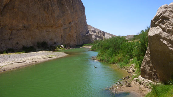
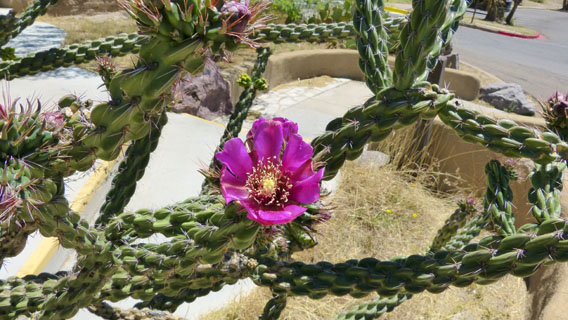
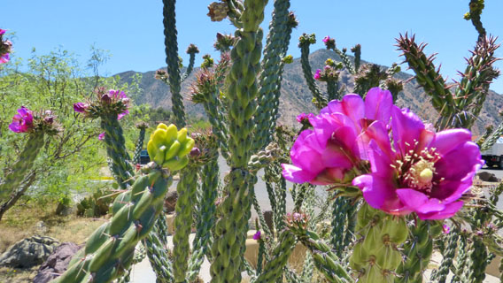
Fred and I also suggested the Lost Mine Trail, but we had to nix that idea, too, for the same basic reasons. Again, Fred and I had done it before and so weren't disappointed about not being able to do it again. Mike wanted to do some more hiking, but he recognized that we only had an hour or so for it. Those decisions made, we continued our leisurely lunch. The weather was perfect- warm, but not too hot- and we enjoyed our lunch and conversation. Fred also found some cactus in bloom, and took a couple of pictures.
 |
 |
When we finished our lunch, Mike again rode with us. He had been talking with Fred and I and we decided that the three of us would stop on the way out of the basin at the Lost Mine Trailhead and spend one hour getting as far up the trail as we could. We told the other folks that we would see them back in Marathon, and both vehicles started off out of the Basin.
A Short Hike on the Lost Mine Trail
|
Many hikers go only a mile in where there is a significant payoff in the views of Casa Grande and Juniper Canyon from a saddle ridge. The remainder of the trail climbs steeply in and out of juniper, oak, and pine forest. The trail abruptly levels out at the ridge with superb views of Pine Canyon and the Sierra del Carmen in Mexico.
Since we only had an hour or so for our hike, in and back, we took Mike up to the Saddle to show him some of those amazing views.
We left the Lodge before the vehicle that Karl was driving, and we had parked at the Lost Mine Trailhead and gotten up on the trail before he went by us, so we did not see them again until we returned to Marathon.
|
Mike wondered aloud as we started out why Lost Mine Peak has its name. I recalled that we had that same discussion back in 1993 with Frank and Joe, and that I'd done some research once we returned to uncover the whole story. Stories that are two centuries old and involve four differrent cultures- Indian, Spanish, Mexican and American- have circulated forever; they talk of lost mines and buried treasure in the Chisos. Though historians may dismiss these stories as legend, documented history does hold suggestions that the eponymous mine may well have existed.
The hike starts out fairly easy, and there is a self-guiding nature trail included. Fred has taken one of the guidebooks and is reading to us at the various stops along the nature trail. We have seen much Mexican pinyon pine, one of the most common evergreen trees in the mountains. Both animals and man have gathered and eaten the pine nuts produced by this tree. There are many plant-eating mammals, such as rodents, and of course a whole population of meat-eating mammals that feed on them, including the ring tail fox, the gray fox and the cougar.
The trail starts out through a montane woodland of species generally only found in Mexico, but whose range just crosses the border in Big Bend and perhaps a couple of other mountains in West Texas. These include Mexican pinyon pine, and the weeping juniper, and the red peeling bark of the Texas madrone. In the case of the first two, the Chisos are the only place in the U.S. to see them. Other common species on this trail include Alligator juniper, evergreen sumac, and a variety of scrubby oak species, including Emory oak and Chisos red oak. In the understory are agave, yucca, sotol, and cactus species- and some of that cactus was blooming.
The Lost Chisos Mine and the trail named for it are so popular in the Big Bend that the National Park Service sanitized one version of the legend:
| "Of many romantic legends which abound throughout the West, few match the lost mine story from which Lost Mine Peak takes its name. Is it true? Did the mine exist? Or was it a camp-fire fabrication handed down from generation to generation? It is true that early Spanish explorers of the Southwest discovered and developed many mines, some yielding silver and gold. According to legend, a rich ore body was discovered near the summit of Lost Mine Peak. Prisoners were forced to work the mine. These men were blindfolded on several occasions, in their march from Presidio San Vicente, to prevent them from learning its location. (The ruins of this presidio are about 20 miles southeast of this peak.) The story relates how Indians who resented the Spaniards' invasion of their homelands, attacked and killed them to the last man. The final act, according to the story, was to seal the mine entrance to prevent further exploration. The legend states, however, that if a man stood in the door of the chapel at Presidio San Vicente on Easter morning, he would see the sun's first rays strike Lost Mine Peak at the exact mine entrance. (It's not necessary to point out that Easter is floating holiday, and that the sun wouldn't always be in the same position on that day; the church no longer exists, and so there is no door in which some modern-day treasure hunter could stand." |
|
|
There was a lot of juniper around, including alligator juniper, so named because its bark resembles the hide of an alligator. The juniper berries (actually small cones with tightly compressed overlapping scales) are eaten by many birds and mammals.
There were several oak species here as well. The oaks of the Chisos Mountains are very difficult to identify because of the great variability of leaf size and shape, even on the same tree. They also hybridize, producing trees with intermediate characteristics. Many of them produce edible acorns for the wildlife, and they are the prime ingredient in the Fall color within the park.
The trip up to the saddle ridge is a bit over a mile, and it took us just under half an hour to get up there. We knew that going down would be a lot faster than going up, so we would have some time to spend on the saddle ridge. That's good, because there were amazing views from there.
|
About one hundred and twenty-five million years ago, the park area was beneath a vast inland sea. The sediments of silt, sand, and seashells became compacted and hardened into layers of sandstone and limestone. These were later elevated above sea level by the tremendous stresses and pressures which occur within the earth's crust. Slowly, over millions of years, this vast surface fractured into great blocks. Some of these were elevated into mountains and ridges while low blocks in between became valleys.
Juniper Canyon and other formations were built by great dome-shaped masses of molten rock moving towards the earth's surface. In some places, like Casa Grande, the lava breached the surface and flowed over the land. In other places, like Lost Mine Peak and Pulliam Peak, the lava cooled beneath the surface. The Peregrine Falcon, and endangered bird, uses some of these cliffs during nesting, which is why you aren't allowed to hike up Casa Grande from February through July.
|
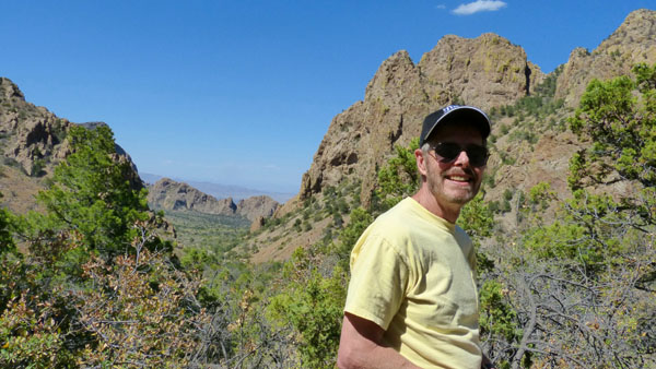
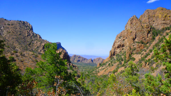
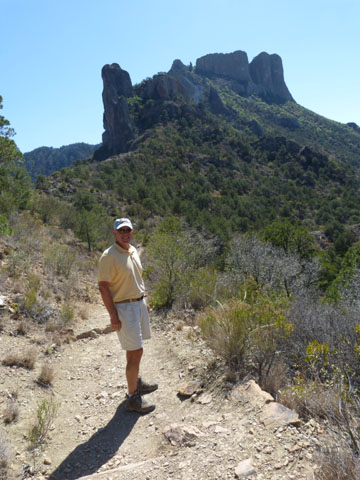
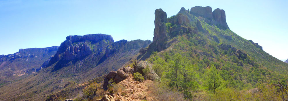
You might wonder where Lost Mine Peak actually is; in fact, it is east of where we are standing (behind Fred). The Lost Mine Trail doesn't actually go to the top of that peak. The trail works its way along the saddle for a ways and then begins a long series of fairly steep switchbacks as it climbs the slopes of Lost Mine Peak. Eventually, the trail comes out on an open rock outcrop from which there are spectacular views of Juniper Canyon and, across the canyon, Casa Grande. Lost Mine Peak is behind and above.
From our vantage point here on the saddle, we could of course look past Casa Grande to the south and down into Juniper Canyon but also across the north slope of Casa Grande in the general direction of the Basin. As we are facing back towards the campground here on the ridge line, notice that the north slope of Casa Grande is densely covered with Mexican pinyon pine, juniper and other trees of the Chisos woodland community; the slope facing Juniper Canyon has very few trees. That slope is covered instead with such desert plants as ocotillo and lechuguilla. The reason for this, of course, is that the south side of Casa Grande gets the full sun most of the year, and so it is hotter and drier. The north side is in shade much of the time, and also receives the weather that moves from the northwest during the year, getting first dibs on the rain that falls.
We have been passing many varieties of cactus on our hike so far. Common among them is the lechuguilla, which is closely related to the century plant. The Agave, or century plant, spends its entire life, ten to twenty years, manufacturing and storing nutrition in roots and leaves. In its final year of life, the plant uses this energy to grow a great flowering stalk which may grow as much as twelve inches in one day. After seeds have matured, the plant dies.
We had spent twenty minutes or so here on the saddle; the views were tremendous and it was hard to tear ourselves away. But we were enjoying ourselves in the afternoon sun, just taking in the vistas around us:
 Juniper Canyon This view looks almost directly south down into that canyon- the southern slopes of the Chisos Mountains. |
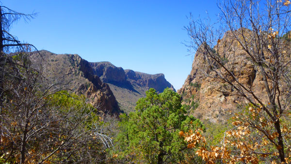
 Casa Grande This view has both Casa Grande and Emory Peak, and looks generally southwest. You can see the Casa Grande Trail. |
Before we turned to head back down the trail, I created two panoramic shots. One I let my little camera do; it is essentially a wider view of Emory Peak and Casa Grande:
 |
The other panorama was more ambitious, and is the merger of nine different photographs. It is a 360° view; since Lost Mine Peak is directly behind me, its slopes are at the extreme left and extreme right of this view. The view is so wide that for you to see much detail I had to put it in a scrollable window:
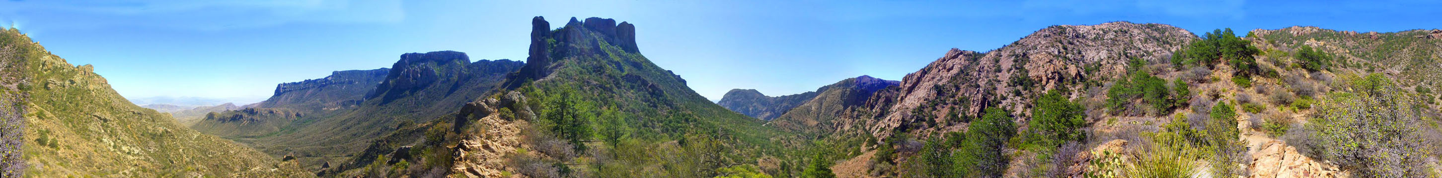 |
We really didn't want to go, but we had places to be and people to meet. We were back at the car in 20 minutes or so and heading back north out of the park and on to Marathon, which we reached a bit over an hour later.
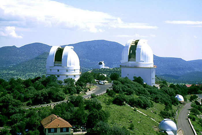
Dinner in Alpine/The Star Party at McDonald Observatory
|
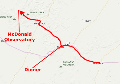 |
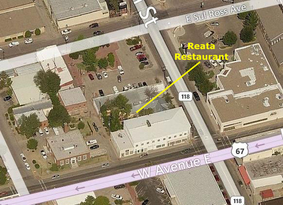
Ron and Prudence used to eat at the Reata Restaurant in Fort Worth frequently, before they both moved to San Antonio. I did not know that it was actually the second Reata, the first one being here in Alpine.
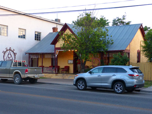 The Reata Restaurant |
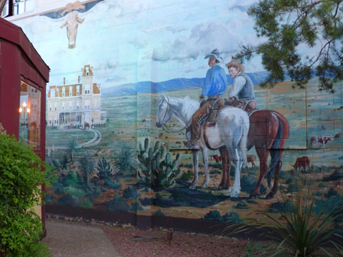 Patio Mural at the Reata |
We were having dinner at the original Reata Restaurant, nestled in the southern end of the Davis Mountains in west Texas where, according to the Reata website, is where their "legendary cuisine" was born. Again according to their website, the "Reata Alpine has been providing fine dining to residents and visitors of the Big Bend for nearly two decades".
|
Now, these folks, and others whom they might have told about the reataurant, go out of their way to come to Alpine to eat here. These diners include people like us- guests at the famed Gage hotel- as well as wedding parties from Marathon and Fort Davis make the drive to Alpine to enjoy what the Reata styles "sophisticated cowboy cooking cuisine".
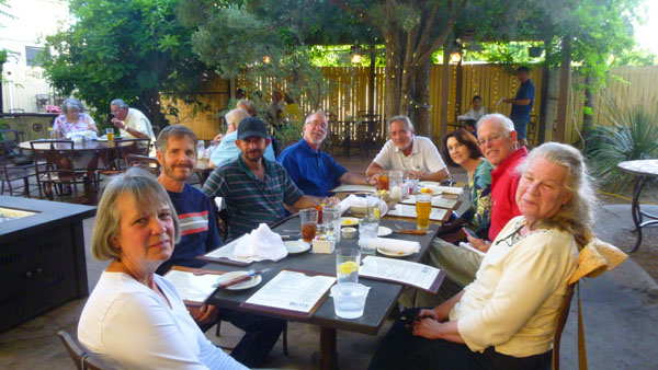
I remember eating at the Reata in Fort Worth, and it was always good, and the dinner this evening was no exception. I am not a foodie, though, and no matter where I eat I tend to choose simple, familiar dishes, as I did this evening. Everyone else also enjoyed their meal, but for me it was the setting that was unique- out here on an enclosed patio.
After dinner, we headed off to drive through Alpine and on northwest to the McDonald Observatory and this evening's Star Party.
|
The 2-hour Star Party program is very much a family affair, and offers visitors an educational opportunity. The parties have become so popular that what used to be an open-ended affair in terms of attendance has now become a reservation only event. There are only a limited number of spaces available each evening, and reservations must often be made weeks in advance- as Mike and Vickie did.
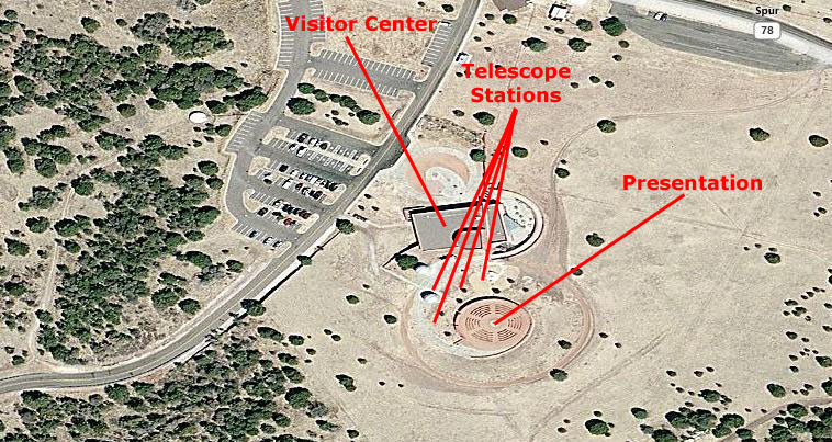
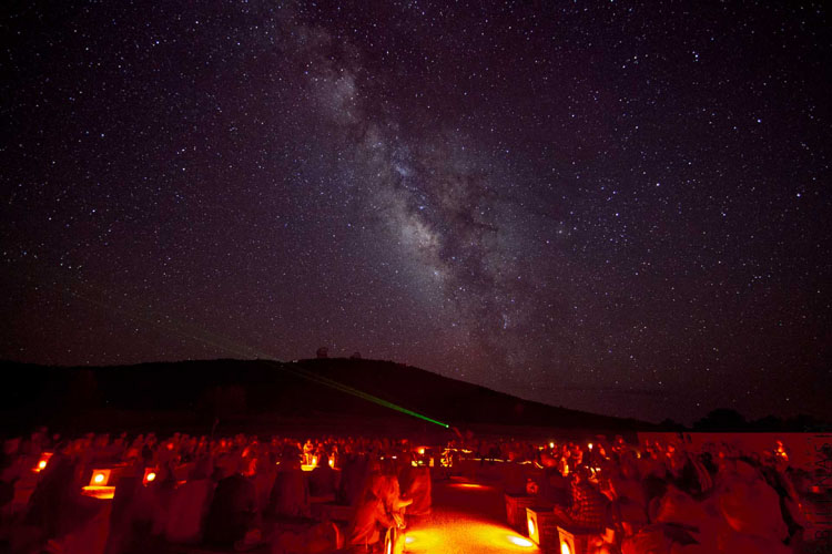
The Observatory's climate offers us a high percentage of clear nights so, in general, most of the Star Parties occur on a clear evening, and ours was no exception. Our program began in the outdoor Amphitheater at the Visitors Center where we got a short introduction to the program; one of the admonitions was the restriction on the use of various light sources such as camera screens and camera flash, as these affect the dark adaptation process of the human eye and thus the enjoyment of views of the night sky. This meant that neither Fred nor I would be able to take any photographs, although Fred did try a couple without his flash and with turning off his LED screen. Neither turned out, and so there won't be any of our own photographs in this section on the Star Party. I will include two official photographs taken by McDonald Observatory folks, however.
|
It seems to have been taken from the rooftop of the visitor center, because the amphitheatre was uphill from the center, and the only way to get a photograph looking slightly down would be from that roof.
In the picture, you can't quite make out all the people sitting in the pie-shaped seating sections, nor can you see the astronomer who was conducting the session. You can, however, see the powerful laser light that he was using to point out various stars and constellations. Using the pointer was very effective; one could always follow the beam of light to see the sky feature that he was talking about. This was particularly effective as he traced many of the familiar constellations (and some that were quite unfamiliar to most of us).
I wish that the Milky Way had been "up" on the night we visited. The astronomer pointed out that we were early in the season for it to be as visible at this time of night as you can see it is in the picture at right. It would have been quite a sight in the clear, dark West Texas sky- without almost any of the "light pollution" we have in cities.
Seated in the amphitheatre, then, we were led by the astronomer through a constellation tour in which he pointed out the brighter stars and many of the constellations, related some of the practical uses of the stars, talked about the mythology of some constellations, and told us about the scientific understanding of various patterns and objects in the night sky.
As the night sky slowly changes from week to week, month to month, season to season, so to do the constellation tours as some constellations fade from view in western twilight and others become visible in the east. These constellation tours serve as an orientation to the night sky and can help make the telescope viewing to follow more meaningful. However, guests are always welcome to skip the constellation tour if they prefer to move directly to telescope viewing following the introduction. At certain times, brighter twilight may mean that viewing some fainter objects may not be visible through the telescopes directly following the introduction.
|
We could move from telescope to telescope where different objects will be viewed in each telescope. Each station had a couple of observatory people manning the scope and talking with the people in line about what they would be seeing. We got the chance to actually view the celestial objects directly through these various telescopes with our eyes at the eyepiece- not on a screen (which is why issues regarding night-adaptation are so important).
The person manning the scope helped people in the viewing process and also made sure that the telescope stayed on target. After all, the earth is constantly in motion which means that objects would eventually move out of the telescope's field of view unless its position was constantly adjusted. At one station, we were among the last people to view one particular object before it moved too low in the sky for the telescope to be trained on it.
Waiting in line for the telescopes was made interesting in itself with the presence of someone to whom we could direct questions- and everybody always had some interesting ones to ask. I recall that I learned a lot I didn't know (which isn't all that unusual), and the questions and answers made it seem as if every line moved quickly.
We were fortunate that this evening was a good one for sky viewing. There were few, if any, clouds, and of course no inclement weather. But we did learn that bad viewing weather is unusual; that's one reason why the observatory was built here and not somewhere else. We spent all our time at the telescopes, although the Visitor Center was also open. There, they were offering virtual sky tours using sky simulation software, video/animations, and images from ground-based and space-based telescopes to demonstrations of the principles of the technique of spectroscopy which forms the basis of much of the research conducted at major research facilities like McDonald. One repeat visitor told me that when they were here on a cloudy night, and the only thing available were the indoor programs, that they felt they actually learned much more about astronomy and how astronomers know so much about the Universe.
We enjoyed the Star Party immensely, and want to thank Mike and Vickie profusely for putting it on our schedule. After about two hours, the party wound down and we caravaned back to Marathon and a well-deserved night of rest. Tomorrow, it will be back to Big Bend and a hike in Santa Elena Canyon.
You can use the links below to continue to another photo album page.
|
May 11, 2016: Big Bend: Santa Elena Canyon |
|
May 09, 2016: The Trip to Marathon, Texas |
|
Return to the Big Bend Trip Index |