|
May 12, 2016: Fort Davis |
|
May 10, 2016: Big Bend- Boquillas Canyon |
|
Return to the Big Bend Trip Index |
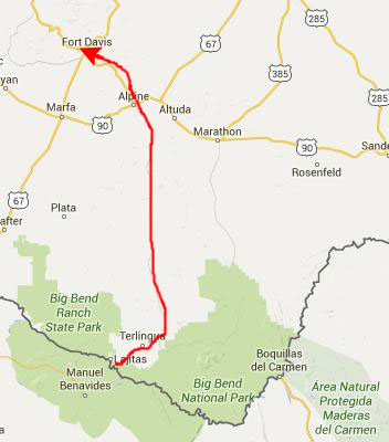
Today, we will be leaving the Gage Hotel and spending most of the day in Big Bend at Santa Elena Canyon. After that hike, we will drive to Fort Davis and the Indian Lodge in Fort Davis State Park.
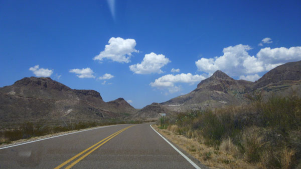
The Drive to Santa Elena Canyon
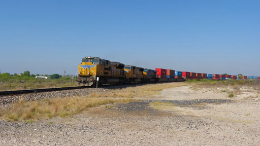 "The Train! The Train!" |
(Mouseover Image Above for Player Controls) |
|
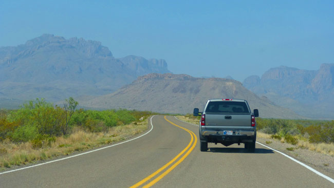
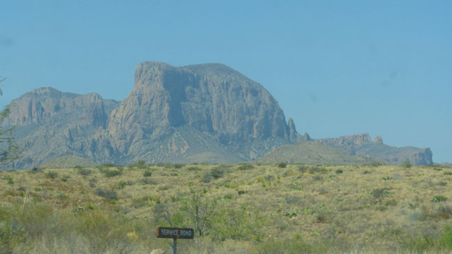
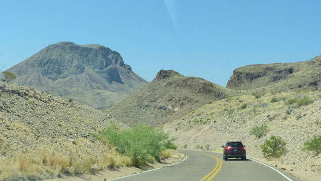
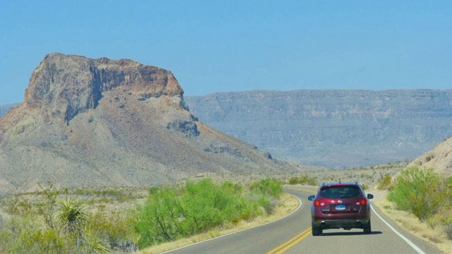
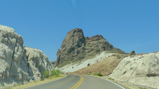
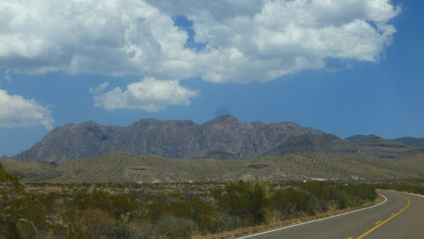
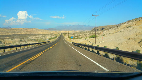
At Panther Junction, we stopped briefly, and then continued west this time on the park road, driving about ten miles and going past the road into the Chisos Basin where we'd been yesterday. Instead, we turned south on the Ross Maxwell Scenic Drive to first Castolon and then Santa Elena Canyon.
The total distance down to Santa Elena Canyon was about a hundred and ten miles- 70 from Marathon to Panther Junction, 10 to the Ross Maxwell Scenic Drive, 22 to Castolon and finally another eight to Santa Elena Canyon.
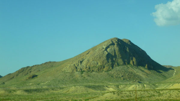
It was a nice drive down from Marathon. The weather, of course, was excellent- bright and sunny. The drawback, though, was that it was also quite warm, but that didn't really matter until we got out of the vehicles at Santa Elena Canyon and got ready for our hike. But hot weather is the price you pay for visiting Big Bend any time between May and September. As a matter of fact, the information below was taken from the Big Bend National Park website today, July 20, as I am creating this page:
 |
It was not nearly this hot when we visited in May, nor was there a water shortage at the time. But the second week in May was the latest in the Spring that we have ever visited Big Bend (and September has been the earliest in the Fall that we have been here).
|
|
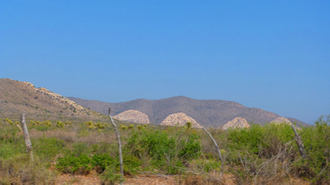
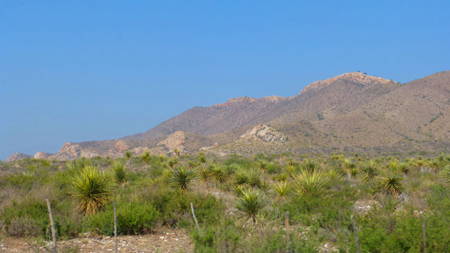
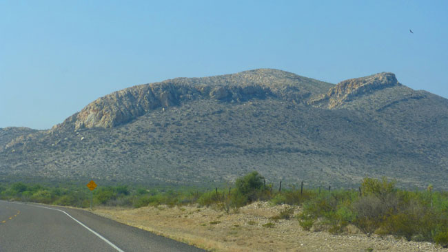
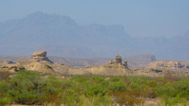
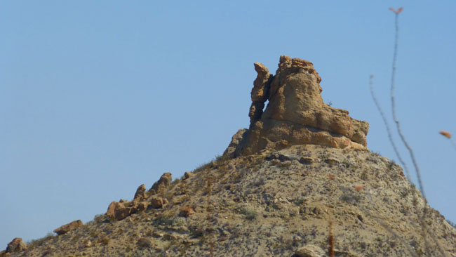
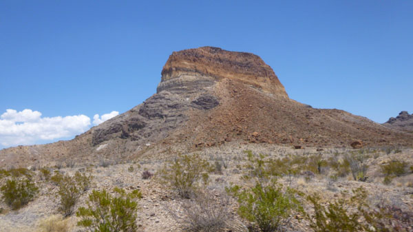
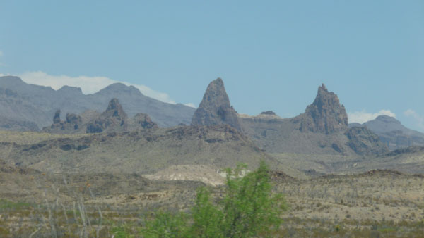
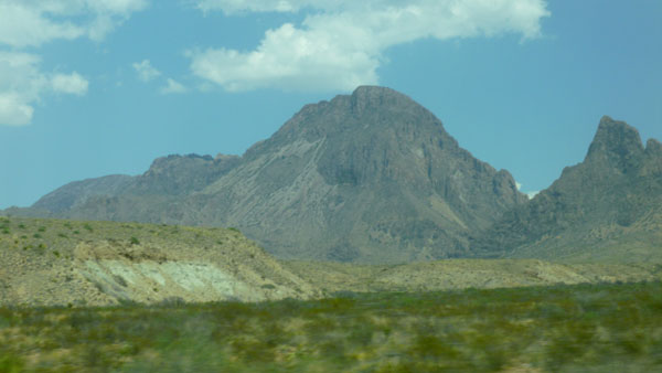
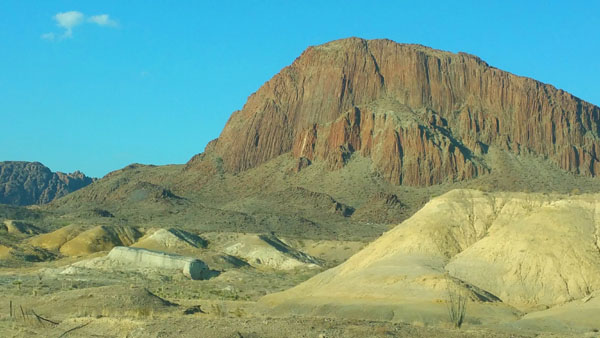
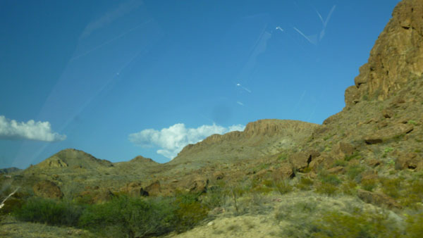
First, I want to include a selection of the best of the pictures that Fred took (about a third of the number) on the way from Marathon to Panther Junction.
Each of these pictures has something interesting about it, but I don't think they deserve a lot of commentary from me. So I have created a slide show that you can control, and it is at left. To move through the pictures, just click on the "forward" and "backward" arrows in the lower corners of each picture; you can track your progress through the show with the index numbers in the upper right corner of each image.
We hope you think the West Texas landscape as starkly beautiful as we do.
Our caravan stopped for a little while at the Panther Junction Visitor Center where we'd been yesterday. We thought it wise to stop here as facilities at Santa Elena Canyon are limited. Fred took a few pictures worth including here. The right-hand picture below is an outdoor sign about air quality here at Big Bend. You probably can't read it as it is, but if you will click on any area of the sign, I will pop up an enlargement for you.
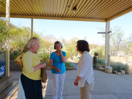 Nancy, Prudence and Vickie |
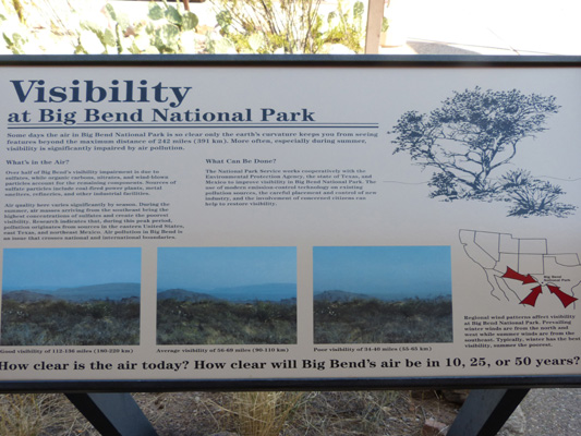 Air Quality in Big Bend |
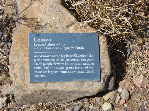 Figwort |
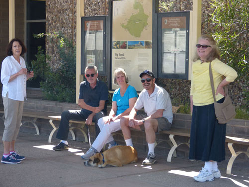 Vickie, Ron, Prudence, Jax, myself and Nancy |
In the right-hand picture, above, I might point out that I had to make an adjustment because one of the subjects wasn't "with the program" when Fred took the picture. Ron Ruckman will know who wasn't cooperating and just what the adjustment was.
|
|
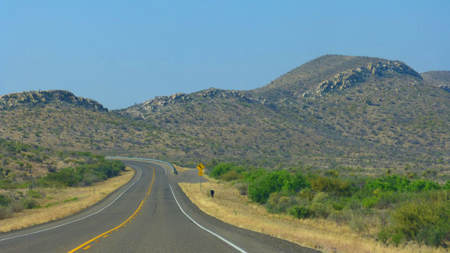
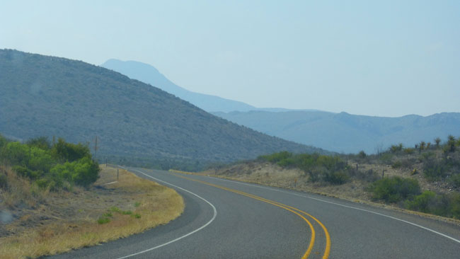
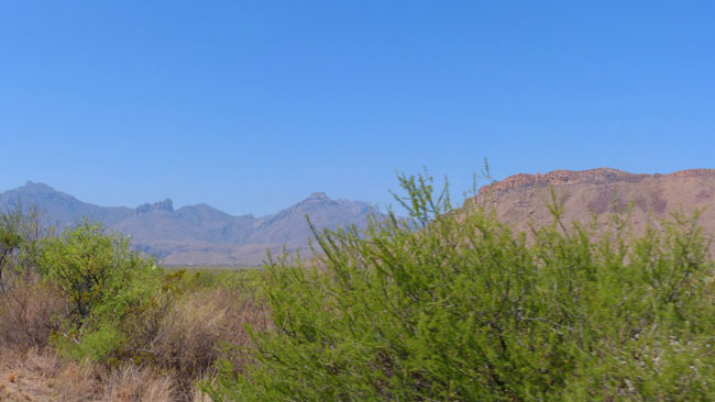
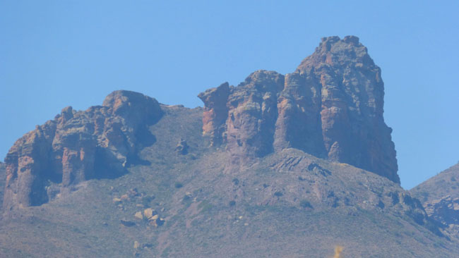
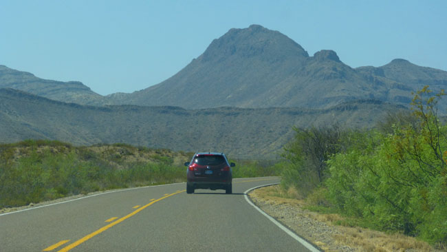
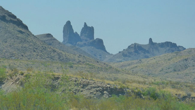
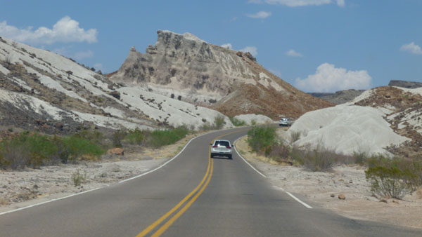
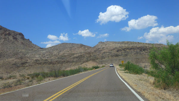
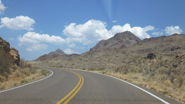
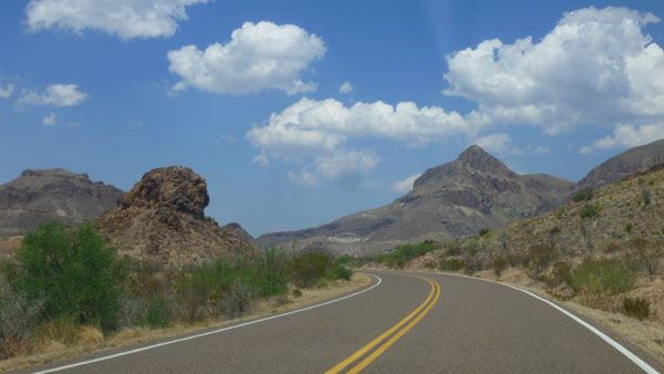
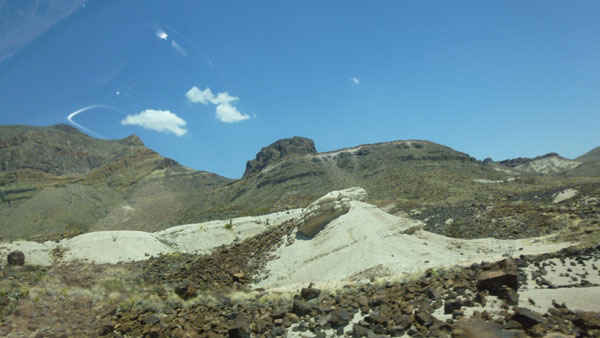
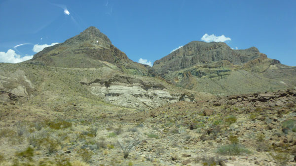
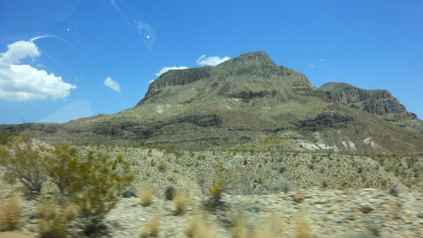
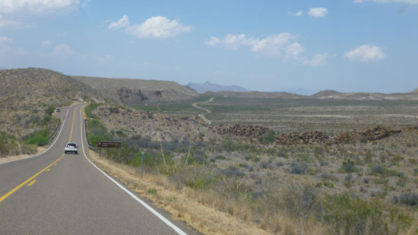
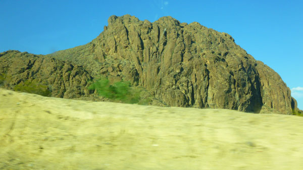
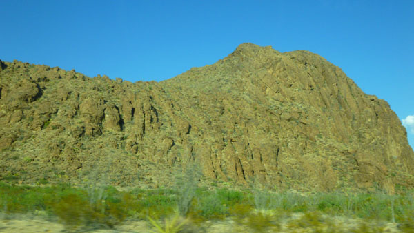
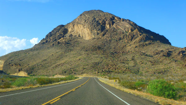
Again, since I am driving, Fred has been free to compose and take a number of pictures that will tell you why this is the Ross Maxwell Scenic Drive.
As I have done before, I have put some of the best of his pictures into a slideshow that you can control. That slideshow player is at left. To move through the pictures, just click on the "forward" or "backward" symbols in the lower corners of each picture. You can track your progress through the show with the index numbers in the upper left corner of each image.
Have a look at the pictures, and ride with us down to Santa Elena Canyon.
Our Hike Into Santa Elena Canyon
Across the Creek...
|
(Mouseover Image Above for Player Controls) |
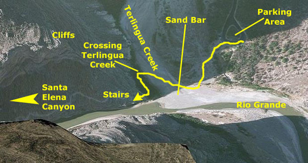
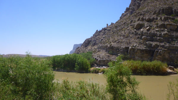
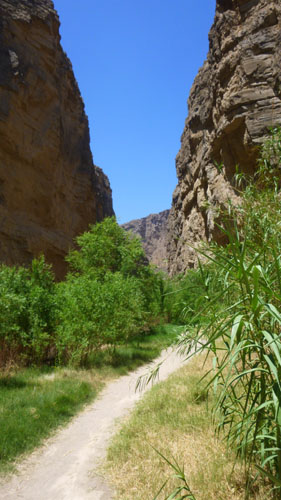
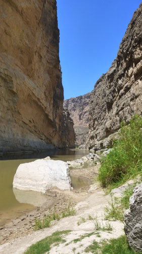
Across this sandy area, the trail goes down about six feet to a lower rocky/sandy area; this area is, in effect, a sand bar, created when Terlingua Creek floods. At the edge of the shallow drop off down, you get your first amazing view into Santa Elena Canyon. Here are a couple of pictures Fred took as we descended onto the sand bar:
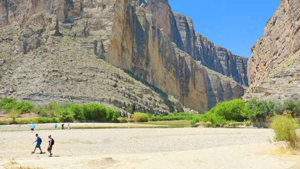 Looking Into Santa Elena Canyon |
 Looking South Along the Rio Grande |
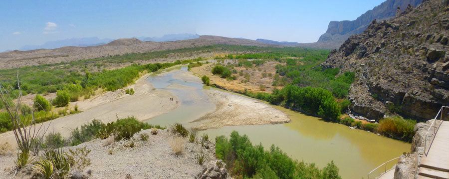
Standing down on the sand bar, I thought that this would be a good opportunity for another stitched-together panoramic view:
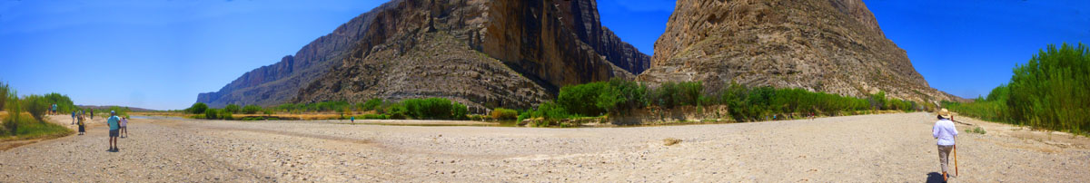 From South(L) to North at Santa Elena Canyon (six separate pictures) |
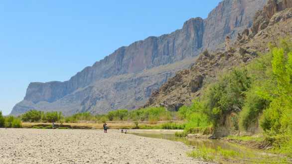
Fred was ahead of me and already on the other side of the sand bar, where Terlingua Creek ran along at the base of the cliffs. In this dry part of the year, the creek was only a few inches deep but four or five feet wide.
|
I found another place to cross and joined everyone up on the bank once we'd all gotten across.
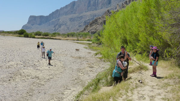
...and through the woods...
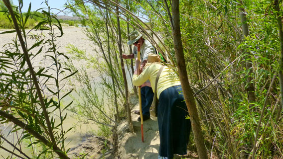 Karl Helping Nancy Through the 'Woods' Fred followed Karl and Nancy as they made their way along the trail through the small trees. |
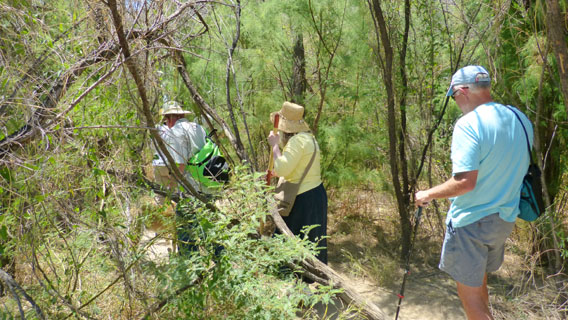 Vickie, Karl, Nancy and Mike on the 'Woods' Trail This was an interesting departure from the main trail, and we could tell lots of people used it. |
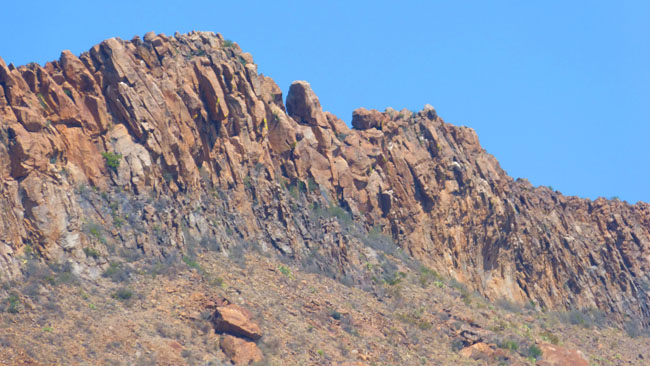
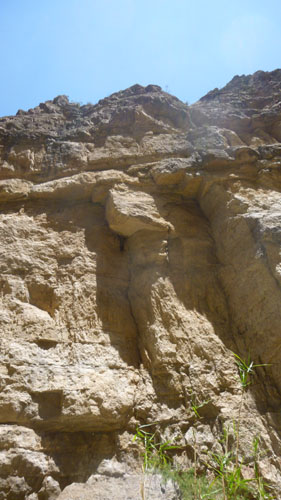
 The Geology of Santa Elena Canyon Fred found this rocky outcrop along the woodland trail, and it seemed to be full of mostly opaque quartz crystals- even though the crystals weren't well-formed. |
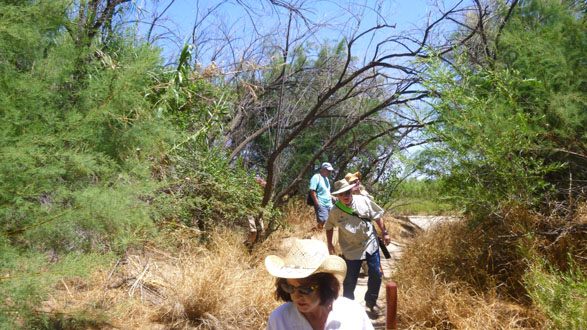 Coming Out of the Woods Onto the Main Trail I climbed up to the main trail to get ahead of everyone so I could take this picture of Vickie, Karl, Nancy and Mike as they approached the stairs. |
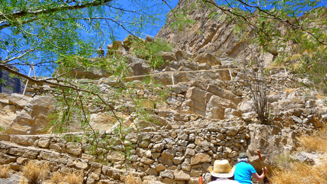
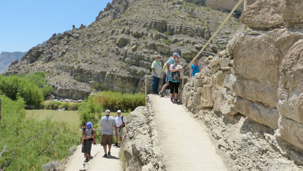
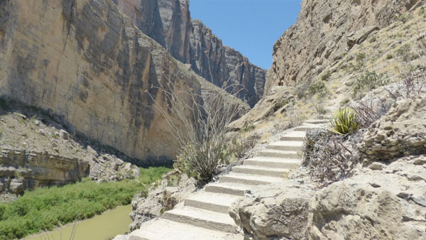
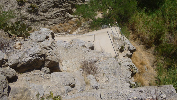
...and up the stairs...
|
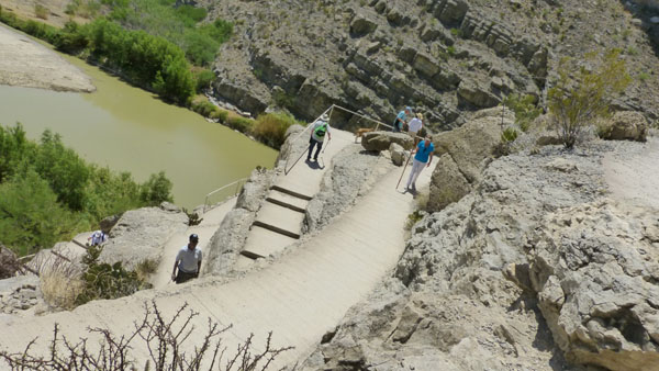
The trail began to ascend quickly along a straight series of stone steps that eventually ended right at the cliff face into which the paved staircase had been built.
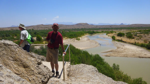
It was at the base of the paved steps that we got our first view into Santa Elena Canyon, and we could see where we were headed. I stopped at the base of the steps to take another picture looking directly up the paved staircase.
When we were all at the stairs, I didn't see Ruckman, but Prudence said that he had gone on ahead. Prudence might have stayed with him, but she had Jax with her and so could not move as fast. I have to say that I thought some of our group might not make it up to the vista point, but to their credit, everyone did.
|
|
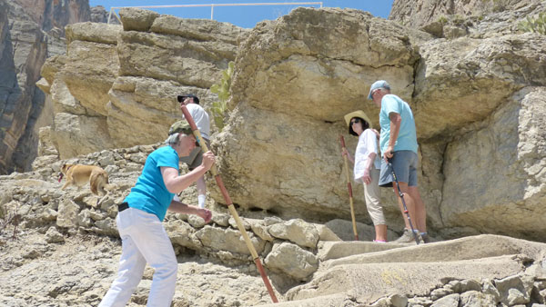
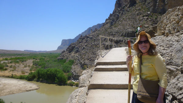
I took a couple of other pictures on the way up to the vista point that I didn't include in the slide show. In one of the pictures, taken about halfway up, you can see Mike, Vickie, Jax, Prudence, and Fred on their way up the stairs. At the next landing, I took another picture looking into Santa Elena Canyon.
It was getting pretty warm, so we took it slowly as we went up the stairs. Prudence also had Jax to contend with, although he was pretty good about getting up to the vista point.
...to the vista point.
|
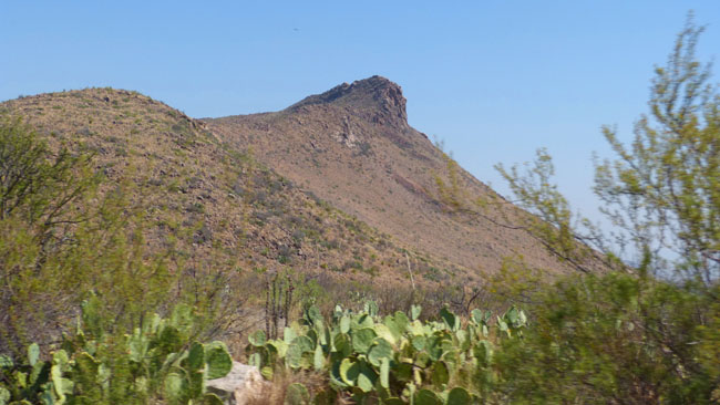
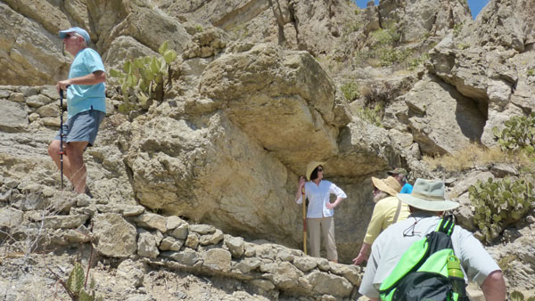
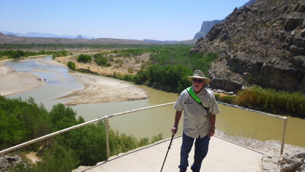
In addition to views out to the valley, there were, of course, nice views looking into Santa Elena Canyon. The views from here are often described as some of the grandest spectacles in the park.
Since Ruckman wasn't up here, Fred and I knew he had gone on along the trail into the canyon itself, and so we followed him on a hike that we had done once many years before. Mike stayed with Vickie for a while, and then came along a bit later on.
Into Santa Elena Canyon
|
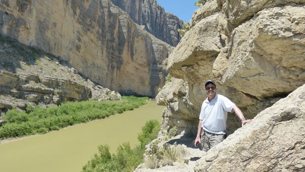
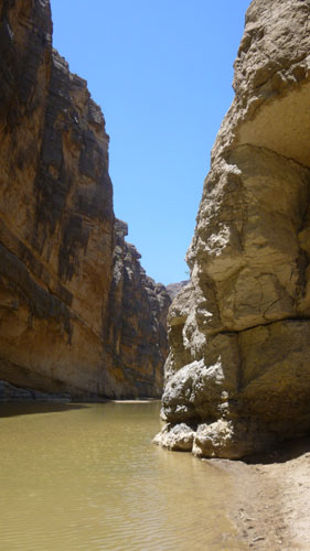
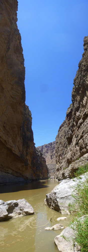
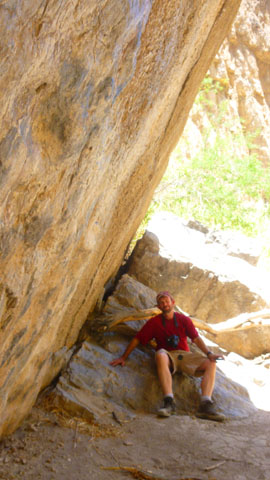
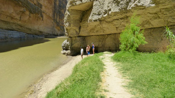
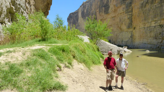
The trail into Santa Elena Canyon divides into two sections. In the first, one is descending from the vista point down to the level of the river, down to a large rock overhang that provides just about the only shade on the trail. That is where we found Ruckman waiting for us. The second part of the trail continues on the relatively flat ground beyond that resting place to come to an end at the point where the cliff meets the river and the flat, sandy trail and the vegetation come to an end.
As for the first second, ending with our meetup with Ruckman, here are some of the pictures Fred and I took:
(Click Thumbnails to View) |
When we met up with Ruckman, he was sitting under the rock overhang bemoaning the fact that he hadn't brought a cigar with him. I guess he thought it would have made a fitting reward for having hiked this far. He had already gone pretty much to the end of the trail, so after a few minutes he turned to head back, and we continued to the trail's end.
|
|
At one point along the trail, Fred stopped to make a movie of the canyon, and he happened to see someone wading out in the river. We would meet them at the end of the trail, but for now, have a look at his movie:
(Mouseover Image Above for Player Controls) |
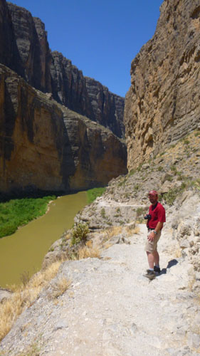
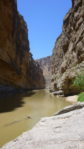
Walking along to the end of the trail was very enjoyable, and of course the canyon provided endless opportunities for pictures and just to crane your neck upwards at the 1500-foot cliffs.
|
 |
But it was the height that was so impressive, and landscapes just couldn't get it in. In the scrollable window at right, first scroll all the way to the bottom, and then slowly go upward to look at the vertical panorama I put together.
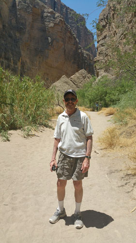
We continued to the end of the trail, as we had done once before many years ago, and at the end we found the couple that Fred had noticed when he made his movie. At their request, Fred and I took a couple of pictures of them, got their email address, and sent them off after we returned. At the end of the trail, they also returned the favor and took a picture of us:
 The End of the Santa Elena Canyon Trail |
 Fred and I At the End of the Trail |
The Walk Back to the Parking Area
 The Santa Elena Canyon Trail- Heading Out |
(Mouseover Image Above for Player Controls) |
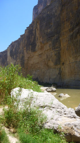
We ran into Mike back near the big overhang rock, and we relaxed there for a few minutes while he went quickly to see what the end of the trail was like. He told us that everyone else had just started back to the parking area.
|
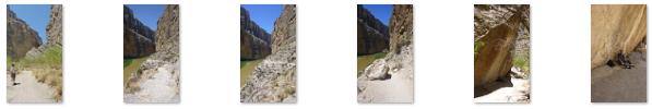
We took a few more pictures at the overhang and on the way back because we were seeing things from a different direction this time. I have weeded out most of the pictures that duplicate those we took coming in, and that left me with these pictures from our walk back:
(Click Thumbnails to View) |
We actually caught up with everyone as they were walking across the large sand bar, and we all were able to walk back together after that. Back at the vehicles, the first order of business was a cold drink, and we appropriated one of the picnic tables in the shade to sit, relax, and congratulate ourselves on a pretty neat hike. When we were entirely refreshed, we piled into the vehicles to head to the town of Terlingua, where we planned to have lunch.
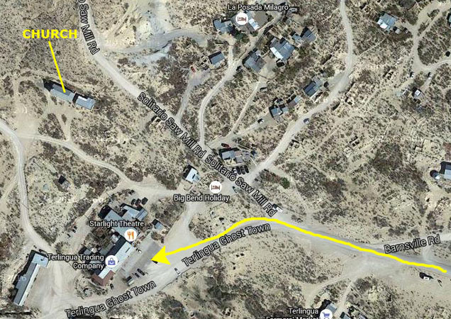
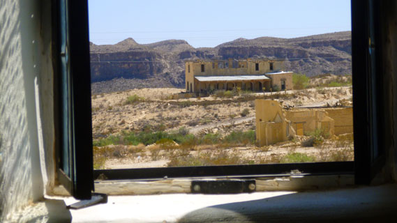
The Terlingua Ghost Town
|
|
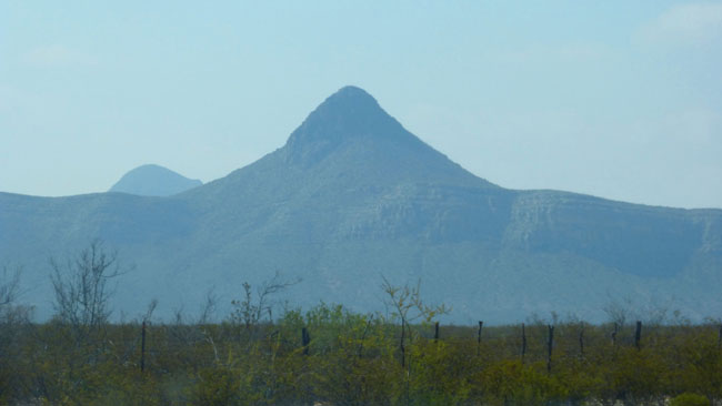
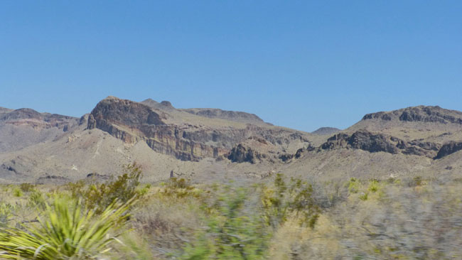
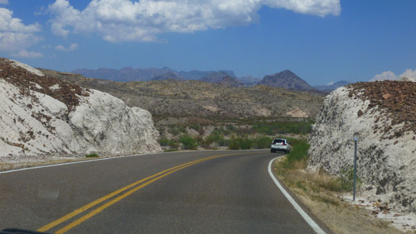
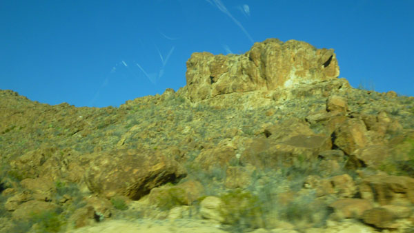
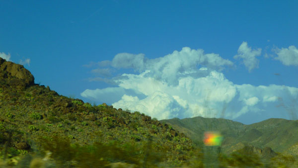
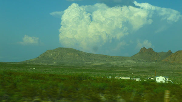
Since I was driving, and since Fred's camera batteries needed recharging, he used my camera to take more pictures out the car windows of the incredible scenery we passed in the park and on the way to Study Butte. As usual, I've chosen the best of these to put in the slide show at left, and you can go from one picture to the next by clicking on the arrows in the lower corners of each picture. The index numbers in the upper left of each image will tell you where you are in the show.
The drive to Study Butte was very scenic. I had seen signs for Study Butte on previous trips to the area, but Fred and I had not been here before. And there wasn't much "here" here; both town taken together have a current population of about 275. Neither town is even incorporated; each is simply a "CDP"- a "census designated place".
|
Facts concerning the discovery of cinnabar in the Terlingua area are so shrouded in legend and fabrication that it is impossible to cite the date and location of the first quicksilver recovery. Cinnabar was apparently known to Native Americans, who supposedly used its brilliant red color for pictographs.
A man named Jack Dawson reportedly produced the first mercury from Terlingua in 1888, but mining companies didn't arrive on the scene until the publication of his feat in industry magazines in the mid-1890s. By 1903, seven mining companies were at work, and thousands of flasks of mercury had been produced. A post office was established in 1889 at the California Mountain mining community. The origin of the name Terlingua may be a corruption of Tres Lenguas, in reference to an early mine or local feature. By 1903, 3000 people populated the area.
By 1887, a Chicago resident named Howard E. Perry had acquired four sections in Texas, as security on an unpaid debt. Perry was offered increasingly more money for his property which prompted him to hire the attorney Eugene Cartledge to investigate. Cartledge determined the mining on adjoining property was actually infringing on the Perry property, through an error in a previous survey. Perry's attorneys filed a motion on 8 Nov. 1900, and Perry finally was granted legal possession on 13 May 1901 when the case was decided in his favor. Perry founded the Chisos Mining Company on 8 May 1903.
|
The departure of Perry's onsite manager in 1906 began Perry's direct management of the mine. Remarkably, he did this from his Chicago office; business historians identify this as one of the first instances of the technique of "management in absentia". In 1906, Perry built his Perry Mansion in Terlingua; the two story structure had nine bedrooms and a wine cellar. By 1913, Perry had opened a hotel, established a company store, built an ice-making plant, started telephone service, brought in a company doctor, and began mail delivery three times a week. The Chisos Theatre and the Oasis Confectionery Shop followed; his mainly Mexican miners were provided rent-free dwellings. Terlingua became the "Land of Perry", where he controlled all aspects of life.
By 1930, however, the end of large-scale mining in Terlingua was in sight. Perry himself lost some legal battles over claim infringement, he had to increase wages as part of the National Recovery Administration programs, and he had to deal with increasingly loud criticisms that his mines were unsafe. Perry doubled down, buying the Mariposa mine in 1928 and then the Rainbow Mine in 1938. Though a major ore body in the Mariposa was found in 1935, by 1939 the Chisos Mine had played out. Perry squandered scarce cash on the Bonanza silver mine near Sierra Blanca, Texas, and the Stanley gold mine in Canada. Perry was forced into bankruptcy in 1942, and he died two years later. By the late 1940s, the mining district of Terlingua had become the ghost town it is today.
|
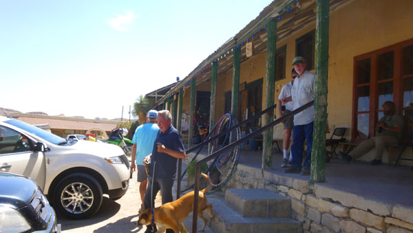
Housed in the old company store of the Chisos Mining Company, The Terlingua Trading Company is the spiritual descendant of the old Trading Post operated by Rex Ivey for the trappers, settlers, and cowboys along the Rio Grande. His son, Bill Ivey, and his family, carry on the tradition as the owners and proprietors.
They actually do sell stuff inside, but what they're really famous for is sittin' on the front porch, especially at sunset. Some people talk. Some listen. Some play the guitar and sing. Then -- little by little -- it gets dark. Admittedly that may not sound all that exciting, but folks come from all over, time and time again. We did, too, although we weren't there when it got dark.
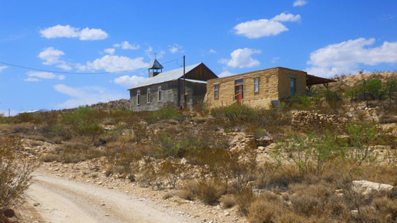
The place that Ron and Karl had thought of for lunch was the Starlight Theatre Restaurant & Saloon, which was right next door to the Terlingua Trading Company. By their own admission, they are "the finest dining establishment in the entire Terlingua Ghost Town, offering a fine selection of gourmet dishes and rollicking drinks, plus the best in live entertainment". Sadly, they did not open for lunch, so while Ron and Karl thought up some alternate plans, and I sat on the porch soaking up the local color (and there was a lot of it), Prudence, Mike, Vickie, Fred and Nancy walked up the hill to have a look at St. Agnes Church.
 |
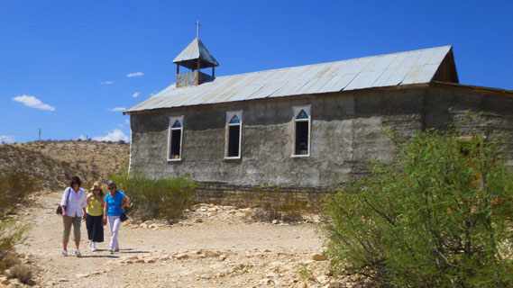 |
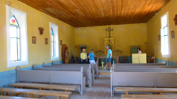
Fred didn't photograph any signage, even if there was any, so all I have about St. Agnes Church is what I can glean from the various websites devoted to the Terlingua Ghost Town. What I learned was that sometime in 1914, St. Agnes Church, also known as Chisos Mission, was established and became the focal point of the mining town. Itinerant priests held services at the church once a month and also officiated at baptisms, weddings, and funerals.
|
The group wandered around inside the church for a while; you can see from the picture at left how small and simple it was. Here are some other pictures that Fred took inside the church:
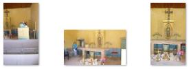 (Click Thumbnails to View) |
Church records indicate the priests adopted the Terlingua Cemetery. The burial ground is listed as St. Agnes Chisos Cemetery on church records but the official death records continued to list it as the Terlingua Cemetery. And although the town was segregated with Mexican families living east of the company store and Anglo families to the west, both Mexicans and Anglos were laid to rest in the same cemetery.
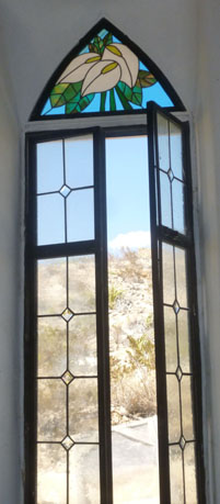
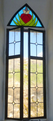
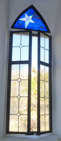
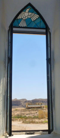
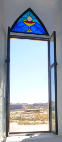
The church had six windows, each with a bit of stained glass at the top. Having more than there was would have been out of keeping with the simplicity of the church; this wasn't Notre Dame, after all:
 |
 |
 |
 |
 |
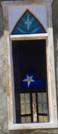 |
When the group came back, they said they'd enjoyed seeing St. Agnes Church. Fred also took some pictures of some of the other buildings in the Terlingua Ghost Town; these were apparently left from the heyday of the mining boom:
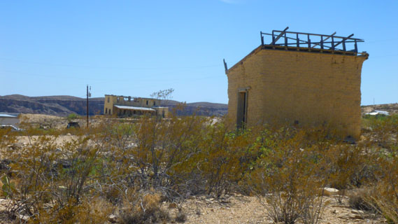 |
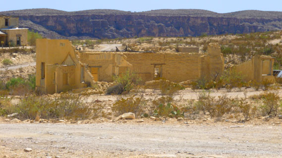 |
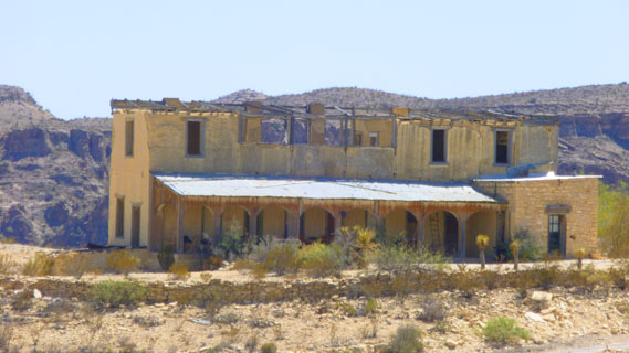 |
 |
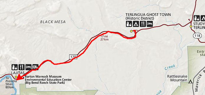
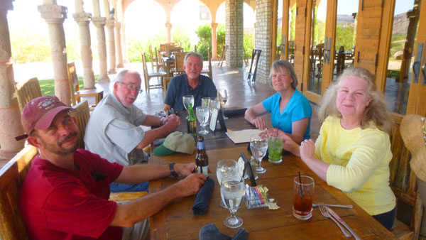
Ruckman thought that our best bet for a nice, late (very late) lunch was to drive another fifteen miles west to the resort of Lajitas. I knew nothing about it, but that's where we headed.
Lunch at the Lajitas Resort
|
The region was sparsely inhabited for thousands of years by semi nomadic peoples related to the Patarabueyes and Jumanos tribes before the Spanish arrived. It is speculated that Cabeza de Vaca crossed the Rio Grande at Lajitas around 1530, and it is almost certain that Antonio de Espejo�s party did in 1588. Later, after as the horse became integrated into the Apache and Comanche culture, these nomadic tribes frequented the area, causing the Spanish to set up a series of Presidios and military colonies, one of which, San Carlos, lies 18 miles south of Lajitas. Anglo-Americans first arrived around the time of the Mexican War. In 1852 Lt. William H. Emory visited the site as part of the first official US survey party.
In the late 1890s quicksilver was discovered near Terlingua, eleven miles from Lajitas, and a rapid influx of people followed. At the same time a number of cattle ranches and mining enterprises appeared in northern Chihuahua and Coahuila. These activities increased commerce across the Rio Grande into Texas; consequently, by 1900 Lajitas was designated a substation port of entry. Farming along the narrow floodplain of the river served to bring in more families, and by 1912 the town had a store, a saloon, a school with fifty pupils, and a customhouse. The crossing, a smooth rock bottom all the way across the river, was the best between Del Rio and El Paso.
|
McGuirk sold his landholdings around Lajitas to Thomas V. Skaggs, who continued farming. Skaggs also became successful in a candelilla wax business, the Lajitas Wax Company. In 1916 the interruption of commerce by civil unrest in Mexico, and isolated bandit raids into the US brought Gen. John J. Pershing�s troops to Lajitas, where they established a small cavalry post to monitor this critical river crossing.
The Lajitas property continued to change hands and in 1949 was bought by Rex Ivey, Jr., who hand-dug a well and installed a generator for the area�s first electric lights. Due to the closing of the Terlingua quicksilver mines, the number of residents in Lajitas had dwindled to four.
In 1977 Ivey sold part of the Lajitas area to Houston entrepreneur Walter M. Mischer, of Mischer Corporation; Mischer had begun development and restoration of the community in 1977, under the name of the corporation�s subsidiary, Arrow Development Company. By the early 80s, Lajitas on the Rio Grande had a 9 hole golf course, two lodging units, several condos, and was a local center of economic activity in Brewster County.
|
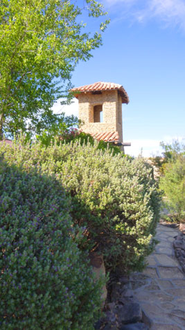
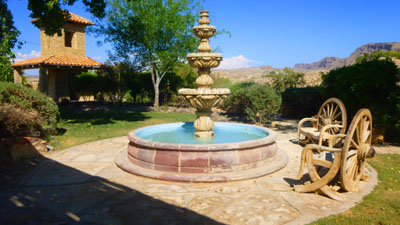
I took a few pictures around the restaurant area where we had lunch. There was a little garden next to the restaurant, and it had a very pretty fountain.
 |
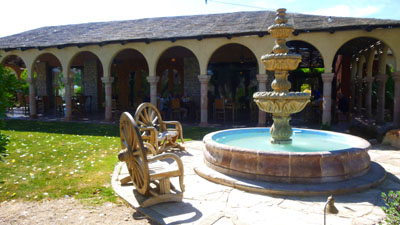 |
There was quite a bit here at the resort. We saw a traditional hotel, as well as some condos (or perhaps timeshares) that folks rent for a long term. We didn't get to see the zipline, but there were meeting rooms, an exercise facility, and lots of other buildings around. Apparently, there is a landing strip as well; many of the guest who come here either have their own planes or take a charter flight from Love Field in Dallas. Before we left, I snapped a couple of other pictures:
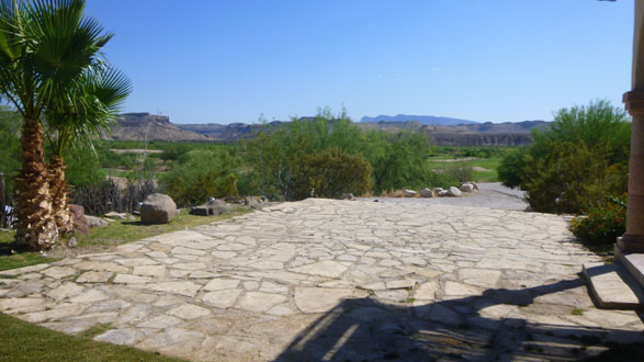 The View Towards the Rio Grande |
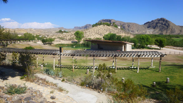 The Equestrian Center |
After our late lunch (actually, as it turned out, an early supper, since we didn't finish and get away from the resort until almost six), we got back into our cars and headed off to Fort Davis, Texas, where we would be spending the night.
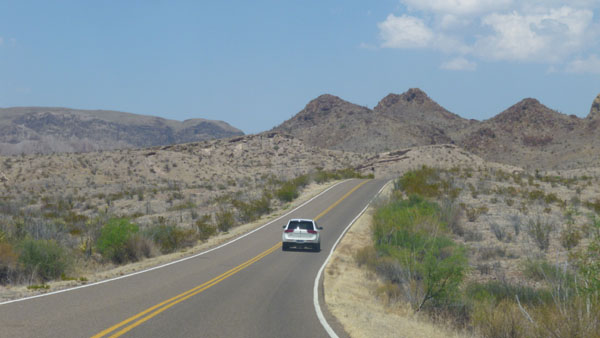
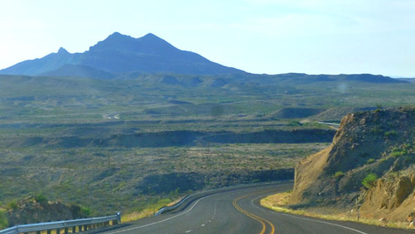
The Trip to Fort Davis
|
|
|
I have put the best of these pictures in another slide show at left. You can move from picture to picture with the little arrows in the lower corners of each image, and the numbers in the upper left will tell you where you are in the show.
I'd read about a Nature Conservancy where there were some gardens and some interesting hikes, and so I was looking for the signs for it so we could find it easily tomorrow. I did see them and noted where it was located so we could return tomorrow afternoon.
|
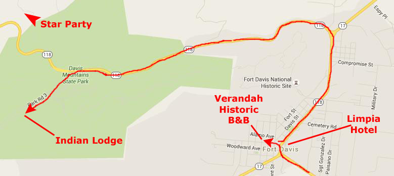
The reason that we were separating was, of course, Jax. The Indian Lodge did not allow pets (although they were allowed in the State Park itself), and so Prudence had to find a different place to stay. Mike and Vickie went on to the Lodge, while we helped Ron and Prudence get their stuff out of Nancy's vehicle. Then we, too, headed up and into the State Park to the Indian Lodge.
As it turned out, we found out the next day that Ron and Prudence had intensely disliked their accommodations at the Verandah, and when we met them the next morning, they had packed up and were going to change to the Limpia Hotel about two blocks away.
|
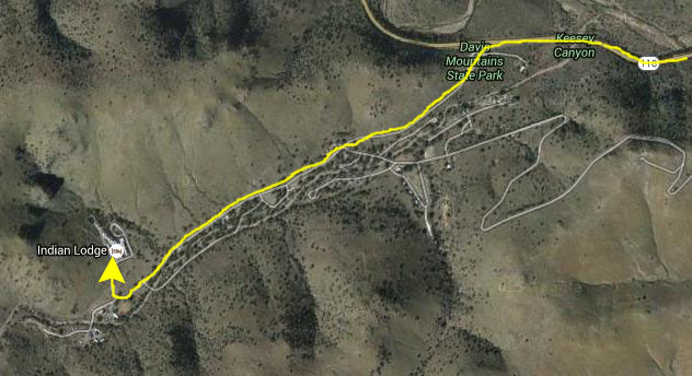
This time, though, we took the entrance into Davis Mountains State Park itself, and followed the main park road southwest for about a mile until we came to the drive up the hill to Indian Lodge.
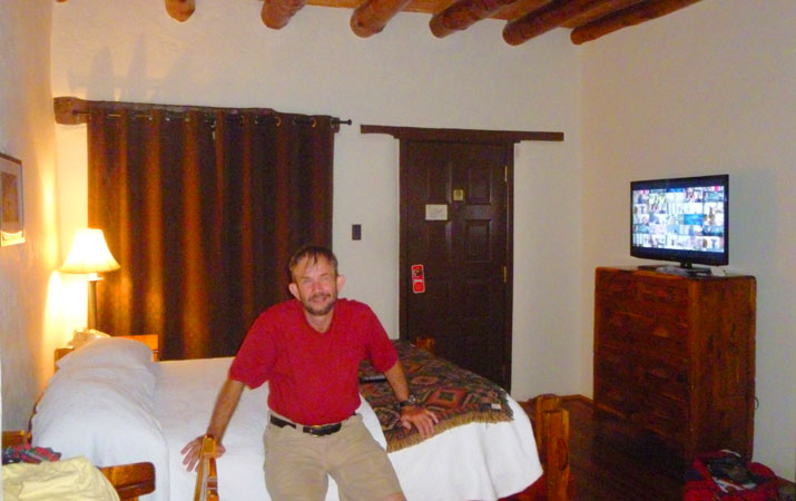
Check-in was pretty easy, and we found our room in the rambling, multi-storey structure with just a couple of wrong turns. We'll take a tour of the property tomorrow in the daylight, but this evening we took some pictures inside our comfortable room.
|
Opposite the door was an archway, typical of many hotel rooms, and we expected to see the sink area and then the bathroom off to one side or the other. What we found, however, was a kind of hall, with the bathroom down at one end and a dressing table and mirror at the other. The open closet was along the hall to the bathroom.
Here are a few photos that will give you a better idea of the layout of our room.
 (Click Thumbnails to View) |
All the furniture was very rustic, all of it made out of heavy, polished wood. There was no actual reading chair; all three of the chairs were very plain, straight-back chairs or stools, one of them pulled up to a bedside desk. There was no padding anywhere on any of the chairs, which made them a bit uncomfortable.
But we didn't plan on doing a lot of sitting around. For this evening, we just took a short walk around the property and then turned in.
You can use the links below to continue to another photo album page.
|
May 12, 2016: Fort Davis |
|
May 10, 2016: Big Bend- Boquillas Canyon |
|
Return to the Big Bend Trip Index |