|
June 2, 2017: A Tour of Istanbul |
|
Return to the Index for Our Visit to Istanbul |
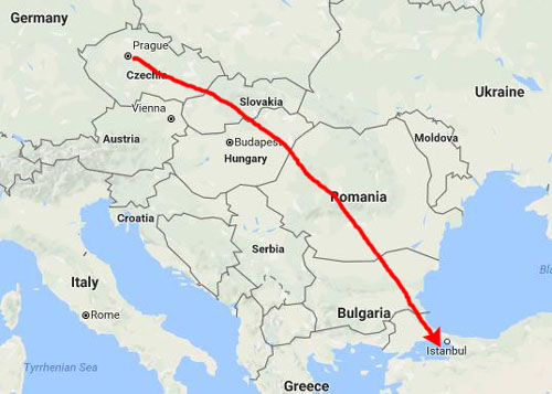
Today we will be traveling from our hotel in Prague to our hotel in Istanbul, Turkey. Once we check in and get settled, we plan to head out to see what we can see, in preparation for Jeffie's arrival tomorrow.
Traveling to Istanbul
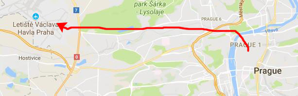
We'd said goodbye to Jeffie last night, and this morning we are off to the airport. There are lots of ways to get there, but Prague public transportation is so good that it was our method of choice.
|
At the metro stop, we walked about fifty feet to get on the bus that takes you to the airport terminals. This was the only time that the announcements were a little confusing, and we ended up getting of at the Terminal 1 stop, but it was the stop for employees and long-term parking.
We had to schlep our bags quite a good ways to the actual terminal, whereas if we'd stayed on the bus for one more stop we would have been let off right at the terminal door. No problem, though; the day was quite nice and the walk was on sidewalks.
|
When our passports were collected, it reminded me that no one had asked to see them when we traveled from Germany to the Czech Republic. But when I thought about it, I realized that today's checking was because Turkey is not a member of the European Union, and so passports are a much bigger deal. (I also told Fred that I thought that perhaps the checking was a bit more thorough due to the fact that Turkey is undergoing its own political difficulties, and there have been some incidents of violence.)
In any event, checking our bags and getting our boarding passes was smooth and efficient, and we were politely directed to the line for customs and security. We negotiated both of them fairly quickly, even though at this time of the morning the lines were fairly long. (We'd checked everything that is usually a problem in the States, including my tablet. Fred was carrying his camera in his luggage, but no one asked him to take it out.) I think the process was about thirty minutes, and we were at the gate for our Turkish Airlines flight to Istanbul about an hour before departure.
|
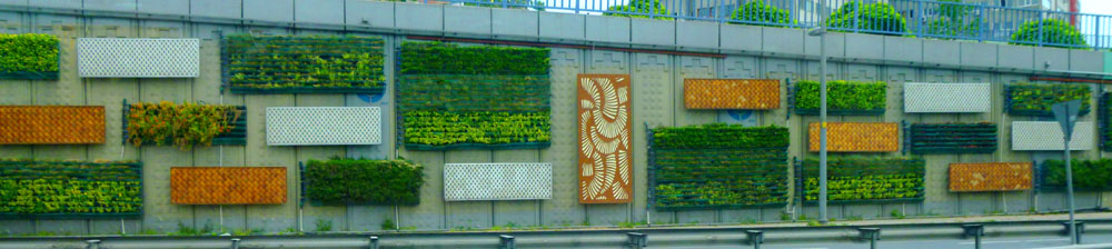
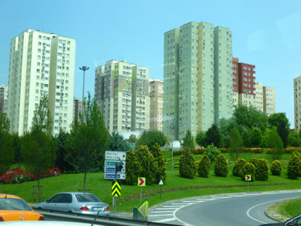
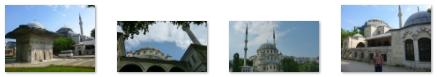
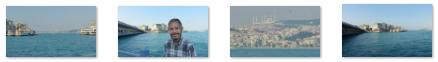
I had already researched how to get to the Nippon Hotel near Taksim Square and decided that we would just get a taxi. I should always also take a look at airport bus service, for we discovered that when we got to the hotel, there was a stop for the airport limousine bus just a block down the street- and it would have cost about half of what the taxi cost. But it wasn't a big deal. We took a number of interesting pictures on the way in from the airport, including our first picture of a mosque.
|
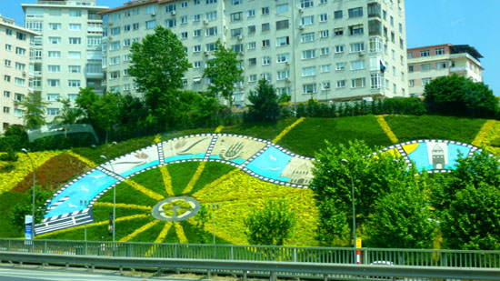
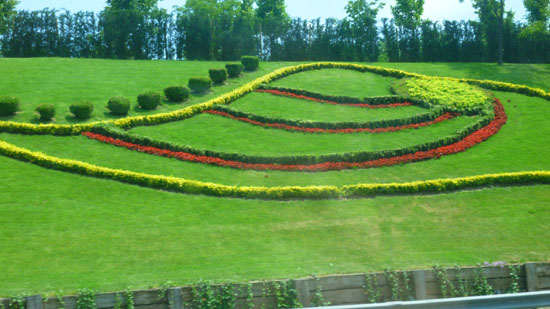
The other kind of beautification was the sloping grassy areas along the road, and here, all kinds of plants and flowers had been put in, and they had been planted in what were sometimes very intricate designs. And, unlike here in Dallas, it looked as if someone was taking good care of them- including keeping them watered. Here are a couple of examples:
 |
 |
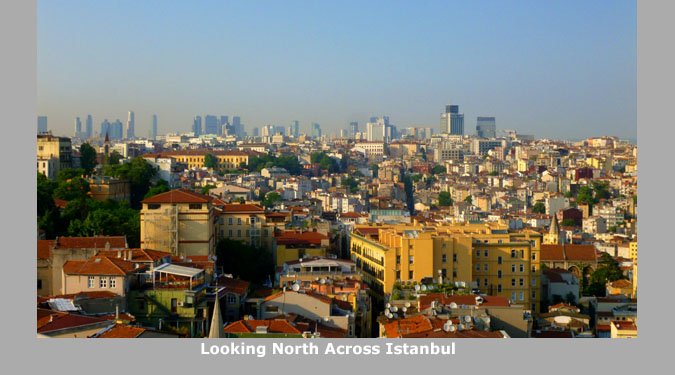
The only other pictures I want to include from our drive in from the airport are below. Istanbul was more modern than I expected, and also more congested, and both these pictures speak to those aspects:
|
|
Taksim Square
Today, Fred and I are going to just wander around Istanbul to see what we can see. We will have this afternoon here, and also tomorrow. Jeffie arrives tomorrow night and we will spend a full day with her on Saturday.
|
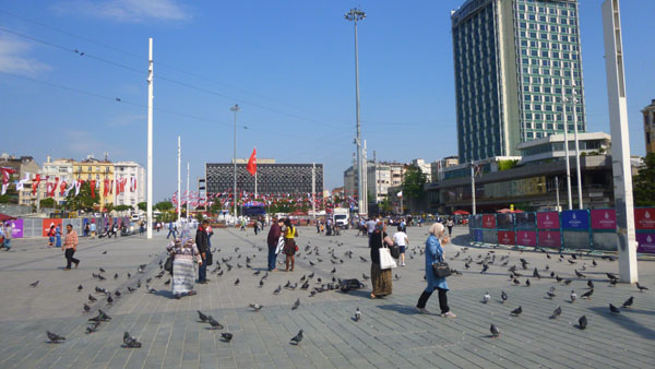
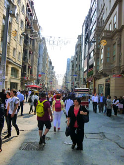
In retrospect, though, I can show you where we went this afternoon. We began at our hotel, the Hotel Nippon (more about the hotel later) and walked through the blocks around it to reach one of the central points of Istanbul- Taksim Square- a huge open area at the top of a hill overlooking the Bosphorus. We actually walked through that square daily, as one needs to cross it to get back to where we were staying. We took most of our pictures in the square today, but I'll also bring forward a couple of pictures from the next few days into this section.
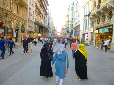
From the square, we thought that we would head down one of Istanbul's iconic streets, Istkilal, a pedestrian-only street that runs all the way from Taksim Square down to the Galata Tower. Partway down the street, we angled off to head down the backstreets that lead down the steep hill from Taksim Square to the Bosphorus. Once down there, we foound a palace and a mosque that we took pictures of. We learned a bit about the palace, and thought that it would be a good place to take a tour, so we put it on our list for tomorrow.
From the palace and mosque, we walked southwest along the Bosphorus to one of the bridges at the Golden Horn- the Galata Bridge. It turned out to be interesting for a number of reasons and we got some good views of the harbor from there. Leaving the bridge, we walked back up the hill towards Taksim Square to stop at the Galata Tower- an old fortress. We went up in it to get some panoramic views.
Finally, we took Istkilal Street back to Taksim Square. Most of the pictures we took along Istkilal Street were taken on our return from the tower. So come along with us on our afternoon walk through Istanbul, with our first stop in Taksim Square.
|
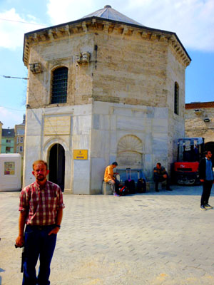
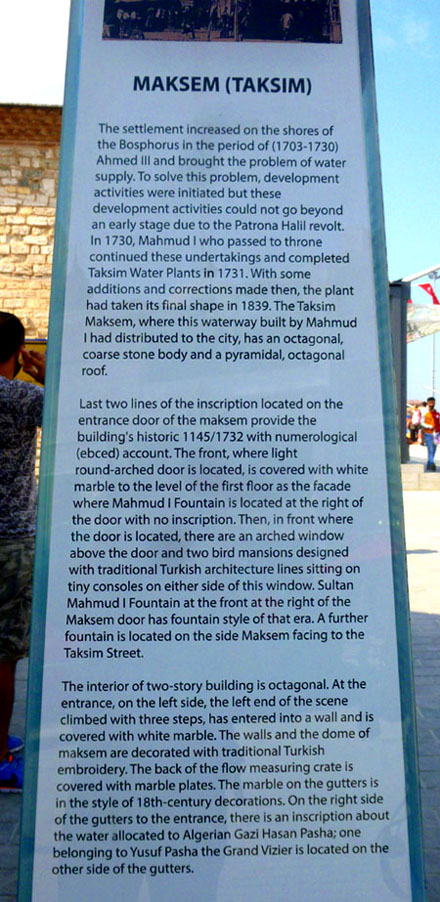
The word "taksim" means "division" or "distribution", and the square got its name because it was originally the point where the main water lines from the north of Istanbul were collected and branched off to other parts of the city. Sultan Mahmud I built a stone reservoir, the Maksem, which still stands here today. Another significant building that once stood on the square was the 19th century Taksim Artillery Barracks, but it was demolished in 1940 during the construction works of the Taksim Gezi Park.
One thing we noticed was what appeared to be a very small police barracks near the point where Istkilal Street comes into the square from the south. Parked beside the small structure were a couple of armored vehicles, and we saw three or four paramilitary standing around as well. We knew that Turkey had been undergoing some violent demonstrations over the past year, and I think we were prepared for a much, much bigger military presence than we found; this turned out to be the only facility we saw, although when we went to the Hagia Sophia, I think we saw a couple of military walking around that area. It turns out that this particular installation was installed after the "Occupy Taksim" movement in 2013 (which had to do with city plans to demolish the Taksim Gezi Park nearby). That project is in limbo, but the government has the Police stationed in and around Taksim Square ready with riot control equipment to deter any large demonstrations.
|
There was an interesting obelisk in front of it on which the historical information about the Maksem was found. I thought you might want to read it for yourself (partially because I didn't want to try to correct its convoluted grammar), so I have put it in the scrollable window next to the picture at left.
Prior to 2010, there were some violent demonstrations in which lives were lost. For a time, all forms of group protests were banned in the square and the police units maintained a round-the-clock presence to prevent any incidents. The ban did not apply to surrounding avenues or streets. While political demonstrations are still banned, gatherings for events such as New Year's Eve, Republic Day celebrations, mass-screenings of important football matches, and even the annual Istanbul Pride are excluded from the ban.
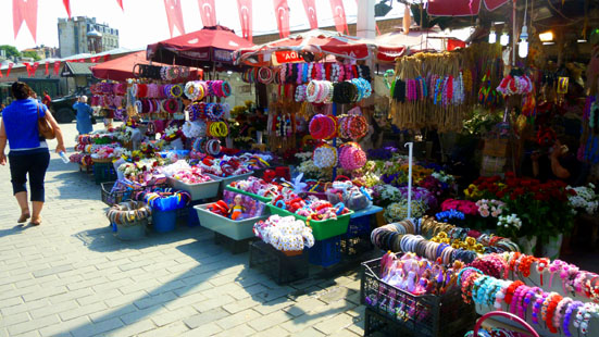
Taksim Square is once again the starting point or destination of many political demonstrations; moreover, mass meetings on Labour Day were permitted for the first time in 2010 and have been taking place peacefully ever since. The police presence has been maintained, though. We did see a number of gatherings in the three days we were here, but I believe they were all music events. But the square is a gathering place, with many vendors and even some flower displays.
 |
 |
On one of our passes through the square, I tried making a complete 360° panorama, but wasn't able to coerce my little camera to go all the way around. I was able to put my view together by doing two "half-panoramas and then stitching them together. The resulting vieew is in the scrollable window below:

Istiklal Caddesi (Independence Avenue)
Istiklal Caddesi (English: Independence Avenue) is one of the most famous avenues in Istanbul; on the average weekend, nearly 3 million people per day visit all or part of the avenue. Located in the historic Beyoglu (Pera) district, it is an elegant pedestrian street, a mile long, housing boutiques, music stores, bookstores, art galleries, cinemas, theatres, libraries, caf�s, pubs, night clubs with live music, and a number of famous patisseries, chocolateries and restaurants.
|
A number of notable sites are located along this avenue. For example, Galatasaray Square is located at approximately the center of the avenue and is home to the oldest secondary school in Turkey. At the southern end of the avenue is the world's second-oldest subway station (T�nel) which entered service in 1875; the German High School of Istanbul, one of the finest educational institutions in Turkey, is located near this station.
Small, intimate restaurants and taverns are sprinkled among Roman Catholic and Greek Orthodox churches; there are several synagogues and mosques, academic institutions and consulates. During the Ottoman period, the avenue was a popular spot for intellectuals, and when 19th-century travelers referred to Constantinople (today, Istanbul) as the Paris of the East, they mentioned this street, with its half-European, half-Asian culture.
The Avenue's worst period was in September 1955, during the anti-Greek Istanbul Riots. In one night, almost the entire Avenue was pillaged, and when the riots ended it was covered with pieces of glass, clothes, smashed white goods, rolled down and burned automobiles and other goods, all belonging to the wrecked shops.
|
The avenue briefly fell from grace in the 1970s and 1980s, with its old Istanbulite inhabitants moving elsewhere, and its side streets� then stereotyped with their bars and bordellos� being populated by migrants from the rural areas of Anatolia.
However, during the late 1980s and early 1990s, a massive restoration process took place, master-planned and executed by the Istanbul Metropolitan Municipality and Beyoglu Municipality; this including the restoration of the historic buildings, new pavements for full pedestrianization, and the reinstallation of the historic trams, and it brought the avenue its old charm and popularity. Istiklal Avenue once again became the center of fine arts and leisure in Istanbul, with real estate prices skyrocketing as a result.
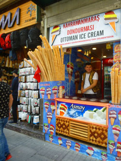
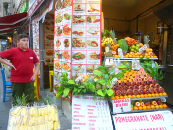
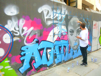
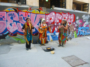
Numerous new art galleries, bookstores, caf�s, pubs, restaurants, shops and hotels were opened. The venues around the avenue became the host of many international art festivals, such as the annual Istanbul Film Festival. Istiklal Avenue is also a popular venue for all sorts of parades (such as the annual Istanbul Pride), marches, gatherings and protests (such as the 2013 Gezi Park protests) in the city. I thought there were all kinds of interesting scenes along the avenue (particularly the numerous ice cream shops). Here are a few of those scenes:
 |
 |
 |
 |
 |
 |
 |
All has not been pleasant on the avenue though. As society has deteriorated worldwide in this century, iconic locations have become targets- whether it is a major train station in England, a well-known nightclub in France, or even a major intersection in Berlin- and this avenue has been no exception. On 19 March 2016 it was the location of a suicide bombing attack that killed 5 people, and it was the government reaction to this event that we initially thought might mar our visit to the city. Happily, we were very much mistaken.
Walking Along the Bosphorus
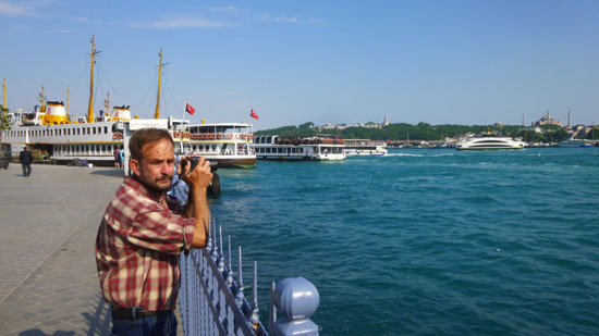
We had wanted to get down to the Bosphorus this afternoon; this would be my first look at this major waterway, one that I had read about and studied through school and afterwards. I was not quite prepared for what we found- a much busier place than I expected.
|
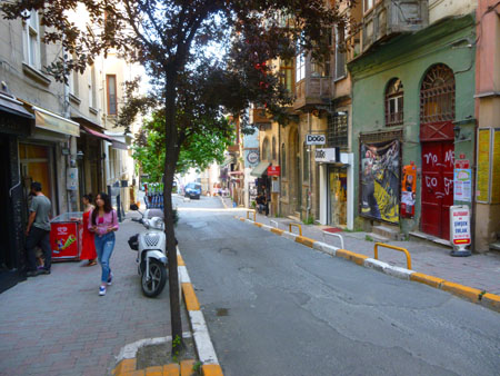
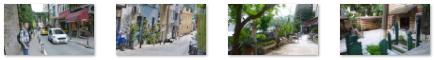
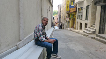
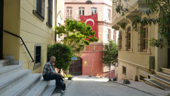
Walking down the streets was easy; walking up them later in the day not so much! We have encountered this same kind of terrain in other coastal (and non coastal) cities like Lisbon, Barcelona, and Cusco. At one point, they gave up on trying to maintain a street and the one we were on turned into a stairway. There were lots of interesting candid scenes, even not counting all the cats (more on them later). Here are some of them:
 (Click on Thumbnails to View) |
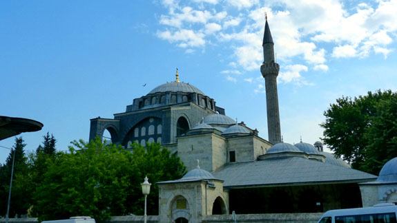
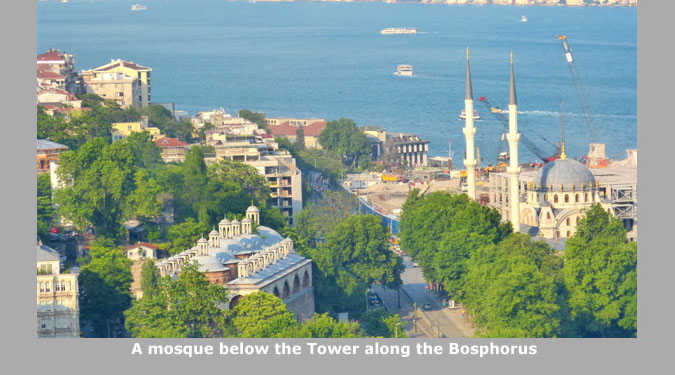
We got down to the street that runs along the Bosphorus, and there we found both the Dolmabah�e Mosque and the Dolmabah�e Palace. We investigated going into the Palace, but discovered that there was so much to see there that it would be better if we came back tomorrow to take a guided tour, so I'll postpone the pictures we took outside it until then.
|
Near the mosque there was what appeared to be an older prayer tower; it did not seem to be constructed out of the same materials or in the same style as the main building. There was also an interesting square building whose purpose was unclear. We weren't even sure it was associated with the mosque itself. Fred took a good closeup to show its exterior decoration.
I actually stepped back across the street to get a better view of the Dolmabah�e Mosque and its dual towers. We saw quite a few mosques here in Istanbul; it seemed that most of them had four towers rather than two, but I am not sure if there is a significance to that. I also walked a bit down the street past the side of the Dolmabah�e Palace where we planned to go tomorrow.
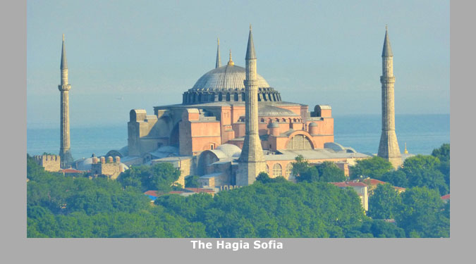
The mosque was pretty, and I suppose we might have been able to go inside, but since we planned on visiting the Hagia Sophia in a couple of days, we thought we'd wait until then. We were able to wander into the courtyard of the mosque.
|
And here are some other interesting views of the mosque; note that in one of Fred's, he happened to capture an airplane going over:
 (Click on Thumbnails to View) |
|
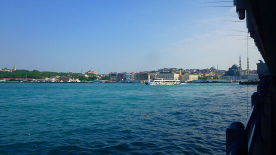
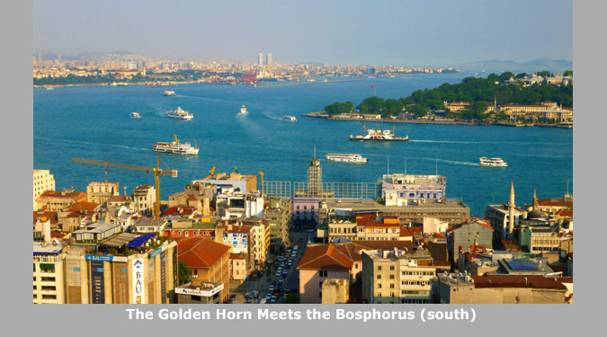
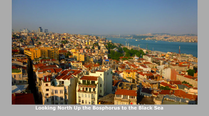
Let me take a moment to orient you to how Istanbul is actually laid out, and this may help you relate to some of the terms that you'll find me using in the narrative. First, of course, I have mentioned the Bosphorus- the natural strait that connects the Black Sea on the north with the Sea of Marmara on the south. You can see this natural waterway on the diagram at right.
This waterway separates Turkey into two sections, vastly unequal in size. On the left (west) of this waterway is Europe, and approximately a tenth of the land area of the country is located on that continent. On the right (east) is Asia, and most of the land area of Turkey is located here.
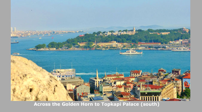
The Golden Horn is an estuary off the Bosphorus that runs west and then north; it eventually ends at the point where two small rivers run into it. Istanbul itself is thus separated into three areas. The oldest part of the city is on the peninsula between the Golden Horn and the Sea of Marmara. The newer part of the city is between the Golden Horn and the Bosphorus; both the oldest part and the newer part are European. The newest part of Istanbul is the area on the Asian side of the Bosphorus; three major bridges connect this area to the area where our hotel and Taksim Square are located. We will be visiting Topkapi Palace and the Hagia Sophia two days hence; these are in the older part of the city.
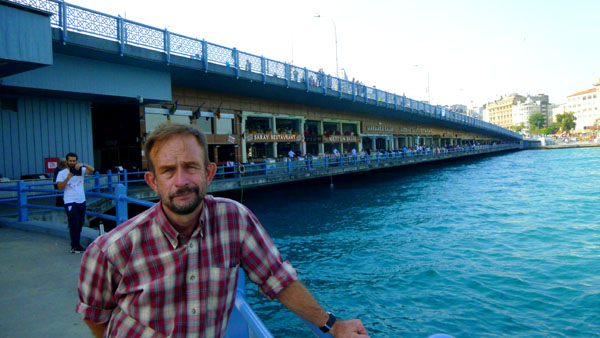
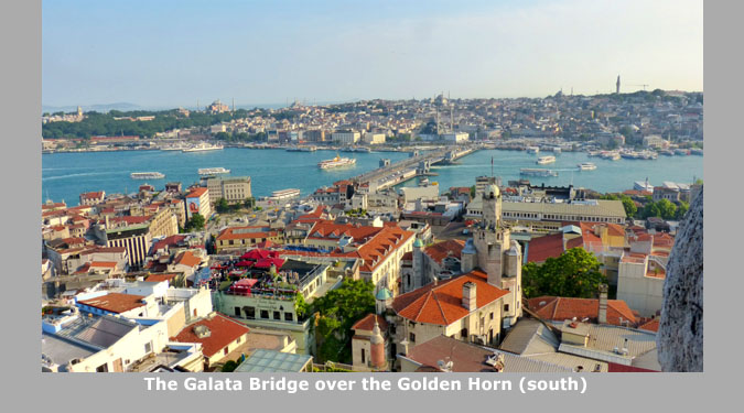
We have come to the Galata Bridge, which connects the oldest part of Istanbul to the newer area where our hotel was located. Before we actually went out onto the bridge, we stopped at waterside to take some pictures looking out into the busy waterway:
|
|
The Galata Bridge is one of three that span the Golden Horn; it is the one furthest east- closest to the Bosphorus. The bridge we will visit today is relatively new; it was built only 25 years ago. But it is not the first bridge that has crossed the Golden Horn at this point by any means; it is actually the fifth.
|
The first recorded bridge over the Golden Horn in Istanbul was built during the reign of Justinian the Great in the 6th century, but it was some distance west of here. In the subsequent centuries, mobile bridges made of ships side by side were sometimes used in wartime; this was done by the Turks at the Fall of Constantinople in 1453.
The first plans to construct a permanent bridge at this location were drawn up by Leonardo da Vinci in 1502. His single span- 750 feet long and 75 feet wide- was unprecedented; if constructed, it would have been the world's longest. The Sultan, however, did not approve the plan. The idea of building a bridge across the Golden Horn was shelved until the 19th century.
The first Galata Bridge at the mouth of the waterway was constructed of wood in 1845 by Valide Sultan, the mother of Sultan Abd�lmecid (1839�1861) and used for 18 years. For the first three days, crossing the bridge was free. After that, tolls of varying amounts were collected.
|
The fourth Galata Bridge was built in 1912 by a German firms. This floating bridge was 1500 feet long and 80 feet wide. It is the bridge, still familiar to many people today, that was badly damaged in a fire in 1992 and towed up the Golden Horn to make way for the current bridge.
The current Galata bridge was built by a Turkish firm just a few feet from the spot where the fourth one stood. It connects the districts of Karak�y on the north and Emin�n� on the south; it was completed in December 1994. The current bridge is also some 1500 feet long, but is wider- at 130 feet. The main span, under which boats can pass, is 175 feet long.
The deck of the bridge has three vehicular lanes and one walkway in each direction. Tram tracks were recently re-added to it, allowing the Istanbul Tram to run from Zeytinburnu, in the suburbs near Atat�rk International Airport, to Kabatas, a few blocks before Dolmabah�e Palace. The commercial areas were built later, and those parts of the bridge were opened for use in 2003.
|
There were lots of neat views from the bridge; here are some of them:
 (Click on Thumbnails to View) |
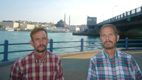
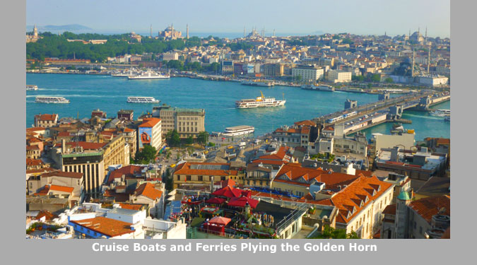
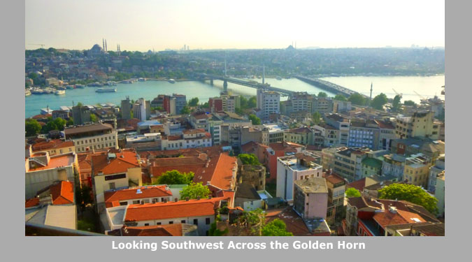
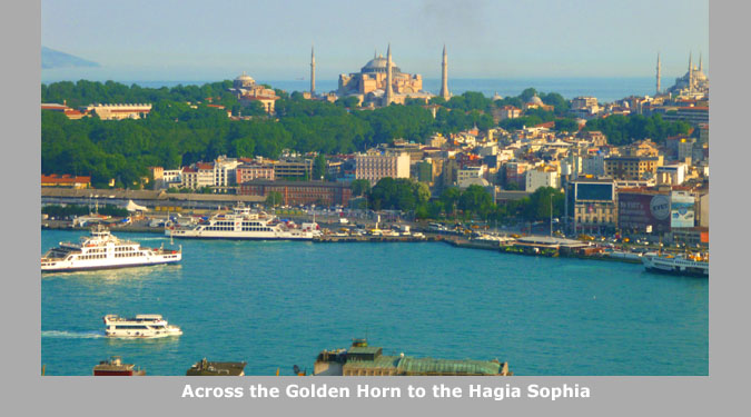
We could also look across to the Emin�n� district where many of the famous spots we would visit later in the week were located. Although we didn't quite know what we were looking at at the time, we had excellent views of the Yeni Cami (the New Mosque), built between 1660 and 1665 as an Ottoman imperial mosque and which is currently being renovated. We could also see the Topkapi Palace- the former main residence and administrative headquarters of the Sultans built in the 15th century and now a museum. The third major structure we could see was the Hagia Sophia.
We walked up some stairs to the bridge deck and walked past all the fishermen back towards the Karak�y district and our next destination- the Galata Tower.
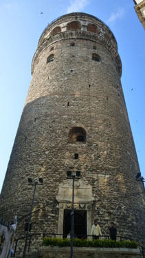
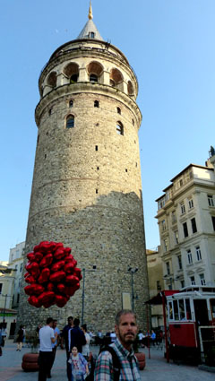
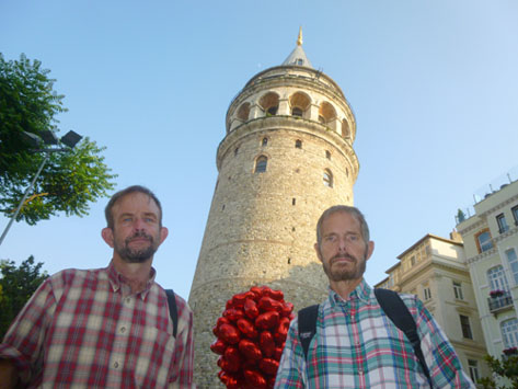
The Galata Tower
The Galata Tower is a medieval stone tower here in the Galata/Karak�y quarter, just to the north of the Golden Horn's junction with the Bosphorus. One of the city's most striking landmarks, it is a high, cone-capped cylinder that dominates the skyline and offers a panoramic vista of Istanbul's historic peninsula and its environs.
|
|
 |
 |
This Romanesque style tower was built as Christea Turris (the Tower of Christ) in 1348, and was the tallest building in Istanbul at 220 feet. It was built to replace the old Tower of Galata, an original Byzantine tower which controlled the northern end of the massive sea chain that closed the entrance to the Golden Horn. That tower was on a different site and was largely destroyed in 1203, during the Fourth Crusade.
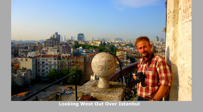
The upper section of the tower with the conical cap was slightly modified in several restorations during the Ottoman period when it was used as an observation tower for spotting fires. That cap was destroyed by a storm in 1875; the current one was built during restoration works between 1965 and 1967. It was during this restoration that the wooden interior of the tower was replaced by a concrete structure; this allowed the tower to be commercialized and opened to the public. We paid the small entrance fee and headed up the circular stairs to the top of the tower.
|
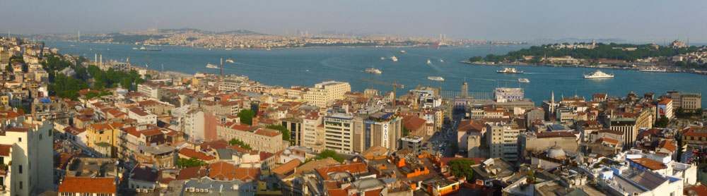
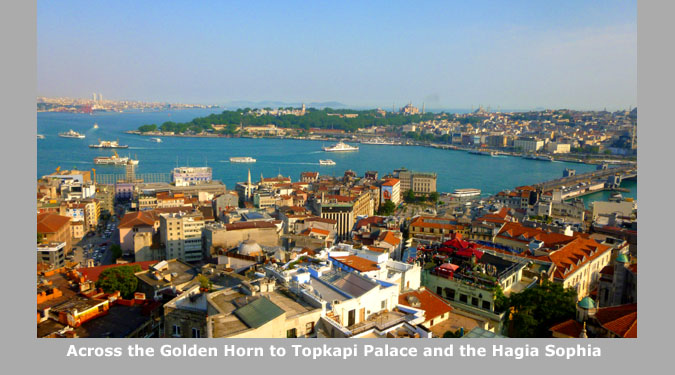
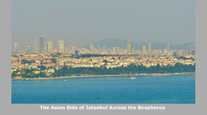
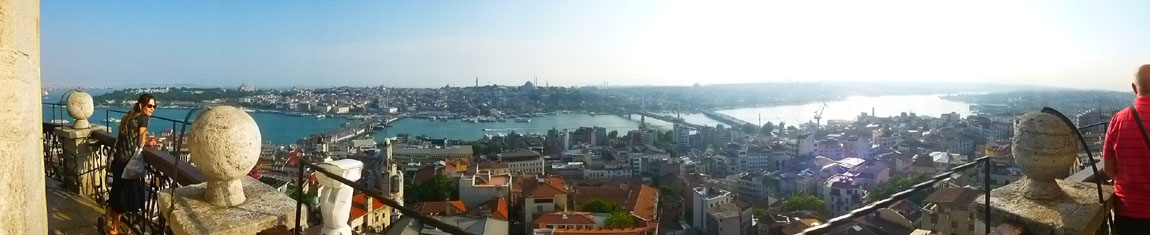
Take the panoramic view at right, for example, probably the best of our many views of the Bosphorus. It looks east across the Bosphorus. The strait stretches north to the Black Sea out of the picture to the left and south behind the point of land to the Sea of Marmara. On this side of that point, the water going out of the picture to the right is the Golden Horn. Across the water in the distance is Asia, and atop the point of land is Topkapi Palace, which we will visit a couple of days hence. I thought that this picture was particularly beautiful with the afternoon light giving the buildings and their red roofs a glow.
|
P> The narrow, open air platform here at the top of the tower was a little disconcerting, as I didn't know at the time that the ancient structure had been reconstructed some years ago with reinforced concrete inside to give added support. Trying to pass people as we walked around was a little tricky as I preferred to stay to the inside next to the tower wall.
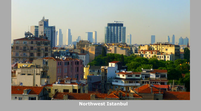
We took a lot of pictures here (maybe 75 all told)- too many to include. I've gone through and tried to weed out the duplicates and pick just the best of the remaining views. Even getting it down to about 20 means that a slideshow will be the best way to let you have a look at them easily (and give me a chance to add a few words of explanation to some of them). The slideshow is below, right. As usual, move from one picture to the next using the little arrows in the lower corners of each slide, and track your progress with the index numbers in the upper right.
|
|
|
(Mouseover Image Above for Video Controls) |
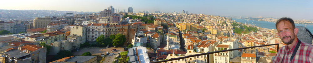
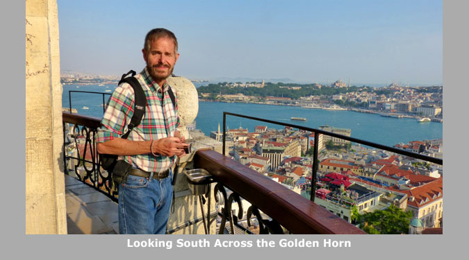
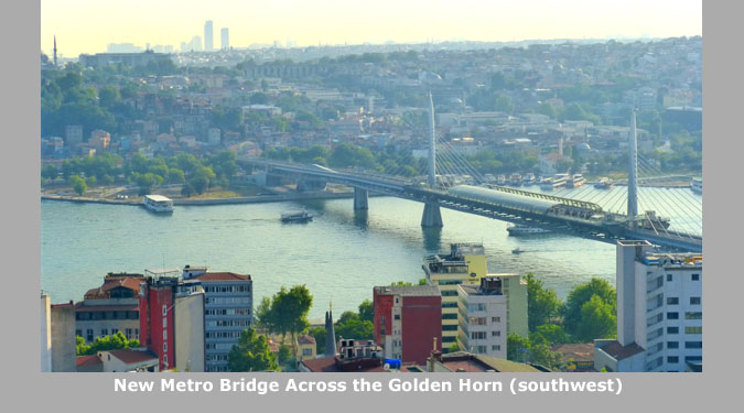
I have one more good panoramic view from the top of the tower, and you can have a look at it below. It is a view to the south across the Golden Horn.
 |
We stayed up at the top of the tower for about an hour before heading back down the wooden spiral staircase to the ground floor and outside into the early evening.
|
|
Remember that there were restaurants and other businesses on the lower level of the bridge- at both ends and on both sides. At first you might not think that there are any of those businesses on this side of the lower level, but if you look closely you will see that they are screened by the shades that can be lowered to block the afternoon sun on this side of the bridge.
I do not know for sure, but I would suspect that there may be similar shades on the east side of the bridge to screen out the morning sun when that is necessary.
Before we leave the tower, there's one more photo that you should see. Fred used his zoom to zero in on the very top of the tower's conical roof and the golden ornament atop it. He did get an excellent picture, and in taking the picture he got an unexpected bonus. See if you can spot it when you look at his picture here.
We began walking back towards Taksim Square, beginning our walk at the foot of Istiklal Street; here, the street is much narrower than it is near Taksim Square. We had a very pleasant walk back, and found a typical Turkish restaurant for some supper. For dessert, we stopped by a bakery we'd seen earlier in the day. I had some baklava, and took a few more pieces back to the hotel as well. The afternoon was a good introduction to much of Istanbul, and we put a number of things on our list of stops to make tomorrow.
You can use the links below to continue to another photo album page.
|
June 2, 2017: A Tour of Istanbul |
|
Return to the Index for Our Visit to Istanbul |