|
August 17, 2021: Santa Fe Trip Day 2 |
|
Return to the Index for Our Santa Fe Trip |
On this first page, you'll find our travel to Santa Fe, a couple of stops we made in Santa Fe and Taos, and a tour of our accommodations for this first night- the original Earthship that has been turned into an AirBnB.
Getting to Albuquerque, New Mexico (August 15th)
Fred and I left Dallas on Sunday, August 15th for the all-day drive out to Albuquerque. Fred had booked an Earthship on AirBnB (actually the first one built) for Monday night, so we would stay Sunday night down in Albuquerque.
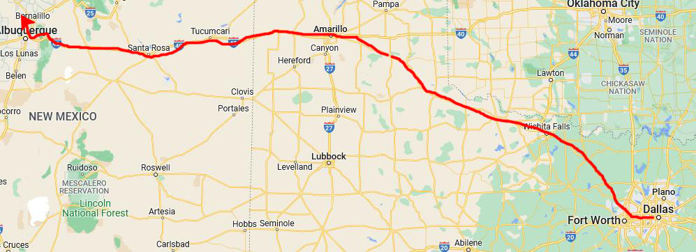 |
We are used to long drives; we routinely drive about 700 miles on our first day of driving when we head to Florida, so getting an early start and driving the 600+ miles out to Albuquerque wasn't anything special. We did know that it would be late when we got there, so trying to find the Earthship up by Taos would be a bit much, so we booked a Fairfield Inn just on the north side of Albuquerque, and we had a nice supper at Cheddar's right next door.
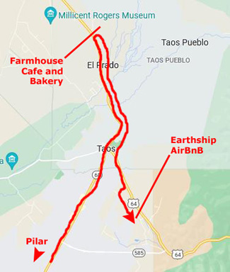
Getting to Taos, New Mexico (August 16th)
The Fairfield Inn was a pretty nice place, although Fred thought he'd been making a reservation at one we'd stayed at with Guy a couple of years earlier. Little did he know that there were a couple of them in Albuquerque, so when we got to the front desk of the first one was when we found out that our reservation was a few miles north off I-25. No problem; we just had to drive a few more minutes to get there.
|
We were pretty familiar with the route around Santa Fe; we didn't need to go into town as we would be staying there beginning Tuesday night anyway. Our route around Santa Fe was on US Highway 285, which we picked up about 25 miles north of Albuquerque.
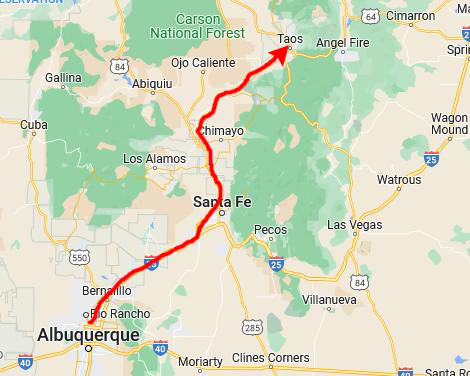
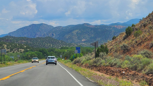
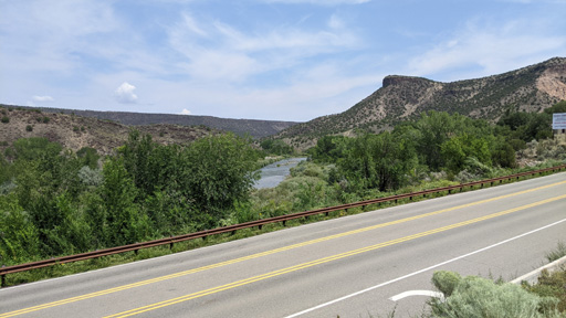
We stayed on US Highway 285 into Espanola, and then we angled off northeast towards Taos on New Mexico Highway 68 towards Taos.
The scenery along US Highway 285 was pretty neat, and as I drove, Fred was able to get some good pictures:
|
|
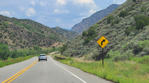
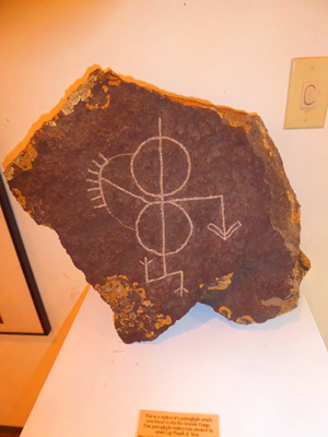
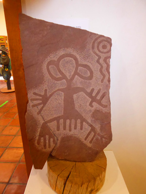
Just past Pilar, we came alongside the Rio Grande River, and we found signs for a Visitor Center for the Rio Grande Gorge, so we stopped in. The Rio Grande Gorge Visitor Center provided information and interpretive exhibits about the wild and scenic Rio Grande and surrounding countryside. Here are some of those exhibits:
|
|
|
In the center's bookstore, operated by the nonprofit Public Lands Interpretive Association, we found books, maps, and educational gifts and toys. Commercial outfitters use the visitor center and its parking lot as a staging area for daytrips down the Lower Gorge of the Rio Grande. The building and its veranda overlook the river and provides a convenient spot for watching rafts, canoes, and kayaks floating downstream.
|
|
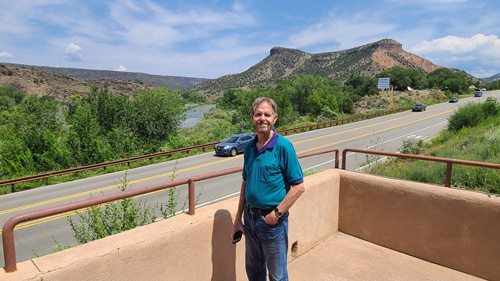
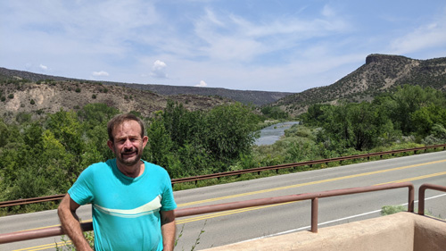
Standing on the verandah and just admiring the scenery across the highway was pretty neat. I took a number of pictures and a movie or two, and the best of these are below:
|
|
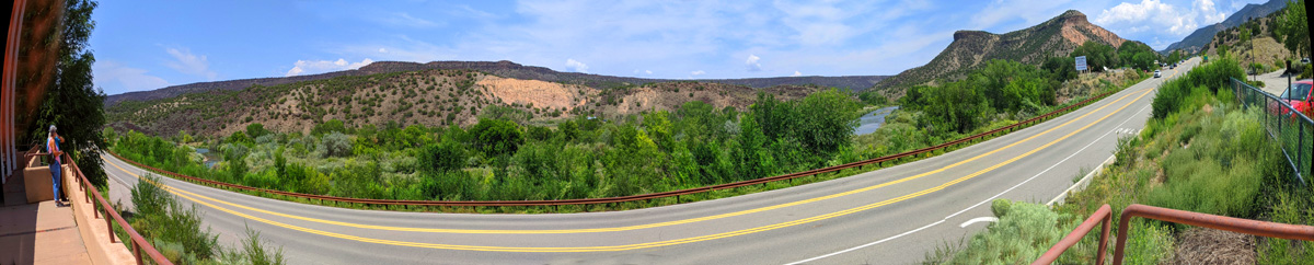
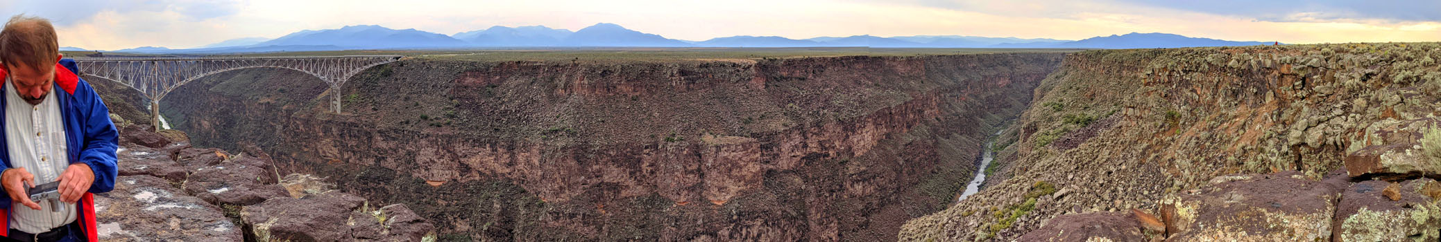
Finally, before we left and headed up to Taos, I took a series of four pictures of the view across the road, and put them together into this panoramic view:
 |
Lunch
Fred has done a lot of planning for this trip (wanting to make sure that Guy had a good time), and one of the things he'd investigated were some places in the Taos area to eat.
|
|
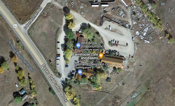
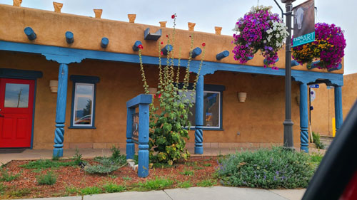
We found a charming little restaurant that was quite busy. The cafe is a farm-to-table eatery that sources almost all of its foodstuffs from 20 local farmers and ranchers. As the menu said: "We strive to provide healthy choices featuring fresh fruits and vegetables in season!"
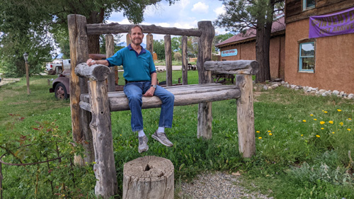
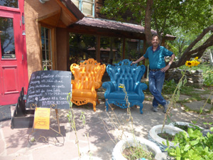
We had to put our name down and wait about twenty minutes to get an inside table (as there were some showers around) and so we had time to wander around the complex for a while.
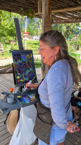
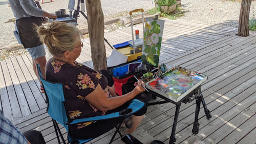
One interesting thing we found was that there was a group of artists out in the courtyard painting "en plein air"; watching them work was intriguing.
|
|
Something else interesting was a car belonging to one of the artists- the car had more bumper stickers on it than just about any car I'd ever seen (and it would seem the owner was "sympatico"):
|
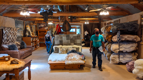
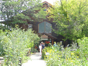
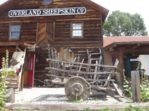
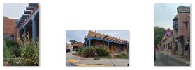
We had a nice lunch at the restaurant, and then when we were done we went into the sheepskin store for a bit; the furniture store was closed as the sign said they were out on a delivery. Here are some of the better pictures we took as we wandered around the area:
|
|
|
The Farmhouse Cafe |
|
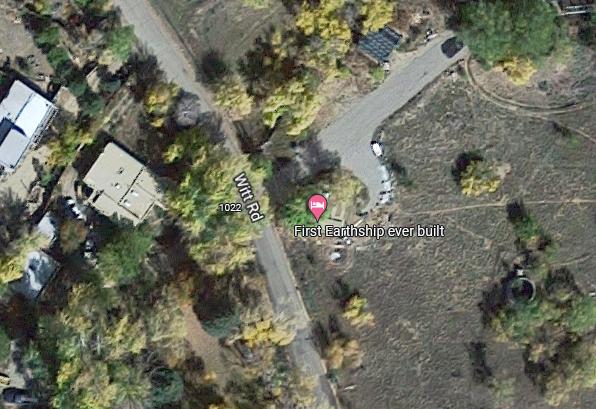
Our Earthship Accommodations
After lunch, it was time for us to go check in at our AirBnB. Fred had the address, but the navigation got a little confused but we found it with little problem.
|
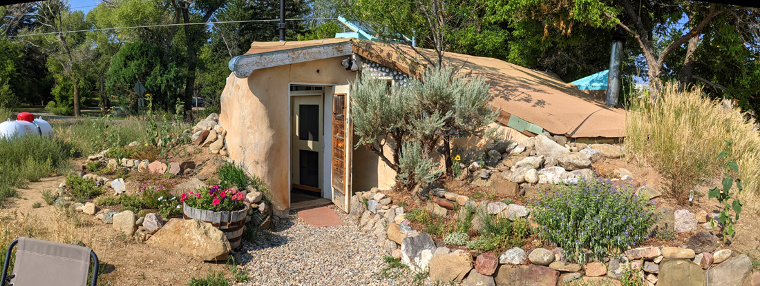
Basically, an Earthship is a style of architecture developed in the late 20th century to early 21st century by architect Michael Reynolds. Earthships are designed to behave as passive solar earth shelters made of both natural and upcycled materials such as earth-packed tires. Earthships may feature a variety of amenities and aesthetics, and are designed to withstand the extreme temperatures of a desert, managing to stay close to 70 °F (21 °C) regardless of outside weather conditions. Earthship communities were originally built northwest of here near the Rio Grande, and the style has spread to small pockets of communities around the globe, in some cases in spite of legal opposition to its construction and adoption.
Reynolds developed the Earthship design after moving to New Mexico and completing his degree in architecture, intending them to be "off-the-grid-ready" homes, with minimal reliance on public utilities and fossil fuels. They are constructed to use available natural resources, getting energy from the sun and water from rain. They are designed with thermal mass construction and natural cross-ventilation to regulate indoor temperature, and the designs are intentionally uncomplicated and mainly single-story, so that people with little building knowledge can construct them. They can be perceived as a realization of the utopia of autonomous housing and sustainable living.
The home we are staying in was Reynolds' prototype, and on the morning of our departure, I took this picture of the EarthShip:
 |
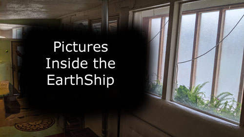
As you will see from the interior pictures, most of the structure is below grade, and this minimizes solar heat gain and maximizes the cooling influence of the earth that is piled around it.
|
The best way to show you the pictures that we took inside the EarthShip is via a slideshow, so you can go through the pictures at your own pace without having to open and close one window at a time. Just click on the image at left to begin the slideshow. You can move from one image to another by clicking on the little arrows in the lower corners of each picture, and you can track your progress through the images by referring to the numbers in the upper left.
We hope you enjoy seeing the interior of our EarthShip accommodations!
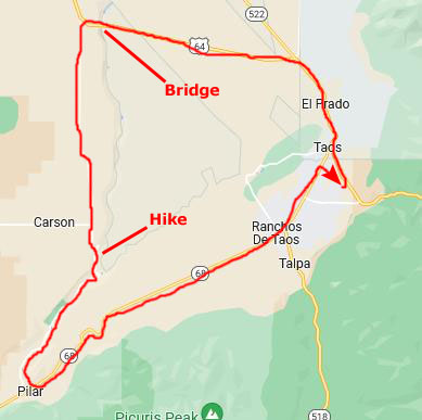
A Drive Along (and in) the Rio Grande Gorge
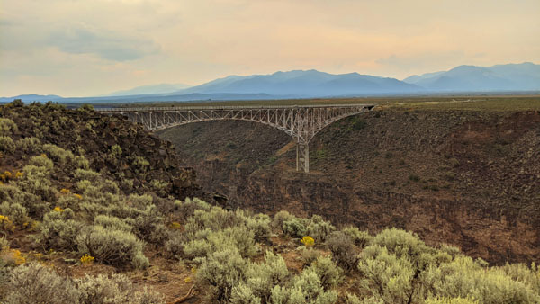
After we got settled in at the EarthShip, it was still early enough that we could go and do something else, so we decided to drive out to the Rio Grande Gorge Bridge- someplace we'd been before.
|
|
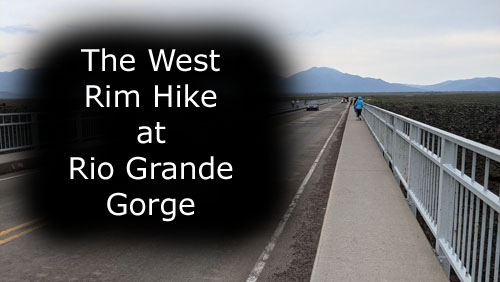
The West Rim Hike
|
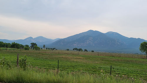
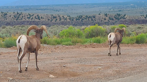
It was a bit overcast, but it didn't look like rain. On the way out to the bridge, the scenery was very nice.
 |
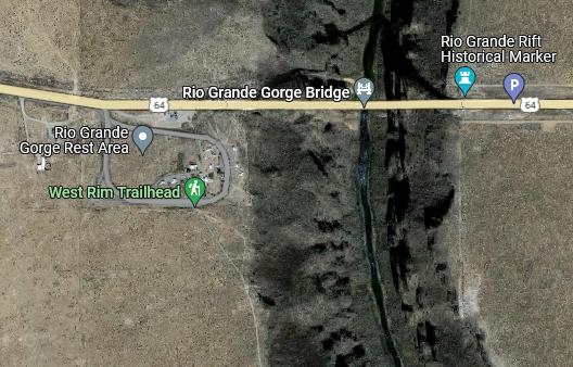
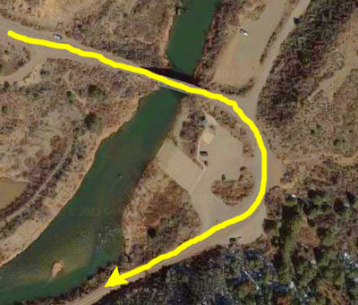
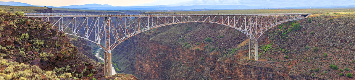
From Taos, we drove out to the Rio Grande Gorge Bridge, going directly across it to the parking area on the west side of the canyon. Here, at the West Rim Trailhead, there were some facilities and a walking trail you could take heading south on top of the west rim.
|
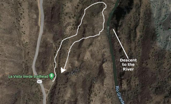
We left the car and headed off south on the trail that you can see in the aerial view at left. This trail stayed well away from any dangerous drop-off, although, as you might expect, we both left the trail occasionally to get a better picture of the bridge or the canyon.
This easy-to-moderate trail is mostly packed dirt and rock with only a couple hundred feet of elevation change if you do the whole hike- which is 8 miles round trip. We weren't planning on doing anything like that distance, but the good thing is that you can turn around whenever you want. The parking area and trailhead are just west of the Taos “High” bridge off of US-64.
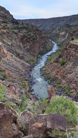
We just wanted to go far enough to get some good views of the bridge and also to be able to look down into the canyon. We'd already done that from the bridge itself years ago, so the hike would offer a different perspective. And it didn't take long for us to get to a point where that "different perspective" became obvious:
 |
My phone does panoramic views, but sometimes I like taking separate shots and putting them together, as I put together the four separate pictures above. This gives me more control over the size of the picture. I also like taking movies, as I think they give you a better appreciation for something than just looking at stills. Here are the two best movies that I took (out of five or six of them) on our hike:
|
|
|
Of course, there were lots of opportunities for spectacular still pictures as well. Here are two of the best of them, looking upstream and down:
|
|
But we took lots of other pictures, most of which had something different about them, or something to recommend them, and even though some of them might seem repetitive, I want to include a bunch of them here.
|
So a slideshow it is. At left, you'll see an image that you can click on to initiate the slideshow. Once it opens, you can zip through the pictures as fast as you wish- looking at all of them or just some of them. Use the little arrows in the lower corners of each image to move from one to another, backward or forward. You can tell how many pictures are in the group, and which one you are currently looking at, by referring to the index number in the upper left corner of each image.
So if you would like to see more of the High Bridge and the Rio Grande Canyon, by all means take a look at the pictures in the show. Just close the slideshow window when you're done.
Finally, before we return to the car, I have another panoramic image to show you. This one is wide enough that I've put it in a scrollable window, and that window is below. (As usual, if the image in the window doesn't appear to fill the space allowed for it, just click on the picture and it will expand.
 |
The Drive South Atop the West Rim
 |
The road was pretty much straight as an arrow while it was up on the plateau, but eventually the road came to the edge of the canyon and began descending into it.
|
|
Oh, I know the movie isn't anything special, but I always think that video is often the best way to show something; words and still pictures are often totally inadequate.
So have a look at the movie at left, and you'll see what I mean.
The La Vista Verde Hike
|
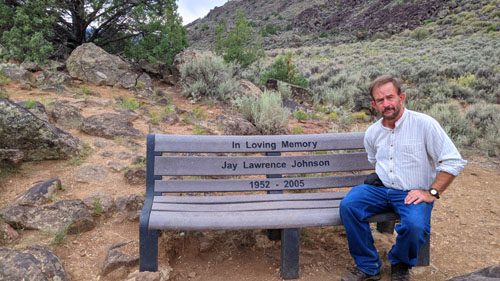
There were supposed to be some benches at strategic points where there are views of the Rio Grande below.
The hike was billed as getting us to a point where we would have good views down to the river itself at the bottom of the gorge, and we were not disappointed.
|
|
|
|
At the furthest point on the trail, we did indeed come to a promontory with a bench- and the view was of the Rio Grande itself, looking north:
 |
 |
I want to include some additional pictures here that we took along the hike on the plateau about a hundred feet above the river itself. There was a lot to see on the hike, and the desolate beauty of the surrounding landscape figured into every view we got:
|
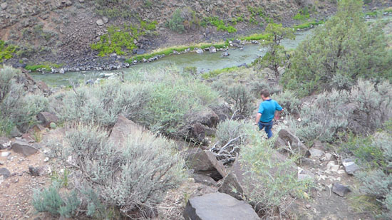
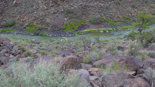
A Scramble Down to the River
|
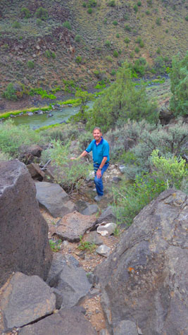
Then I turned around and started down, when Fred snapped the picture below:
|
As I descended, Fred took a number of pictures of my progress, while I was taking a few of the river as I descended.
|
|
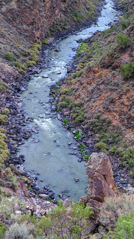
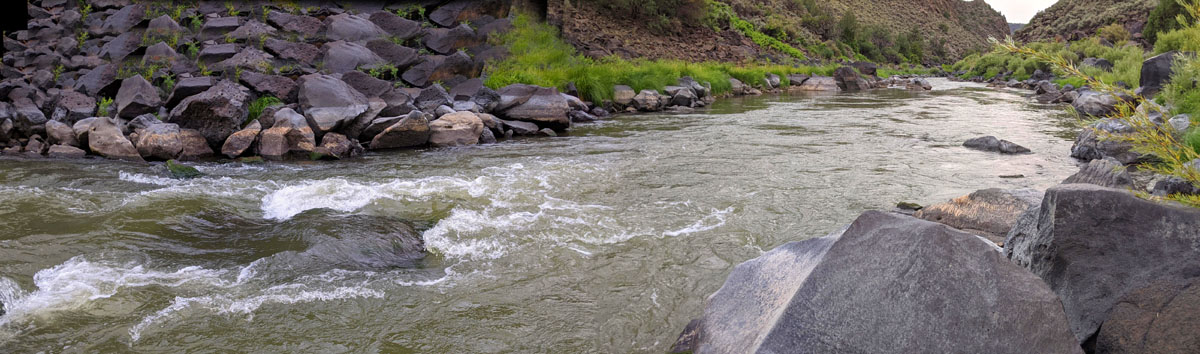
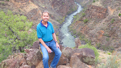
When I got down to the waterside, it was as if I were in a different world. The sound of the rushing water and the vegetation all around me were a much different experience than up on the plateau. I took a nice picture of the Rio Grande looking upriver, and below you an see a panoramic view of the river passing in front of me and heading south:
|
Once again, movies are the way to really express what a place is like, and while I making my movie at the river's edge, Fred was filming me way down below. He also took a zoom picture of me as I was filming.
|
(Mouseover Image if Video Controls Not Visible) |
(Mouseover Image if Video Controls Not Visible) |
I spent a few more minutes at the water's edge before heading back up, and Fred got a nice picture of of me reaching the plateau.
Scrambling down to the river was neat; it reminded me of bouldering at Mt. Scott in the Wichita Mountains. But it was getting late, so we returned to the car and continued on down the gravel road to the south.
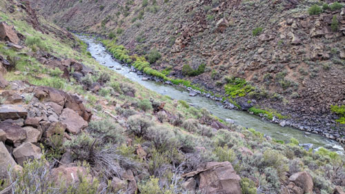
|
From there back to the highway and the Visitor Center we'd stopped at earlier, we stayed down by the river, and there were numerous campgrounds and picnic areas and, when we got a bit closer to the highway, a number of residences.
It was a very nice, leisurely drive in the late afternoon's fading light.
It was just before eight o'clock when we got back to Taos, and we were lucky to just get in under the wire and find a Mexican restaurant that was still open.
Then it was back to the EarthShip after a long and interesting day.
You can use the links below to continue to another photo album page.
|
August 17, 2021: Santa Fe Trip Day 2 |
|
Return to the Index for Our Santa Fe Trip |