|
Casa Pina (Pineapple House): Our Lodging in San Miguel |
|
May 8, 2022: The Trip from Dallas to San Miguel Allende |
|
Return to the Index for Our Mexico Trip |
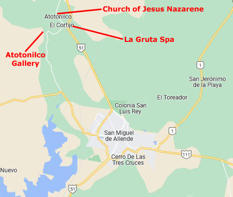
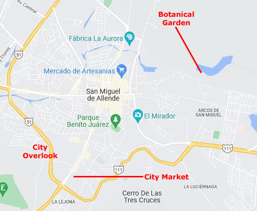
I think that perhaps the first thing to do is to orient you to the city of San Miguel Allende, and perhaps show you an area map with some of the destinations we visited marked on it. Then, I think a map of the central core, where we spent most of our time, would be helpful.
|
The city's name derives from two persons: 16th-century friar Juan de San Miguel, and a martyr of Mexican Independence, Ignacio Allende, who was born in a house facing the city's central plaza. San Miguel de Allende was also a critical epicenter during the historic Chichimeca War (1540–1590) where the Chichimeca Confederation defeated the Spanish Empire in the initial colonization war. Today, an old section of the town is part of a proclaimed World Heritage Site, attracting thousands of tourists and new residents from abroad every year.
At the beginning of the 20th century, the town was in danger of becoming a ghost town after an influenza pandemic. Gradually, its Baroque/Neoclassical colonial structures were "discovered" by foreign artists who moved in and began art and cultural institutes such as the Instituto Allende and the Escuela de Bellas Artes. This gave the town a reputation, attracting artists such as David Alfaro Siqueiros, who taught painting.
This attracted foreign art students, especially former U.S. soldiers studying on the G.I. Bill after the Second World War. Since then, the town has attracted a significant number of immigrants from the United States and Canada, artists, writers and tourists, which has shifted the area's economy from agriculture and industry to commerce catering to outside visitors and residents.
|
We have zoomed in quite a bit in the map at right, which is only about four miles on a side. At this level of detail, we can see some of the places we visited close in, including the City Overlook (which we visited as part of our city tour), the City Market (the largest and nicest grocery store that was a twenty-minute walk from Casa Pina), and the Botanical Garden up by the reservoir, which Greg, Fred, and I visited one morning.
Foreign residents (less than 5% of the total municipal population) have considerable cultural and economic impact; they are attracted by the mild climate, cultural opportunities, low crime, and proximity to the US. There are so many US retirees here that you can find the Lion's Club, an American Legion post, and also a VFW post. San Miguel Allende has about 60,000 residents.
The area has many indigenous groups, mostly Otomi and Nahuas; together, these two groups are 50% of the population. But the visitor would think all these people simply Hispanic, as the native languages have declined to almost no speakers. This is also a Catholic area; 96% of the residents are Catholics. San Miguel Allende is home to three institutions of higher learning, and the many of the city's schools are bilingual and follow an American educational model curriculum.
|
The historic core zone of San Miguel was defined by the federal government in 1982 and adopted by UNESCO in 2008. This is an 80-acre area, centered on Jardin Allende and Parroquia de San Miguel Arcángel, which remains much as it was 250 years ago. The layout of the center of the city is mostly a straight grid, as was favored by the Spanish during colonial times. However, due to the terrain, many roads are not straight.
There are no parking meters, no traffic signals and no fast food restaurants. The roads are lined with colonial-era homes and churches. With a few exceptions, the architecture is domestic rather than monumental, with well-tended courtyards and rich architectural details. The houses have solid walls against the sidewalks, painted in various colors, many with bougainvillea vines falling down the outside and the occasional iron-grated window. Many of the larger structures have large entrances that once accommodated horses and carriages.
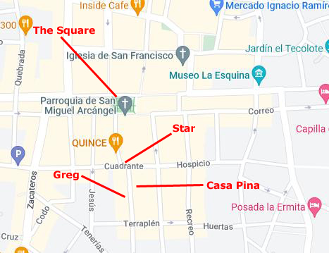
As you will see in picture after picture, the streets seem empty and sterile, lined with walls of different compositions and colors. The doors to residences and businesses are set in those walls, and it is hard to spot something until you are right upon it, or looking at it from across the street. Residential doors are usually carved wood, and are often framed by flowers or some other colorful border. Inside these doors are not the interior rooms of the house, but rather a courtyard (sometimes quite large), around which the rooms of the casa are arranged. Our own Casa Pina, which you will tour later, is a good example of this.
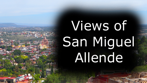
Now that you've been oriented to the city of San Miguel Allende, let's take a look at the various pictures that we took of the city itself. We'll look at it from a distance and close-up; on this page I will put pictures we took while walking or driving around town, and we'll begin with the panoramic views we had at the City Overlook- one of the stops we made on our guided tour around the area.
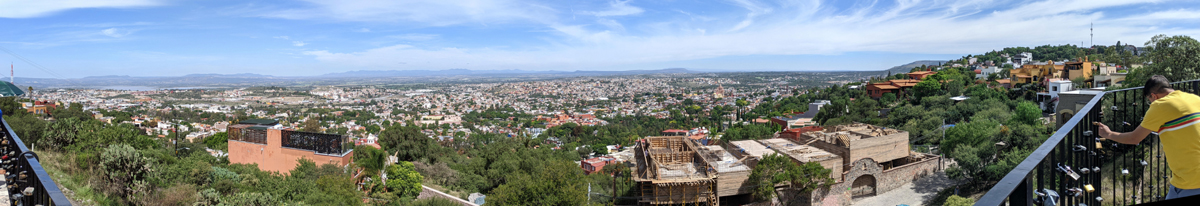
At the City Overlook
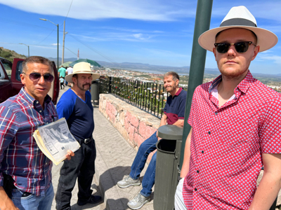
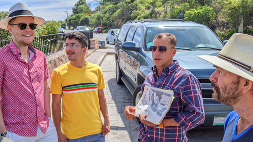
On Thursday, August 11th, Greg had arranged for the owner of the company that provided him (and us) transfers from Guanajuanto Airport over to San Miguel to give Fred and I, along with Chase and Mohammad, a half-day tour of some of the more interesting spots in and around San Miguel Allende. One of these stops was southwest of town where the major road around the west side of town is up on a ridgeline offering good views of the city. This stop was marked on one of the maps above.
Let's begin this section with perhaps the best picture from here at the overlook- a composite of four separate pictures that I took:
 |
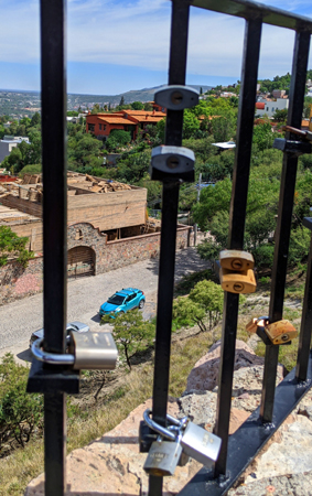
The overlook was basically a wide shoulder along the roadway, with a wrought-iron fence to keep people from falling down the fairly-steep hill just below the roadway. Affixed to the vertical and horizontal members of the fence were hundreds of padlocks.
|
Since the 2000s, love locks have proliferated at an increasing number of locations worldwide. They are treated by some municipal authorities as litter or vandalism, and there is some cost to their removal. However, there are other authorities who embrace them, and who use them as fundraising projects or tourist attractions.
|
As young women from Vrnjačka Banja wanted to protect their own loves, they started writing down their names, with the names of their loved ones, on padlocks and affixing them to the railings of the bridge where Nada and Relja used to meet.
In the rest of Europe, love padlocks started appearing in the early 2000s as a ritual. The reasons love padlocks started to appear vary between locations and in many instances are unclear. However, in Rome, the ritual of affixing love padlocks to the bridge Ponte Milvio can be attributed to the 2006 book I Want You by Italian author Federico Moccia, who made a film adaptation in 2007.
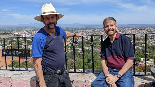
Even though we were not all that high here, the views out across San Miguel Allende were pretty impressive, and the four of us and our guide (who explained the area we were looking at) spent a bit of time here.
|
|
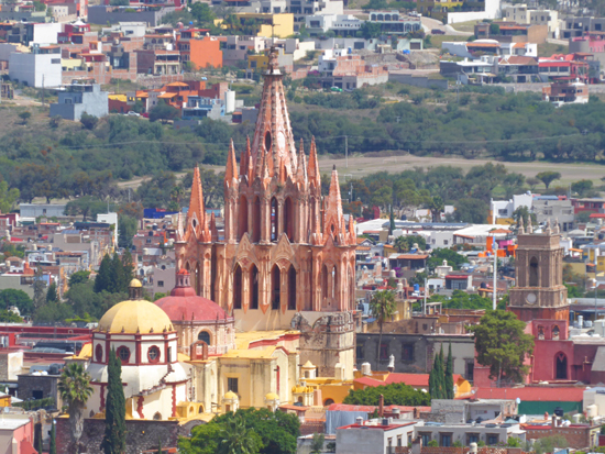
As I said, just the normal views from here were very expansive, although Fred also used his zoom lens on his camera to capture an excellent view of the Parroquia de San Miguel Arcangel. That view, shown below, left, shows the "back" of the church; its facade faces the square which is just beyond the church in this picture. (Casa Pina is in the area just this side of the church complex.)
|
|
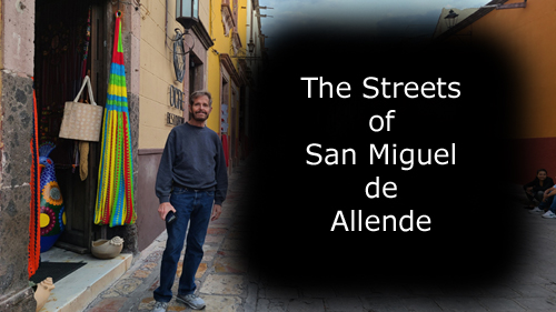
City Scenes
Having gotten an introduction to San Miguel de Allende, and having seen views of the city from a distance, I would like to "complete" this page of the album by including some pictures of the city from our various walks. San Miguel de Allende may look similar to many other places from, say, an overlook up above, but entirely different when you are down at street level.
And one way to get the flavor of this charming colonial town is via a movie or two. One afternoon, when I'd gone out to buy a few things at one of the small groceries north of the main square, I stood on the street corner outside the store to capture the activity. I made two movies here, and you can use the players below to watch them:
|
The Streets of San Miguel Allende |
The Streets of San Miguel Allende |
Those two movies, I think, will give you a good impression about a typical area in the central area of San Miguel (I may begin leaving off the "de Allende" for brevity, not as a comment on the contribution made by Ignacio Allende to the city and to Mexico.)
|
To view the pictures of San Miguel city scenes, just click on the image at left and I will open a slideshow in a new window. Each "slide" or picture will have little arrows in the lower corners that you can use to go back and forth through the pictures. The index numbers in the upper left corner of each slide/picture will tell you where you are in the series. When you are finished looking at the pictures, just close the popup window.
Since the first artists and authors arrived in the 1940s, the town's cultural, foreign and cosmopolitan nature has grown. The city took on a bohemian quality starting in the 1950s with the party ambiance of many resident immigrants and artists. In the 1960s, Cantinflas promoted the area among his friends in the film industry; hippies were taken in for haircuts by the authorities in the 1970s. But now the town is generally too expensive for the backpacking travelers of the 21st century. The growing attraction of the town and its colonial buildings created a vibrant real estate market, which until recently has not been affected by Mexico's fluctuating economy. Many of the old "ruins" of colonial houses have been sold for more than a house in Mexico City.
The city and nearby areas were declared a World Heritage Site by UNESCO in July 2008. It was chosen both for its well-preserved Baroque colonial architecture and layout and for its historic role in the Mexican War of Independence. The area that has been inscribed includes 64 blocks of the historic center and the sanctuary of Atotonilco with the title "Villa Protectora de San Miguel el Grande y el Santuario de Jesus Nazareno de Atotonilco".
You can use the links below to continue to another photo album page.
|
Casa Pina (Pineapple House): Our Lodging in San Miguel |
|
May 8, 2022: The Trip from Dallas to San Miguel Allende |
|
Return to the Index for Our Mexico Trip |