|
July 2, 2001: Glacier National Park (Canada) |
|
June 30, 2001: Kootenay NP and the Icefields Parkway |
|
Return to the Index for Our Canada Trip |
|
July 1, 2001 Maligne Canyon On the Icefields Parkway Yoho NP: Takkakaw Falls Yoho NP: Laughing Falls Yoho NP: Natural Bridge Rapids Yoho NP: Wapta Falls
|
We are up early today, for there is a lot to do and see. We found out about a water-carved canyon that is nearby in Jasper National Park, and once we've hiked there, we'll be driving back down the Icefields Parkway to pick up the Trans-Canada Highway heading west. We'll spend the afternoon in Yoho National Park where there are some waterfalls we want to stop and see.
Maligne Canyon in Jasper National Park
|
This park was declared a UNESCO World Heritage Site in 1984, together with the other national and provincial parks that form the Canadian Rocky Mountain Parks, for the mountain landscapes containing mountain peaks, glaciers, lakes, waterfalls, canyons, and limestone caves as well as fossils found here. Major river systems originating in the park include the North Saskatchewan River (part of the Hudson Bay basin), and the Athabasca and Smoky rivers (part of the Arctic Ocean basin).
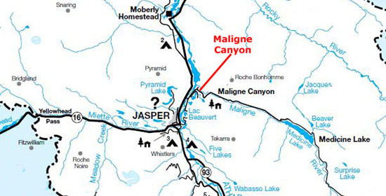
This morning, we'll be driving just a short distance outside of Jasper to the northeast to find Maligne Canyon. The canyon is a natural feature eroded out of the Palliser Formation; it is over 160 ft deep, and the canyon area contains waterfalls, stream outlets, birds and plant life.
|
The smaller streams that feed the valley below that point rebuild the river by the time it reaches the top of the canyon. The river drops down the canyon and intersects the bedrock layers where the underground river flows. Also at this point numerous large underground streams join and greatly amplify the flow. The canyon has been deepening steadily from the churning and swirling of the water; while at the surface the canyon is only about seven feet across, it is 25 times that deep. In the United States, the general term for a canyon this narrow but this deep is a "slot canyon." Limestone is one of the most dominant minerals within the canyon, having been originally deposited when the interior of the North American continent was a vast, shallow sea.
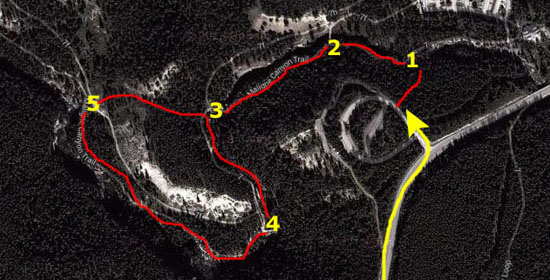
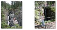
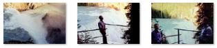
We found the parking area with no problem and then cut through the woods on a narrow trail to reach the first of 5 bridges over the canyon. From this point, we followed the signs directing us along the hike, eventually making a loop before retracing our path to the first bridge.
The canyon, which is pronounced 'Mal-een', is an odd duck- a slot canyon with a river running through it. "Maligne" is French for evil or wicked, from the same Latin root as our word "malign." It may have gotten its name due to the weird sights one can see here- alternating sections of running water and dry river bed, water flowing upstream and waterfalls that are swallowed by the earth.
|
There are times when the water disappears entirely; for a distance it runs underground through an unexplorable cave system that is about 20 miles long, running from Medicine Lake all the way to the Athabasca River. It is the source for such beautiful lakes as Lake Annette and Lac Beauvert and many a spring down the valley.
|
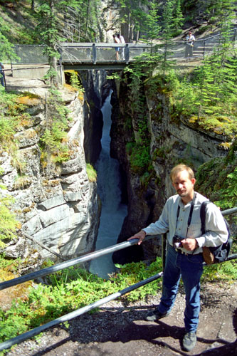
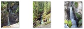
There were numerous waterfalls, and the sound of them was always present. Sometimes, we couldn't even see them, the canyon was so steep and so deep. At one waterfall we could see, the water went right into the earth at the bottom of the cascade, reappearing a hundred feet down the canyon.
Along the hike we ran into Crasher Squirrel; either he travels very fast and is following us, or there is more than one of him. Fred also got a nice closeup of some of the forest flowers.
We spent about two hours walking around Maligne Canyon before returning to the car and heading off back down the Icefields Parkway.
You can return to today's index
or continue with the next section below.
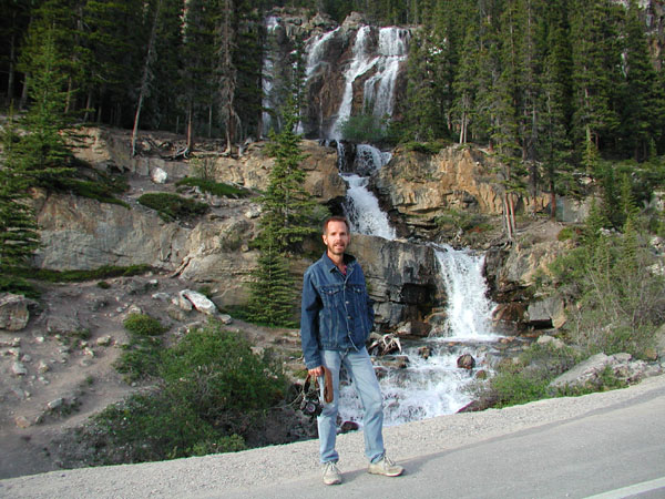
On the Icefields Parkway
|
|
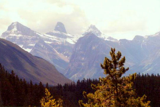
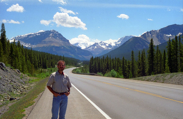
Jasper National Park has two main valleys. We are traveling in the Bow River valley which goes generally north-south. Yoho National park is beyond the mountains to our right, and to our left, on the other side of a range of mountains to the left of the highway is the valley that contains Maligne Lake.
|
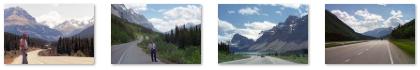
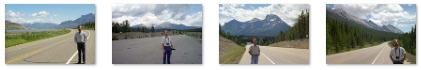
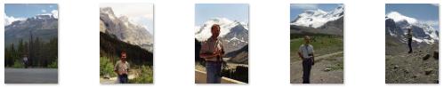
This was just one of many stops; use the clickable thumbnails below to see some of the pictures that we took at some other scenic points:
 |
Just before we reached the Athabasca Glacier again, we stopped for lunch at a picnic table up on the hillside. (We decided to bring that cooler back with us on the airplane, and even now, thirteen years later, I still have it.) Just before we packed up to move on, Fred got a very nice closeup of a mountain flower.
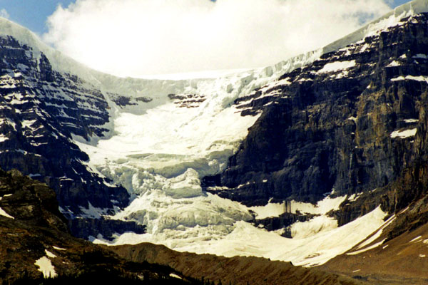
We did go by the Athabasca Glacier again, and it was even more beautiful today when the weather was much nicer. Fred got a closeup of the glacier from the highway. As you can see, there are people and small vehicles pretty far up the ice flow- a lot further than we went.
|
It was extremely hard to tell from this distance, but if I had to guess, I'd saw the snow was perhaps 40 or 50 feet deep!
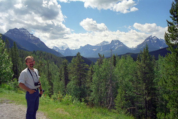
I can't say enough about how much prettier the scenery was this morning than it was yesterday; that's why we took so many pictures today and so few vista-centric pictures yesterday.
|
|
To view the slideshow, just click on the image above and I will open the slideshow in a new window. In the slideshow, you can use the little arrows in the lower corners of each image to move from one to the next, and the index numbers in the upper left of each image will tell you where you are in the series. When you are finished looking at the pictures, just close the popup window.
We turned west on the Trans-Canada Highway, and soon we were entering Yoho National Park.
You can return to today's index
or continue with the next section below.
Yoho National Park: Takkakaw Falls
|
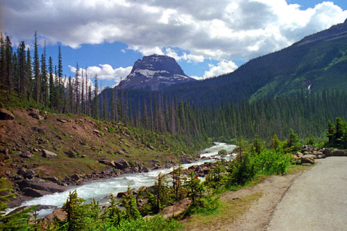
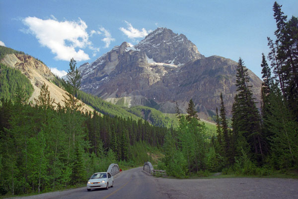 Yoho Peak in Yoho National Park |
Yoho covers 507 square miles and it is the smallest of the four contiguous national parks. Yoho, together with Jasper, Kootenay and Banff National Parks, and three British Columbia provincial parks (Hamber Provincial Park, Mount Assiniboine Provincial Park, and Mount Robson Provincial Park) form the Canadian Rocky Mountain Parks World Heritage Site. The park's administrative and visitor center are located in the town of Field, British Columbia, beside the Trans-Canada Highway.
From our park brochure, we could see that there were two waterfalls to our north that we wanted to see, so at the Field junction, we took a park road to them. The view of Yoho Peak above was right in front of us as we drove up to the parking area for the two waterfalls.
|
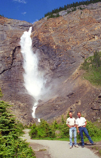
At its highest point, Takakkaw Falls is 1,260 feet from its base, making it the second-highest officially measured waterfall in western Canada after Della Falls on Vancouver Island, and third-highest in the entire country. However its true "free-fall" is only 833 feet.
"Takakkaw", loosely translated from Cree, means something like "it is magnificent", and nothing captures the awe and wonder of Yoho National Park like the tremendous thunder of Takakkaw Falls. Plunging from above, the water coming over Takkakaw Falls leaves every visitor humbled. Fed by the Daly Glacier above, Takakkaw Falls' flow is at its peak in July when glacial meltwater is running freely, so we have timed our visit pretty well. As a matter of fact, the Yoho Valley access road that we took coming in is closed during the winter season due to the high-frequency of avalanches; it is only open from June through October.
It was hard not to over-photograph the falls, which were the best we had seen so far, and we did take quite a few pictures. I have selected five of these to include here, and you can use the clickable thumbnails below to have a look at them:
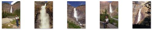 |
The footbridge takes you over the stream created by Takkakaw Falls, and you can see it flowing to the southeast towards Page Peak here. There were two other pictures I wanted to include from Takkakaw Falls, and they are below:
 Looking Towards Page Peak from Takkakaw Falls |
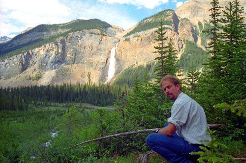 Takkakaw Falls from Across the Valley |
You can return to today's index
or continue with the next section below.
Yoho National Park: Laughing Falls
|
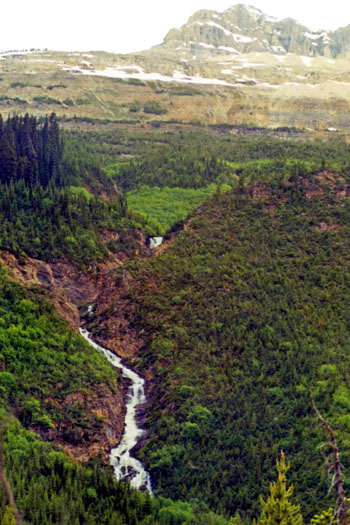
I liked Laughing Falls because we could make our way right up to them, and scramble up and down the hill beside them. You can use the clickable thumbnails below to see some other pictures we took here at Laughing Falls- of the falls and of each other:
|
From here, we got back in the car and back to the Trans-Canada Highway, and headed southwest through Yoho National Park.
You can return to today's index
or continue with the next section below.
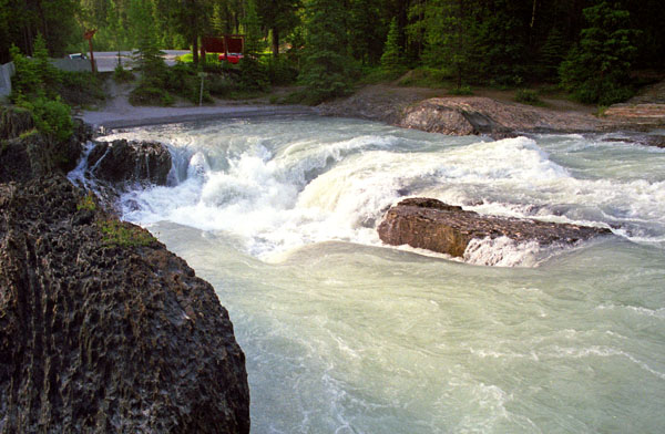
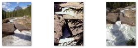
Yoho National Park: Natural Bridge Rapids
|
It was fun to climb around on the rocks for a while, and we took some additional pictures while we were doing so. You can use the clickable thumbnails below to have a look at them:
 |
We got back to the highway for another ten mile drive to the last waterfall on our list.
You can return to today's index or continue with the next section below.
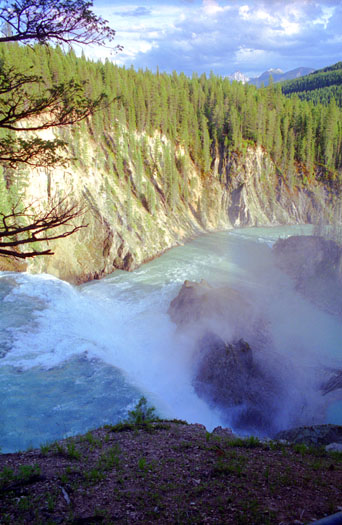
Yoho National Park: Wapta Falls
|
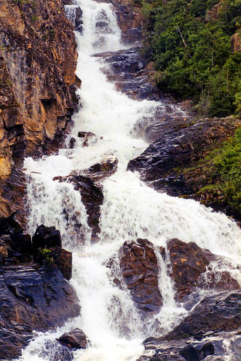
To get to the waterfall, we parked at an area just off the highway and followed the signs for a 30-minute walk through forest and meadow. Our reward was to see one of Yoho's largest waterfalls backdropped by the jagged peaks of the Ottertail Range. When we got to the falls, we found an overlook (with supplied iron railings to keep der kinder from falling in), and the widest, loudest waterfall in quite some time (and in quite a few trips).
|
Wapta Falls, as named by First Nations people, was the location of an historical event in 1858 that gave the Kicking Horse River its name. During this year the Palliser Expedition brought the first white explorers to Yoho. Near Wapta Falls, expedition member James Hector was kicked in the chest while trying to recover a runaway horse. The other expedition members, believing he was dead, began digging his grave, only to be surprised by a blink of Hector's eye 2 hours later -- luckily for Hector, before his grave was put to use. He recovered suitably to push on with the expedition which proceeded to make the first recorded passage of what is now known as the Big Hill leading up into the Bow Valley from the present day location of Field.
Expedition members aptly named the river "The Kicking Horse".
Wapta Falls was our last stop of the day. All that was left was to hike back to the car and continue west on the Trans-Canada Highway to the small city of Golden, where we spent the night and had dinner. I should mention that it was a surprise when, after it got dark in Golden, fireworks started going off. It took a few minutes before we realized that July 1 is the Canadian version of our July 4th holiday.
You can return to today's index
or use the links below to continue to another photo album page.
|
July 2, 2001: Glacier National Park (Canada) |
|
June 30, 2001: Kootenay NP and the Icefields Parkway |
|
Return to the Index for Our Canada Trip |