|
July 13-14, 2002: Colorado Trip Days 8 and 9 |
 |
July 11, 2002: Colorado Trip Day 6 |
 |
Return to the Index for Our Colorado Trip |
July 12, 2002
Colorado Trip: Day 7
We leave Glenwood Springs today and work our way down to Ouray, Colorado, where we plan on doing a couple of hikes and seeing the town.
Driving to Ouray, Colorado
On Friday morning, we broke camp, packed up the tent and took the picture that you saw at the tail end of yesterday's page. Then it was off to Ouray, Colorado.
We drove back into Glenwood Springs for some breakfast, and then headed south out of town. Pretty soon, we were out of the built-up area and driving through the beautiful landscape between the Gunnison and Grand Mesa National Forests. For the first part of our trip, the road went through a canyon cut by
the Roaring Fork River,
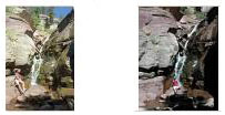
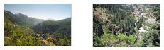
which flows into the Colorado at Glenwood Springs. At one point, we saw the sign for a trail to a small waterfall that we'd read about during our preparations, so we stopped the car and hiked the short quarter-mile trail. We were rewarded with a picturesque little waterfall. To see a couple of pictures of it, just click on the thumbnail images below:
It was really a beautiful drive through the mountains that now, in the summer, are covered in green.
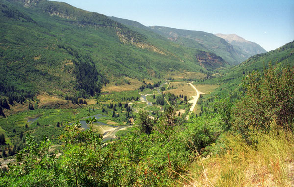
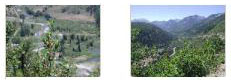
Our road alternated between narrow canyons with the stream running through them, and wide valleys, like the one in the picture at right, with the same stream running through them, too. Below are more thumbnails for pictures we took along this part of our drive; just click on them to view the full-size pictures:
Before we left the National Forests, there was one more short waterfall hike we'd read about, and we stopped to take it, too. It led to
a large boulder with a cascade running over it.
It wasn't a spectacular waterfall, but then and again it was only a four-minute walk to get to it from the road.
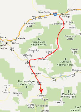
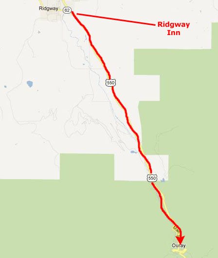
We merged with US 50 near Delta, and continued south towards Montrose. There, we continued south on US 550 towards Ridgway. In the next two days we were going to do hikes in both Ouray and Telluride, and because we'd spent a good deal of time driving, we thought we do the closer of the two, Ouray, today. Both the road to Telluride and the road to Ouray meet at Ridgway, so we decided to stay there this evening. We stopped and got a room at the Ridgway Inn, and then continued south to Ouray. (As we were driving through Ridgway, Fred noticed a piece of
roadside artwork,
and he took a picture of it because of the buffalo on it.
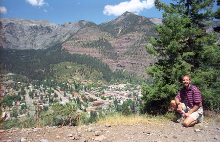
The highway climbed into the San Juan National Forest, and then descended into the valley in which Ouray is situated. There was a viewpoint above Ouray, and Fred stopped to take a picture of me at the viewpoint:
You can return to today's index
or continue with the next section below.
Box Canyon Falls
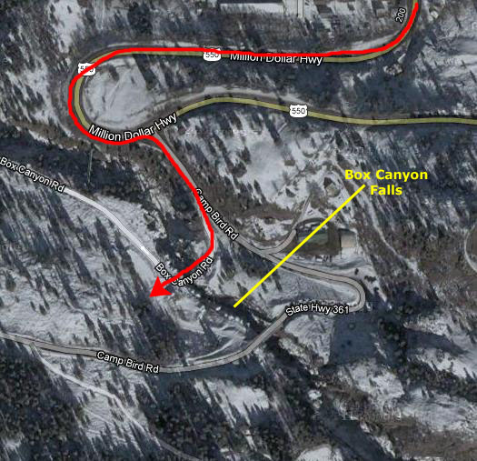
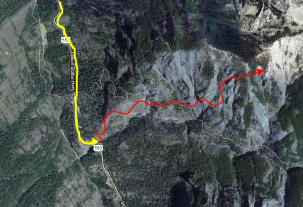
We stopped in Ouray for a bit of lunch, and then drove south out of town on US 550. In about a mile, we saw the sign for Box Canyon Falls.
(I should point out that the aerial view at left must have been taken in late fall or early spring, for there is a dusting of snow on the ground. When we were there, it was a sunny, warm day. Also, you can't really see the falls in the aerial views available; the canyon is way too narrow to make out much of anything from the air.)
The Box Canyon Waterfall & Park is Ouray�s natural wonder� formed when the rushing waters of Canyon Creek eroded a
deep and narrow box canyon
(the Uncompahgre Gorge) through fault weakened limestone. There were a couple of ways to get to the falls, we found out later. We could have walked walked a half-mile trail from the southwest corner of Ouray, just off Third Avenue, but the only way we'd read about to get there was by car, and we followed the route marked on the aerial view.
We found the falls with no problem, paid our entrance fee and looked around in the Visitor Center for a few minutes.
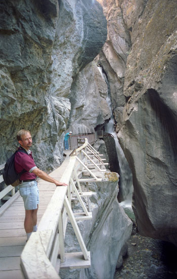
There were two trails we could follow here at Box Canyon Falls, and we did both of them. The first trail was only about an eighth of a mile long, and it led straight into the the belly of the falls via a walkway and suspension bridge. The roar of the water was loud before we even got to the falls themselves; thousands of gallons of water a minute ricochet off a mix of rugged crags and smoothly eroded pre-Cambrian rock, rushing eighty feet to the canyon�s bottom.
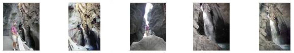
We traversed the walkway that led from the trail "outside" into the gorge, and then across a small bridge to the base of the falls. Then we descended a flight of steps to stand on the rock at the base of the falls. The sound was almost deafening as we snapped some pictures of the falls from below. Click on the thumbnails below to have a look at these pictures:
The other trail that we could follow was a walk from the Visitor Center, which contained interpretive exhibits on the geology, wildlife, rare plant life, and history of the area, up a steep slope to
the bridge above the falls.
From there, we could look down on the water as it plummeted into and then
ran through the canyon.
From this vantage point we also had
a beautiful view of Ouray.
The bridge
was actually positioned directly above the falls, and directly above
the walkway to the base of the falls.
I think the bridge made Fred a bit nervous; the floor of it was not solid and so you could see through it and look directly down. Heck, it gave me pause, too. But the views were worth it.
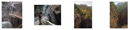
When we had been down at the base of the falls, and had taken the flight of steps down to stand on the rocks for our picture-taking, I had noticed that the stairs went up as well as down, but at the time I wasn't sure where they went. But from this trail we found that you could take
the steel stairway
back down if you wanted to, and so we did that, coming out right by the falls again.
We returned to the Visitor Center where there was also a loop trail that led through the native vegetation on a short walk through the woods, and we did that, too. I also want to include a few additional pictures that we took while here at Box Canyon Falls- another view of the stairs, a picture on the lower walkway, and two views looking up Box Canyon. In 2001, Box Canyon Park was designated an important bird watching area by the National Audubon Society. It supports one of the state�s largest populations of Black Swifts, a protected species. These birds nest here in their preferred habitat� which just happens to be on canyon walls sheltered by overhanging rocks and near waterfalls.
You can return to today's index
or continue with the next section below.
The Shale Hill Hike
Highway 550 south of Ouray was very scenic and, not knowing whether tomorrow's weather would be as good as today's, we decided to drive south a short ways.
As it turned out, the road crossed over and then paralleled one of the streams that feed Canyon Creek- the water that goes over Box Canyon Falls; it actually crossed
the stream
a couple of times. At one stop, there was a trailhead for a short hike that took us up
a side canyon
through which this stream was flowing. We took the time to climb maybe an eighth of a mile up this canyon where we got an excellent view
looking back down towards the highway
from our perch a hundred feet above it.
There was also another stop that offered a short climb to the top of a huge pile of rocks, and which then rewarded you with nice views up and down the highway, such as
this view, looking south.
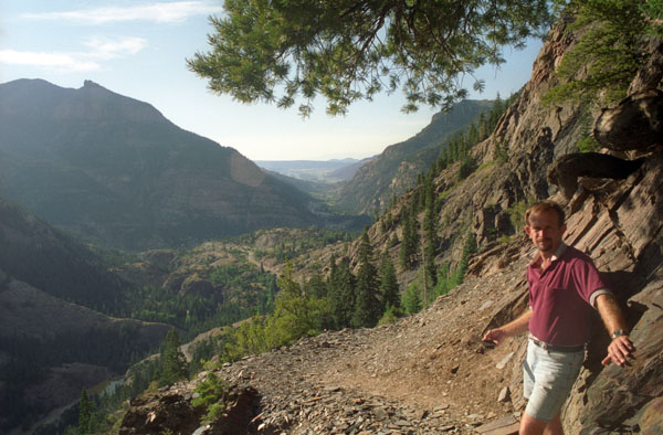
And then we ran across the parking area for another hike, the information board for which said that it was a three-mile hike up and across the sides of mountains east of the road to another waterfall and small lake. That one we decided to do as well.
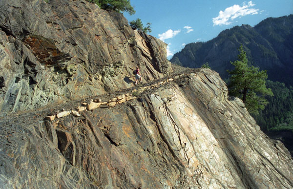
The hike began on what seemed like a normal trail, but pretty quickly we found that the path consisted of thin pieces of what looked like shale; it was all fractured and in relatively small pieces. Shortly, we hiked across
an avalanche of shale pieces
that extended way up the hillside. The hike wasn't all across that kind of stuff; sometimes it crossed rocky areas but it was almost always right on the hillside. In the view you can see
here,
we are crossing a rocky area on the side of the mountain and on the cliff ahead of us you can see the narrow trail winding across its face. The path was fairly narrow in spots, but we were treated almost continuously to
beautiful views to the south
and west.
We hiked along the path for over a mile, ascending across the faces of the mountainsides.
But the path got progressively narrower and as you can see in the picture at left of Fred ahead of me on the trail, the drop-off was steep on our right; one false step and there wouldn't be much to stop you for a long ways. I could tell that Fred was getting nervous about that; when I caught up to him and went ahead to scout the trail, I found that it was even making me a bit concerned- and the view ahead revealed spots that might be dicey. So, discretion being the better part of valor, we decided we'd made a good effort and seen some nice scenery but that yet another waterfall wasn't worth the chance of some serious mishap. We decided to turn back.
Still, the hour was well-spent; the landscape was certainly beautiful. Click on the thumbnail images below and you'll see what we mean:
While we hadn't done that much hiking today, we'd covered a lot of ground, and it was nice to get back to the Ridgway Inn and just relax. We had a nice dinner down in Ouray and then looked at some things we might do tomorrow in Telluride.
You can return to today's index
or use the links below to continue to another photo album page.
|
July 13-14, 2002: Colorado Trip Days 8 and 9 |
|
July 11, 2002: Colorado Trip Day 6 |
|
Return to the Index for Our Colorado Trip |