|
July 19, 2007: New Mexico/Colorado Trip Day 6 |
|
July 17, 2007: New Mexico/Colorado Trip Day 4 |
|
Return to Main Index for New Mexico/Colorado Trip |
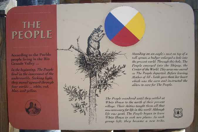
Chimney Rock Archaeological Area
 |
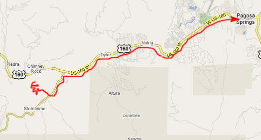
Chimney Rock is about twenty miles west of Pagosa Springs along Highway 160. Fred had talked about it quite a bit the day before. It seems that he and his family had driven this road many years ago, but that Fred's urging that they stop to see Chimney Rock had been ignored by his parents, and so he's wanted to return here for quite some time. This was his chance.
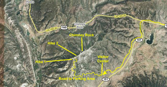
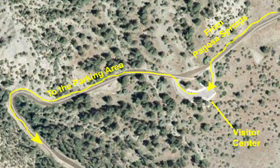
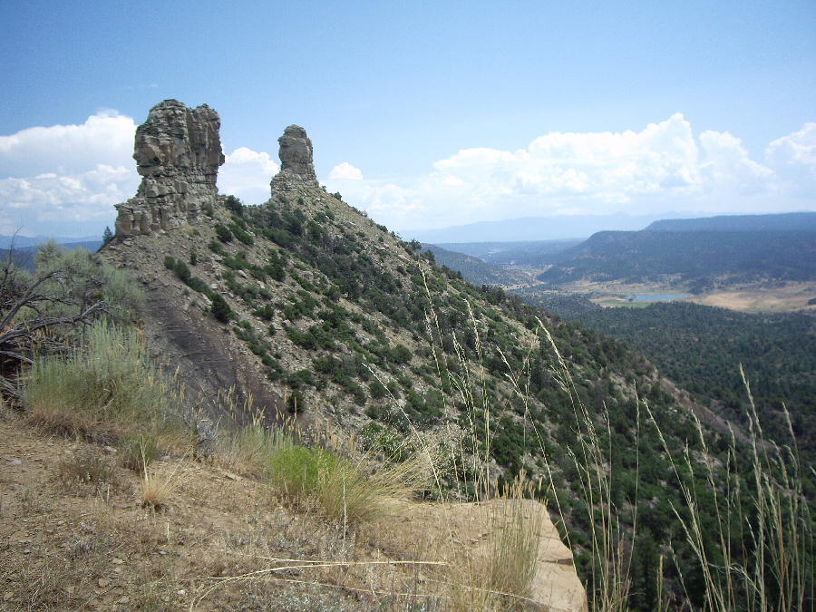
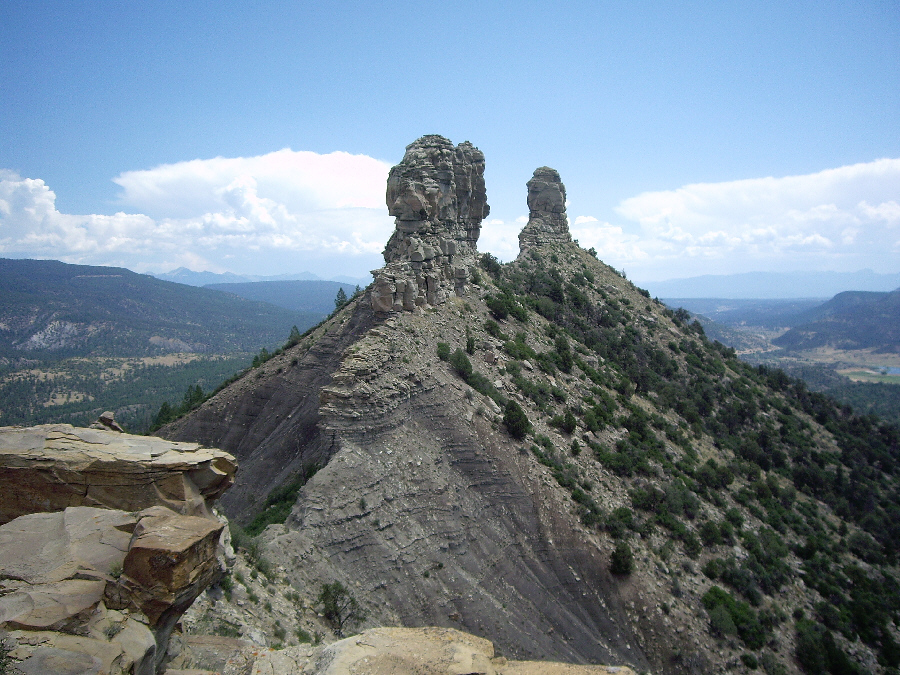
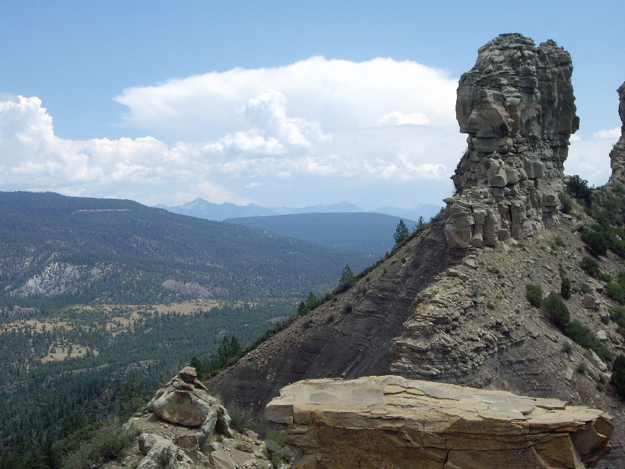
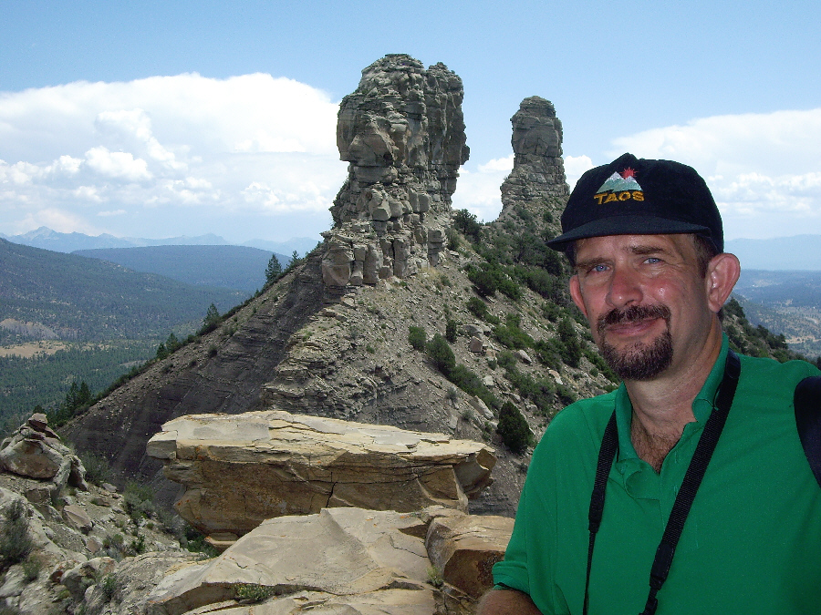
As we drove west to the turnoff for State Highway 151, we were treated to the continual observation of two early-morning baloonists. They floated up above the highway, and eventually we drove straight under them. After about a half an hour, we reached the Highway 151 turnoff, and headed south west for about five miles to the entrance to Chimney Rock. Then it was only a mile or so until we reached the Visitor Center. On the way, I got my first good view of the two spires of Chimney Rock- one called Chimney Rock and the other The Sentinel.
The Visitor Center
 |
We spent that time in the small Visitor Center itself, looking at the various exhibits. It was here that I discovered that Chimney Rock was not just the rocky spires, but that adjacent to the rock up atop the mountain was an extensive area of Anasazi ruins. As it turned out, this area has many of the same features as Chaco Canyon, although not nearly so extensive. But we learned that we would see rock rooms and kivas that we'd seen elsewhere in the southwest.
Among the exhibits was a model of what it is thought a typical Anasazi building might have looked like. We learned a lot about their supposed construction methods, and we could understand why only the rock walls were now left.
Another exhibit displayed some of the many pottery shards that have been collected at this site. Alongside the display of these shards was an extremely informative explanation of the markings we could see on the shards, and the ribbing that many of them displayed.
There were lots of other interesting exhibits, and Fred found a souvenir to buy. Outside, just before the tour began, we sat and watched the many hummingbirds taking advantage of the two feeders that were hung under the eaves of the center.
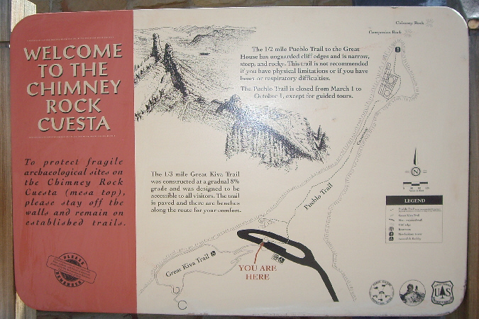
Right on schedule our tour guide came out and gathered us all together and gave us an initial explanation of what we'd be doing. There are going to be two trails- The Great Kiva Trail and The Pueblo Trail. Our guide mentioned that while he'd be explaining as much as he could about what we would see, there would also be many explanatory signs along the kiva trail. I decided that I'd photograph as many of them as I could and use them instead of writing a lot of narrative.
(Now that we are home and I am creating this album page, I'm going to include pictures of as many of these signs as I think provide information, and let you read them as if you had been on the tour with us. I won't attempt to point out on the tour map where each sign was; that is hardly important information. But I will supplement each with any pictures or movies that we took of the area each sign describes.)
 |
Orientation Atop the Ridge
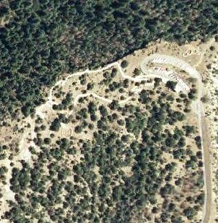 |
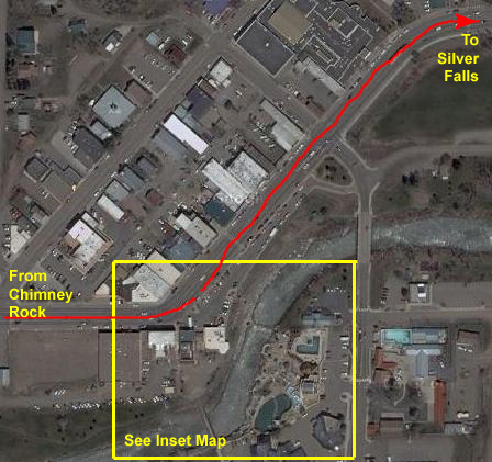
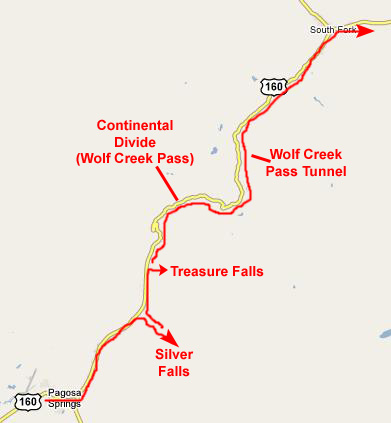
We reached the top in about fifteen minutes, parked the car and walked with the other tour members over to the beginning of The Great Kiva Trail. I've included an aerial view of the portion of the mountaintop that was covered by The Great Kiva Trail, and you can match up the actual trail (you can see the sidewalk in the aerial view) with the map of the trail above. I have annotated the map with numbers to show approximately where we were on the trail when various sets of pictures were taken. You may wish to refer to this map as we proceed around the trail.
Our tour guide gathered us together and began discussing the known history of the Anasazi.
 |
The main mystery, as you may know, is "Why did they leave their cities and settlements so abruptly, and where did they go?" They left behind remnants of a culture that must have been very advanced for its time, with their knowledge of astronomy, time-keeping, construction and so on. For North America in 1000AD, it was a high culture. But then, in the space of less than a century, it was gone, and all we see are the stone ruins of their buildings and all we find are the broken shards of their possessions.
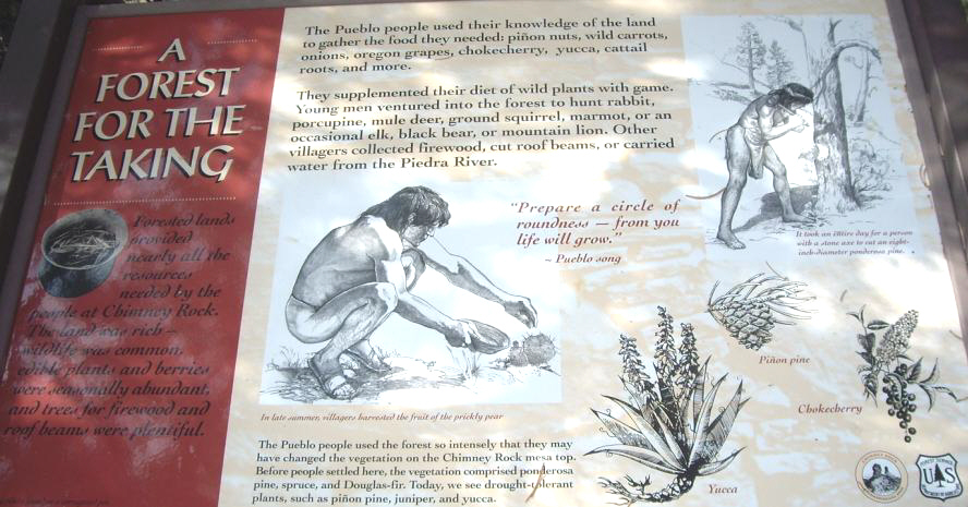 |
All along The Great Kiva Trail, our guide pointed out the evidence of their presence.
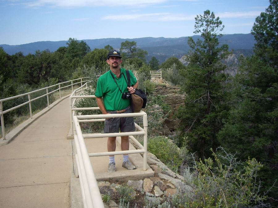
After our introductory talk and some time for questions, the group headed off down the paved Great Kiva Trail. We had just gotten down below the rock wall that surrounded the area by the parking lot when Fred noticed this interested observer, watching us warily as we headed down the trail.
The Great Kiva Trail
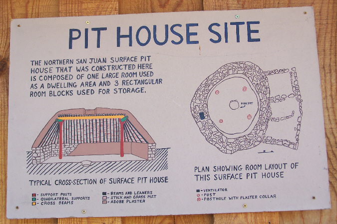 |
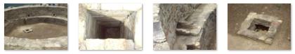
Because of bedrock, this pithouse was built mostly aboveground. To enter, the inhabitants used two ladders. The first was used to get from ground level to the roof, and the second to climb into the dwelling through the smoke hole. I didn't think to ask our guide why such a complicated method of entry was used. Surely the Pueblo could have figured out how to build a doorway, which could have been covered with a hide or something for easy entry. Just one of the many mysteries left by these people.
Read more about this particular pit house here.
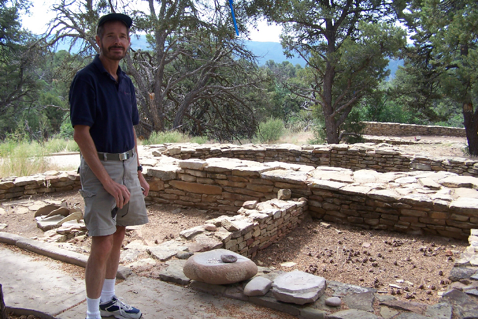
Wandering around the remains of this pit house was immensely interesting, for it offered a look at how a normal family might have lived. Fred and I took a number of pictures of the wall remains and of the reconstruction of some of the implements that the inhabitants used. Thumbnails for four of these pictures are below; to see the full-sized image, just click on the thumbnail:
 |
 |
 |
 |
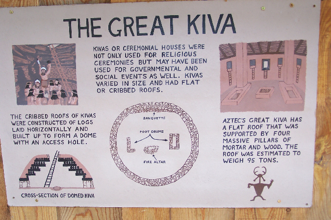 |
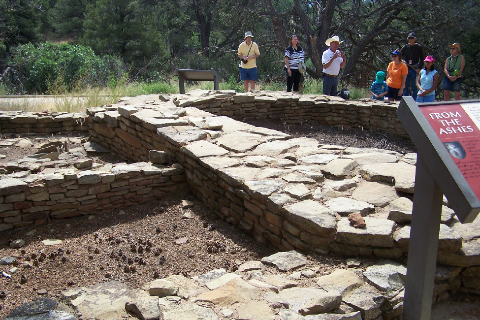
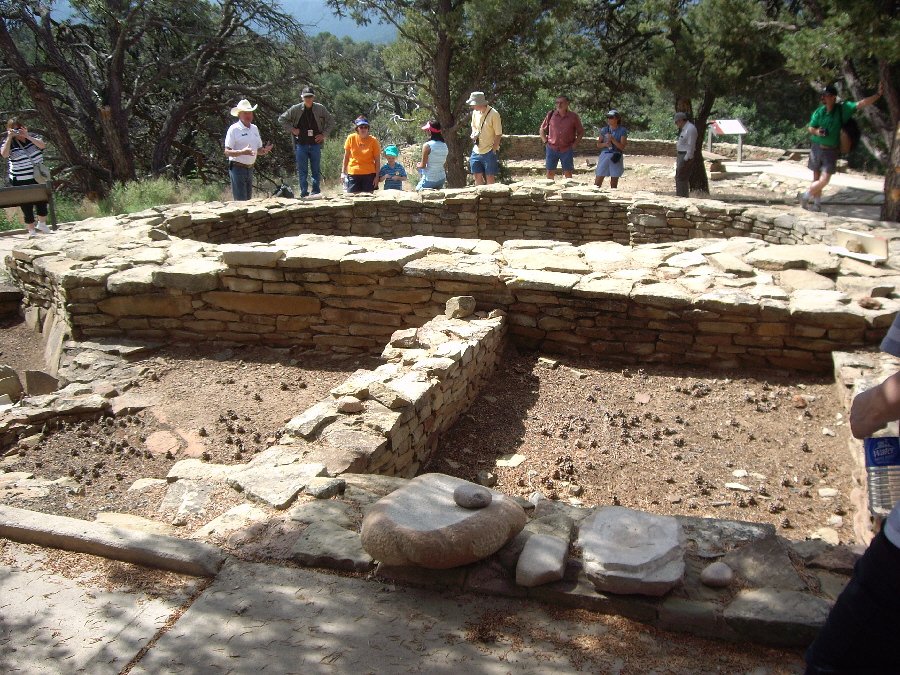
This kiva was almost identical to those we have seen all over the American Southwest, wherever the Anasazi people have lived. To this day, no one has provided definitive answers for the many questions that surround these structures. What were they used for? Why are they all the same? What's the meaning of the common structures built inside them? These and other questions are still unanswered.
One of the common elements of the kiva structure is the vent hole that is always built into the wall somewhere. Of course, I am assuming it was for ventilation, or to let out smoke, but of course I can't be sure.
Our group had lots of questions for the guide, and we stayed here for some time, getting what answers we could. This particular kiva certainly had a spectacular view.
Read more about this kiva here.
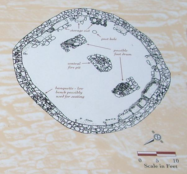 |
I've blown up the inset diagram from the panel you just looked at so you can read the description of the various rock structures inside the kiva. I note that in many cases the archaeologists are not sure what the structures were for.
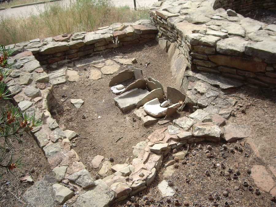
When we were through asking questions at the great kiva, the trail backtracked a bit and then headed towards the edge of the ridgeline ( click to show trail map ). Just before reaching the ridgeline, we passed another point of interest where there had been another, smaller pit house and where the inhabitants of this site apparently discarded broken or useless items- kind of like a landfill. Many shards of pottery and other items have been found at this spot, and you can read more about the rubble mound and the nearby pithouse here.
Just after this spot, we reached the edge of the ridgeline, where we were treated to beautiful views of the Piedra Valley to the northwest. It is hard to describe how beautiful this valley was, but you can see some excellent views of it here, here and here. I can only imagine that the Pueblo must have thought the views magical, and perhaps that is part of the reason why they built their houses and kivas at the crest of a mountain, rather than in desert valleys as we have seen before. Of course, when the Pueblo were here, the farms in the Piedra Valley were far, far in the future.
|
|
 |
There was a little inset picture on the previous sign that you probably couldn't read, so I've blown it up and clipped it out and you can take a look at it here.
The walk along the ridgeline was spectacular, with the constant view of the Piedra Valley laid out below us. Just after the trail turned to go along the ridgeline, we came to the first of two overlooks ( click to show trail map ) where the paved trail has been extended out a few feet over the edge of the ridge. At the first overlook, there was an interpretive panel describing some of the relationship these early inhabitants had to astronomical events, in this case, the rising sun. You can take a look at that interpretive panel here. Fred and I have always been fascinated thinking about how much these ancient people actually knew about the relationship between the earth and its nearby planets, the moon and the sun. Patient observation, curiousity and a keen mind were all that was needed for them to develop a reliable "cosmological clock," which they used to control their seasonal activities.
The group, and Fred, went on ahead along the ridgeline path, while I hung back taking a picture of the panel I just described. Just before leaving that first overlook, I took a picture of the group up ahead, and Fred at the second overlook, after which I walked up the trail to rejoin the group. At this last interpretive spot on The Great Kiva Trail, our guide talked about the theories concerning the apparent disappearance of the people who inhabited this site and, indeed, all of the Anasazi. We learned that the disappearance may not have been as mysterious as some might think; there could be a number of reasons why these inhabitants left everything behind and just moved elsewhere. At this last spot on the first trail there was an interpretive panel that set out some of these theories, and you can read that panel here.
We'd reached the end of the first trail and the group returned to the parking area for a rest stop before we headed out on the second trail up to the Chimney Rock viewpoint. As the group moved off from this last spot, Fred and I took some pictures looking back along the ridgeline trail, and I've put thumbnails for some of these pictures below. You can view a full-size image by just clicking on its thumbnail.
 |
 |
 |
The Pueblo Trail
As I did for the Great Kiva Trail, I've cut out a trail map from one of the signs and, as we proceed along the trail, will mark on the map our route and where certain pictures were taken. Each time, I'll provide you a link that will pull up the trail map should you want to see it.
Just beyond the entrance gate, our tour guide took us on a short side trail off to the left ( click here for trail map ) over to two small circular kiva-like structures. These structures, our guide told us, may have been dwellings but were, more likely, used for storage. There were quite some distance from the main Chaco House up the hill, so that might be plausible. My own idea is that they formed an early residence while the main buildings were being constructed up the hill, but who knows?
 |
Even from the lower part of the trail, the views of the surrounding mountains are spectacular, and only improved as we got higher. At the end of the row of small house ruins, we stopped and looked west back along the trail towards the parking area. Then, we walked along the trail portion that is at the very crest of the ridgeline, with just a matter of ten feet or so on either side before the ridge dropped off to the north or south. After negotiating this narrow portion of the trail, we stopped again and looked back along the narrow ridgetop trail.
From this same viewpoint, we could now see some of the farms in the Piedra valley, certainly as picturesque view as you could hope for. And also from this same point, here's a picture of Fred and the trail ahead.
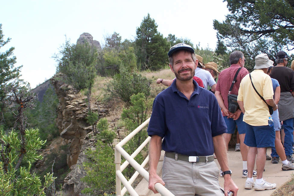
At the end of this section of the trail, it rises steeply in "the stairway," a series of trail switchbacks that end on the plateau where the Chaco Great House is located. It was at this point that we found a number of the tour group members having to sit down and take the stairway in stages. Many of them didn't look any older than Fred or I, but there were some of them who were obviously out of shape. But I give 'em credit for making the climb anyway. Their reward would be the Chaco Great House and the amazing view of Chimney Rock.
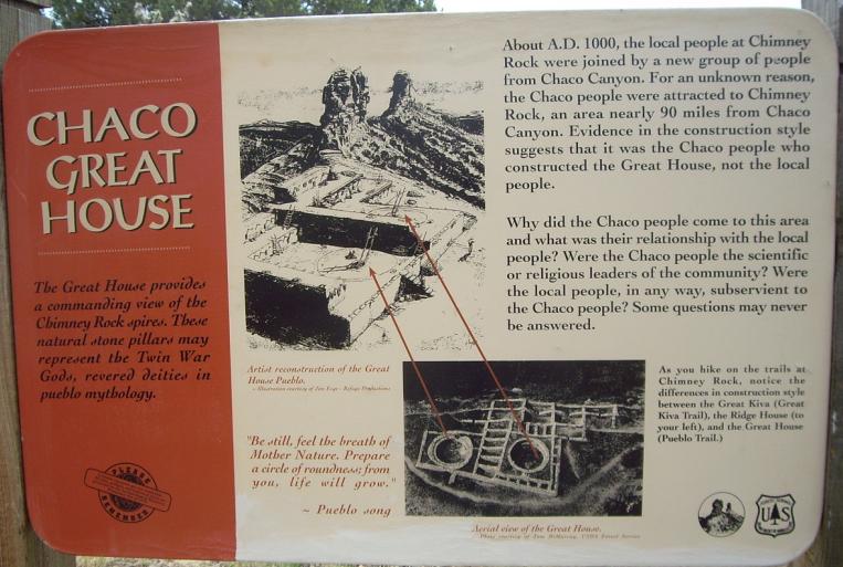 |
As the trail reached the Chaco Great House ruins, we found ourselves below the southeast corner of the House where we stopped to get a picture. The tour group had moved around to the east side of the ruins- an area known as the Long Wall- where our tour guide stopped and gave us an introduction to the history of the ruins. As it turns out, archaeologists and historians believe that this particular Great House was not build by local residents, but rather by Chacoans who traveled here from the Chaco Canyon area- this determined by the style of construction. It is thought that these emissaries from Chaco Canyon began to share much knowledge and technology with the original residents of the Chimney Rock area, and, eventually, the two groups became indistinguishable.
I found the wall construction to be immensely interesting. You can see from the picture that the construction was very precise, with layers of very thin shale alternating with layers of three-inch bricks. Cutting the forming the stones so precisely must have taken a great deal of time and effort; I was impressed. Behind and above the Long Wall are the kivas and rooms of the Great House; there is a great deal of weight being held back by the wall. From a vantage point at the northeastern corner of the ruins, you can look back along the wall and see the wall bulging outward. This not an uncommon sight anywhere you see modern retaining walls, unless they are very, very sturdily built. But the difference is that the amount of bulging that you see here took almost a thousand years to occur; modern walls collapse completely in less than a tenth of that time, which is an indication of the care with which these walls were built.
|
|
The tour guide had a lot of interesting things to say about the main kiva here and kivas in general, but we had heard most of it years before in Chaco Canyon. But it was interesting to get out onto the ruins and stand on the edge of the kiva- something I don't remember doing at Chaco Canyon.
While we were listening to the guide, we took a number of pictures of the various architectural elements of this main kiva (and of almost all kivas, all of them seemingly built on the same model). I've put thumbnails for these pictures below; to view a full-size image, just click on its thumbnail:
|
Fred took a couple of really nice pictures capturing the ruins and the mountains in the background, and you can view those pictures here and here. And before heading off to see Chimney Rock, we both took some other interesting pictures of the Chaco Great House ruins, and I have selected the best of these and created thumbnails for them below. To view any of the full-size images, just click on the appropriate thumbnail:
|
|
|
Chimney Rock and Companion Rock
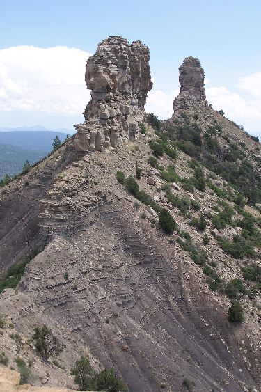 |
The observation tower is a combination of a fire lookout and a tower built specifically to allow unobstructed views of the rock formations and the surrounding mountains and valleys. The observation tower sits atop a rock outcropping just across from Companion Rock, and affords excellent views of both Companion Rock and Chimney Rock- also shown in closeup here.
The views from the tower were nothing short of spectacular. Of course, you could look from the tower down across the Chaco Great House ruins and back along the trail we'd come up. But it was the views of Chimney Rock (the small spire further out) and Companion Rock and all the surrounding area that were really neat. I've selected four of the best pictures we took from the tower and put thumbnails for them below. To view the full-size images, just click on the thumbnails:
 |
 |
 |
 |
I also took another 360-degree movie view from the tower, walking around the outside of it as I filmed, and you can watch that movie using the player below:
|
|
Our visit to the Chimney Rock Archaeological Area was really neat, not quite what I had expected. But we had lots of other things to do and see, so we left the tower and headed back down the trail towards the parking area and our drive back down the mountain. We passed the visitor center and got back out to the highway and, as we headed back to Highway 160 and our trip back east, Fred took this excellent view from the highway of the entire Chimney Rock Archaeological Area. Then it was on back to Pagosa Springs.
Pagosa Springs, New Mexico
 |
 |
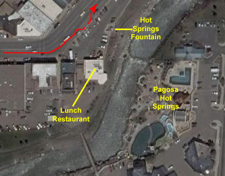
To give you an idea of the layout of downtown Pagosa Springs, look at the inset map below.
|
|
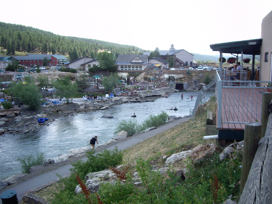
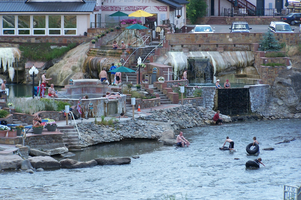
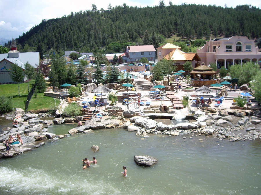
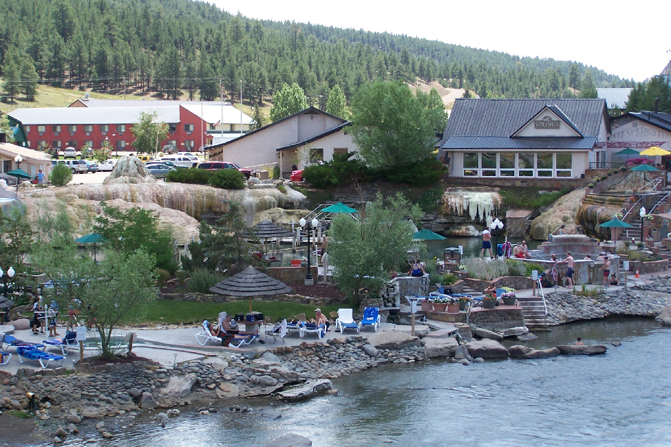
We took a number of pictures of the hotels and various hot springs pools across the river, and I've put thumbnails for some of the best ones below. As you click on the thumbnails to view the full-size images, note the multiple hot springs pools, the channels that carring the constantly bubbling spring water into the river, and the deposits left behind as the various minerals in the springs waters are deposited on the walls and other structures of the pools:
 |
 |
 |
 |
Pagosa Springs has a rich history, beginning with the Anasazi Indians. Later, the Utes Navajos and Apaches inhabited this corner of the Southwest. They also visited the great "Pagosah" hot springs which they believed had curative powers. In time, the military established a post here to protect settlers from Indian hostilities. Archuleta County was established in 1885, and the town of Pagosa Springs was incorporated in 1891. The Pagosa & Northern Railroad steamed into town in October, 1900. Over the years, the economy of the town and county was maintained through ranching, logging and lumber, and pesons seeking relief for their ailments at the hot springs. In the 1970s, developers discovered this area. About the same time, the local skiing and tourism industries boomed.
Up on the walkway where we were, the city had created a small fountain, probably by creating an artificial channel for one of the springs to push its way up to this level above the river. Here, the spring water emerges and falls into an enclosed pool, with the excess running back into the river. The interesting thing is that you can see the calcium and other deposits close-up, as they have formed a rather large cone over the years- mineral deposits of varying colors, depending on what happened to be dissolved in the water at various times.
Since it was long about lunchtime, we decided to stop into a Mexican restaurant just down from where we were standing to have a bite to eat. The patio was full, but we did get a booth with a good view out the windows to the Pagosa River. Fred thought it interesting to get a picture of the brightly colored woodcarvings behind us on the walls of the booth. After lunch, we got in the car and headed east out of town, stopping briefly at a bakery we'd seen on our way in yesterday to get some cookies to take with us.
Hiking to Silver Falls
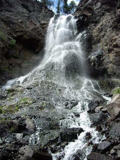 |
We found out about Silver Falls on the Internet, on a web site devoted to hikes to Colorado waterfalls; otherwise, we would probably not have known it was there, as it is a very out-of-the-way spot. The dirt road up to the falls was certainly scenic, although it was slow going, but the trip was worth it. There was a small parking area (on private land, I think) marked for the trail, which led about a half-mile up through the woods to the falls themselves. When we got there, one of the first things Fred did was to set up the tripod so as to get a good picture of both of us at Silver Falls.
|
|
|
|
When I came back down, I found Fred intently studying and photographing an odd bird that he'd spotted wading near the stream below the falls. There were actually a couple of them, and they were very amusing as they walked back and forth bobbing their heads into the water. They weren't fishing or anything, so we weren't quite sure what they were doing, but it turned out that we saw the same kind of bird a couple of times near water features during the remainder of our trip. Before we left the falls, we took quite a few more pictures, but most of them were fairly repetitive of the ones I've included here, except for a shot Fred took of me beside the stream below the falls and one that I took of Fred leaning against a boulder below the falls.
The falls were certainly pretty, and we could have stayed longer, but we headed back down the trail to where the car was parked and went on back down to the highway and east to our next stop- Treasure Falls.
Hiking to Treasure Falls
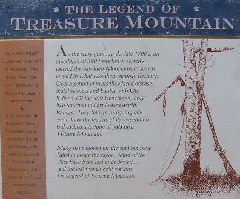 |
Read the rest of the sign above, and you'll get a feel for some of the history and legend surrounding the area, but we were here to see the falls themselves. Mountain building has long ended in the San Juans, and now they are slowly eroding. Harder rock resists the powers of erosion, such as the ledge that forms Treasure Falls. Eventually, Falls Creek will wear through these layers, revealing a different view of Treasure Mountain. But, for now, we can follow the well-marked and well-maintained trail about a half mile to the falls.
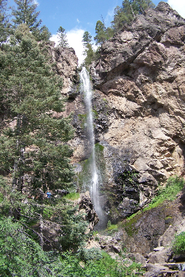 |
When you arrive at Treasure Falls, you find yourself first on a bridge below the falls , seen here looking from further up towards the falls. From the vantage point of the bridge, you can get a really spectacular view of Treasure Falls, and Fred, with his excellent zoom lens, could also get an interesting picture of the very top of Treasure Falls showing how the waters of Treasure Creek have eaten away at the rock ledge high above. We climbed around down below the falls and below the bridge for a while, and you could make your way up the rocky streambed (rocky due to the continual erosion and collapse of chunks of rock from the top of the falls) towards the falls themselves (although there was also a trail you could take). I scrambled quickly up almost to the base of the falls, and Fred was able to get another good picture of Treasure Falls with me for scale.
We both made our way up the streambed to the viewing area near the base of the falls, and one of the first things I did upon reaching it was to take a movie of the valley below, the streambed and Treasure Falls, and you can watch that movie with the player below:
|
|
We found that at the base of the falls there was a beautiful little pool, although when we got to it there were lots of other people climbing around and into it, and not offering us a very photogenic scene. Presently, they all made their way elsewhere, and we were able to get a couple of good pictures. So here is one of Fred at the Treasure Falls pool and here is one of me at the pool.
It was even possible to climb further up to the rock face over which the falls tumbled, and of course I had to do that, and of course Fred had to photograph me at the base of Treasure Falls. Finally, I came back down to join Fred at the viewing area, and had him pose for this picture: Fred and the Treasure Falls bridge. We enjoyed the hike to the falls and the beauty of them very much, but eventually had to leave and hike back down to the parking area.
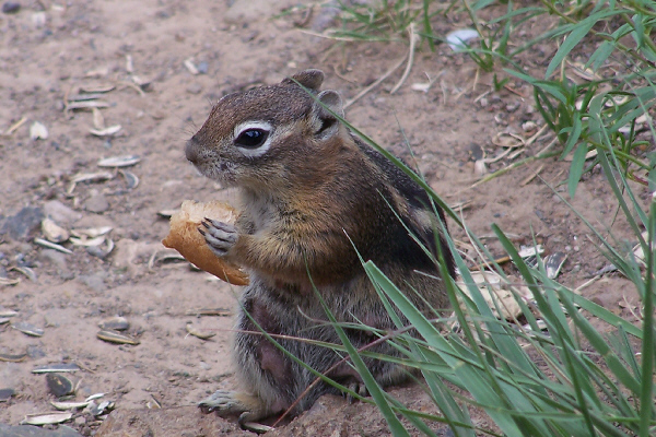 |
I honestly don't know what the attraction is for me and everyone else to stop and play with the little animals; perhaps it's because we don't have much contact with them in our cities and towns, and so seeing them in this relatively wild area and seeing them so tame is that unusual. As I said, people were feeding them just about anything, and, just so they didn't get thirsty, I guess, some folks were even giving them something to drink!
After being amused for a while by the little creatures, we got back in the car and headed on down the road.
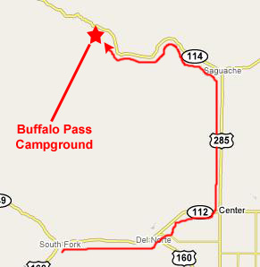
The Buffalo Pass Campground
|
The road from Treasure Falls led eastward, up the side of the valley wall to a spot high enough that we could look back and see the entire valley spread out below us, certainly one of the most beautiful sights on the trip. And then, Fred noticed something that I missed- we could actually see Treasure Falls, way off in the distance. I had to use all the zoom I had to even pick it out.
A bit further on, there was another overlook of the valley, but this spot also offered a rock outcropping you could walk out to, but, for once, Fred put his foot down and said there was no way I was going out there. So I had to content myself with the view of it before we got back in the car and continued our climb into the mountains.
Finally, the highway stopped ascending and we found ourselves at the crest of Wolf Creek Pass and at the Continental Divide. This was actually our second crossing of the Divide on this trip; the first being near Santa Fe. But this one was a good deal higher and thus a lot more scenic. Time for an excellent picture of Fred straddling the Continental Divide. Behind Fred you can see some very informative signs, and I thought you might want to read them, so if you click on the three links below you can do just that:
|
|
From there, it was a steady downward slide all the way into the town of South Fork. Coming down out of the mountains, we were able to pick up some good radio stations, so we (actually Fred) engaged in a few miles of sing-along. If you want to hear Fred singing, use the movie player at right. As we came down out of the National Forest in the San Juan Mountains, we began to find residences and farms along the highway. There was a really pretty mountain stream paralleling the highway, and many of the residences have had to build their own private bridges over that stream.
 |
When we got to the campground, there were plenty of spots and we basically had our choice. Setting up the tent and having dinner were pretty routine (although Fred's cooking is always a treat). The air was cool and the night was clear and it was a great evening. After dinner, we got out the laptop and I off‑loaded our camera cards and we went through the day's pictures.
Chimney Rock, hot springs, two waterfalls, tunnels and beautiful scenery- what a great day.
You can use the links below to continue to another photo album page.
|
July 19, 2007: New Mexico/Colorado Trip Day 6 |
|
July 17, 2007: New Mexico/Colorado Trip Day 4 |
|
Return to Main Index for New Mexico/Colorado Trip |