


|
Acadia National Park- Day 3 (September 17) |
|
Acadia National Park- Day 1 (September 15) |
|
Return to the New England Trip Master Index |
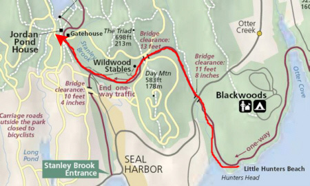
Thunder Hole
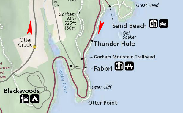 |
From the campground, we had to do the usual- drive north on Route 3 to the Sieur de Monts Entrance and then head south on the one-way loop road to the parking area for Thunder Hole.
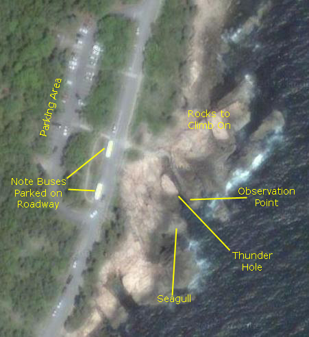 |
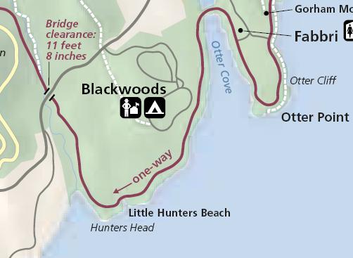
On the aerial view of the Thunder Hole area at right, I've marked the pertinent locations that will help you orient yourself when you look at some of the pictures.
Thunder Hole is a formation much like the blow holes that we have seen in Hawaii and on the coast of Oregon. As the information sign indicates, water is forced into the rock formation by wave action and by the tides. As it rushes into the narrow crevasse, it is forced into a partially submerged tunnel and, if the level of the water is just right, there will be a "thundering" sound as the water hits the roof and the back of the tunnel. If the tide is too low, the water doesn't enter the tunnel at all, and if it is too high, the tunnel is submerged and no sound is generated. So you have to hit this formation at just the right time.
We took a great many pictures and movies while here at Thunder Hole this morning. You might first want to watch the best of the movies that I made this morning, and you can do so using the player below:
|
|
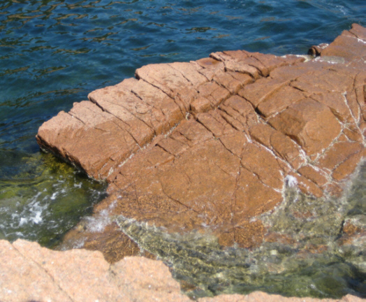
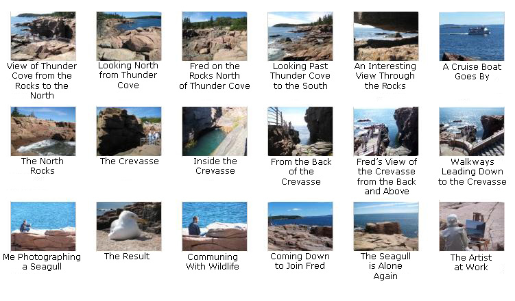
When we first arrived, we went down to the observation point to see if we could hear the thundering noise, but I guess the conditions were not right this morning, either. So we first climbed onto the rocks north of the actual crevasse and walked around there for a while and we got some very nice pictures. Then I crossed over the observation walkway and went on the rocks down in the crevasse, and then up the cliff at the back, to come out on the rocks south of the crevasse. It was here that I found the seagull. Fred, meanwhile, had also crossed the walkway and was south of the crevasse, looking back and taking pictures of me and the seagull. He also found an elderly lady painting, and used his zoom to obtain a close-up view of her at work. Finally, we got some good pictures of the coastline looking south.
 |
Do you remember this formerly very familiar and oft-seen image? To see if you agree with me, first click here and then click here.
Now that I've explained generally where we were here at Thunder Cove this morning, you can take a look at the pictures we took. From top to bottom, left to right, they are pretty much in sequence (on the rocks to the north, in the crevasse, with the seagull and on the rocks to the south). We hope you'll spend some time here at Thunder Cove with us (albeit vicariously) by clicking on the small image thumbnails below:
|
Otter Cliff
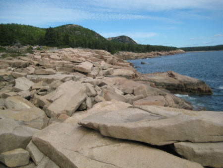 |
From this point, we could also see the next stop we wanted to make, and Fred took a telephoto picture of it- Otter Cliff. As we discovered later, the people on top of the cliff were practicing rock climbing and rapelling.
So we walked back to the car which was in the Thunder Cove parking area, and drove a bit further south along the Loop Road to the parking area for Otter Cliff.
|
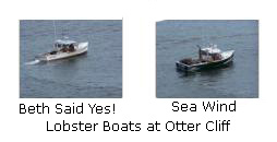
In addition to the great views of the coastline, it seemed as if there were a number of fishing boats nearby. Fred took pictures of a couple of them with his excellent zoom, and you can click on the image thumbnails at the left to see them up close:
|
There was a pathway leading down from the overlook along the top of the cliff, and I tried to get Fred to go down there with me, but he didn't care to get beyond the walls. (After our experience yesterday at the Precipice Trail, I am a lot more understanding of his inclination or disinclination to go someplace when we are hiking.) Another couple stopped at the overlook right about that time, and the guy wanted to do the same thing but his wife didn't, so he went off on his own. His wife and Fred exchanged pleasantries and commented on the fact that they are often in similar situations (Fred at that point asking me for the car keys), and I went off in a different direction.
When I followed the path and got a ways down and out onto the bare rock, I could look back and up and see Fred at the overlook. Below me, I got a great view of some of the tall, columnar rocks along the shore, and I even spotted some otters on the rocks (at least I assume they are otters, what with the name of the point and all). Further along the path, there opened out below me a whole separate rocky cliff, still quite a ways down. I thought it was extremely scenic. Here, I spotted some folks on the cliff top; when I took a closeup of the people it was apparent that they were rock climbing.
Anyway, I stayed down here for a little while enjoying the scenery, and then hiked back up to the overlook to collect Fred and head off down the Loop Road to our next stop- Little Hunters Beach.
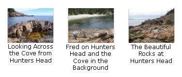
Hunters Head and Little Hunters Beach
 |
|
|
So I joined Fred rock-hunting, and we moved along the beach looking for something interesting to collect. At one point, Fred stopped to take a picture of me with Hunters Head in the background. That is where we headed.
|
|
|
It was getting on towards one o'clock, and so we thought that we might follow the park guide's recommendation and see if we could have lunch at Jordan Pond House. The guidebook said it was an extremely popular place, but since it was our next stop on the Loop Road anyway, we thought we would give it a shot.
Lunch at Jordan Pond House
 |
|
|
One of the attractions of eating at Jordan Pond House is that instead of bread, they bring you popovers with jam and honey and they are delicious. To give you a good impression of what eating on the lawn was like, use the player at right to look at my movie of dining al fresco at Jordan Pond House.
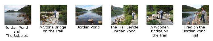
We both took some pictures before our meal, and we've selected the best of them to include here. Click on the thumbnail images below to look at our pictures of dining at Jordan Pond House:

|
A Walk Entirely Around Jordan Pond
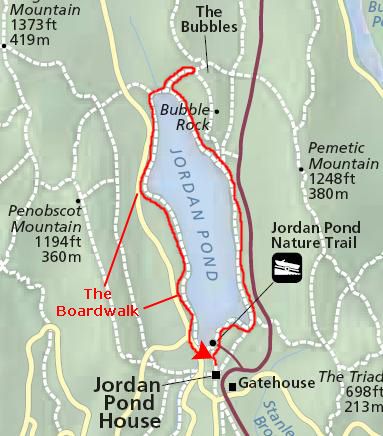 |
I'll divide up the narrative and the pictures in three sections. First will be our walk north along the eastern side of the lake. Then we'll look at pictures from our jaunt up the Bubbles Trail. Next, we'll take a look at some pictures and movies from our walk south along the western shore of the lake. And finally we'll include some pictures that were taken when we returned to Jordan Pond House.
The Eastern Side of Jordan Pond
Then we started off along the fairly level path along the eastern shore of the lake. The first 45 minutes of the hike along the shore was pretty easy. It looked as if the path were designed to maximize access to the lake for everyone. Along the way there were always great views of the lake, and sometimes views of The Bubbles as well. Below are some thumbnail images for pictures that we took on this first part of the hike. Click on them to view the full-size pictures:
|
A Short Hike Up the Bubbles Trail
Anyway, we backtracked to the turnoff and headed up the trail, not quite knowing what to expect. As we hiked, the trail got steeper and steeper. The weather was fairly warm, and pretty soon I had to jettison my pullover, but we kept going for a ways. When we finally saw a sign that told us how far we still had to go, we thought it might be better to hike up The Bubbles from the official trailhead further north along the Loop Road. So we decided to head back down and put The Bubbles as the next item on our afternoon agenda.
So we stopped partway up the trail to take a few pictures. Fred got a nice view of the North Bubble, and he also took a picture of me on the rocky trail. And here's my picture of Fred on The Bubbles Trail.
Then we headed back down the trail to Jordan Pond again, and returned to the rustic bridge.
Walking Back Along the Western Shore of Jordan Pond
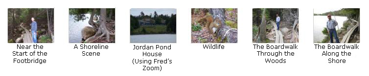
The trail back along the western shore of the lake was quite different. It was more of a trail than a path, first of all, and, for almost two-thirds of its length, it was a footbridge the width of two, rough-boards. It was so interesting that I made two movies. I made the first movie as we were walking over the rough trail and came to the beginning of the long, continuous footbridge, and I shot the second movie after we'd been walking on the footbridge for what seemed like a half-mile or so. You can watch both of them using the players below:
|
|
We also took some pictures as we walked back along the footbridge and trail to Jordan Pond House, and you can see these pictures if you will click on the thumbnail images below:
|
Returning to Jordan Pond House
Then it was back to the car and off up the Loop Road to The Bubbles.
Hiking Up The Bubbles
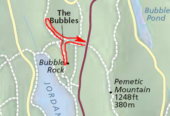 |
To the Top of the South Bubble
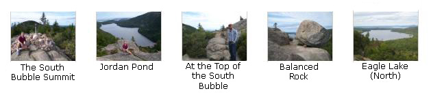
|
|
|
Once we were done at the top of the South Bubble, we thought we would go ahead and hike to the top of the North Bubble as well, so we headed off back down the trail to the junction.
To the Top of the North Bubble
|
|
I also took a movie of the panorama from the top of the South Bubble, and you can use the player at left to watch it.
After wandering around for a while, we headed back on down the trail for one more stop this afternoon.
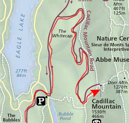
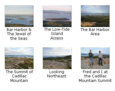
A Drive to the Summit of Cadillac Mountain
There are a couple of interesting things in the pictures we took. In some of them, you'll see a cruise ship in the harbor at Bar Harbor. Coincidentally, the ship was the Royal Caribbean ship 'Jewel of the Seas,' which was, of course, the same ship that we had sailed on in February. I suppose it moves north for cruises in the Fall. In another of the pictures, you can see the sand bar that appears at low tide and allows walking access to one of the islands in the harbor. We were walking there yesterday evening.
 |
|
Before we left, I also made a movie of the view from the top of the mountain, and you can watch that movie using the player below:
|
|
This was our last stop today. This evening, we decided to walk around Bar Harbor for a while, stopping in to a cybercafe so that I could check my email and so we could make some phone calls. We ran across a nice restaurant, but it was closing when we got there, so we resolved to have dinner at the campsite again and then try the restaurant tomorrow night.
You can use the links below to continue to another album page.
|
Acadia National Park- Day 3 (September 17) |
|
Acadia National Park- Day 1 (September 15) |
|
Return to the New England Trip Master Index |