|
Driving to Albany, NY (September 18) |
|
Acadia National Park- Day 2 (September 16) |
|
Return to the New England Trip Master Index |
A Trip to Seal Harbor
 |
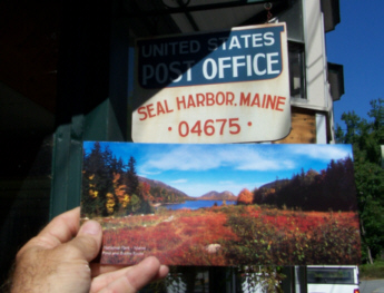
Seal Harbor is outside of the park on the southeastern corner of the Mt. Desert Island coast. To get there, we could have simply turned left out of the campground and gone down Route 3, but hope springs eternal and we thought that we would go north as usual to the Loop Road, and then south past Thunder Hole so we could stop and see if the tides were right for us to really hear something. We just made a short stop, because the conditions were still not good for us to pick up on the (reputed) sounds of Thunder Hole.
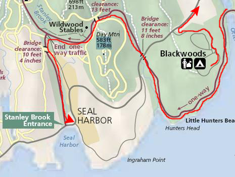
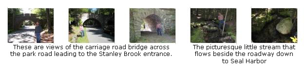
So we just continued around the Loop Road south and then west to the intersection of the park road coming up from the Stanley Brook Entrance. Just as we turned off the Loop Road and headed south, we crossed under one of the many carriage trails through the park. This one went over the roadway on an old stone bridge, so we stopped to take some pictures.
If we haven't mentioned the carriage roads, they are a series of bicycle/equestrian/carriage trails that wind through the park, and they were originally constructed when the Rockefellers owned the entire area. They were designed not to actually cross motor roads, so they either go under or over them. This was quite a nice-looking bridge, and there was a shady creek that flowed under it as well as along the road. We took a number of good pictures here, and I've put clickable thumbnails for them below:
|
 |
|
Long Pond and the Rockefeller Boathouse
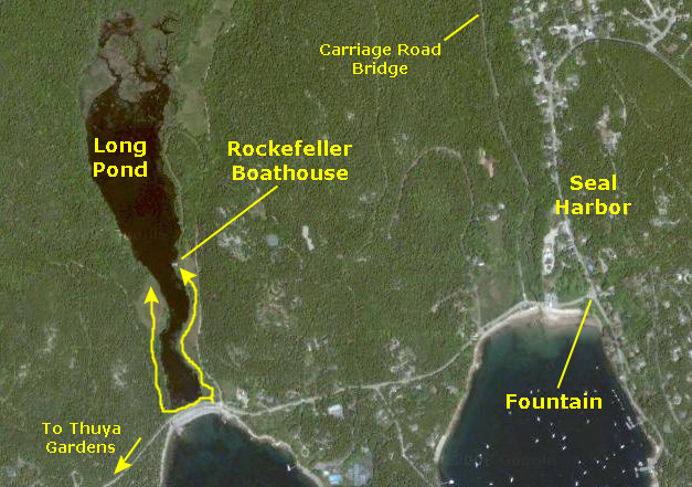 |
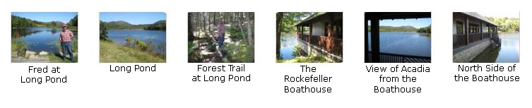
We wanted to take a walk to the boathouse, so we drove a ways down the road from Seal Harbor to the parking area right next to the entrance gate to the pond area. We went in through the gate and then, mistakenly, immediately west around the south end of the pond and onto a path through the forest. This path paralleled a bicycle path/carriage road that runs along the west side of the pond, and we followed it to come out to a broad grassy slope that went down to the edge of the pond. We realized immediately that we were on the wrong side of the pond to visit the boathouse, because we could see it on the other side of the pond.
|
|
So, that is what we did (as shown on the aerial view at left), and shortly we arrived at the Rockefeller boathouse. The boathouse was a real interesting affair- not just a lakeside house alongside which one might dock a boat, but rather a little "garage" into which one could row or drive a boat. The end of the building where the "garage doors" are has a covered area where the boat can sit once it is out of its garage, allowing people to get on and off yet still be covered by the boathouse roof. We've seen the updated equivalent of this boathouse along the New River in Fort Lauderdale. On one side of the boathouse there is also a stairway that goes down into the water, giving access to boats that may just temporarily stop by the boathouse. All in all, it was a picturesque place, and bespoke the wealth that created it.
To look at some of the other pictures we took around the lake and at the boathouse, click on the thumbnail images below:
|
We Visit Asticou Terraces and the Thuya Gardens
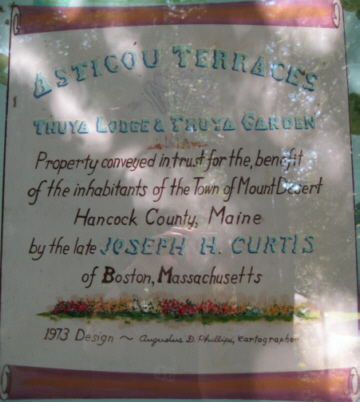 |
The Asticou Terraces are a series of flat terraced areas on the north side of Route 3 near the town of Northeast Harbor and across from the harbor itself. The terraces and their paths and seating areas were the creation of Joseph Henry Curtis a landacape architect and resident of Northeast Harbor until his death in 1928. At the base of the terraces, near the road, there is a memorial monument to Curtis, which calls him "...a vigilant protector of these hills." The carved granite further states that the �... Asticou Terraces are his gift for the quiet recreation of the people of this town and their summer guests.� The words �Asticou Terraces� are carved into a block of granite at the base of the stone steps that lead to Thuya Garden from Route 3. The stairs wind their way up the front of the granite cliffs providing a panoramic view of Northeast Harbor.
Above the highest terrace are the Thuya Gardens. The gardens themselves were designed by Charles Kenneth Savage (1903-1979). According to the plaque at the entrance to the gardens, we was "...(an) artist in landscaping and woodcarving, lover of books, public-minded citizen in community and government conserver of ledges, trees, slopes for our delight. Trustee of Asticou Terraces, 1928-1965." Savage also designed and constructed the massive wood gates (shown here and here) that flank the main entry into the gardens. But credit should also be given to John D. Rockefeller, who provided the financial support for the creation of the gardens. Here, too, there are great places for just sitting down and enjoying the beauty and peacefulness of the gardens. Thuya got its name from the abundance of white cedar (Thuya Occidentalis) located in the area.
Walking through the gardens, Fred was really enjoying himself, investigating the different flower varieties and appreciating the effort that went into the gardens' design.
|
To view the slideshow, just click on the image at left and I will open the slideshow in a new window. In the slideshow, you can use the little arrows in the lower corners of each image to move from one to the next, and the index numbers in the upper left of each image will tell you where you are in the series. When you are finished looking at the pictures, just close the popup window.
|
|
Off to the side near the gardens entrance was the caretaker's work shed, and you could stick your head in and look around. We enjoyed the gardens immensely, and left via the path back to the terraces and the way down to the parking area. Interestingly, as we were going down the stone steps, we looked out past the harbor to the ocean and we could see a fog bank that appeared to be moving in.
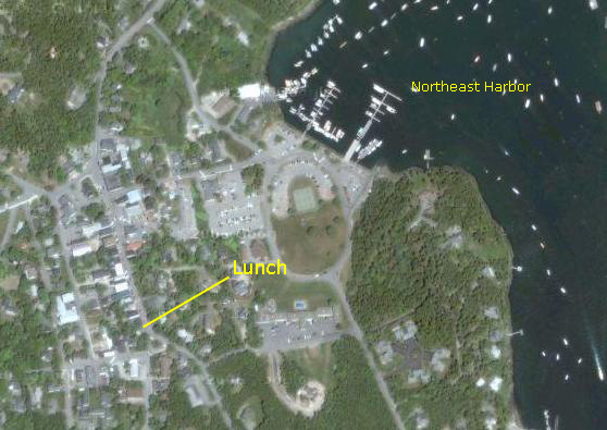
Lunch in the Town of Northeast Harbor
 |
|
|
The restaurant turned out to be quite a nice one, and an excellent place for lunch. After eating, we walked around a bit more and then headed off for another mountain hike.
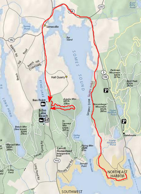
A Hike to the Peak of Acadia Mountain
 |
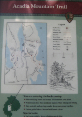 |
Just on the other side of the highway from the parking area, we found the trailhead and sign (a small version of which is shown at left), and we set off onto the trail. Almost immediately, we found ourselves climbing a stone stairway, which turned out to be just the first in a series of three or four. The trail rose very rapidly at first, and we had to follow the blue trail markers when the trail went across bare rock (as it often did).
My guess was that the roadway was about a hundred feet above sea level, and that left us something like 600 feet of vertical ascent, and it seemed as if most of that was in the first part of the trail. After we'd ascended maybe 400-500 feet, the trail leveled out and it became an easy walk through the trees.
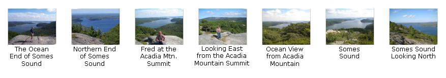
As soon as we came out onto this more level area, we began to get excellent views, such as this one through the trees to the ocean. Another ten minutes of walking brought us to the Acadia Mountain summit.
|
|
As I said, the views from here were quite beautiful, and I've selected some of the best pictures we took from the summit for you to look at. You can view these pictures, of course, just by clicking on the thumbnail images below:
|
After we spent some time here at the summit, we headed back on down the trail to the parking area. We seemed to have made one wrong turn there for a while, but we just had taken a different route back to the same place. (The entirety of Mount Desert Island is criss-crossed with trails, and if you don't follow the right markers, it is easy to go astray.)
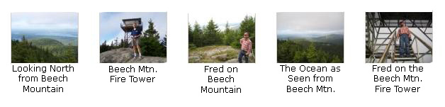
A Hike to the Top of Beech Mountain
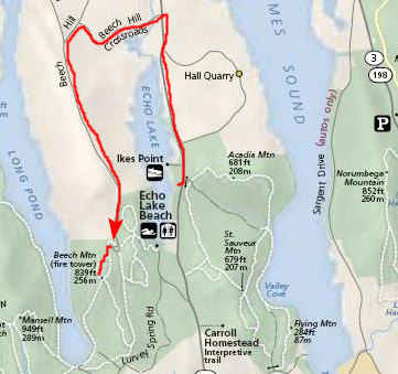 |
The trail was pretty easy, although it was getting chilly since the sun seemed to have disappeared. It took us about forty minutes to reach the summit, where we found the Beech Mountain fire tower. The weather was definitely lowering; it looked as if there were weather coming in from the ocean.
To see some of the other pictures that we took at the summit of Beech Mountain, just click on the thumbnail images below:
|
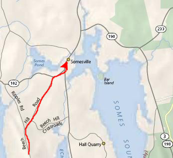
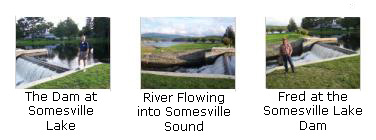
We Visit Somesville, Maine
 |
|
|
|
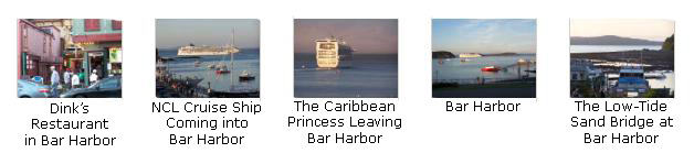
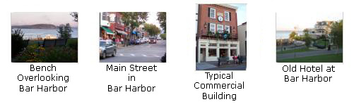
An Evening in Bar Harbor
We arrived in town from Beech Mountain about five-thirty, and already the light was beginning to fade. But we did get some good pictures, and you can have a look at them if you will click on the thumbnail images below:
|
|
You can use the links below to continue to another album page.
|
Driving to Albany, NY (September 18) |
|
Acadia National Park- Day 2 (September 16) |
|
Return to the New England Trip Master Index |