|
October 16, 2010: Hiking Around Sedona, AZ |
|
October 13-14, 2010: Willcox, AZ: Biosphere and Picacho Peak |
|
Return to the Index for our Western Trip |
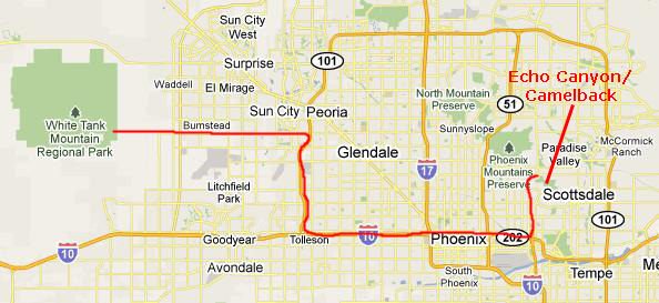
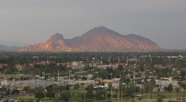
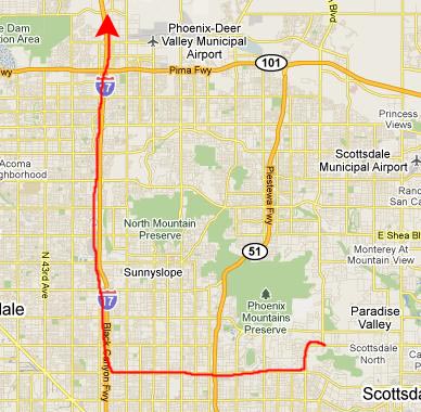
Today we will be spending all our time in the Phoenix area. We'll look at some things in White Tank Mountain Regional Park that we didn't see last time we were here, and then we will head off for the major hike of the day- Camelback Mountain in North Phoenix. That will probably take us most of the day, so we will just head up towards Sedona, Arizona, when we are done there.
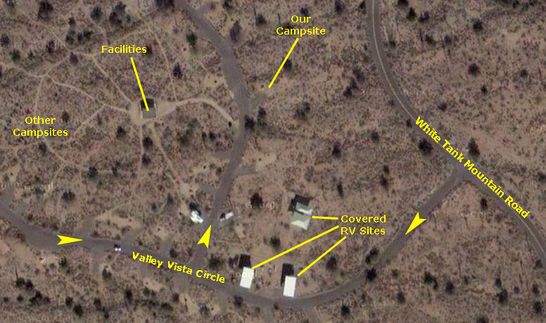
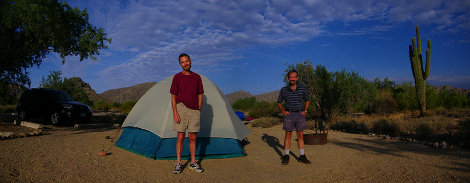
Our Campsite at White Tank Mountain Regional Park, AZ
|
|
Fred also took a very good panoramic photo, stitching together two separate pictures. I have placed a copy of it below:
|
We struck the tent and packed up the RAV4 and headed off to look at some petroglyphs.
The Petroglyph Trail (White Tank Regional Park)
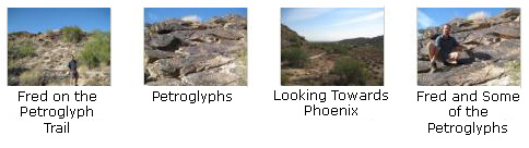
We did drive down the road towards the park entrance and stopped at the parking area for the Petroglyph Trail. Here we could see some of the petroglyphs scattered throughout the park; there is some evidence suggesting that some might predate the Hohokam civilization.
|
Eventually, we came to a rock outcropping where we found the petroglyphs. Fred took a picture of the best example, and you can see it here.
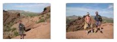
I, too, took a number of pictures along the trail, and you can have a look at them if you click on the thumbnails at right. We completed the half-mile loop in just a few minutes, and then headed back to the parking area to pick up the RAV4 and drive out of the park towards Phoenix and Camelback Mountain.
Climbing Camelback Mountain
|
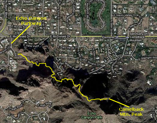
We followed the GPS directions to get to East McDonald Drive and Echo Canyon Parkway. The directions led us back the way we had come last night along Olive Avenue. We couldn't see them in the dark last night, but we discovered that there were huge rose nurseries along this street, with roses as far as you could see.
|
|
We took some time to gather our camera gear together and have a drink; I'm bad, I suppose, but I rarely carry water even on long hikes. I've returned pretty parched on occasion but have never really had a problem. And, after all, this hike was only a little over a mile one-way. But as it turned out my mental image of the hike was quite different from the actuality of it, and had I known what we were in for, I might have carried some. But there wasn't a problem with water as it turned out.
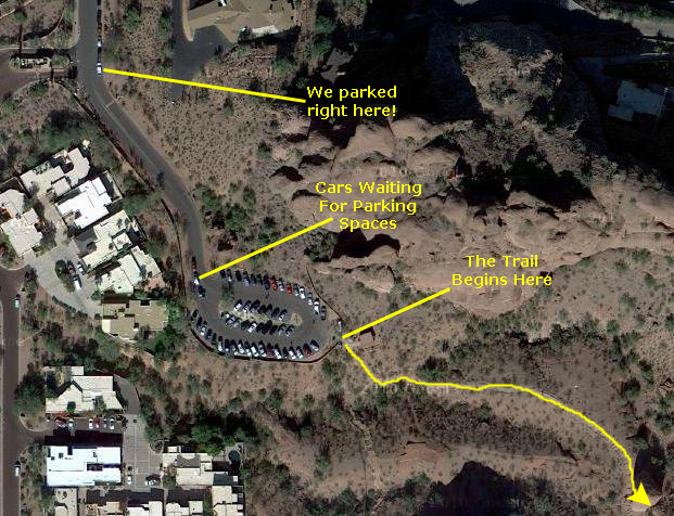
We walked up the drive to the parking area for Echo Canyon Park and the trailhead.
|
As I said earlier, for some reason I had a much different mental image of the hike up Camelback. I should have been prepared, given our hike up Spirit Mountain a few years ago, also here in downtown Phoenix, but I thought that based on my shorter hike up the eastern slope some years ago, that the western hike was an improved, paved trail. Where I got that idea I have no clue, but it turned out to be as far from the truth as you could get. And I could tell it wasn't true as soon as we got to the trailhead.
Trailhead to the Top of the Wash
|
The hike began at the Echo Canyon parking lot, where we found a ramada, an interpretive kiosk, and a drinking fountain. The trail descended a few steps and then headed uphill into Echo Canyon� a shallow drainage flanked by rounded cliffs to the north. The trail reaches the top of Echo Canyon in 0.3 miles, and a bench at this point allows for a rest stop.
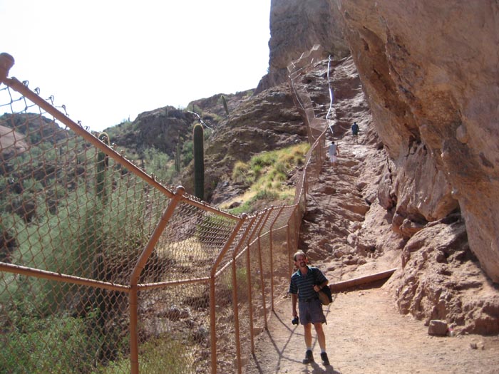
The first part of the trail, from the trailhead to a point where the trail disappeared around the northeast side of the western peak, was relatively easy. There were stairs to climb which made the going easy, and along this stretch we did see, as evidenced in this picture of me on one of the stairways, families and kids.
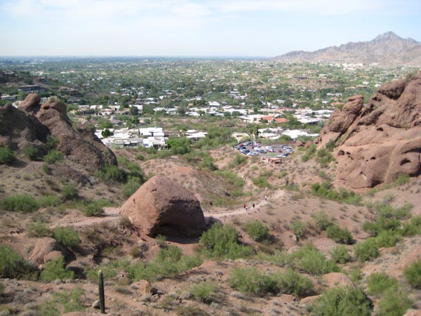
One interesting thing we noticed right away was how the homes in this part of Phoenix were built right up onto the lower slopes of Camelback Mountain. From what we could see (and from what you can see here and here), every reasonable piece of land had been used to build houses. Only when the slopes turned into land too steep for construction did the wild area begin.
|
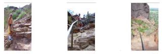
From this vantage point, I took another couple of pictures that you can look at if you click on the thumbnails below. As you can see, I've already had to shed my t-shirt as it's gotten pretty damp already. It feels better with it off.
|
|
I made a movie from the midpoint of the portion of the hike that takes us up Echo Canyon. |
The Extremely Steep Trail to the Saddle
|
It is hard to realize how steep the trail became; it was so steep in spots that a handrail had been provided for balance. Just ahead of us on the trail we could see the beginning of this handrail section� and the view ahead was pretty amazing. We'd encountered trail sections like this before, but they had been much shorter and somewhat less steep. This was one for our personal record books.
I don't know what Fred was thinking, but I was really anxious to negotiate the handrail section. I dearly love rock scrambling, and this section of the trail was very, very inviting. I took the lead and began negotiating up the sheer (and sometimes slippery) rock face- using the handrail when necessary. I reached the top of the section a couple of minutes before Fred, who was taking his time and being cautious (a trait I sometimes seem to lack when hiking).
The views along this section, if you can take your eyes of the slick path, are incredibly beautiful. Along this section, and from the top of it, we took a number of interesting pictures. Have a look at them by clicking on the thumbnails below:
|

|
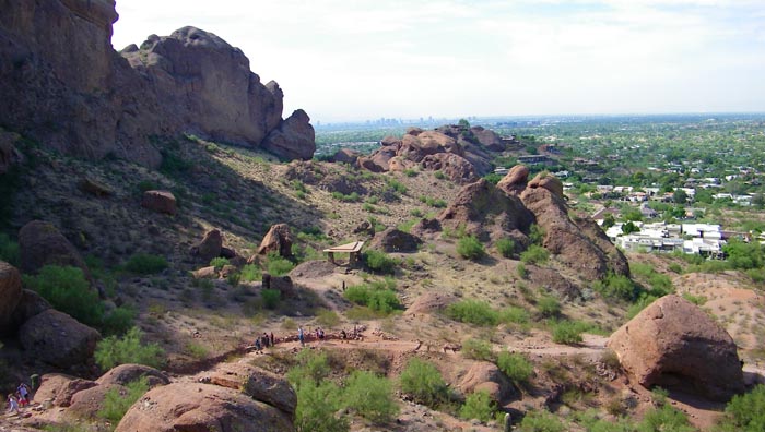
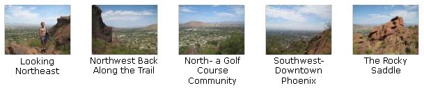
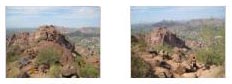
We made our way up the slope and after about 10 minutes of climbing, the handrail ended and we came out on a relatively flat area that is pretty much at the half-mile mark (a little less than halfway to the summit, laterally). Standing here, you are in something of a saddle between the trail to the west peak, which can be hiked but which isn't nearly as popular, and the trail to the summit. There are really great views in all directions, particularly to the north and to the to the southwest and downtown Phoenix.
If you'd like to see some more of the beautiful views from the halfway point on our hike, just click on the thumbnails below:
|
|
At the top of the handrail section, we are about 40% along in the hike, and I made a movie of the views in all directions from this halfway point. |
The Next Quarter-Mile
|
On the downside, there have been so many hikers over the years that much of the sand and gravel has been ground into a fine powder, and this powder can be very slippery when it collects on a rock that you happen to step on. Choosing your steps carefully minimizes the danger of falling, but when you aren't thinking about where your next foot is going to go you can make a mistake. Falling going up is bad enough; falling coming down can be a lot worse.
At this three-quarters point Fred decided he'd forgo the rest of the hike to the summit and either wait for me to return from the top of just begin to make his way down again. I freely admit that we were both getting tired, but as usual I didn't want to have come this far only to turn around at the final fence. Fred was very understanding in allowing me to go on to the top on my own. And after cautioning him to be careful on the way down (we'd already passed what I thought was a girl just resting with her hiking partners but who I learned from another hiker had actually broken her ankle- perhaps when she herself slipped on the fine rock dust that coats many of the boulders) I went ahead to the summit.
I took a couple of pictures as we ascended in this section; click on the thumbnails below to have a look at them:
|
|
As we were clambering up the next section of the trail, I got a bit ahead of Fred so I stopped to make a movie looking back down the trail. |
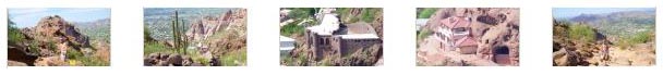
Fred also took a number of good pictures during this section of the hike, some of them showing how new homes have been built as far up the mountainsides as possible. Take a look at his pictures by clicking on the thumbnails below:
|
The Ascent to the Summit
|
Having left Fred to wait for me or begin his way down, I have gone up another short distance and made a movie looking up at the trail ahead. |
I started off, then, up a final rocky ravine that leads to the soaring summit of Camelback Mountain. I didn't take any pictures during this final ascent. There weren't unobstructed views in most directions, and I thought the views would not equal those that I'd get soon at the top.
On the Summit of Camelback Mountain
One thing I did was to try my hand at making a 360-degree view from the summit. To do so, I have to take eight to ten different pictures, trying to keep the camera at the same level so that the pictures will stitch together. I usually take these pictures on an automatic setting, which sometimes means that the exposure is greater or lesser depending on whether I am looking towards or away from a light source like the sun. So when I stitch the pictures together manually, the sky, particularly, can abruptly change from one portion of the final view to the next. I can do some amount of fuzzing to make the transitions less noticeable, but I can't get rid of them entirely. In any event, you can use the slider window below to look at my effort:
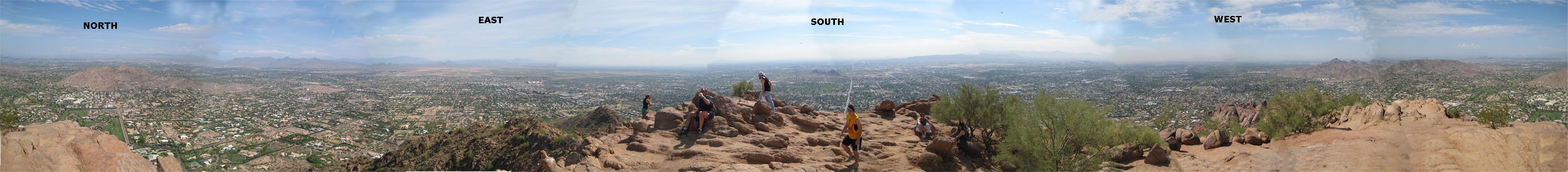 |
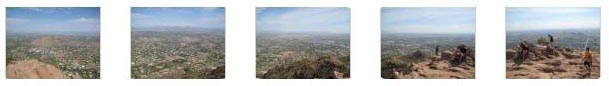
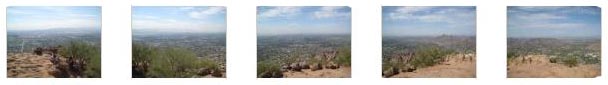
If you would like to see the source pictures that I stitched together, you can click on the thumbnails below. The leftmost thumbnail in the first row is the extreme left of the 360-degree image (north).
|
|
|
Here is the movie that corresponds to the 360-degree picture above. I started in the same direction and panned 360 degrees around from the summit. |
After spending maybe 20 minutes here at the summit, I started down again. It is beautiful up here; everyone should come to a place like this occasionally to keep perspective.
The Rescue
|
After a few minutes, I could hear the helicopter in the distance, so I scrambled over to where I could get a good view of it coming in to make this movie. |
When I saw where the helicopter had landed, I scrambled over around the mountainside further to take up a position very close to the helicopter sitting above me. Then I waited while the EMS guys carried the girl over and put her in the helicopter and it was ready to go.
|
|
After I'd started a few movies at the wrong time, I made this one of the helicopter leaving Camelback for the hospital (presumably). I was shooting into the sun, so try to ignore the interference.
Quite an operation. When the helicopter had left, I started down, as did the other hikers and the EMS personnel. I stayed a bit in front of them most of the way, and overheard them talking about "the guy who was right under the helicopter" and as to how "he probably doesn't have much hearing left." I assumed they meant me, but it wasn't all that loud.
Leaving Camelback
I had a Diet Sunkist and a snack while we discussed what we'd do next. We had done the hike Fred wanted to do in Phoenix, so the next order of business was to have a late lunch and head up to Sedona.
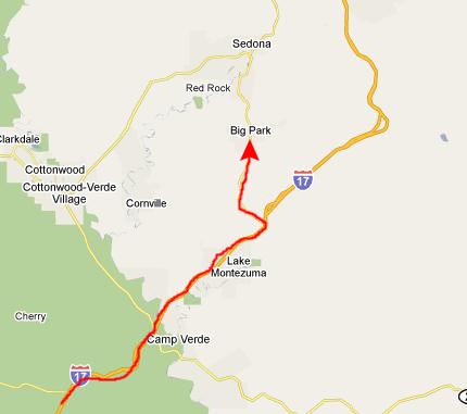
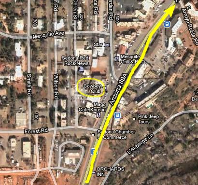
Driving to Sedona, AZ
|
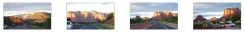
We had just passed the Pima Expressway (kind of like a Phoenix loop) when I saw a sign for a Friday's at an exit called Happy Valley Road. We stopped there and had something to eat and a lot to drink. Then we got back on I-17 and continued north. The further north we went the better the scenery got, and Fred was able to take some nice pictures out the car window. You can have a look at them here and here.
Our plan was to camp in the Oak Creek Canyon campground about eight miles north of Sedona, but this was Friday night and we were understandably concerned that by the time we got there the campground would be full. We also knew that we would need a Red Rock Pass to use any of the camping and hiking areas around Sedona. So we stopped in Camp Verde to get some gas and seek out a tourist office. We found that they did not have the passes and that not only would the campgrounds around Sedona likely be full but so would most of the hotels. There was no way to call the campground and since it was on the far side of Sedona we thought that it would be a waste of time to drive all the way up there to see if there was a space.
|
|
|
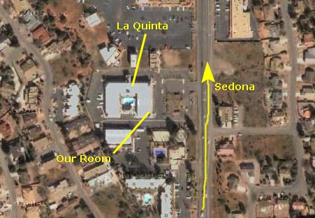
After we'd gotten settled, we decided to drive up through Sedona and see if we could find the campground and find out whether there might be spaces for the other nights of the weekend. We got back on Highway 179 and headed north towards Sedona. We passed a tourist office on the way and I was able to go in and obtain the Red Rock Pass, which would be good all weekend all throughout the area. We also passed a couple of hotels and I stopped in to see about rooms just in case, but every place I tried was full on Saturday although some had vacancies on Sunday.
By the time we passed through Sedona it was dark, and we had a devil of a time trying to find the campground. After passing it once, doubling back and asking at two places, we finally located it. It was a smallish campground down below Highway 89A between the highway and Oak Creek. It looked like a decent place, but it was packed to the gills and noisy. We sought out the campground host, but she wasn't too helpful. She thought the campground would also be full tomorrow with people staying over; one of the big campgrounds nearby was already closed for the season and that was making everything more crowded. So we headed back down towards Sedona, checking at a few more places along the way. It seemed as if there was to be absolutely nothing available tomorrow in the area- not our La Quinta and not anyplace else I checked.
|
Before we retired for the night, we did some planning. There wasn't going to be anything available in the Sedona area for either camping or staying in a hotel on Saturday. Fred, however, had listed a couple things he wanted to see that were back down by Interstate 17 between Camp Verde and the Highway 179 turnoff. We checked on hotels down in that area and found a Days Inn that had some space for Saturday night. So, we planned to spend the day on Saturday hiking around Sedona and then drive down to Camp Verde and stay there Saturday night. We'd do the two things Fred had researched on Sunday morning, and then return to Sedona to do some additional hiking. We would check on the campground for Sunday night; it should clear out as people go back home for the workweek, we thought.
We felt better about things now that we had a plan, so we worked on pictures for a while and then went to sleep.
You can use the links below to continue to the album page for different day.
|
October 16, 2010: Hiking Around Sedona, AZ |
|
October 13-14, 2010: Willcox, AZ: Biosphere and Picacho Peak |
|
Return to the Index for our Western Trip |